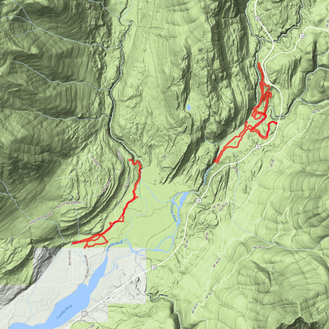
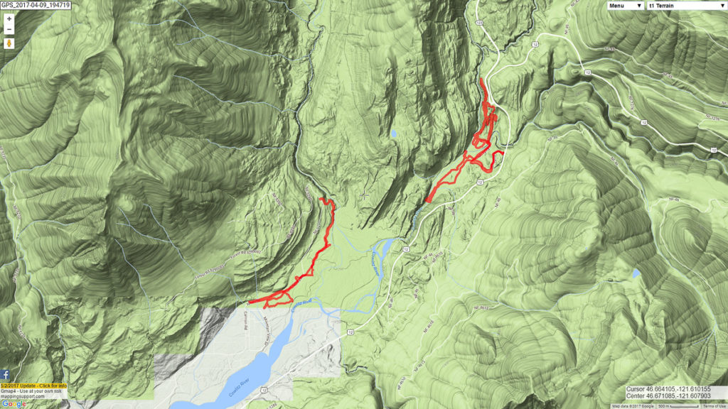
I spent a day exploring the lower reaches of Ohanapecosh Canyon at Lawiswis, then drove across the river for a very short ramble about the mouth of Stevens Canyon. Twice I was left yearning to follow the trail further.
Biking down the road to the campground at Lawiswis was fun. Up again, not so much. Rambling about the dry forest above the canyon – more, please! I was mildly surprised to find a trail from the Blue Hole all the way up to Highway 123. It appeared to go further.
Biking along the end of Cannon Road (which I expected to be gated, but was not), was not so very fun, but then I found some trails to ride along, so I had a really good time. There are now lots of camp sites along the river’s new(ish) edge, so Big Bottom remains a favorite gathering ground still. Making my way to the mouth of Stevens Canyon, I was surprised to find a rope bridge spanning the river – giving access to the old camping area and the road to the Backbone Lake trail, lost with the collapse of Jodie’s Bridge. I am so terribly intrigued.
I was also mildly surprised to find a trail that very obviously connected with the Tatoosh Trail, following along the canyon rim for some distance before crossing a roadway and heading dramatically uphill.

Leave a Reply