DAY 1
I took a long weekend to go hike the Goat Rocks Wilderness. I got turned around a bit sooner than I had hoped – the trail over The Knife looked sketchy after the season’s first snow, and I was not feeling like taking a risk. Regardless, it was a gorgeous hike.
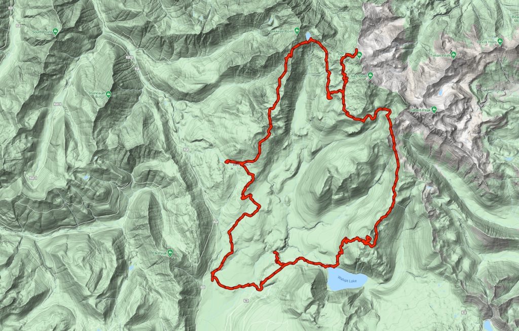
I parked at the Coleman Weedpatch trailhead – it provides quick access to the PCT, but one can also follow a horse-trail to Walupt Lake. Once at the lake, the trail splits, #101 heading up the gentle slopes of Lakeview Mtn to the PCT, and #98 heading up Nannie Ridge. I chose Nannie Ridge, as the last time I was along this trail, I did not get a chance to do Nannie Peak.
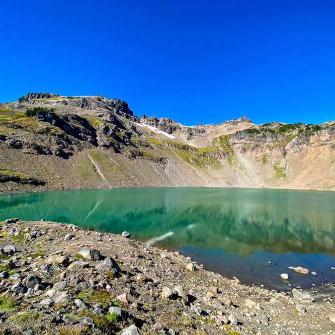
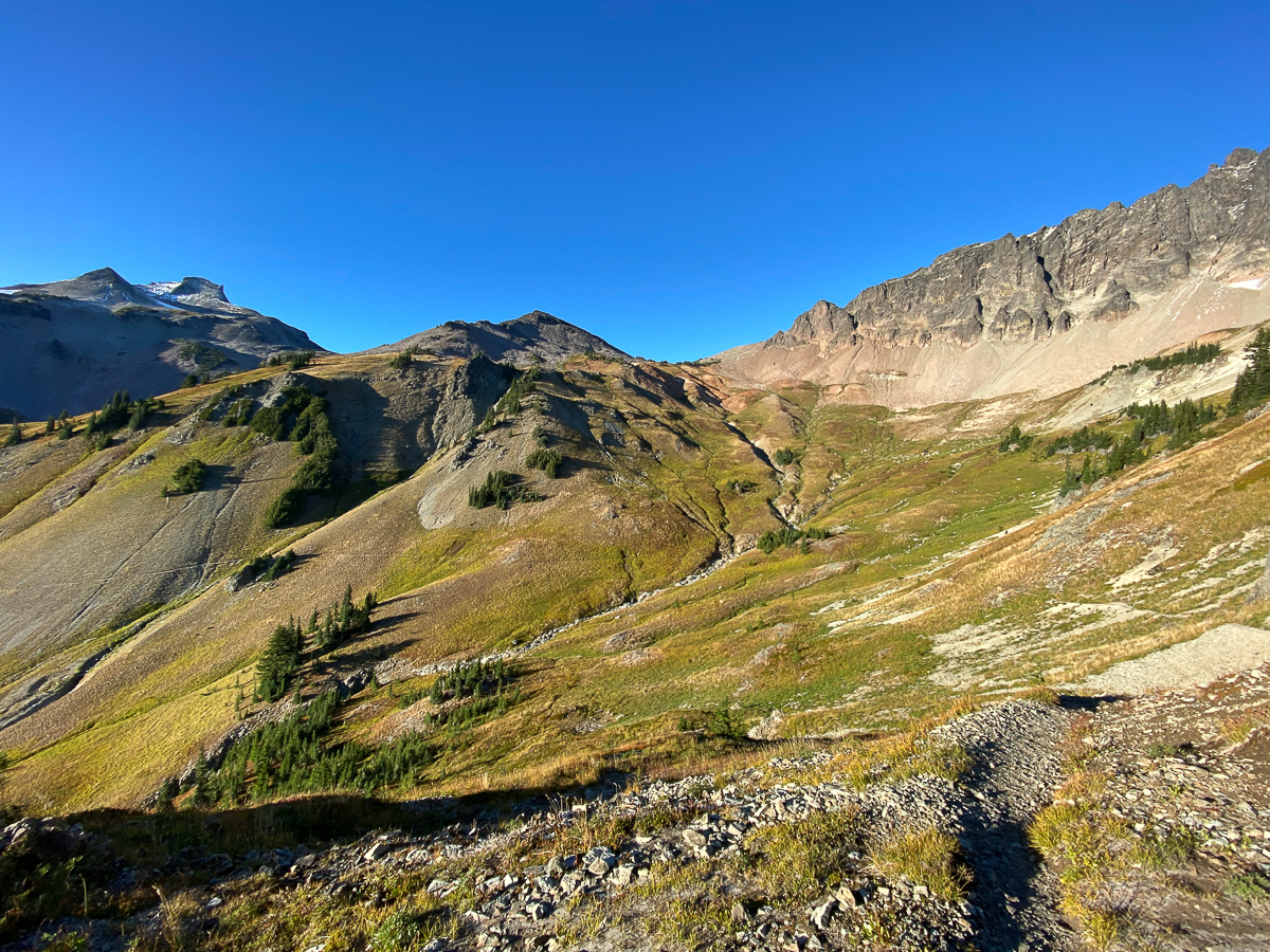
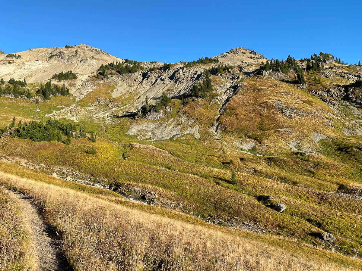
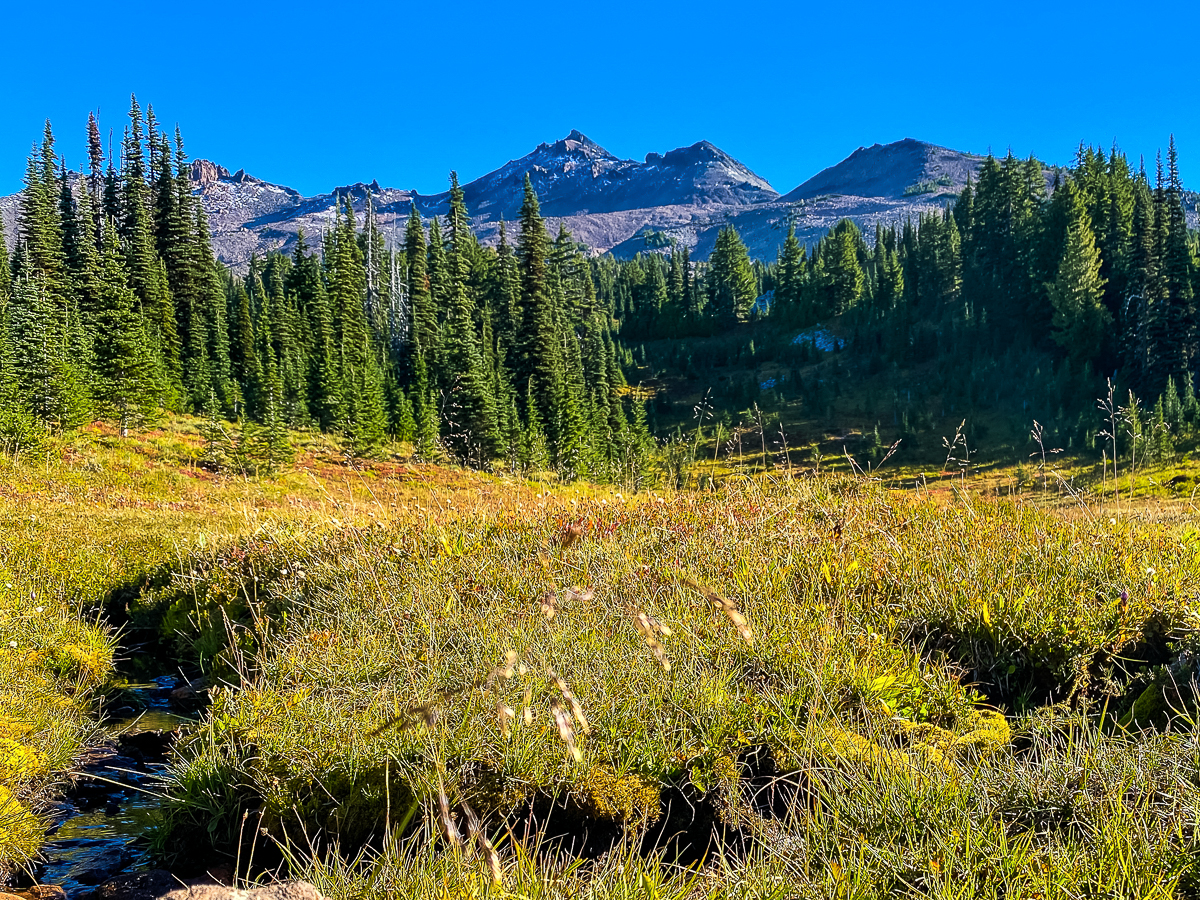
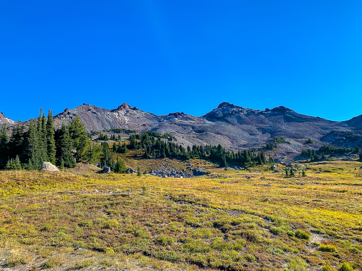
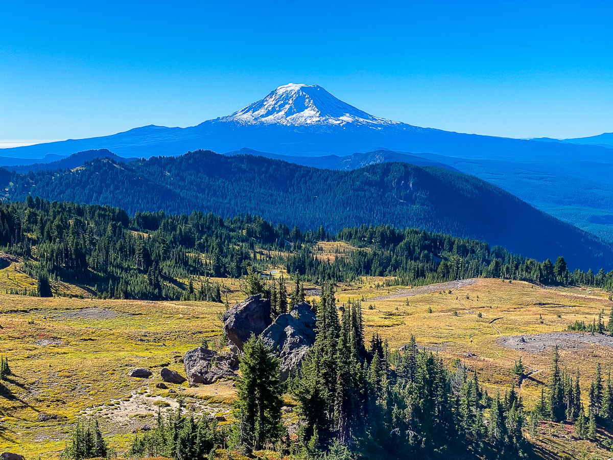
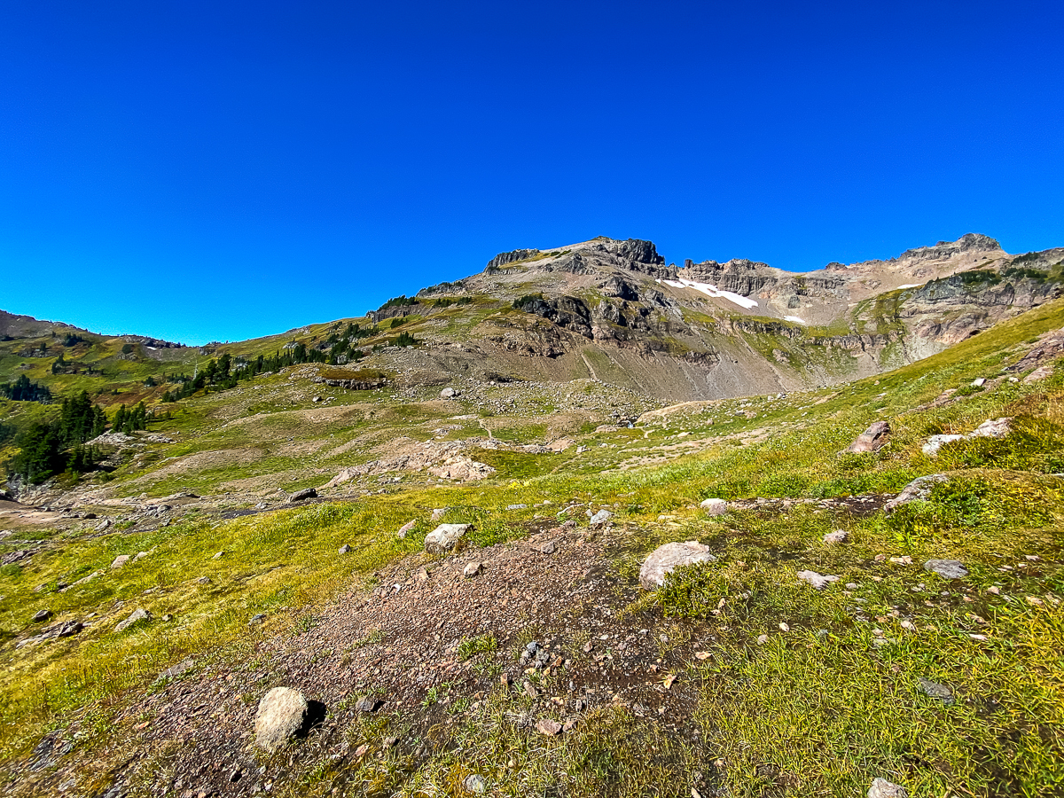
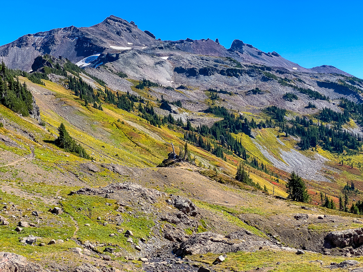
After spending a short while in the sun on top of Nannie Peak, and following the trail along the ridg for some distance, I arrive at Sheep Lake for lunch, sitting on the same tree roots as last time – it was the only shade I could find with someplace to sit. The day is bright and warm at this point. After a lunch of trailmix, I filter some water, then make my way up the trail to Cispus Pass, to which I thought I had been before. Turns out it was simply the pass before the pass (a faux pass? Probably best referred to as Nannie Pass), and I still had some climbing ahead of me to reach the real pass above the headwaters of the Klickitat and Cispus Rivers. I don’t spend much time here as it is windy, but the view is stupendous.
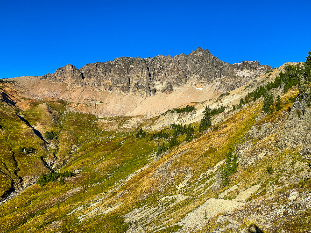
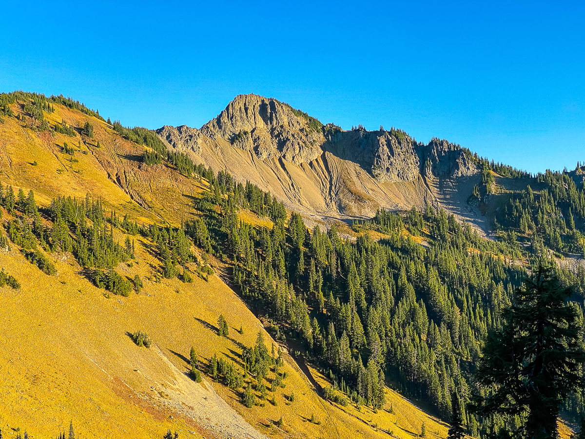
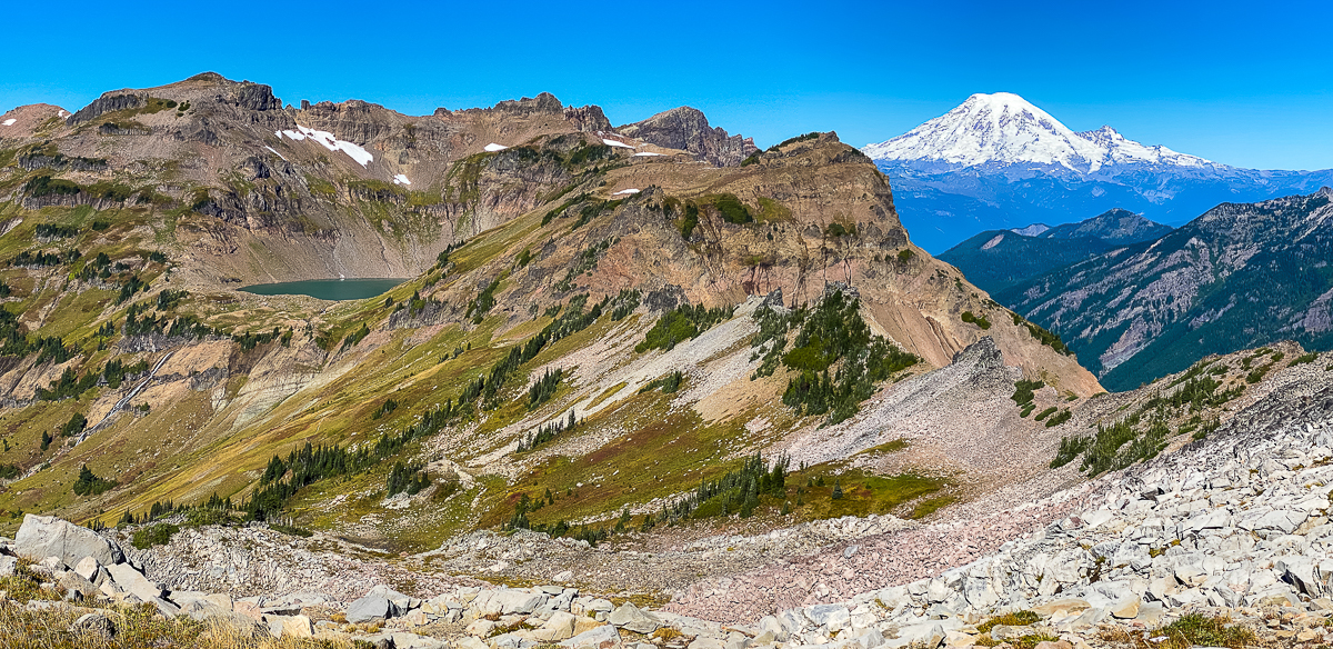
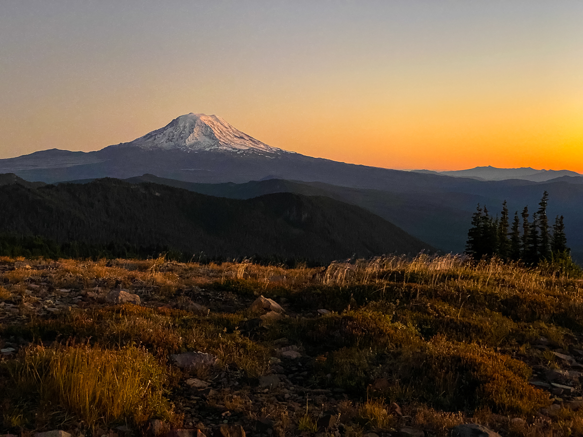
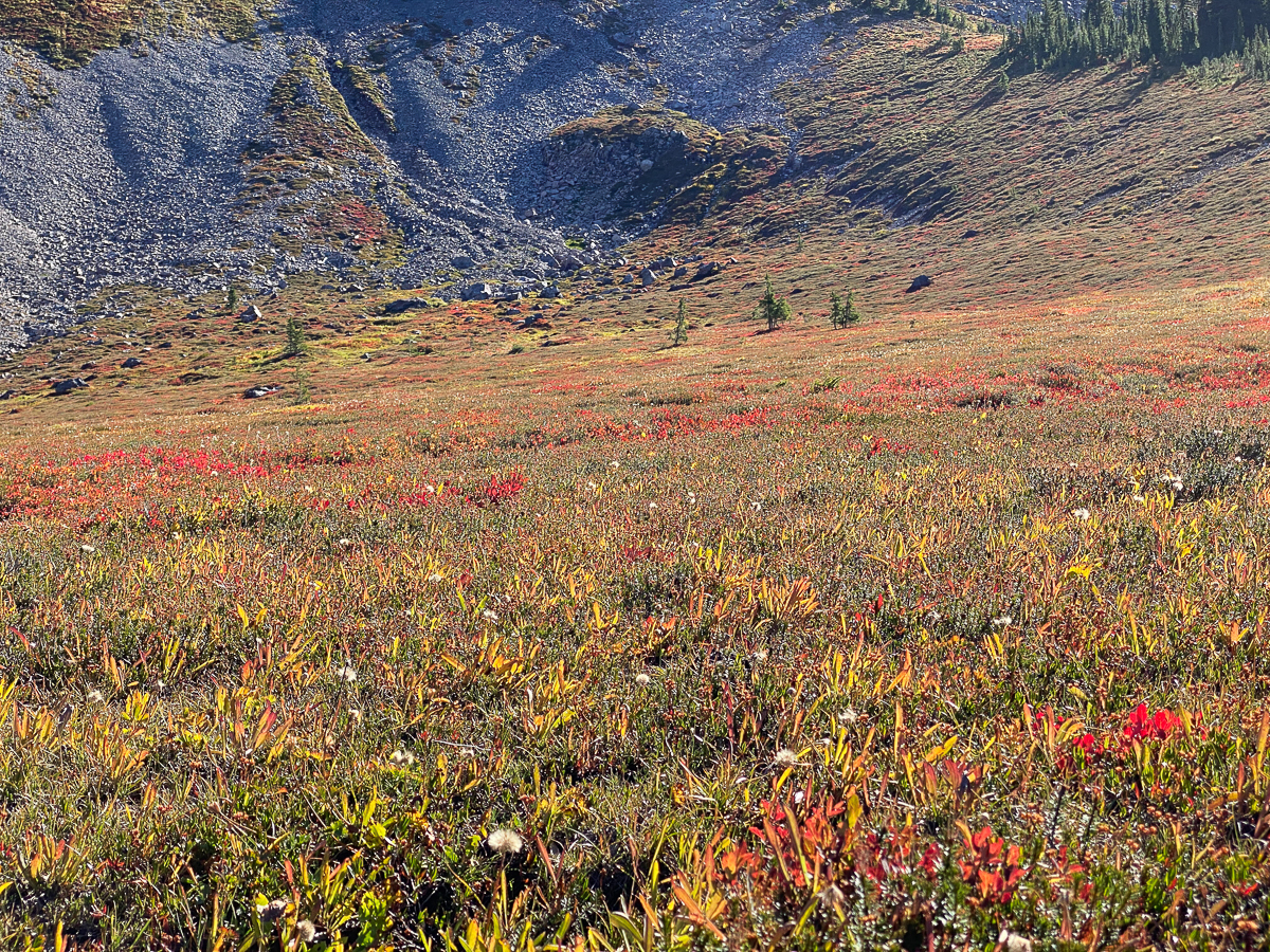
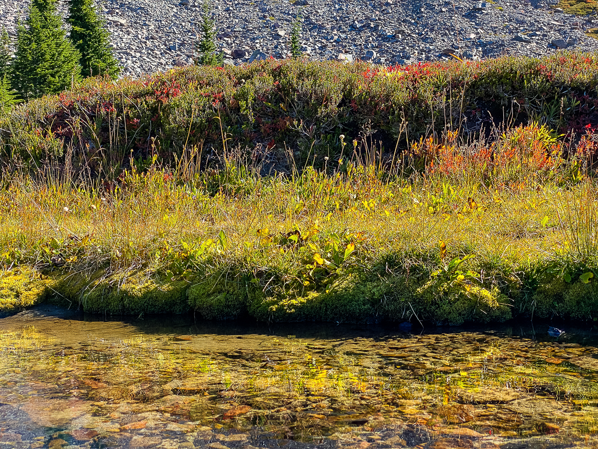
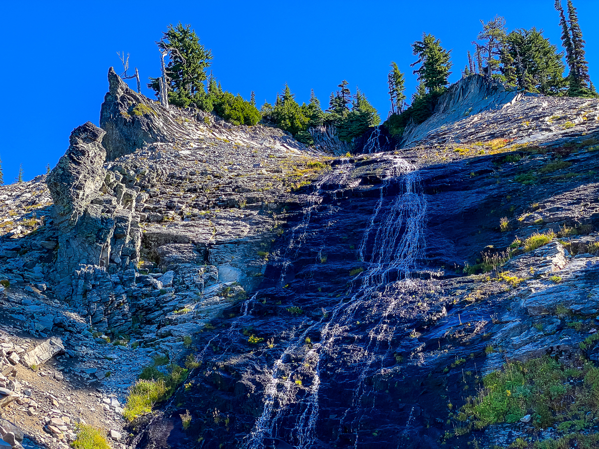
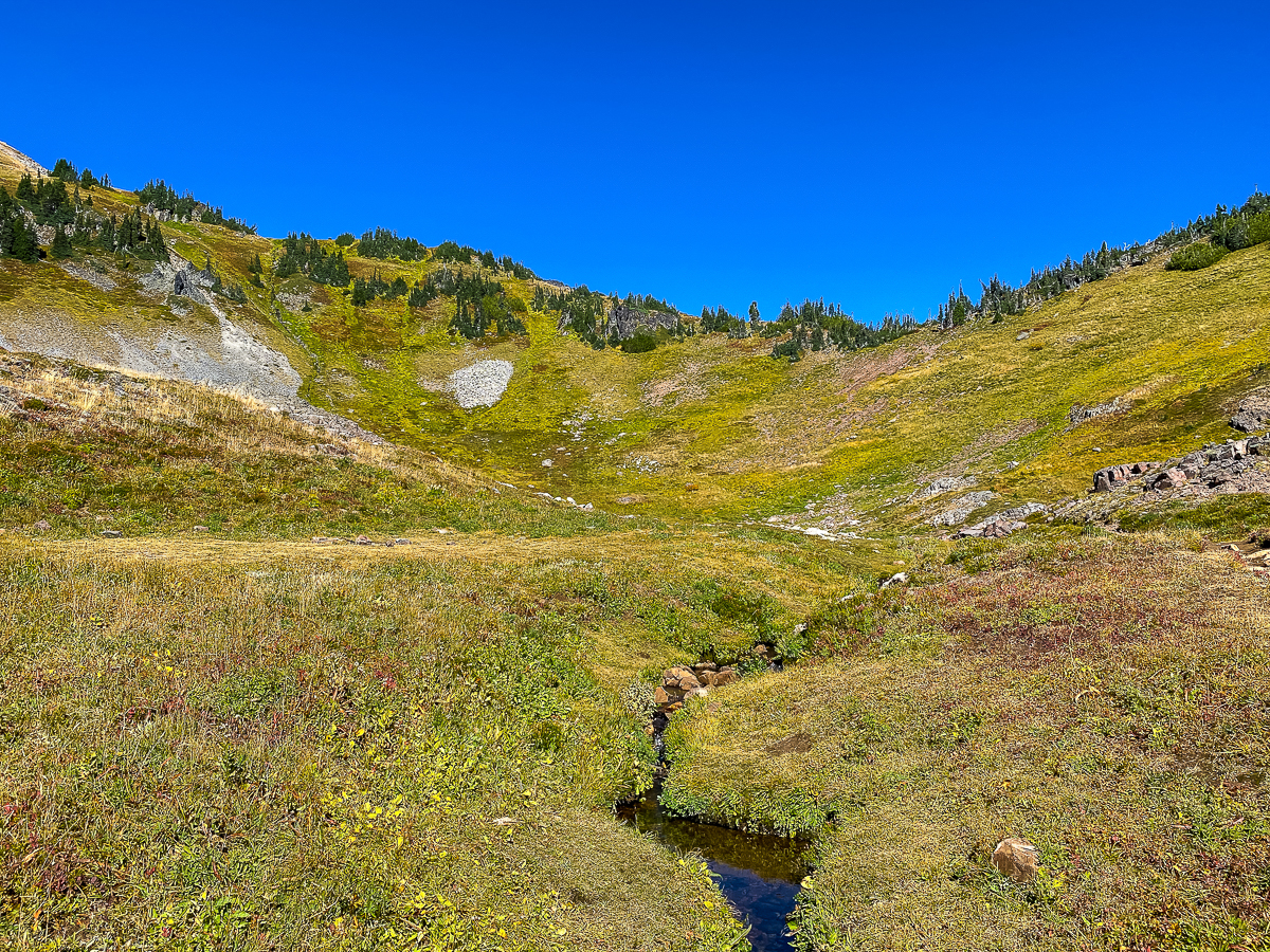
Entering the Cispus Basin, I was greeted by perfection – an alpine basin, set with waterfalls and cliffs all around, draped with meadows glowing with autumn color, all punctuated by the trail elegantly sweeping ’round, and dominated by Ives Peak. I wasn’t able to snag the nice campsite I had hoped, right alongside the trail and the uppermost Cispus River, but I did find a great site some distance along, where I was able to hang my hammock on a cliff-edge high over the river.
The wind blew gustily all night – if it wasn’t tied down, weighed down, or otherwise trapped, it wanted to blow away over the cliff. I nearly lost my jacket at one point, grabbed by a gust and tossed onto a fir tree. I didn’t sleep much, but I did enjoy the swaying back and forth in the hammock as the wind tossed me about. The stars were out in full force, and the moon nearly full. It was a lovely night sky, so sleeping was secondary anyway.
DAY 2
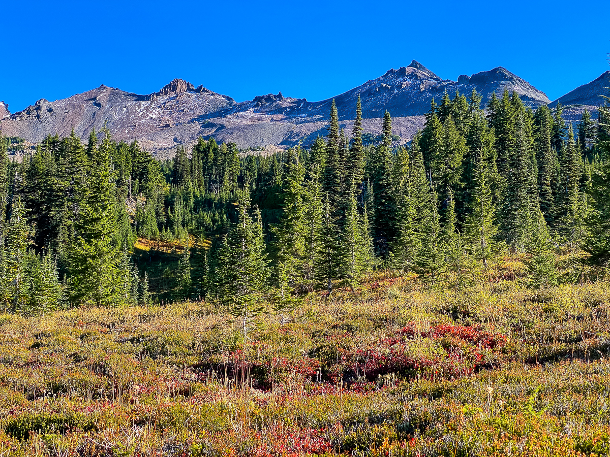
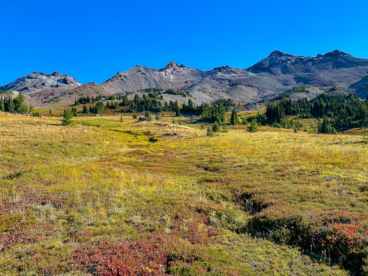
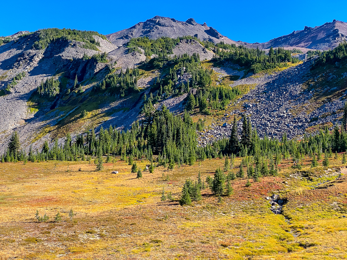
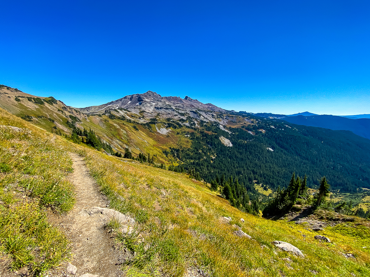
I rose early the next morning and was underway in a pretty reasonable amount of time, my third cuppa dirty chai firmly in hand as I set off down the trail to round out of the Cispus Basin and approach the high meadows above Snowgrass Flats. Approaching the camping area in the large meadow where the Snowgrass Flats trail joins the PCT, I encountered people and dogs – the trail from here to Old Snowy is popular, and plenty of peak baggers were ahead of me, unencumbered with packs and traveling fast. The trail winds its way thru alpine meadows, stepping up level after level, always climbing. Eventually, one leaves the tree line behind, small clumps of alpine fir giving away to expanses of dried grasses and wildflowers. Looking up, one can discern the sky is darker than normal, a testament to the elevation.
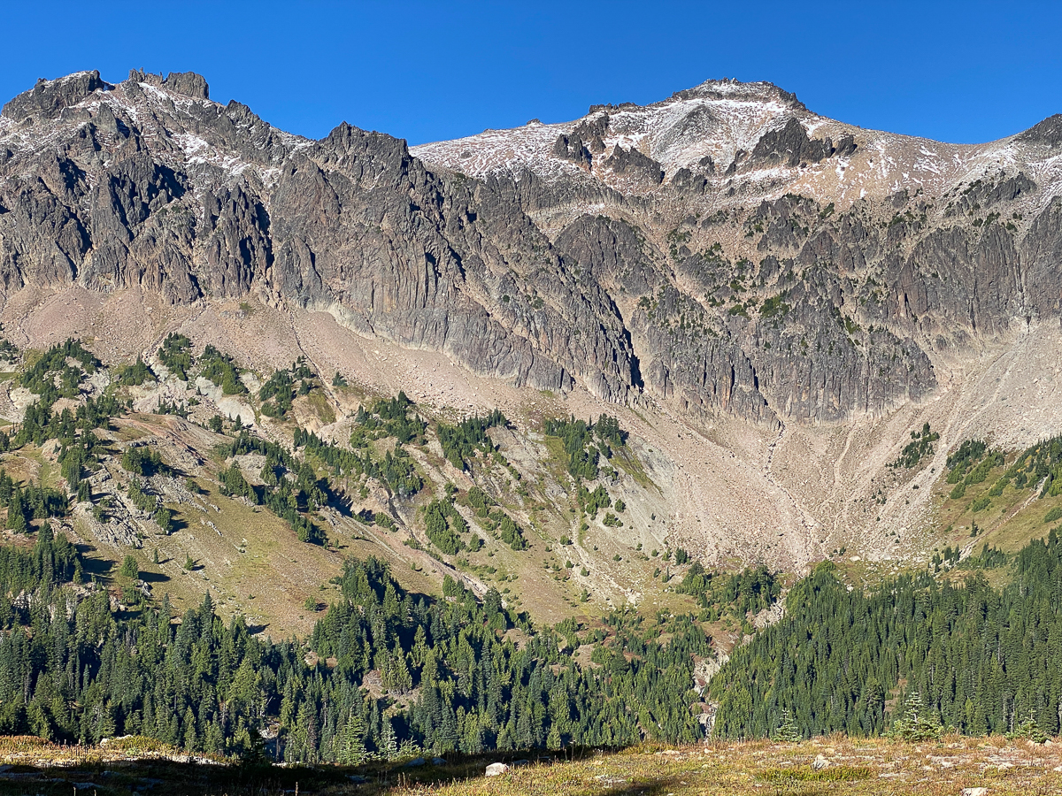
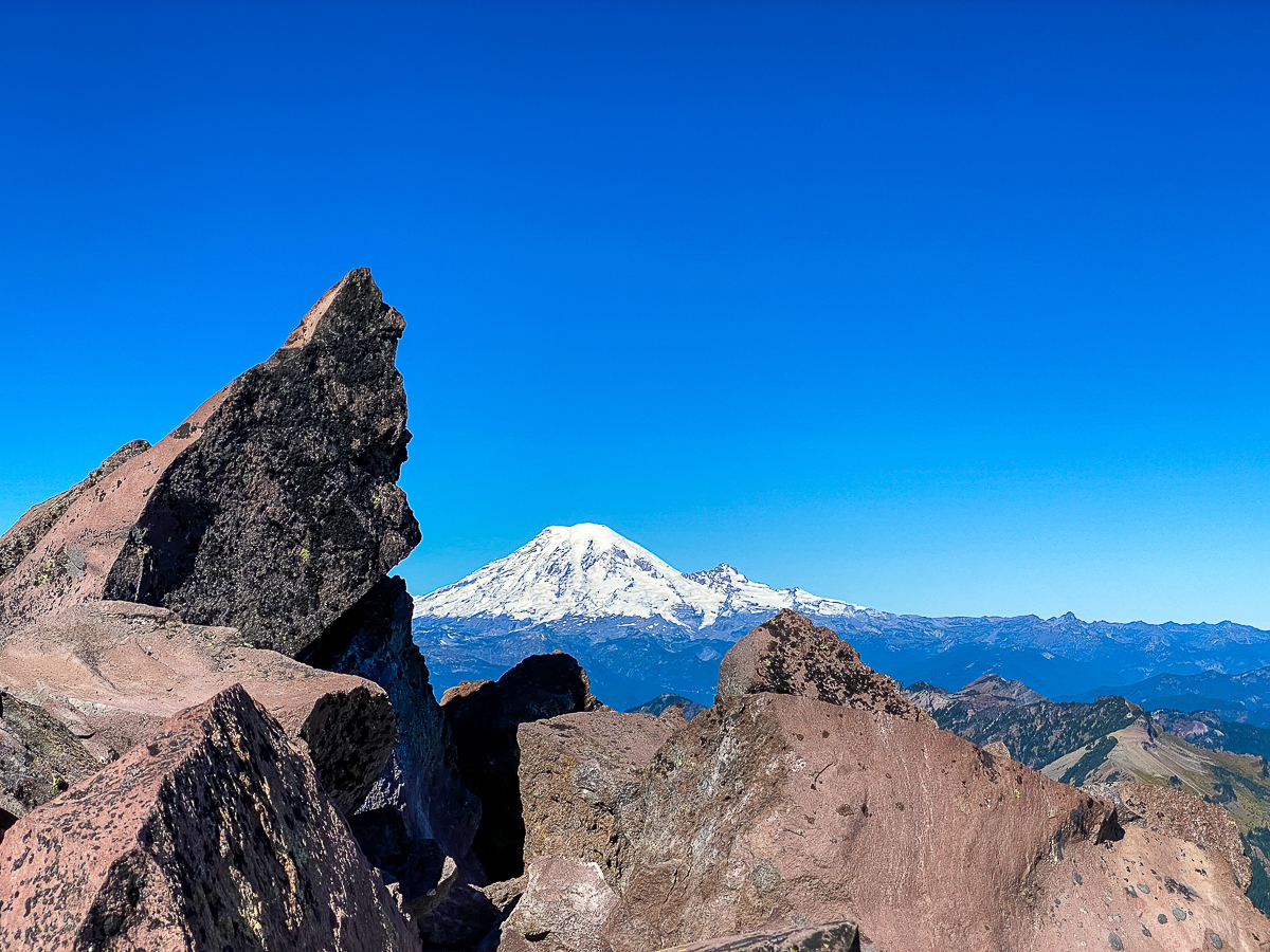
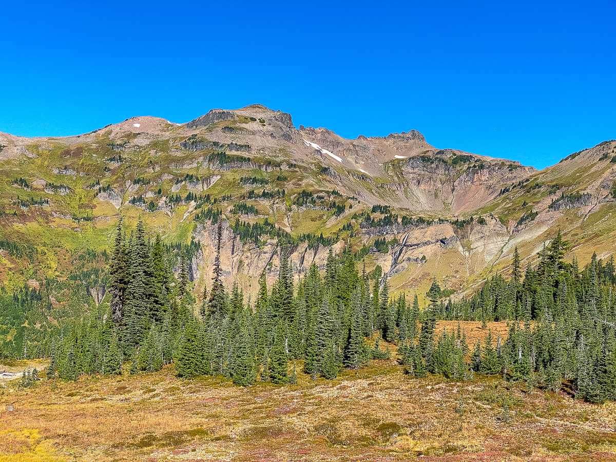
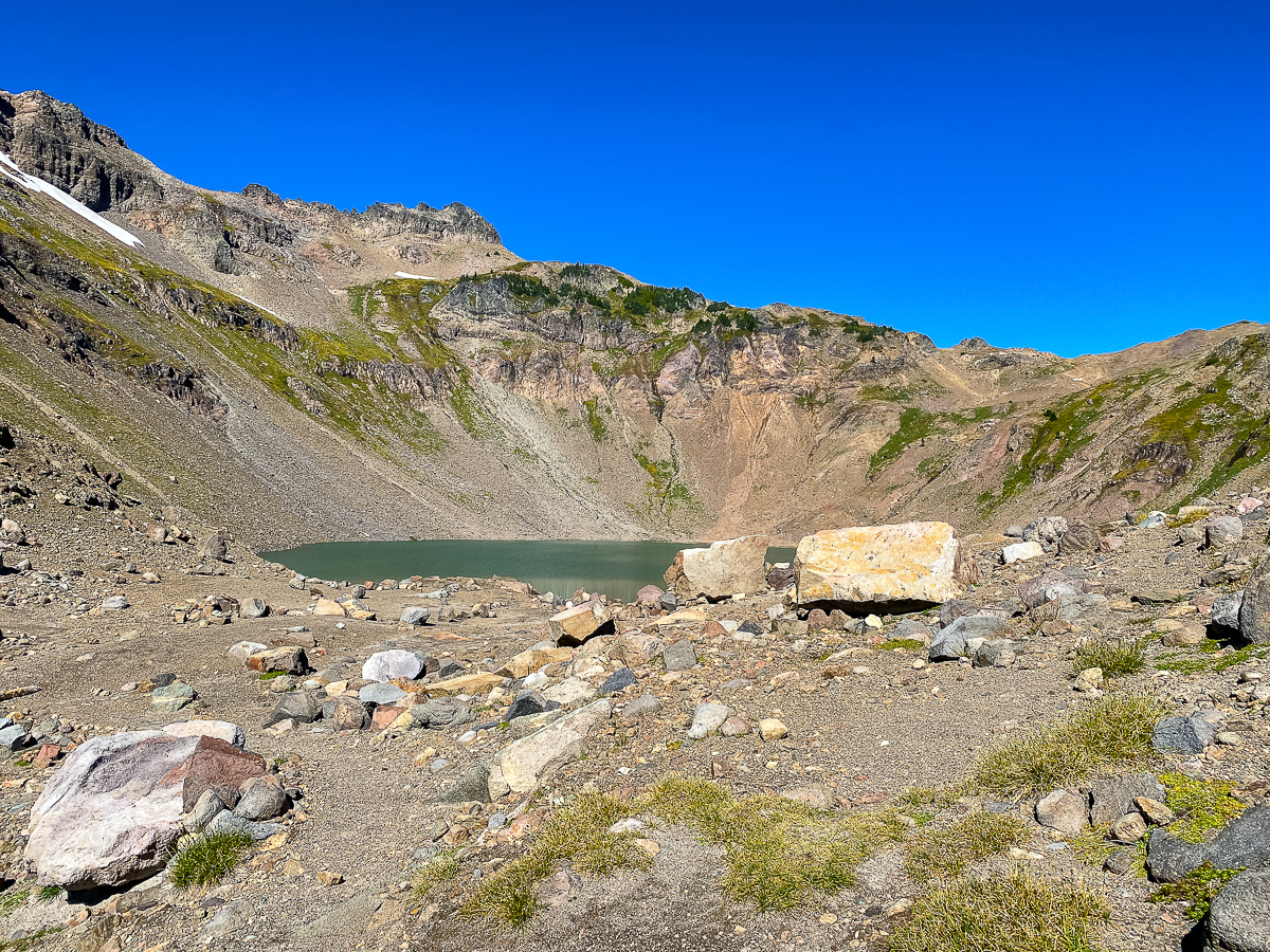
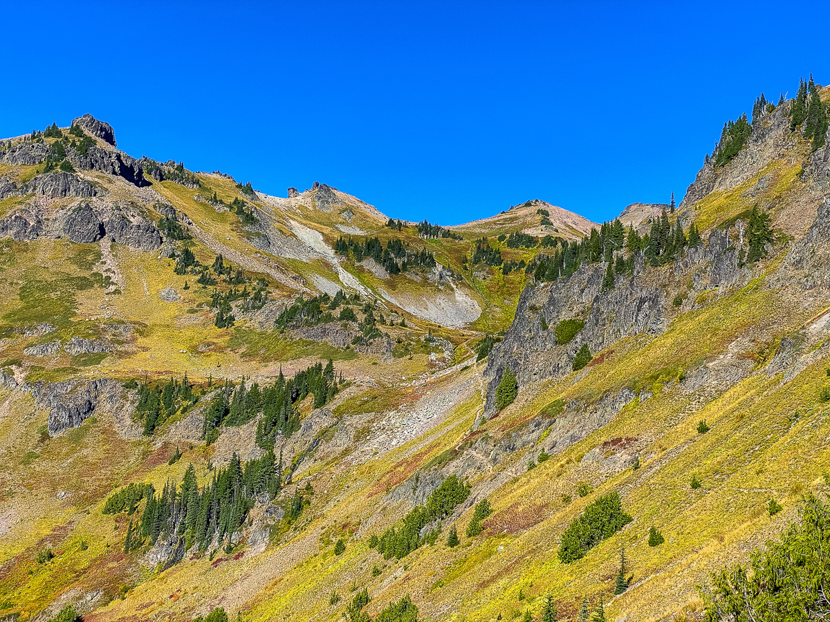
Continuing, the trail climbs up over a rise, and one is greeted by stupendous views of Goat Lake, Tahoma, and the Cascade Crest, as well as a snowfield and tarn. Just above this, the PCT splits at a large cairn – one branch stays pretty level, scooting underneath the massive edifice of Old Snowy, providing safe passage for stock, the other goes straight up to a high saddle.
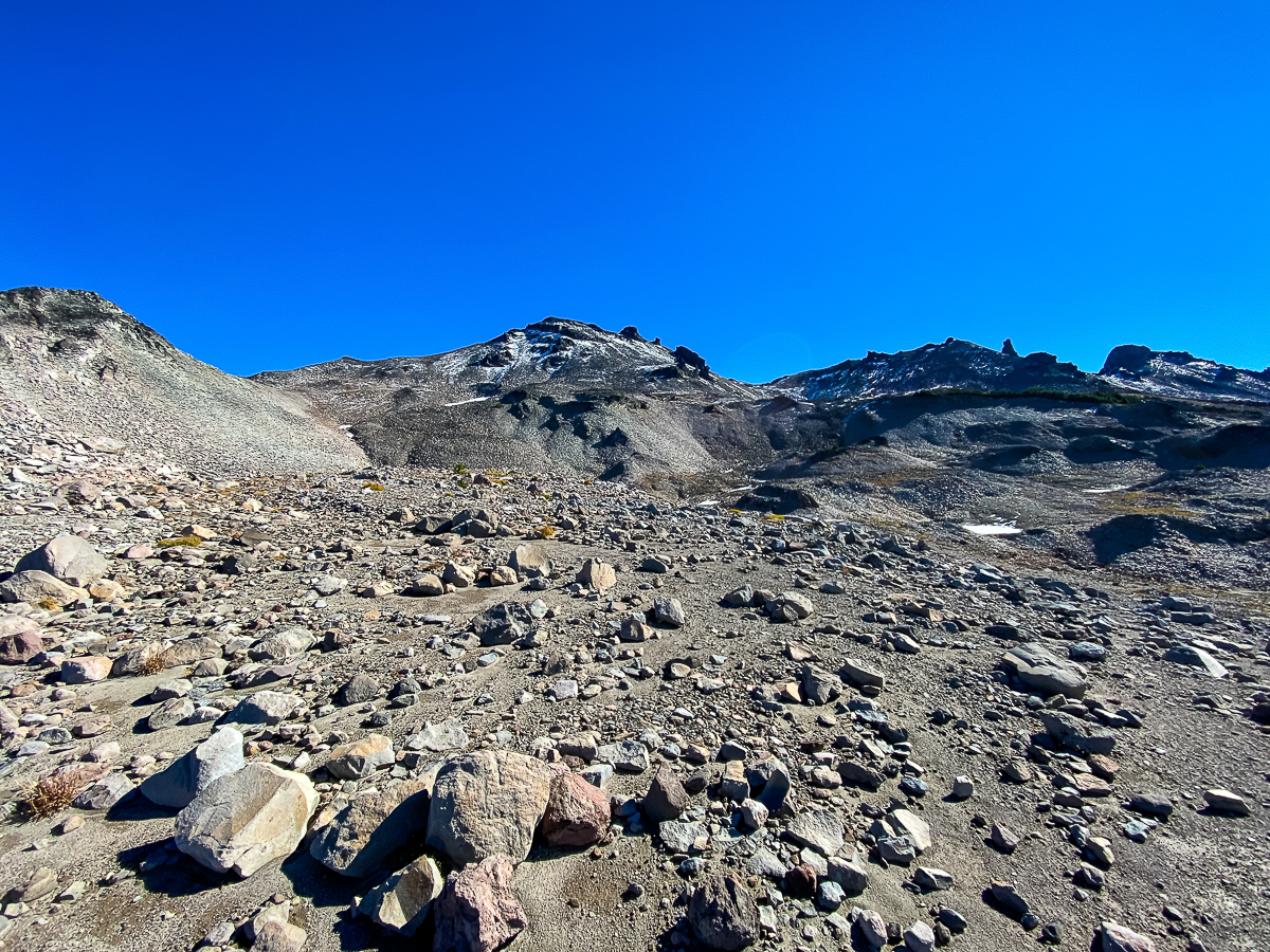
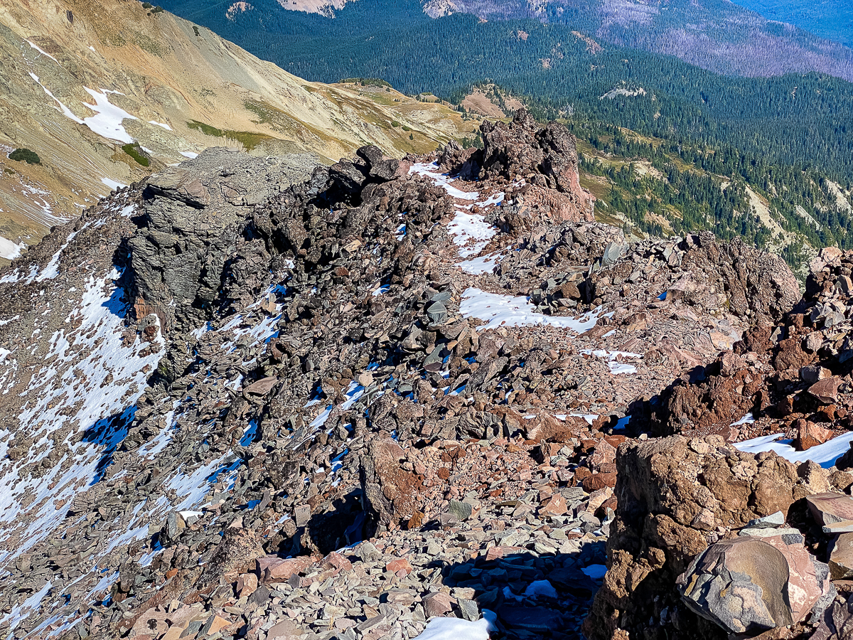
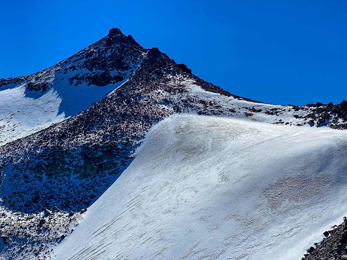
I took a break at the cairn, and watched a fellow who had been some distance ahead of me all day make his way along the stock trail. Having snowed a couple days prior, the stock trail was still covered in snow and ice. I could see the fellow making a very slow passage, and I worried about ice on the trail. Eventually, he came to a hanging snowfield that needed to be crossed. I could see, even from the distance I was at, that the snowfield had been crossed a few times, but not many. After much deliberation, the fellow decided to go around the snowfield, dropping down on to the talus, the re-ascending. I watched him get back on the trail and head for the next saddle, and thought to myself, ‘well, probably best to take the high route”, which I did. Hikers who came over from above were telling me they’d been told micro spikes were necessary, and it was still iffy.
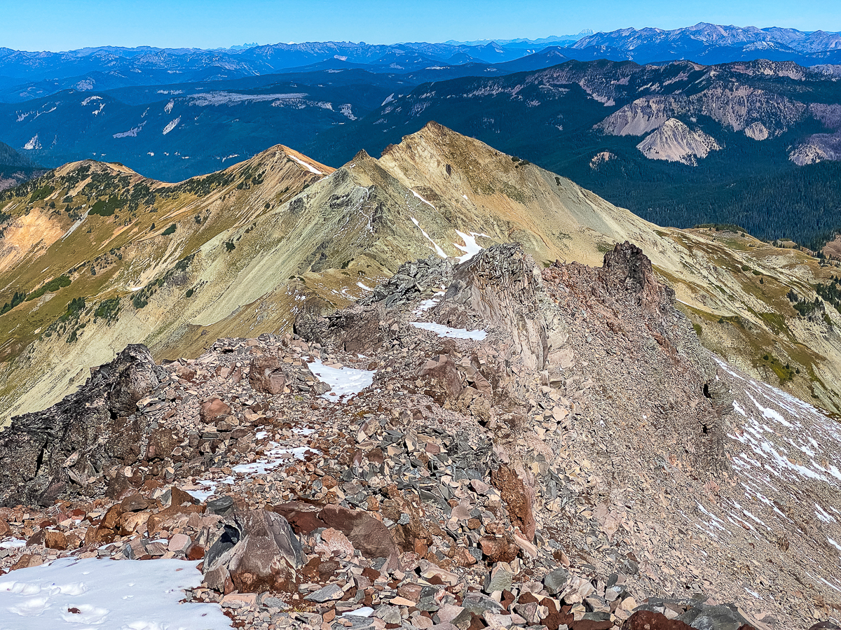
It is a very steep climb, but I took it slow, and after a while my 800-lb pack and I were at the saddle – the summit trail ascending to the south, the PCT following the knife-edge of a ridge top to the north. I took another break, then set off north. I had considered doing the summit, but watching two women, and then a single fellow, follow that trail up, I was uncertain of their path. I didn’t feel like expending the energy, so put the summit off for another day. They all made the summit, and when I asked the fellow, he said it wasn’t too difficult. Still…
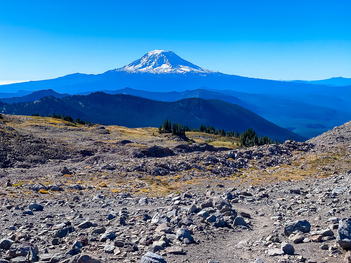
This portion of the trail then traverses the very tip of the ridge north, while a summit trail does the same south. Looking north from here, I could see the famous Knife Edge of the Cascade Crest over Packwood Lake. And I could see it was still covered in snow and ice. And I could see I would be turning back. Looking down the steep trail along the ridge’s top, I saw that fellow who’d been ahead of me headed up. We chatted for a bit, and he’d decided the Knife was not for him this trip. He’d watched someone make the traverse and said they moved very, very slowly. I simply was not looking for that level of adventure, so I let him get some way ahead of me, then turned around.
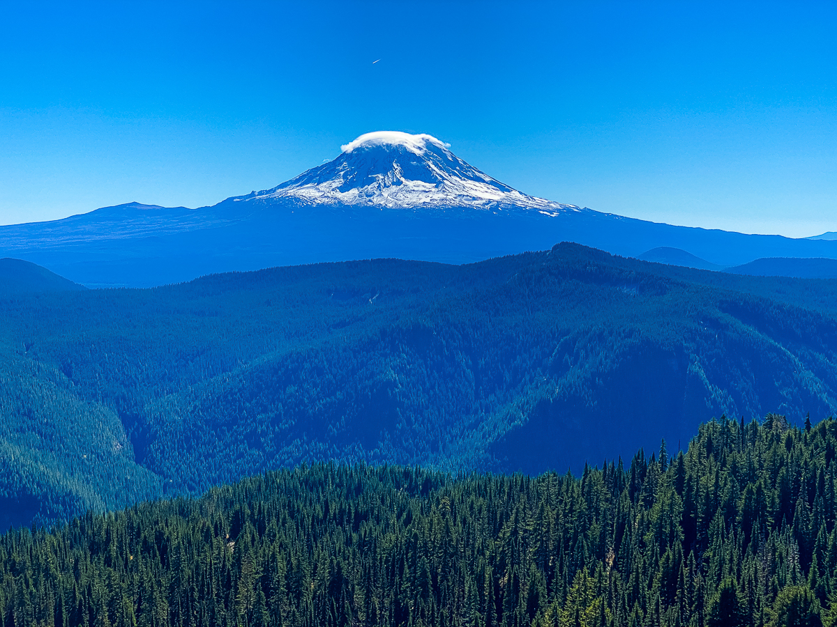
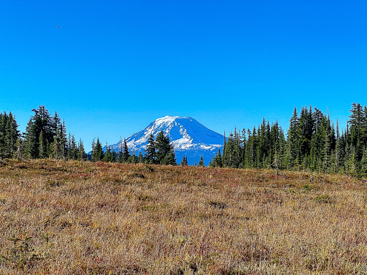
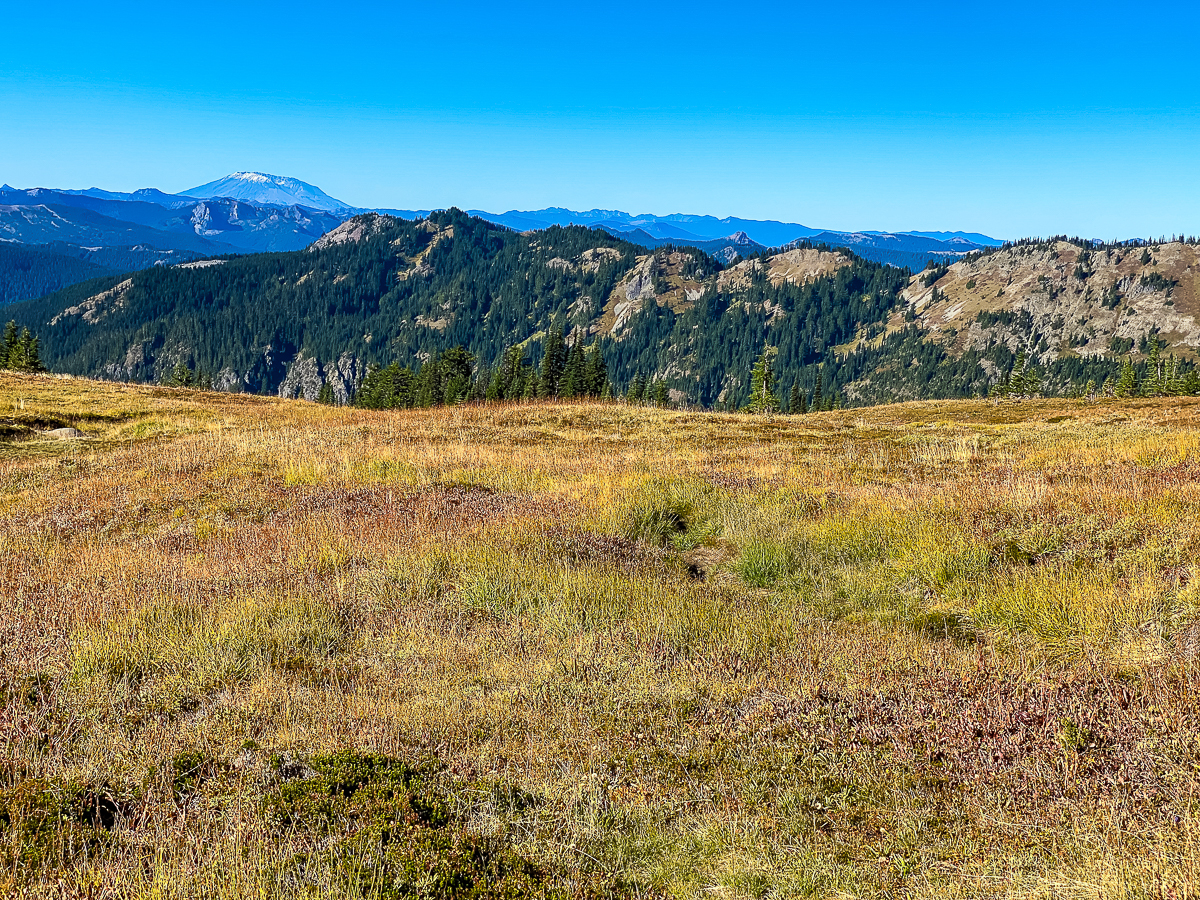
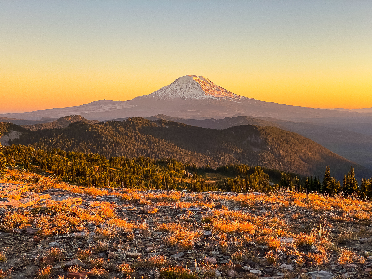
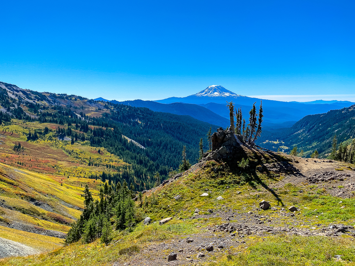
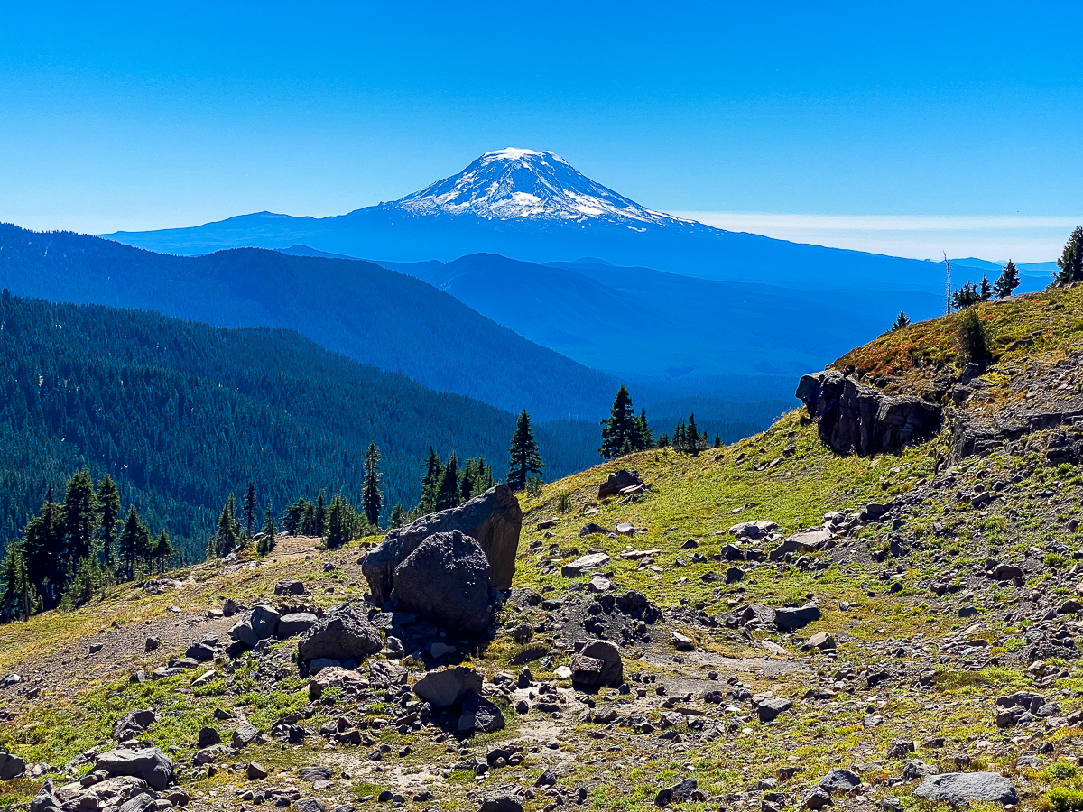
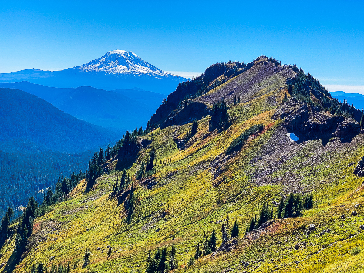
I’d heard, before setting out, that a solar storm was forecast for this night, and the Northern Lights were possible. I thought it best to find a campsite with a good view to the north, maybe with a view of Tahoma, but I also needed a site near water, as I was about out. I ended up backtracking to the meadow above Snowgrass Flats, and finding a ledge up above the trail with a small stream and lots of open sandy spots. The site I chose didn’t provide a view of Tahoma but the view was superb all the same, with Pahto rising to the south, Old Snowy just behind me to the east and Loowit hunkered low to the west.
Dinner was eaten in the wind and gathering dusk, as the moon rose, and by dark I was enjoying my cuppa NiteyNite tea with cinnamon, honey, and whiskey. With the temperature dropping I was adding clothing layer by layer, and by 10 PM sleepiness had caught up with me. The stars were out bright, and even with the nearly full moon, the Milky Way was discernible.
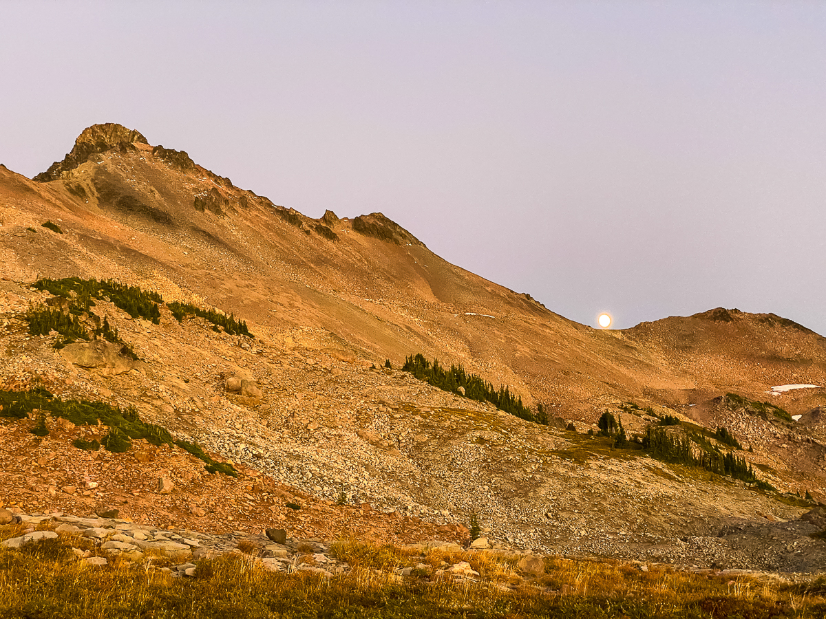
I kept my eyes on the northern sky, hoping to see those shimmering curtains of rainbow light. All I could see was a glow – for all the world looking like light pollution to the north. Of course, there are no light sources to the north, but still, I didn’t register this glow as the Aurora Borealis for quite some time. I set an alarm to wake up at 12:30, and again at 3:30 – the glow was always there, without color or definition.
The moon was setting when I woke at 3:30 – a baleful, misshapen, glaring lump of an ember hanging low, north of Loowit. The world was very still – no wind, no bird call, no hiker sounds. It was as if the entire world was holding its breath in the dark, hiding from something or someone. I fell asleep again just after the last thin red slice slipped below the horizon.
DAY 3
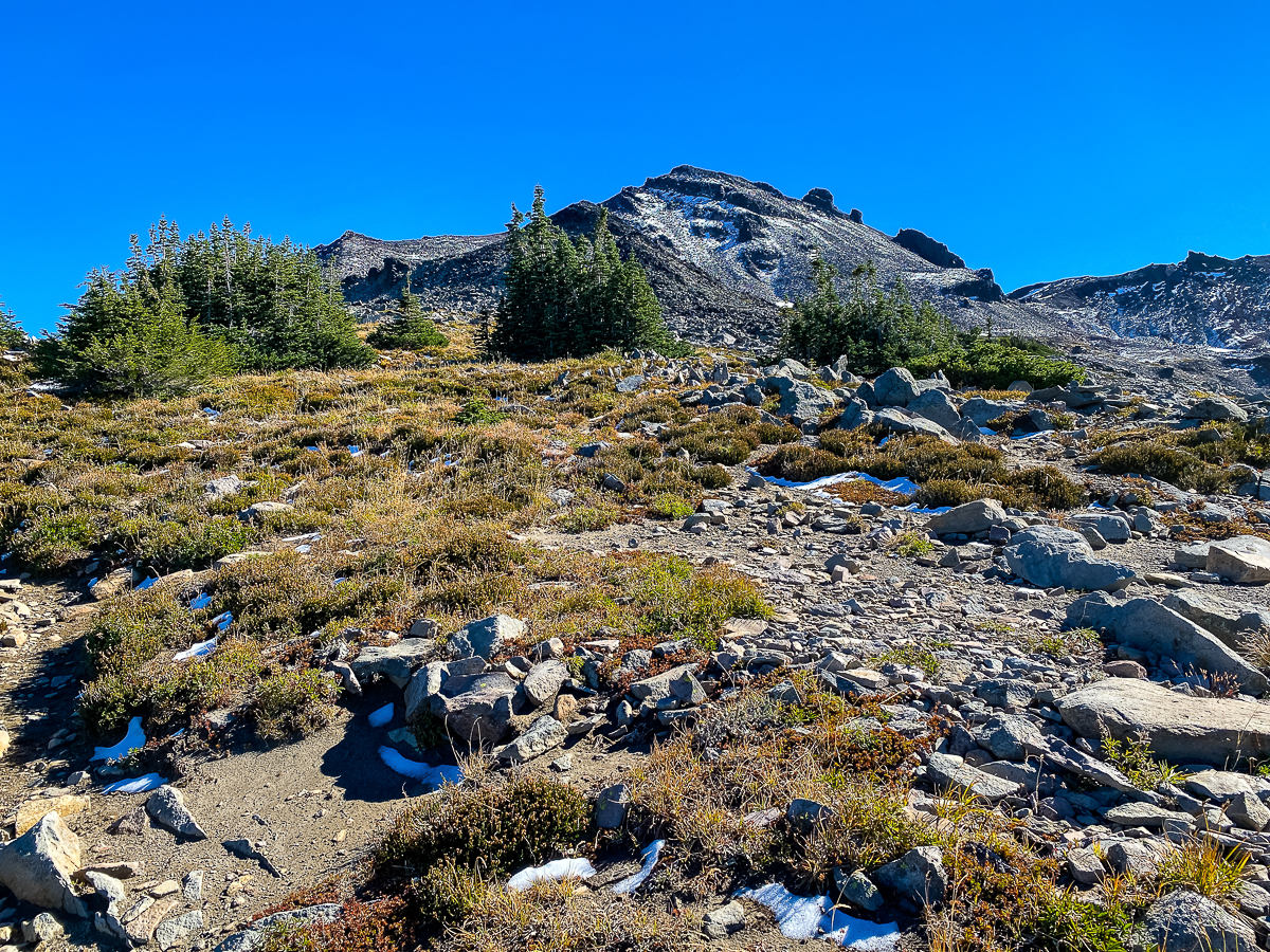
Morning found me sleeping in, and in no hurry to leave my meadow camp. Overnight, I had toyed with the idea of spending today on the Old Snowy summit, and then descending a way for a lower-elevation camp. With morning, tho, I realized that I really just wanted to move along, and hit up that beautiful country in the Goat Creek basin.
Two marmots were very busy hauling hay into their burrows just behind me. They were curious, but not frighted of me, and I made no attempt to get closer to them – I would turn around to look, and see one or the other up on a rock looking at me. It would scream when it saw me looking back at it, then would jump down and continue pulling up vegetation to stuff in burrows above. To be honest, only one marmot was busy storing hay for winter, the other was just busy eating it. I got a sense of which marmot was the male…
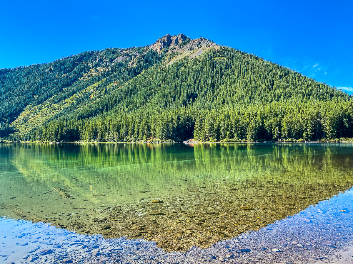
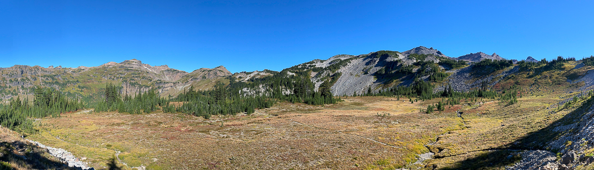
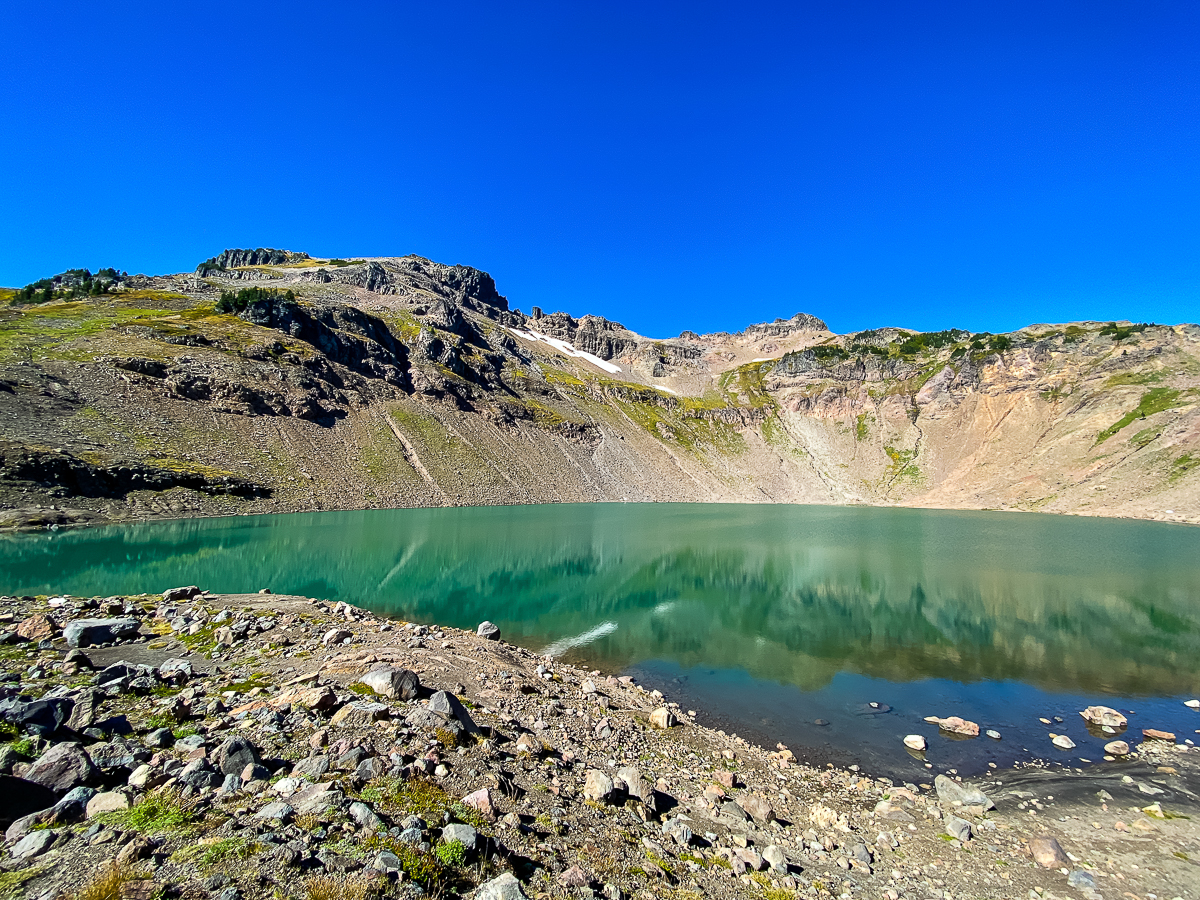
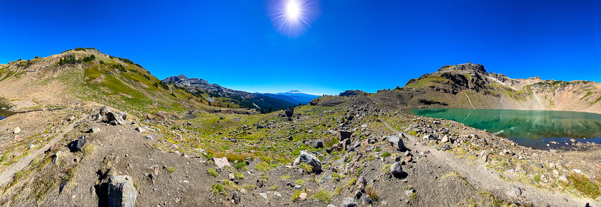
The hike down the Snowgrass Flats Trail to the Lily Basin Trail was one of alternating miniature forest bedecked in diamond dew, and pocket meadow shimmering with the same. Turning north onto the Lily Basin Trail, the meadows opened up, and the air began to warm. By lunch time, I had traversed the eastern wall of the Goat Creek basin and was approaching Goat Lake. There are lots of great camps at Goat Lake, and the outlet stream presents a most amazing angel-hair waterfall plunging hundreds of feet down the headwall of the basin. The waters of the lake are turquoise and the shore edged in small rock and sand.
Parking myself on the eastern shore, I stripped off my boots, socks and shirt, and sat right down in the lake to cool down. That only took about 30 seconds. The remainder of the hour was spent basking in the sun and gazing upon the cliffs.
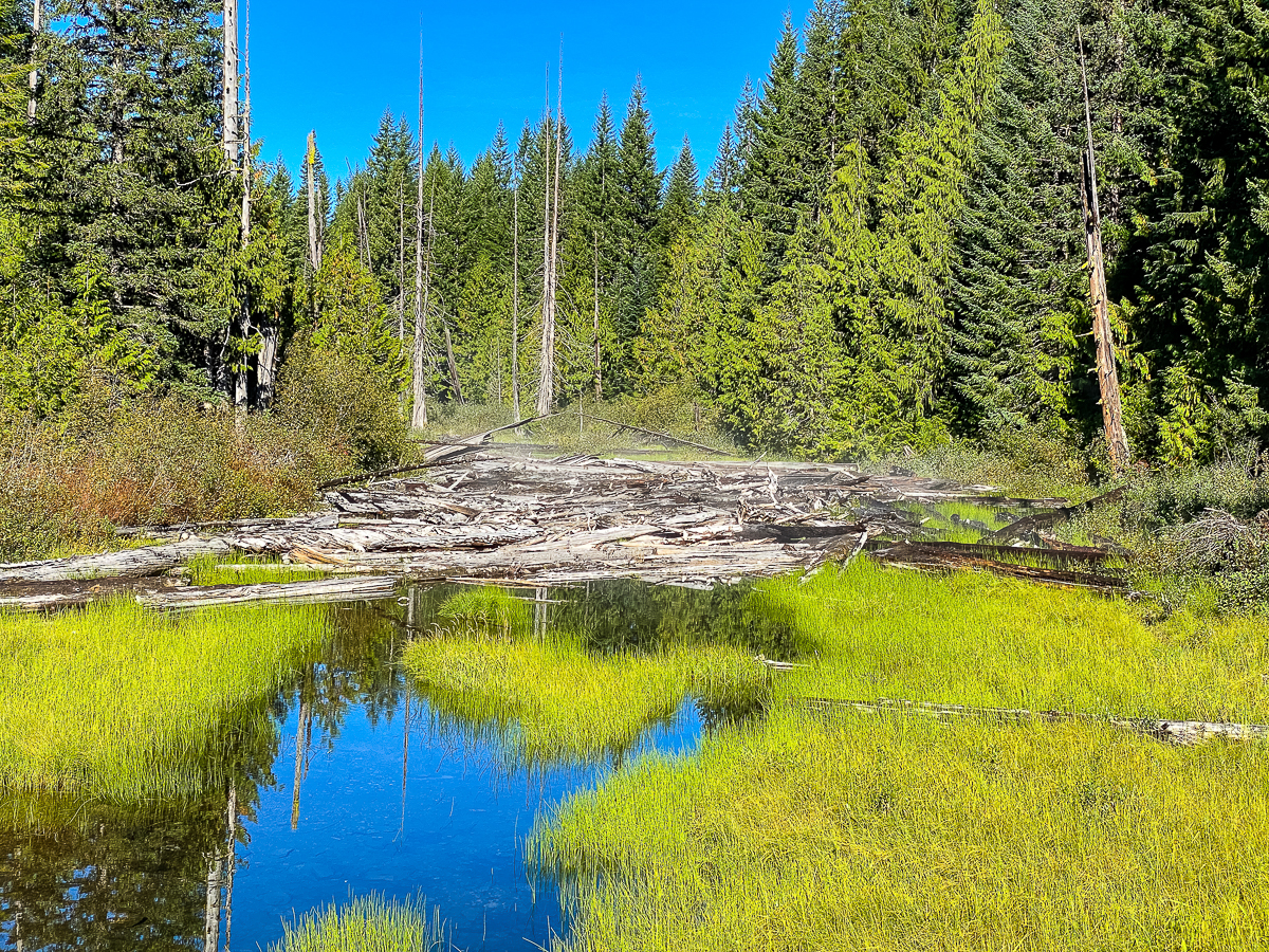
The trail climbs up from Goat Lake to the Jordan Basin Trail, where one can either continue over the pass into the Johnson Creek drainage, or follow the trail down to Chambers Lake, which I did. Jordan Basin is beautiful, and I took another break there, but then hauled down the trail all the way to Chambers Lake. I was hoping to find a campsite near there, but even after wandering down the Klickitat Trail a way, I found nothing, turned back and continued on.
I ultimately followed the Klickitat Trail below Chambers Lake as it parallels the roadway and then enters forest. I missed the point where the trail left the roadway at one point, and ended up hiking all the way down to the USFS 2160 Rd, to spend the night alongside Chambers Creek, making for a very long day of hiking – over 18 miles! I arrived at a campsite at the end of a spur road at dark.
DAY 4
In the morning, a family of Whiskey Jacks made my acquaintance, and even brought a juvenile along to learn how to beg. It was so darling, and spent a few moments harassing a newt before I chased it off. They are such gregarious birds, and always a joy to encounter.
My camp this last night was only a couple of miles of road walking from my truck, so having set off, and having enjoyed a break along the Cispus River, I dumped my pack back at my truck, and decided to add one more small leg to my trip. I had not noticed it prior, but the Klickitat Trail actually crosses the 2160 where I am parked. Following this trail, I suspected would take me to the river, and on to where I had been the day before. I hiked down as far as the river, but decided crossing and working my way up the slopes were not as worthwhile as a burger at the Huff-n-Puff would be.
That burger was divine, but not quite so divine as this hike.
Leave a Reply