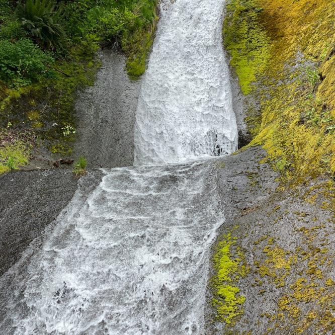
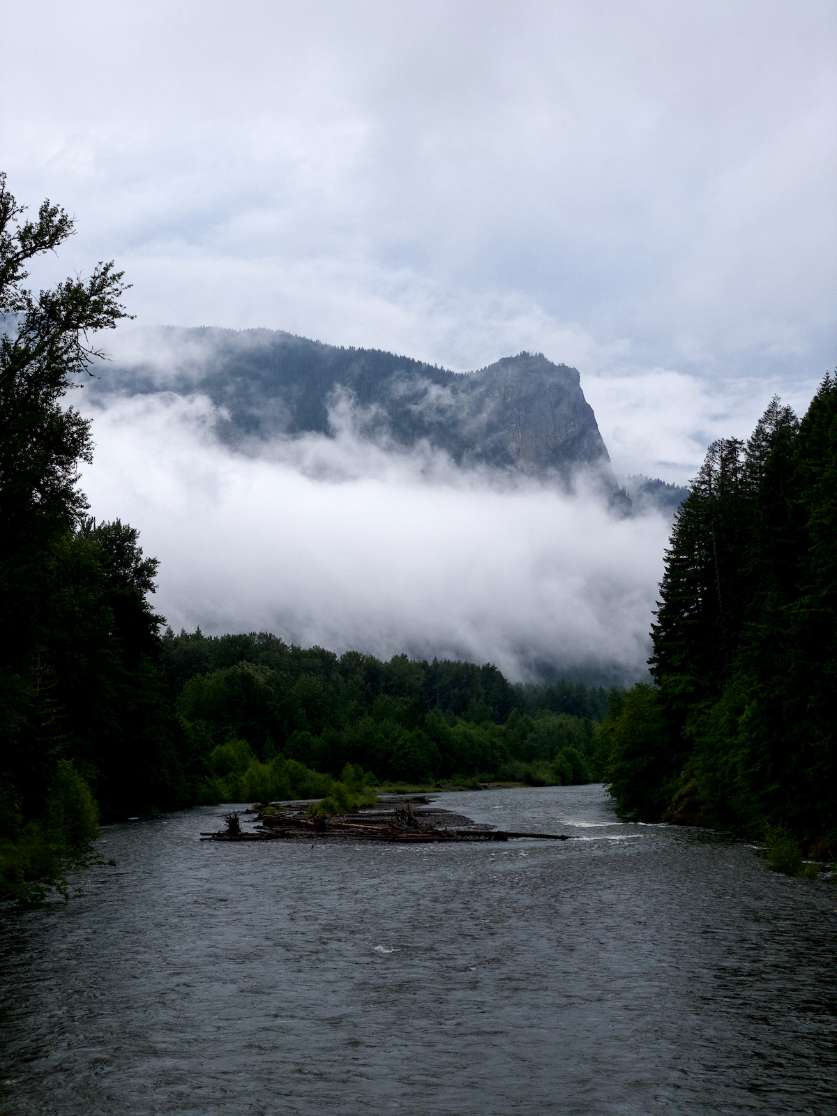
With a crash and a boom, I crossed the Tom Music Bridge over the Cispus River. No, it wasn’t my truck, it was the sky. Often, when I make plans ahead of time to take a long weekend, the weather gets the last laugh. Today, for example, with a very active day of thunderstorms forecast. With five days off, I intended to explore the Cispus – on foot. I’ve certainly driven thru the area any number of times, along the 23 and the 21 and any number of side roads, on my way to the trail heads and high country, but I’d never walked the length of the valley. This is the kind of welcome I like!
I parked on the first pullout along the USFS 2801 Rd, backing in toward the stumps blocking the track down to the riverside clearing under the big cedars, just beginning a slow recovery from its days as an unofficial drive-in group camp. Fat raindrops begin to appear on my windshield – one, then two more, then another dozen. I put the truck in park, and stash my wallet and keys in my backpack on the passenger seat.
BOO-OO-O-M-M-M-M-M-M!!!!!!!! I am briefly almost-blinded by the simultaneous flash. The raindrops begin to come down faster, hitting harder. I wrestle my rain jacket on while still seated in the driver’s seat, two more peals of thunder, no flash, more distant this time, but not much.
I’m lacing my boot, passenger door open, one foot propped up on the door jamb, leaning in against what is now pelting fat drops of rain. I reach into the outer pocket my backpack to retrieve the raincover, wrestling it into place over the fully loaded pack, filled with food and gear for five days (and then some, knowing me) solo. I have no definite plan, and given that it’s shoulder season, wanted extra food, and a bit of extra gear just in case I get holed up in weather for a day, and have nothing to do but hang around in my hammock and snack, and read my book, and listen to the rain. Yeah, that would be horrible, to be sure. I want to walk up the valley, see what’s to be seen, maybe chase the snow-line midway thru. Take some pictures. Get away from the pandemic.
BOOM-BOOM-BOOM-BOOM!!!! The sky is bright under the dark clouds as the heavens split asunder overhead, waves of sound bouncing off the cliffs above. Wetness descends in a fury. But no bother, I am prepared! My gear will stay dry, even if I don’t. Off I go!
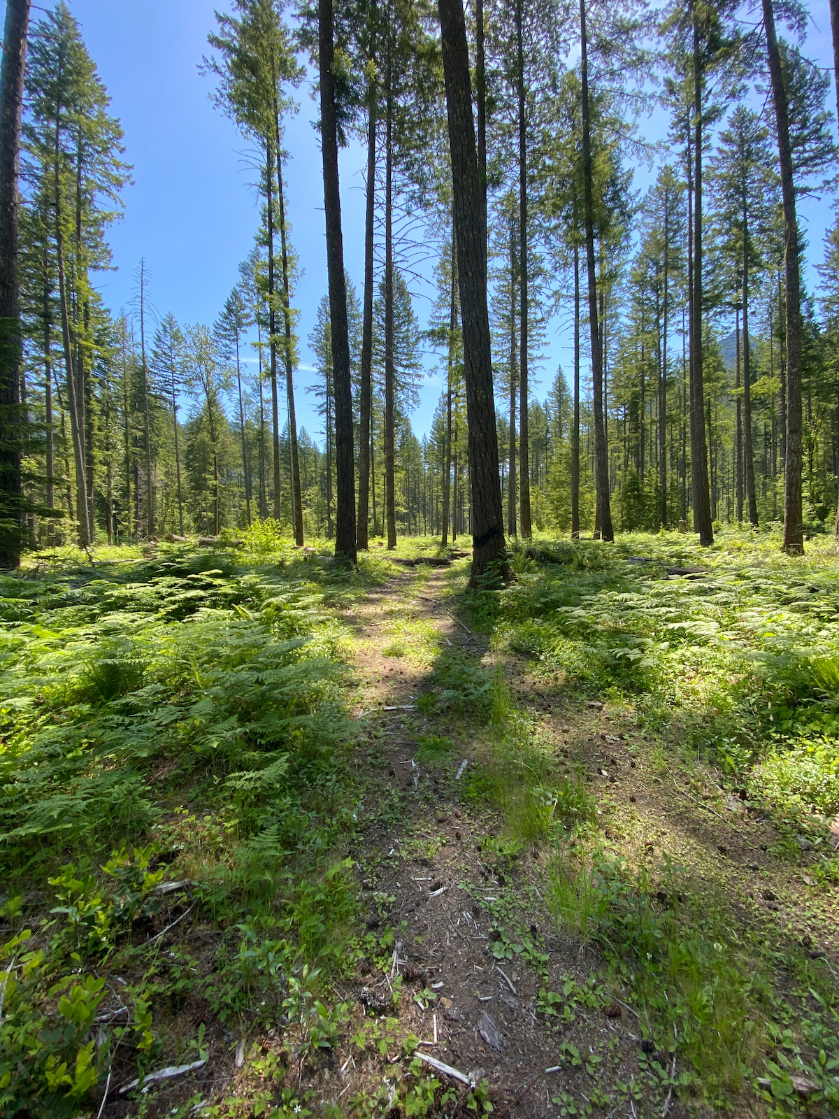
I cross back over the bridge and step down to the trailhead as the rain begins to slacken. I’m already getting warm, dressed in a tank top and field shirt, swim trunks over tights, wool socks and boots, and rain jacket and pants over that. Not five minutes later, I had doffed tights and field shirt, and the rain gear. Sometimes, there’s just no point in staying dry. Sometimes, it’s just not possible. The shower is over, and the trail beckons me thru the forest, the path wide and in great shape, dogwoods brightening the understory. I set a good pace, crossing over the 23 Rd in just a few minutes.
The trail gambols over the rolling valley bottom thru maturing 2nd-growth, relatively open and bright, festooned with more blooming dogwoods and glowing vine maples, sometimes coming close to the road, sometimes veering away. After a while, I cross the 55 Rd thru a thicket of nettles, already waist high, and higher! I used my pole to knock them down and out of my way. It isn’t too long before I cross the 23 Rd again, hugging the NF Cispus upstream, to the 23 Rd bridge. From here the trail crosses the bridge and continues along the 23 to exit just past the North Fork campground. I, however, followed the trail up the NF Cispus to a foot bridge over the river near the NF Guard Station. I (illegally) pause at the guard station for a late lunch.
Fed and rested, I walk down the campground road, cross back over the 23 Rd and, after a short distance, cross over again. Shortly thereafter, the rain returned, with a bit of thunder, but nothing like the previous. Approaching Slickrock Creek, I begin keeping my eyes out for a good place to hang my hammock. Sleeping on the ground is not an option tonight, and as it approaches the dinner hour, I’m getting tired. Nothing stands out, so I continue on, passing Smoothrock Creek. Eventually, a nondescript space between two mid-size firs reveals itself right next to the trail as I round a corner atop a rise. Good enough. I’ve hiked 10 miles today.
I shrug off my pack, and immediately begin stringing my rainfly up, and in about 5 minutes I have a dry shelter out of the rain, and I’m peeling off my wet clothes. Motorbikes have scuffed up the area, so I’m not too worried about trampling the Oregon Grape and Vanilla Leaf in this season of fervent growth, but I do take pains to minimize my footprint. My hammock goes up as quick as the fly, and I begin prepping dinner – freeze dried lasagna – by boiling water in my Ti pot on my trusty little canister stove.
My belly is satisfied, and I’m sipping on Nitey-nite tea with honey, a stick of cinnamon, and a generous shot of Jameson’s, perched atop the bear canister – it makes the perfect stool. The rain is softly pat-pat-pattering on the rainfly, an occasional breeze disturbs the cool saturated air. A pair of elk step very gingerly thru the forest behind me, seeking out their sheltered bedding spot for the night. The light drains from the sky, darkness builds from the ground up, creeping in between the firs. From the opposite direction, a rotten snag collapses, the sound of wet, loose wood smacking into the forest floor in chunks. Not close, fortunately. This is the second time in as many trips out that a tree has fallen and I’ve heard it. The last one, up above Packwood, I got to watch!
Mildly thrilled, and keen to listen even harder to the forest around me, my ears strain. Only the silence of rain and breeze, which is no silence at all, could be discerned. I read an e-book on my phone for a short bit, then simply sit and stare into the darkness. At some point, I hear, from the south, a rockfall, a gentle crack and then a rough groan, rapidly increasing in pitch, growing into to a ripping and crashing rumble, as boulder grinding against stone is translated into a crushing mass of mountain grinding down a chute. It builds and builds, and builds some more, sound washing thru the forest and filling the valley. It ends slowly, petering off into individual rock strikes, and a couple of small minor slides, and finally silence. A moment later, the silence of the breeze and rain returns, and I am left with only the memory of that unseen slide. I hear no more from the mountains that night.
Morning presents bright sun and birdsong, with Stellar Jays screeching, ravens quorking, and robins singing with lusty abandon. “Good morning, beautiful forest”, I shout. I don’t tarry about camp this morning, because I did not leave myself enough water for cooking. After consulting the map, I decide I’d be smart to simply continue along the trail until I find water, then stop for breakfast. My clothes from yesterday did not dry on the line, of course. They can dry on my body. Setting out, my feet squelch in wet boots as the boots squelch in the mud along the trail. After a while I cross over Blue Lake Creek, but didn’t realize it would be so inaccessible, running fast and deep way down in a gorge. Not long thereafter, however, just above the Blue Lake Creek Campground, I cross over a small stream and gather water, then set up for breakfast on a cross-road shortly after that. I’m in no hurry. I fix up a mug of dirty chai, to enjoy while I prepare a breakfast of scrambled eggs and more dirty chai. Finally, I make yet another mug of dirty chai to enjoy along the trail. Yes, it is a 3-mug morning, those are the best. It’s going to be a great day.
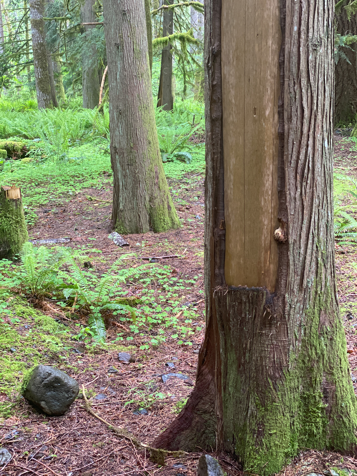
Mid-morning, I arrive at Buck Creek – nothing on the map marks the location as special, but someone has long been coming here. The undergrowth thins out here, becoming very sparse, the gently-sloping forest floor carpeted mostly in moss. The forest looks old, but the trees are not giant, an atv-path angles up the hill toward the sound of falling water. A second path, just a trace, really, also heads up the slope toward the water. A bench has been crudely constructed alongside the path, a small pile of cedar bark cuttings on the ground next to it. In every direction, many of the cedars have been cut, the bark sliced at breast height, a foot or two across, and pulled away from the tree, leaving a long scar running up the trunk, each scar healed and mossed over to varying degrees. This doesn’t harm the tree, being the Ever-Giving Tree-of-Life, but the practice has sustained thousands of years of native persons, likely a single family coming here year after year to harvest the bark from a tree or two. Not many sights like this are to be found in the GPNF these days.
Mid-day, I find myself approaching the Adams Fork Campground, breaking out onto a road in familiar territory. The trail crosses the 2124 Rd here, but a branch leads along the spur down to th 21 Rd and to just shy of the campground. The campground is signed closed, but, I am distracted by wildflowers on the roadside or something and pass the sign without even noticing it. Or something like that. I take lunch on a stump chainsawed into a throne alongside the river. The day is warm and bright, and and a beautiful perfume fills the air.
I have a decision to make. Part of me wants to continue along the trail to Cat Creek, and beyond, and I wonder if Walupt Lake is accessible. My attention turns, however, to the 5601 Rd, and the Sheep Creek Canyon. The road is closed at the bridge over Adams Creek, it being no longer sturdy enough for traffic. I had been to that bridge this past fall, and noticed ATV tracks going across it. The 5601 leads to Olallie Lake, and joins the 2329 Rd just shy of Takhlakh. From Takhlakh, one can cross over the Takh Takh, to continue following Adams Creek up the Camp Trail to the PCT. I expect I can find a good campsite somewhere near Adams Creek, hopefully near a source of clean water. Adams Creek is glacier-fed, and muddy.
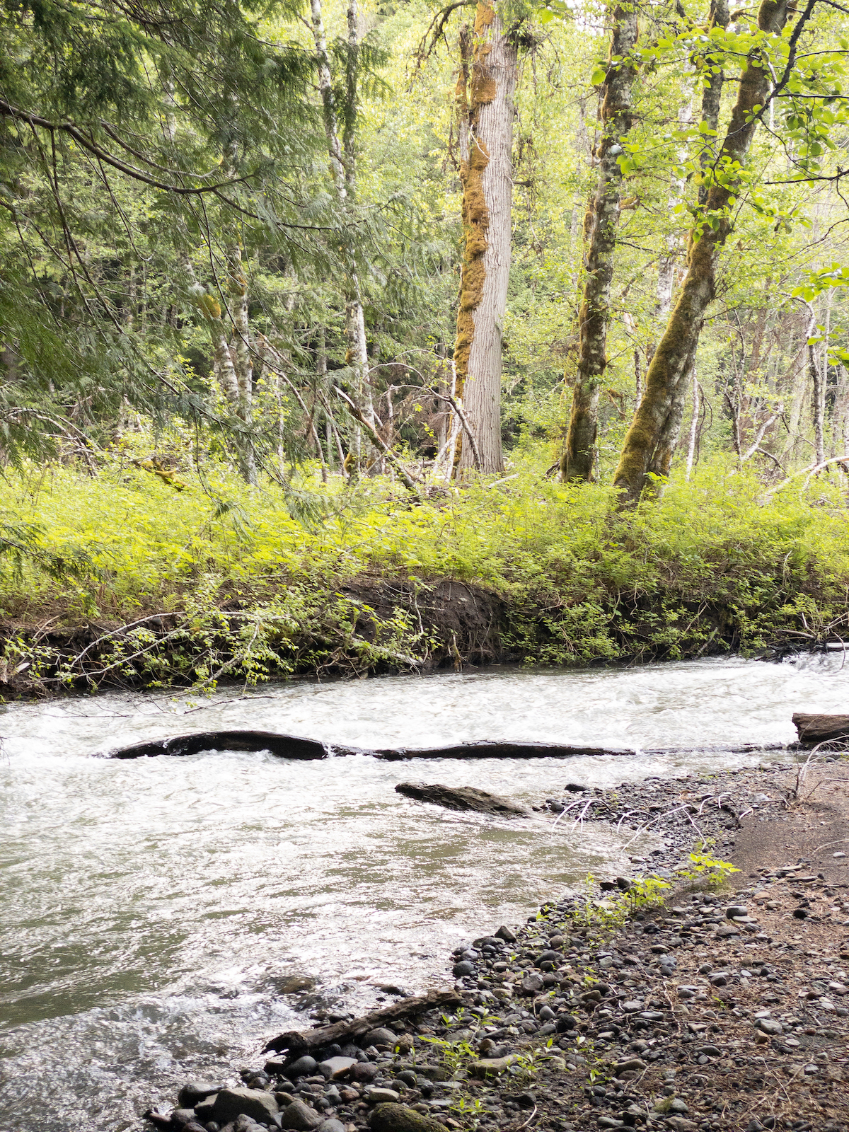
The 5601 Rd travels rather straight along valley floor, following Adams Creek past Sheep Creek to a point where the valley walls close in, the road crossing over here and dog-legging up slope to double back and follow Sheep Creek up to the small plateau upon which rest Olallie and Chain of Lakes, and Takhlakh above that. I find no good campsites with good water the first two miles, and nothing attractive near the bridge. I cross, and begin to climb. A couple of sites without water seem possible as I round the first curve. My curiousity is piqued by a spur bearing east off the road, disappearing under the forest toward Adams Creek.
I follow the double-track across level forest, old-growth with some evidence of selective harvest many years ago, then thru some curves and down a terrace level to what could almost have been an old campground. It’s has definitely been used as such for many years – large areas lack undergrowth more substantial than trillium and vanilla leaf, many areas are entirely bare. A make shift outhouse off to one side, built of black plastic sheeting over a toilet seat on a plywood box, stands half-collapsed, hanging from cedar boughs, being reclaimed by salmon berry. The double-track turns about on itself here in a large circle beneath giant cottonwoods and cedars, with huge firs all around. Adams Creek sings a few feet away, and a small, clear stream flows into it about 30’ from two perfectly placed firs. I have arrived at camp.
I have a very enjoyable afternoon of setting up camp and poking about the immediate area. This is a spot I must return to again – fairly easy to walk or bike into, good water, great camp spaces, room for friends, and rather hidden away. Dinner is chicken-n-dumplings. The evening lasts forever, and the light never really fully leaves the sky. Bats flick thru the trees all around me, the moon rises, and I sway in my hammock under the old-growth, stars oscillating back and forth overhead.
The morning begins with ravens winging audibly overhead, beneath the branches, uttering soft calls between themselves, heading up Adams Creek. My stove is all set, water in the pot atop the burner. I light the flame and dig my food out of the bear canister. I’ve a plan – granola and blueberries for breakfast, and then up the 5601 Rd and on to the PCT! I’ll follow it north, loop back down Killen Creek, hoof it over to Horseshoe Lake, then up to Chain of Lakes along the High Lakes Trail, to return via Sheep Creek. It’s way too many miles, and way too high in elevation, and I’ve no real chance of success- it’s the perfect plan!
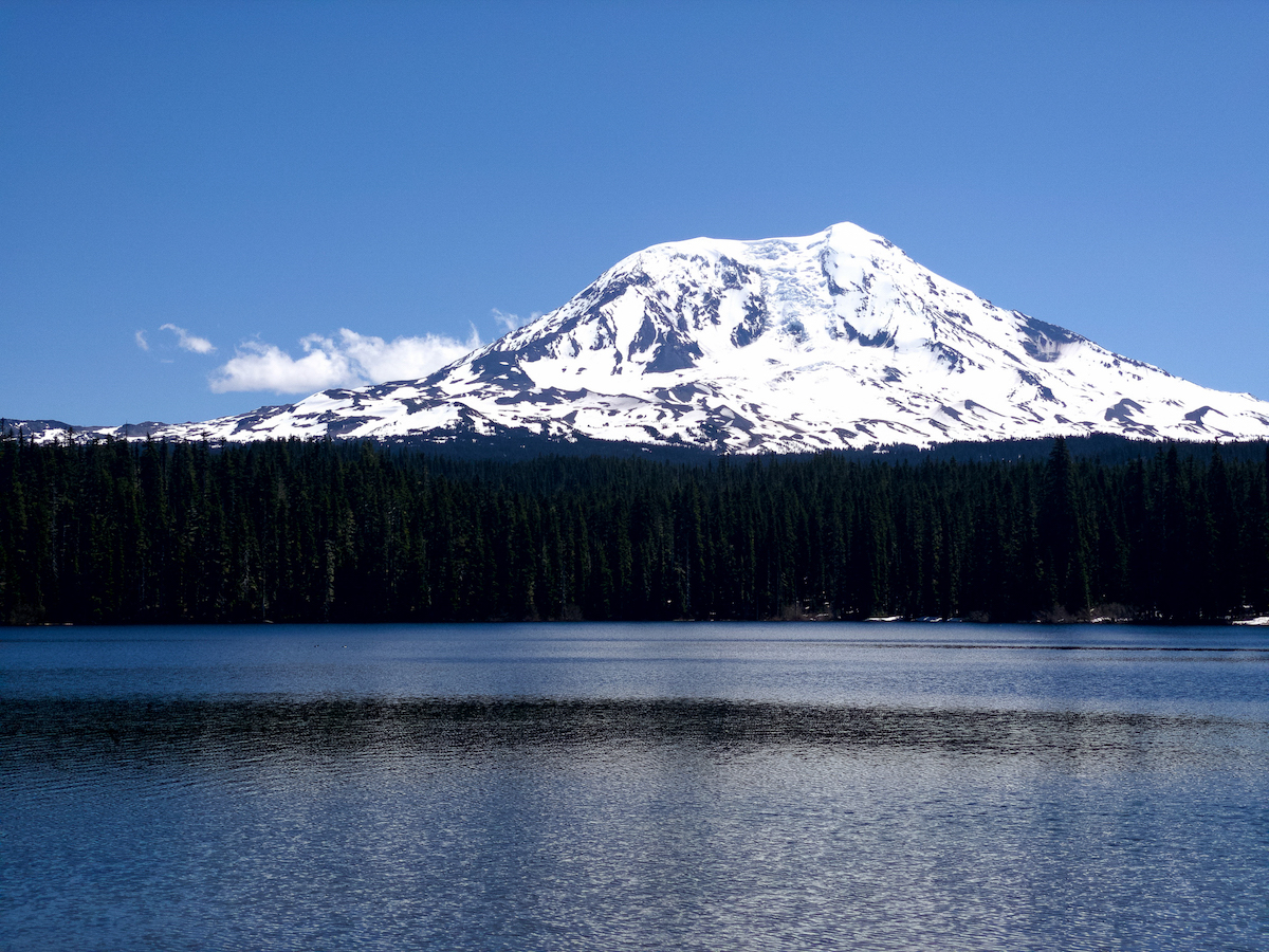
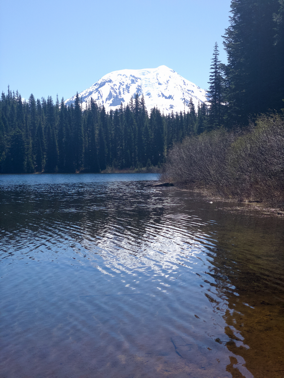
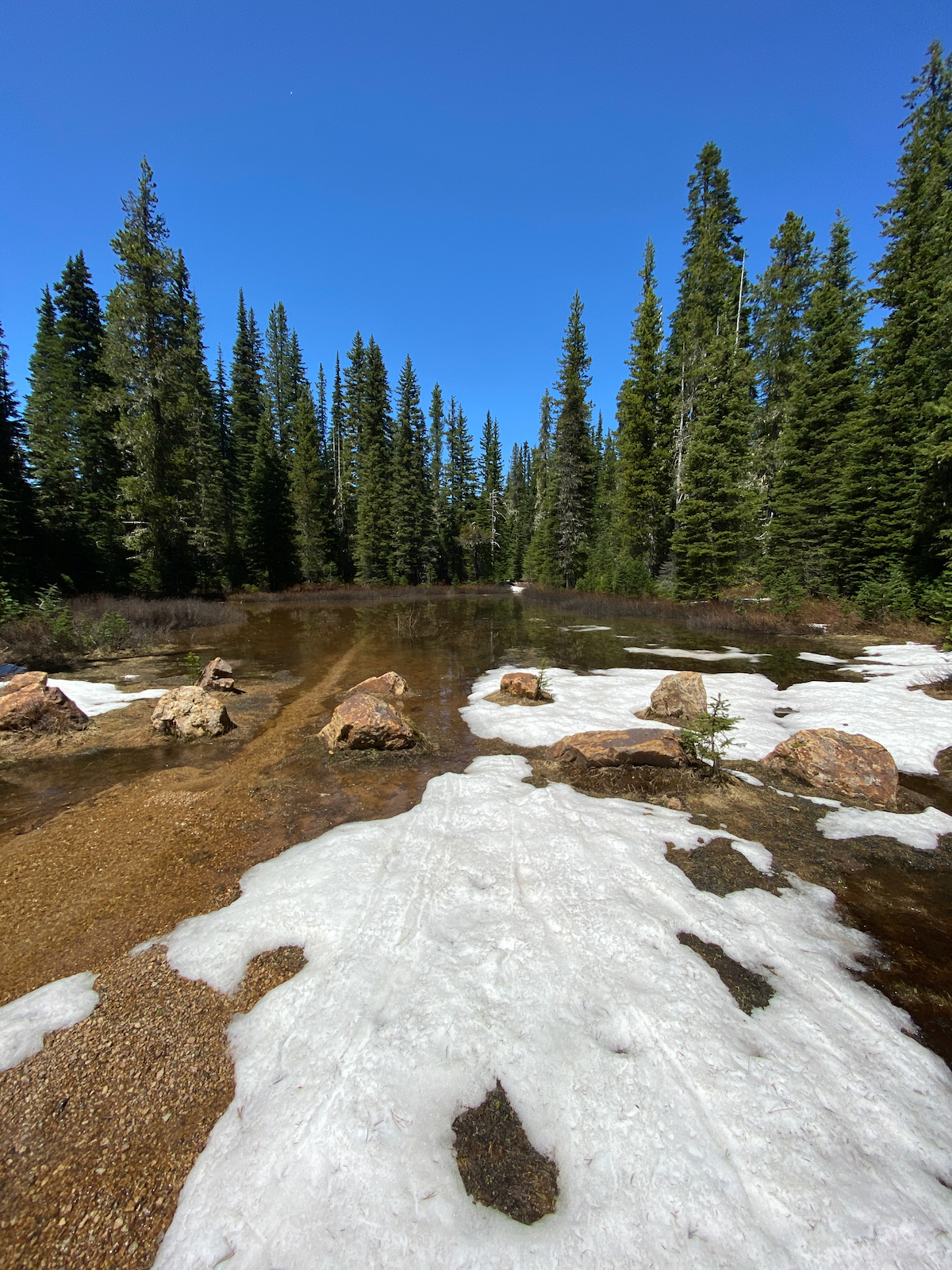
The 5601 Rd presents a steady grade, finally crossing over Sheep Creek, where I encounter the first snow banks, and heading up to Olallie Lake, which is largely melted out. I spend a few minutes here, then continue on to Takhlakh, along an increasingly snow-bound road. I see no sign of recent traffic, except for what was obviously an adventurous, over-sized 4×4. Footprints come in from the 23 Rd, two pair – it would appear they’re still at Takhlakh, but I don’t see them in the short time I am at the lake.
It is obvious this is all the higher I will get – the 2329 Rd is very much snowed in still, so I turn toward Chain of Lakes. The road in is still completely choked with snow, but it’s melting fast. I work my way down the road to the trailhead, but the area is largely flooded with meltwater. I break for a snack on the boulders in the sun, then slog back thru the snow the way I came.
Arriving at Olallie Lake, I realize I have hours of afternoon ahead of me, and nothing to do. Having planned ahead, I set up at a picnic table near the lake, inflating my air mattress, and stripping off my clothes. The lake is quite cold, but the sun is very warm, and the air absolutely still. Too early for insects yet, I abandon myself to the cold water and warm sun. The air mattress is really made more for cushion, not for flotation, so I end up just splashing about in the waist deep water. I stand on the pumice shore to dry off in the sun, turning this way, then that. Once feeling returns to my extremities, I enjoy a very lazy afternoon atop the picnic table in the sun in total marmot-mode – reading, snacking, snoozing. It isn’t until after 5:00 PM that I put everything away and head back down to camp. Dinner is lasagna, and the night just as sublime as the last.
I break camp early the next day. I want to put miles beneath my boots today. I’ve a destination in mind, along the 2801 Rd, and while I don’t know how many miles it will be, I do expect it to take the full day. I bid thanks to the ravens and to the camp, and head out. The miles pass quickly, and it’s only approaching lunch time as I pass Buck Creek, then drop off the trail to cross the 21 Rd to follow the 23 Rd to the bridge over the Cispus River. I stop just over the bridge to take lunch alongside the river, finding a comfy seat among the mossy boulders to have a seat. I take off my boots and socks, and soak my feet in the river. The hour passes slowly, the sun warm, the air lazy. I snack, read, soak up the warmth, watch the occasional car pass over the bridge, heading up and coming back down from East Canyon. Eventually, I get put back together and make my way to the 2801 Rd.
I’ve explored much of the 2801 Rd before, having walked much of it one day this past autumn. It’s closed for wildlife habitat thru the winter, so makes for great walking or biking then. Noteworthy along the road, one can see a number of very large, tall stumps, bearing the scars of fire. Large fires swept the area in 1902, and again in 1918. I am finding the study of the history of fire throughout the region to be rather fascinating, and worthy of further research and writing.
Today, the gates are opened for the season. I encounter no traffic as i follow the road generally north, along the opposite side of the Cispus River. The road walk in completely unremarkable. After a few hours, I arrive at my destination, a spur leading down toward the river thru a restoration project area. Here, the mature 2nd growth has been considerably thinned, to about 25% cover, and then a number of those trees dropped to rot. They’ll provide beneficial habitat to insects and such, while the large open clearing will support winter habitat for the elk.
I follow the track to the first split, which proves to be no good for camping. I turn back and follow the track as far as I can, passing by one spur toward the river, to approach the un-restored forest. Here the track continues, roughly paralleling the river bank, thru un-restored mature 1st-gen growth. (Much of the Cispus was razed by fire in I pass a trail down to good water, and continue to the end, where I find an open glade, a fire-ring, and two well-placed alders. A trail leads past the fire-ring to dead-end at an undercut along the riverbank, with a crude ladder lashed together out of deadwood and rope leading down. Not a chance! I think to myself. Another trail leads into the forest to a place where I can descend to the river bar. The wide open area, river rock grown over with river moss, festooned with elk pellets, interspersed with willow thickets, is prime elk habitat. It also offers no hang, and the sand being infested with ants, I opt to return to the glade above to set up camp. But only after I sit a while on a log next to the river cooling my feet, soaking in the late afternoon sun, and then fixing dinner.
The evening winds down slowly. It’s been a long day, and I’ve hiked many miles. The forest around me is peaceful, but the mosquitoes and flies are on scene. They’re not too much bother, and it isn’t long before the air cools and I feel the need the start layering up. I drink tea and whiskey, read my ebook, and laze about, stretching my legs out while I recline in my air-mattress/camp chair. Light slowly drains from the sky, my little glade gradually dimming, the night sky hidden beneath the thick canopy. I fall asleep about 30 seconds after slipping under the quilt in my hammock.
Another bright morning breaks, but I ignore it, choosing to sleep in. Flies try to bite my face, but I burrow deeper beneath the quilt, no longer really sleeping, just dozing. Eventually, I realize I have a bladder, and soon, an urgency to empty it. The morning begins. I have zero agenda today beyond returning the few miles back to my truck, and making it to Huff-n-Puff for a burger before they close.
I walk back up the path to get water, avoiding the occasional nettle growing in the track amongst all the other delicate little green things. Birdsong is thick in the air, the river an audible rush thru the trees. After spending days in the forest alongside this river, I realize its name is actually onomatopoeic, it is spelled as it sounds. Originally called something akin to schischpash (say Cispus with cotton wads in your cheeks), pash (or pish) meaning stream, it is obviously named after the omnipresent sound of the river that permeates the valley. The Schhisch River. White settlers modified the pronunciation, but not much.
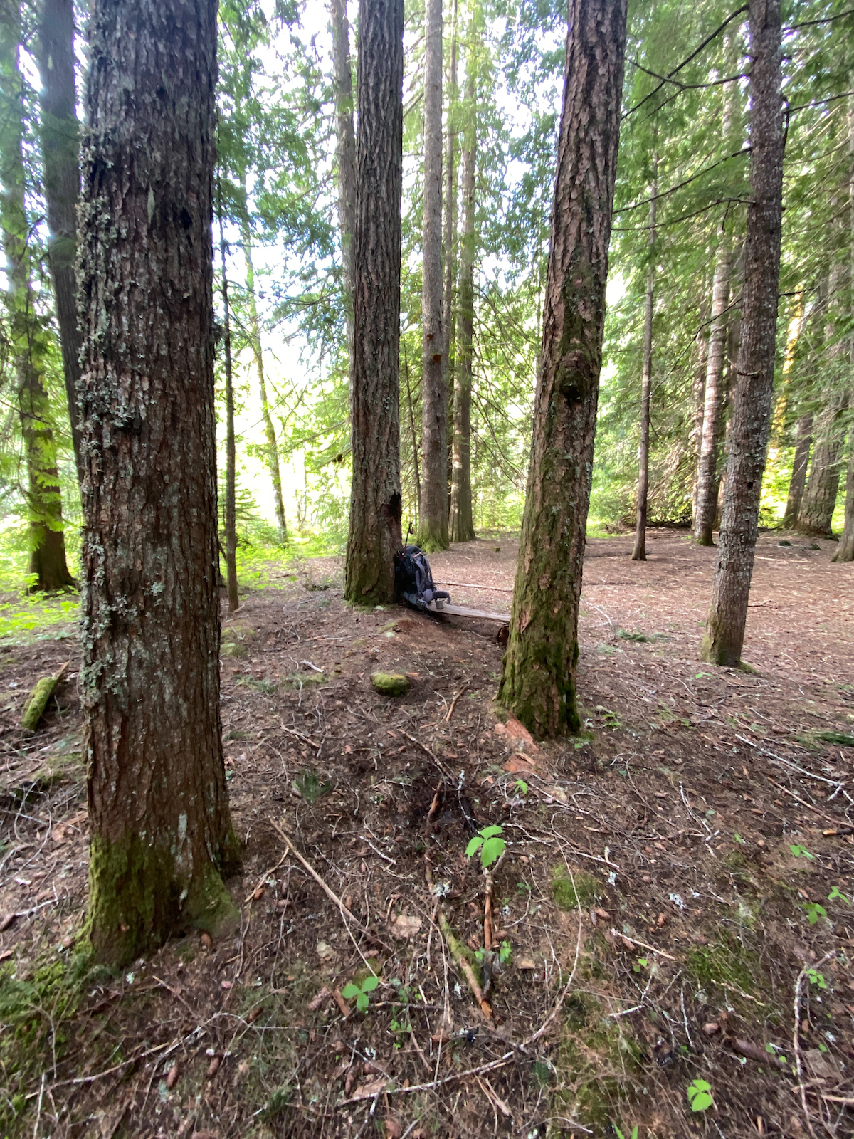
I lay my gear out in the sun in the middle of the glade, organizing and packing, drying as necessary. Breakfast is late and lazy, all three mugs of dirty chai thoroughly enjoyed. With a critical eye, I survey the area – obviously a drive-in, unofficial camp some years ago, the track has been blocked since the wildlife trees were dropped, and it has begun to grow in. I had counted on my way in – there were well over a dozen trees over the track thru the project area, but all save six were cut thru for a truck or ATV, and one of those had been cut, but not rolled out of the track yet. Someone wants vehicular access restored, and are willing to do it themselves. I make a mental note that this would make a great winter camp.
It’s finally time to head out. I make my way back thru the forest, stepping over the wildlife trees. Arriving at the previously passed-over spur, I hang a left, to see what I missed. A most excellent campsite, and where I should have camped all along! Dang it! A grassy, wide open clearing with two young firs in the middle, perfectly spaced, a dozen feet from a large fire ring, behind which an easy trail leads down to the river bar, thru a short section of woods. Sweet! Next time.
I continue making my way to the 2801 Rd. to find a ranger is blocking the roadway with stumps, debris, and whatever he can shove in the way of the timber thieves destroying the wildlife trees. We chat, I selfishly advise trenching the spur, then I carry on. This is the first human contact I’ve had in days, beyond an occasional passing fellow on a motorbike.
It’s only a few miles down to my truck. I explore the camping area behind my truck, flushing out two ravens, one very noisy, the other silent, they wing off in opposite directions. I fully expect a fledgeling to be on the ground where they were, or maybe a carcass, but nothing. I arrive at the river bank, and follow the path all the way back to the bridge before turning back along the road. Once I shrug off my pack, that hamburger looms large in my mind. I see no reason to tarry.
What a tasty burger it was
Leave a Reply