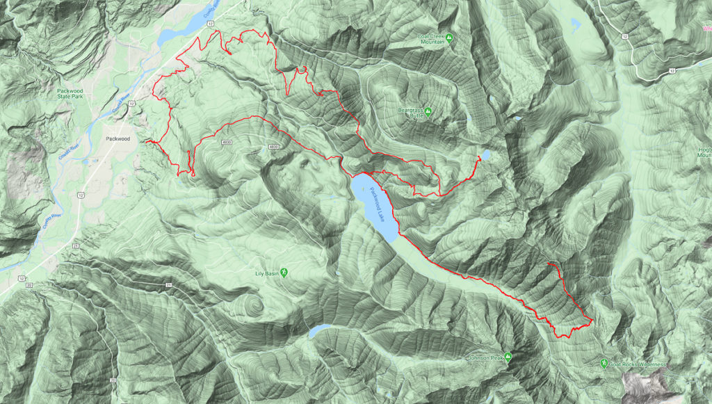
Desire to get very high and far away finds me setting off from the Packwood Lake TH around 11:00 AM – I had gotten there nearly 45 minutes earlier, but need to finish charging my phone and packing my food. While there, the parking lot fills. A steady stream of people are going up and down the trail. None are wearing masks. Needless to say, I choose to take the pipeline trail in. I encounter only a group of horseback riders and one hiker. Again, no masks.
Being the holiday weekend, I know Packwood Lake will be a popular place, but now I am wishing I had night-hiked in and past the lake. A gaggle of teens spends about 20 minutes doing selfies and shrieking with joy on the little bridge. I cough politely and wait. I bark an order to clear the bridge, and am ignored. So I plow thru, and apparently, only cause three heart attacks. They had no idea I wanted across, couldn’t I say something? How rude! Masks are rarer than the Cascade Fox in these parts.
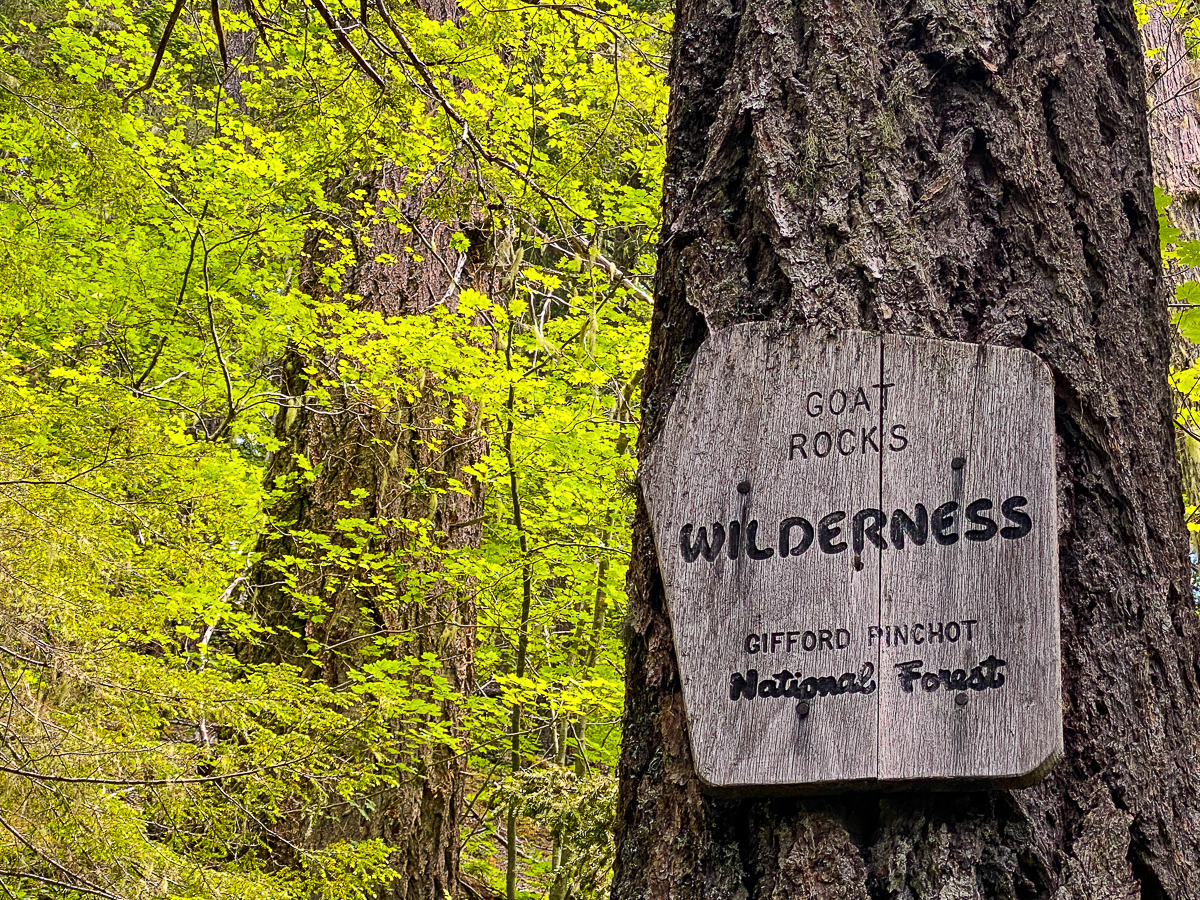
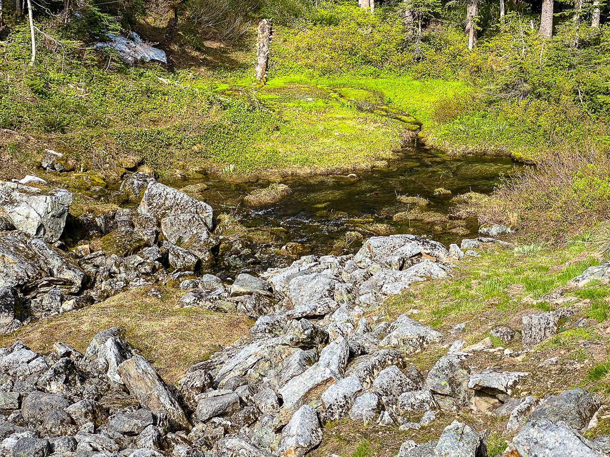
It’s not until I’ve passed the lake, stopping for a snack just past wilderness boundary, and approaching Beaver Bill creek, that I encounter hikers with masks. We both change into our creek shoes and cross in opposite directions at the same time, exchanging pleasantries. It’s nice to see others with some consideration of human life. Their dog is a young, sweet, Aussie-Collie mix and is having a very great time.
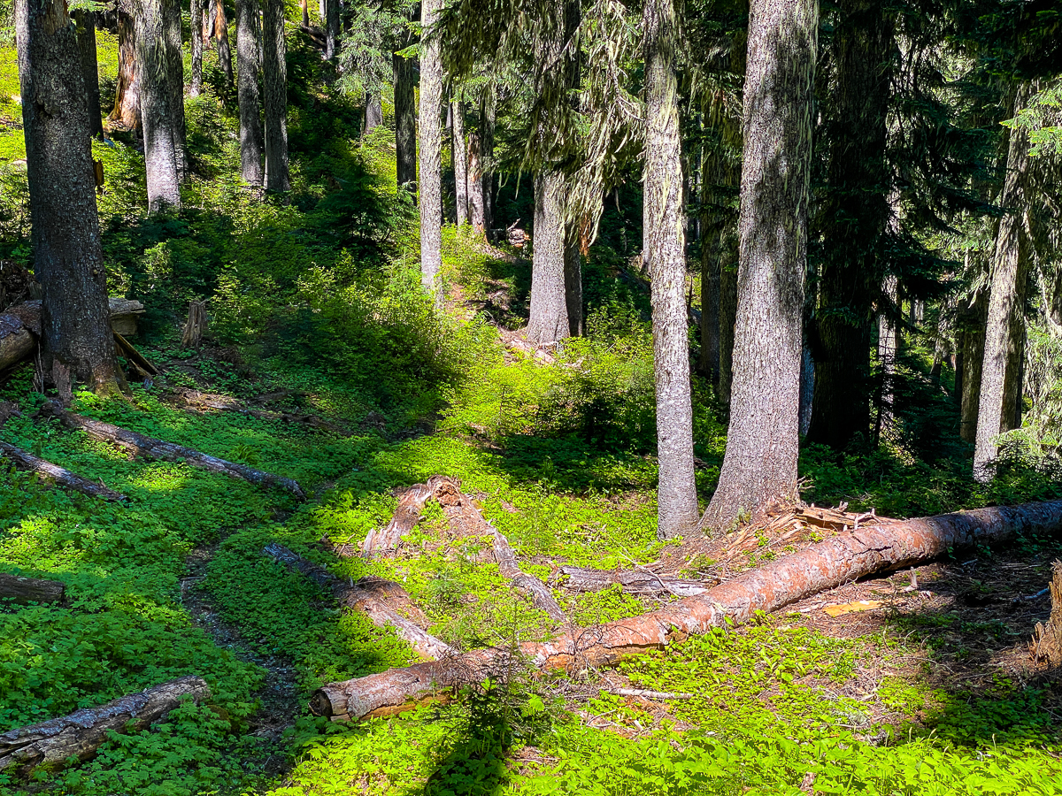
The day is warming, the cloudy sky breaking up, and now that I’ve left the popular area, I feel I can relax. I quickly approach the creek then begin working my way up the valley toward Saddle Creek. Approaching 6:00 PM, I decide to simply camp alongside the trail near a stream crossing. There are no established camps along the trail, and since I’m using a hammock, I’m a bit picky about where I stop. Two well-spaced trees some hundred paces from the stream, surrounded by bear gras, pipsissewa, and vanilla-leaf provide an excellent hang. The night is a bit cold, but I sleep well, after a dinner of mashed potatoes and gravy, followed by Nitey-nite tea with honey, cinnamon, and whiskey – yum!
The birdsong begins at roughly 4:00, with the varied thrush, but the ravens begin their ‘song’ around 5:15, and I am unable to sleep thru that. With the bulk of Old Snowy and the Goat Rocks to the east of me, the sun is a bit later in coming up, but the forest lightens early nonetheless. I had heard from the gals with the dog at Beaver Bill Creek that they’d read the Packwood Saddle was still snowed in. I had no reason to distrust their beta, but I wanted to see for myself. Having camped just before Saddle Creek, my morning would start with steep. The trail crosses Saddle Creek, then heads up. Seriously up. With only one day so far on the trail, I had yet to consume much of my food, so my pack was still pretty heavy. I take a number of small breaks along the way. It isn’t long, however, before I see before me a small stream issuing from a spring, and just past that, Packwood Saddle, elevation 5,515’, covered in old, crusty snow.
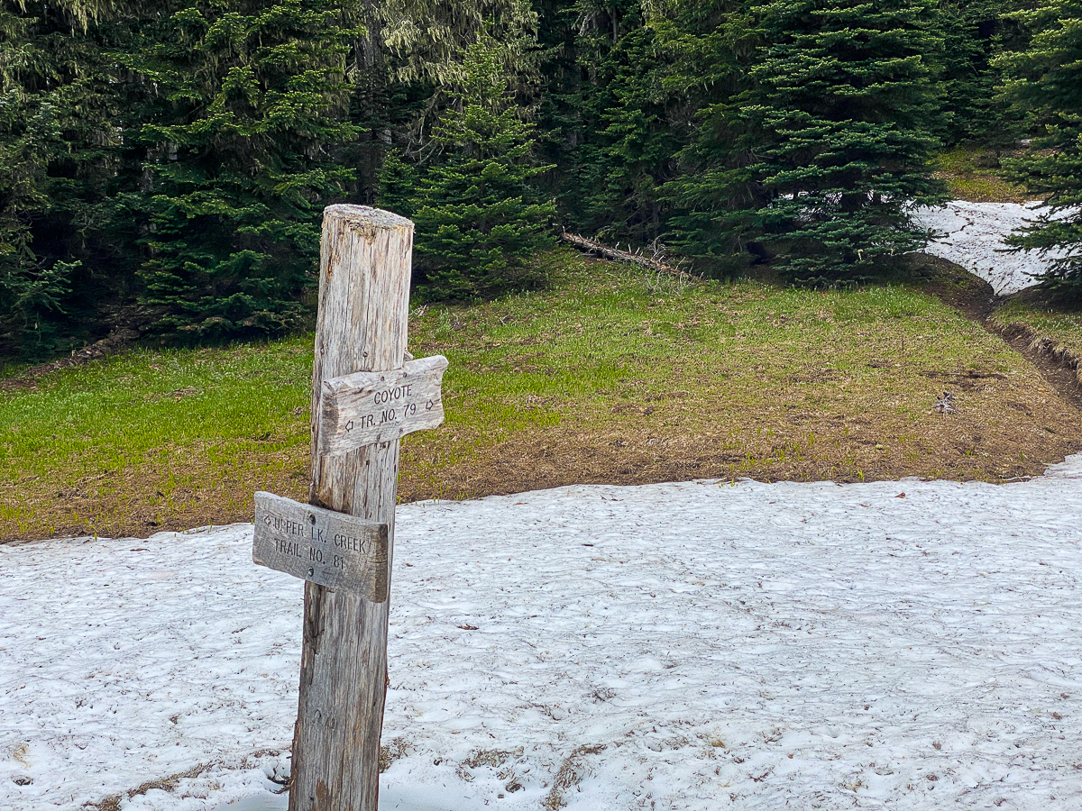
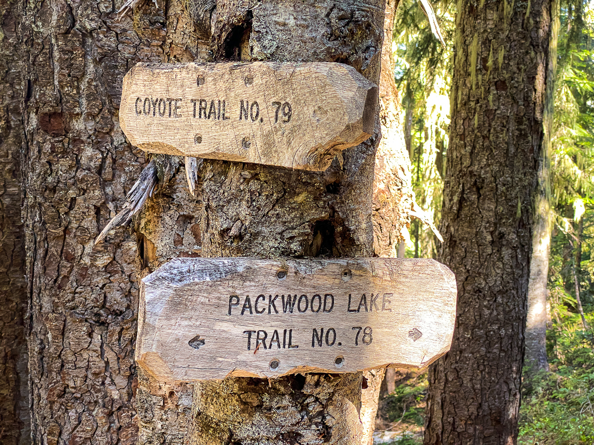
Having made it this far, I’m at a decision point – and the decision is pretty easy to make. My goal is to make it up the Coyote Trail #79 to Elk Pass at the PCT, but I cannot even find the trail up the ridge in that direction. I spiral about a bit, but it’s just not obvious. And I’m just not that adventurous.
So I turn about, and consider the other direction. I could head along the Coyote Trail west, toward Lost Lake. Heck, I can even see the trail. That’s enough for me!
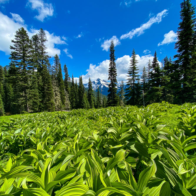
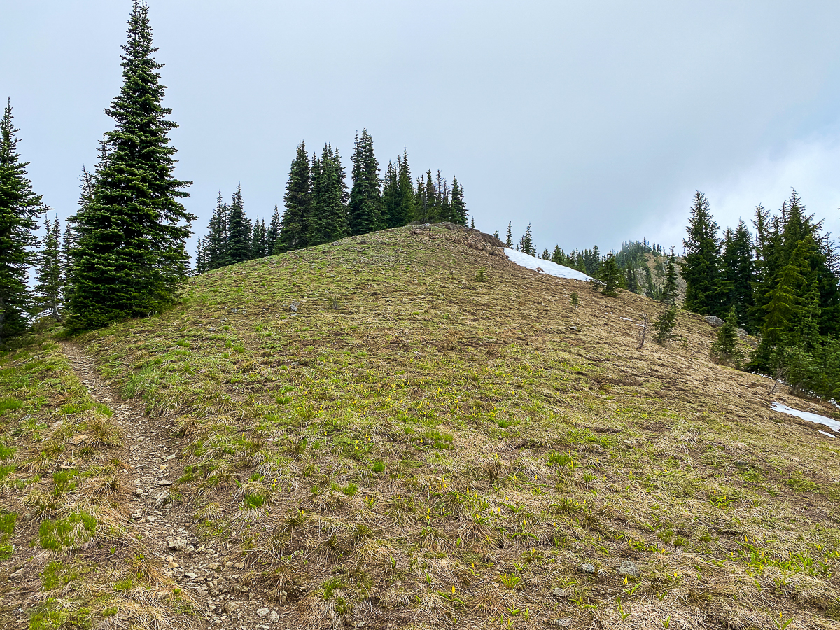
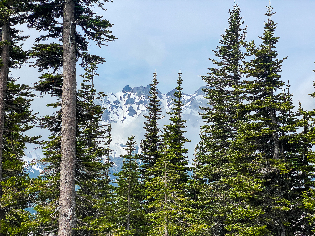
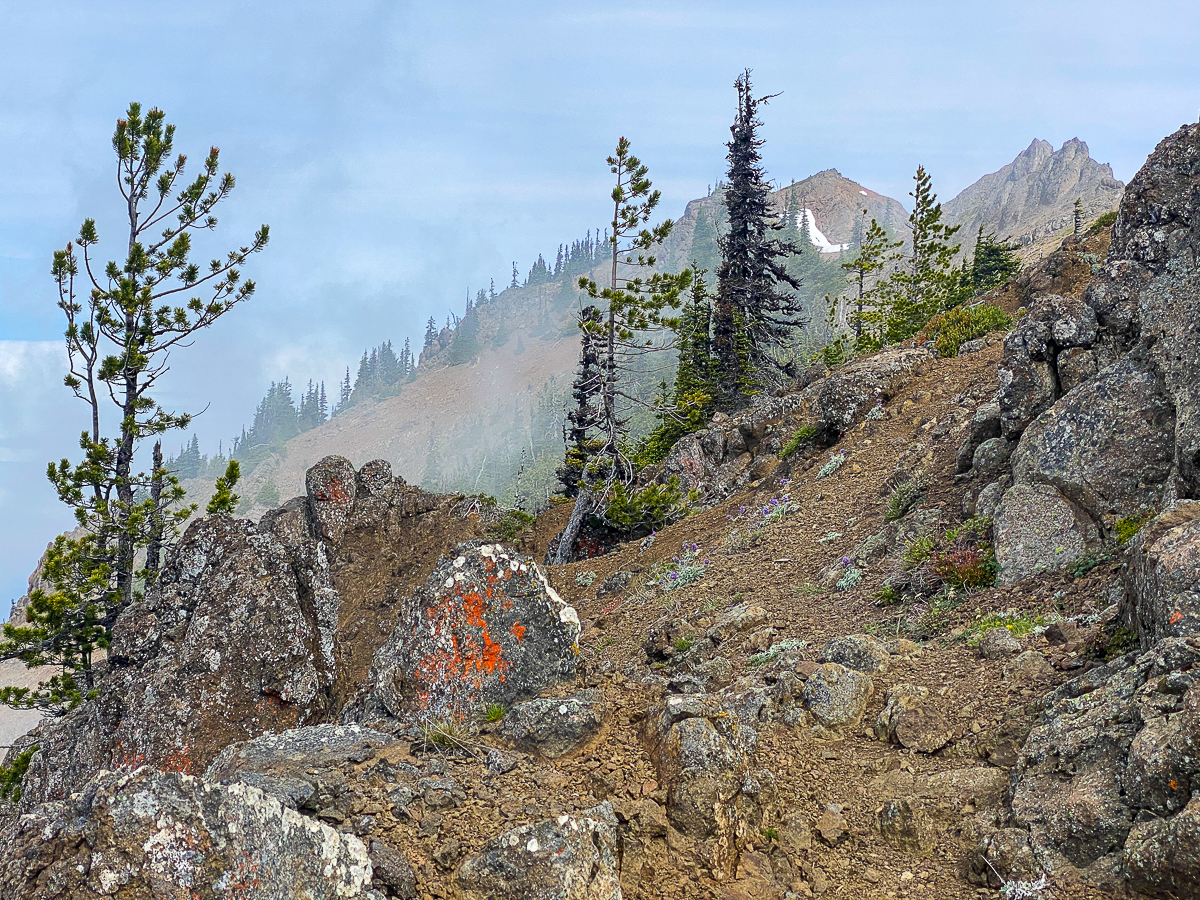
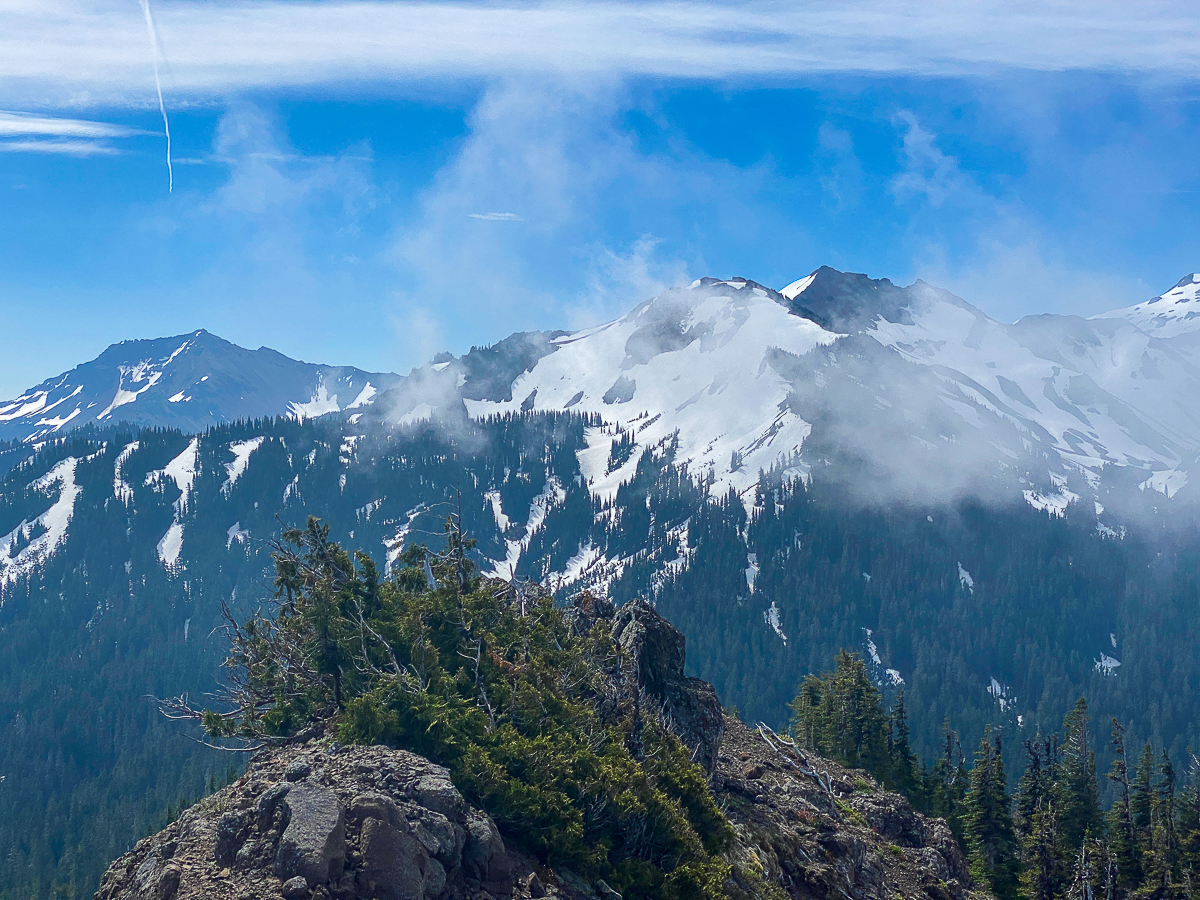
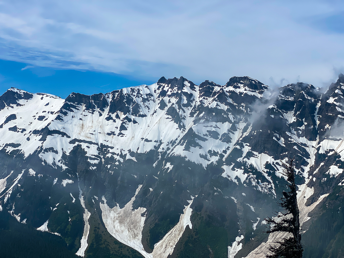
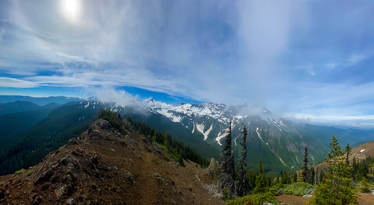
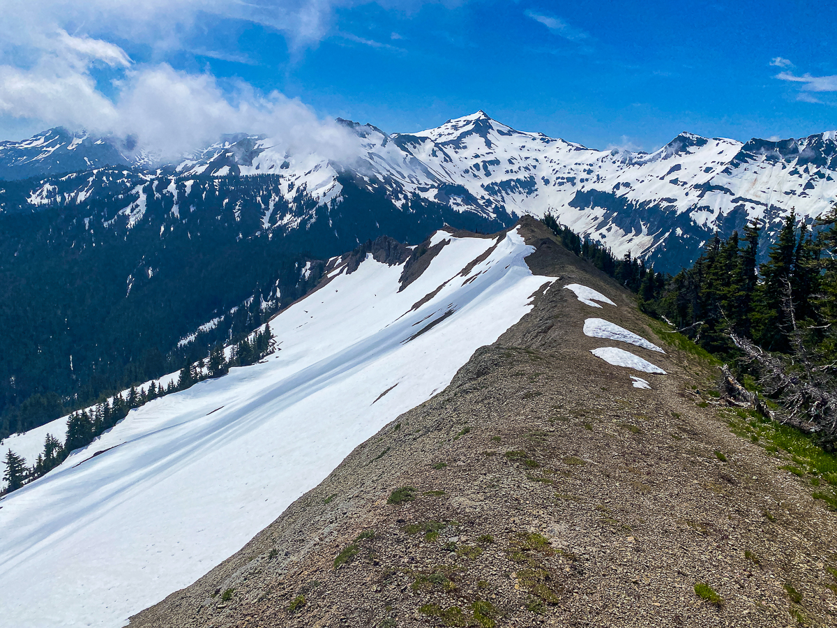
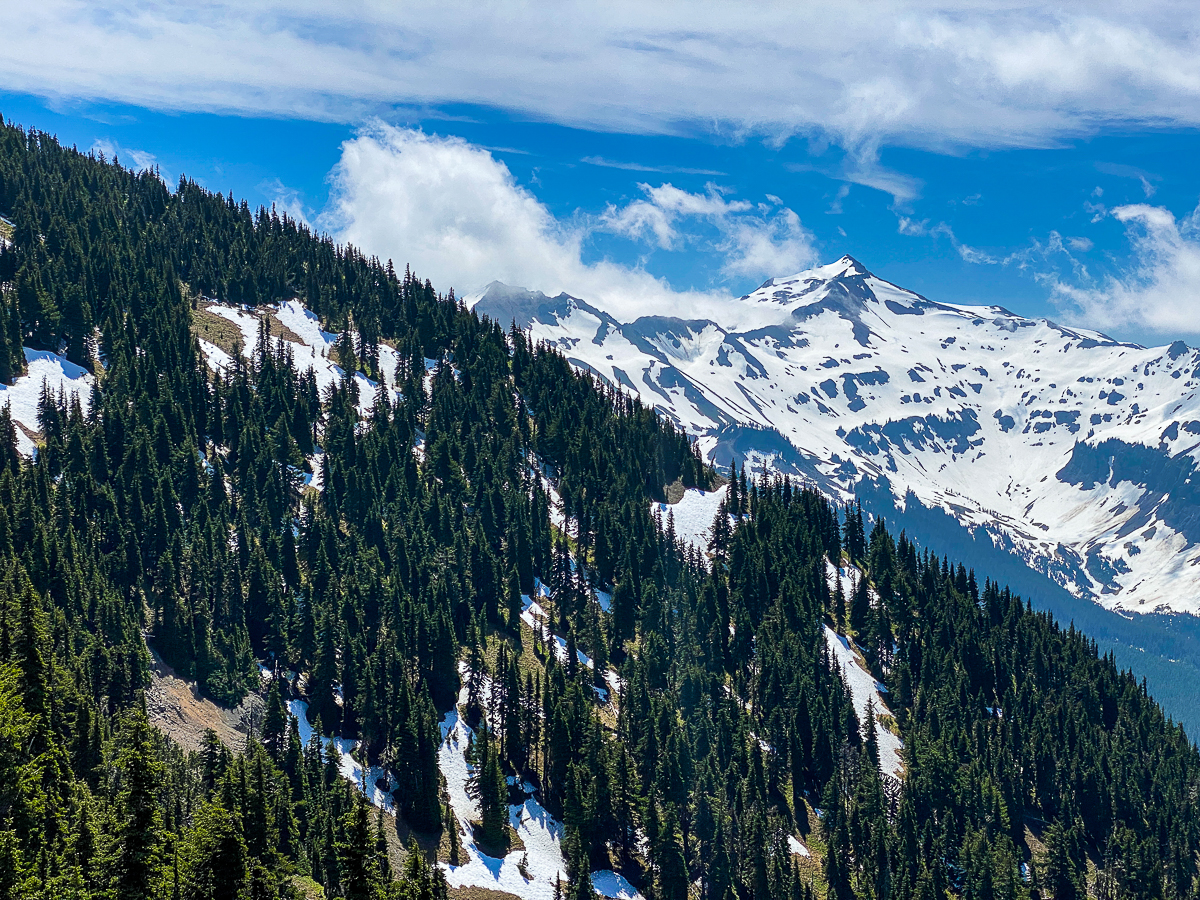
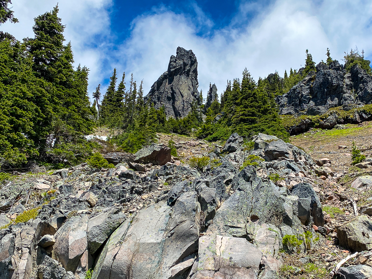
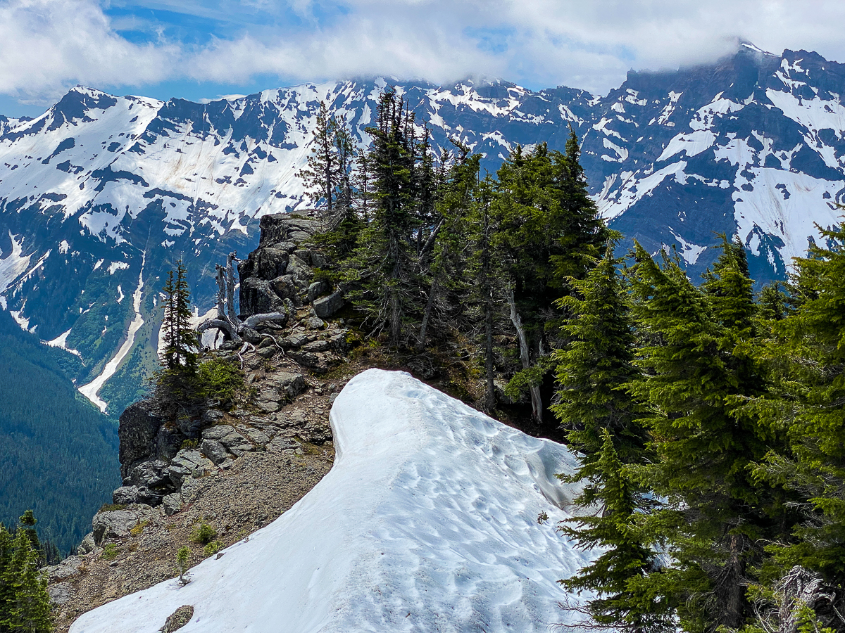
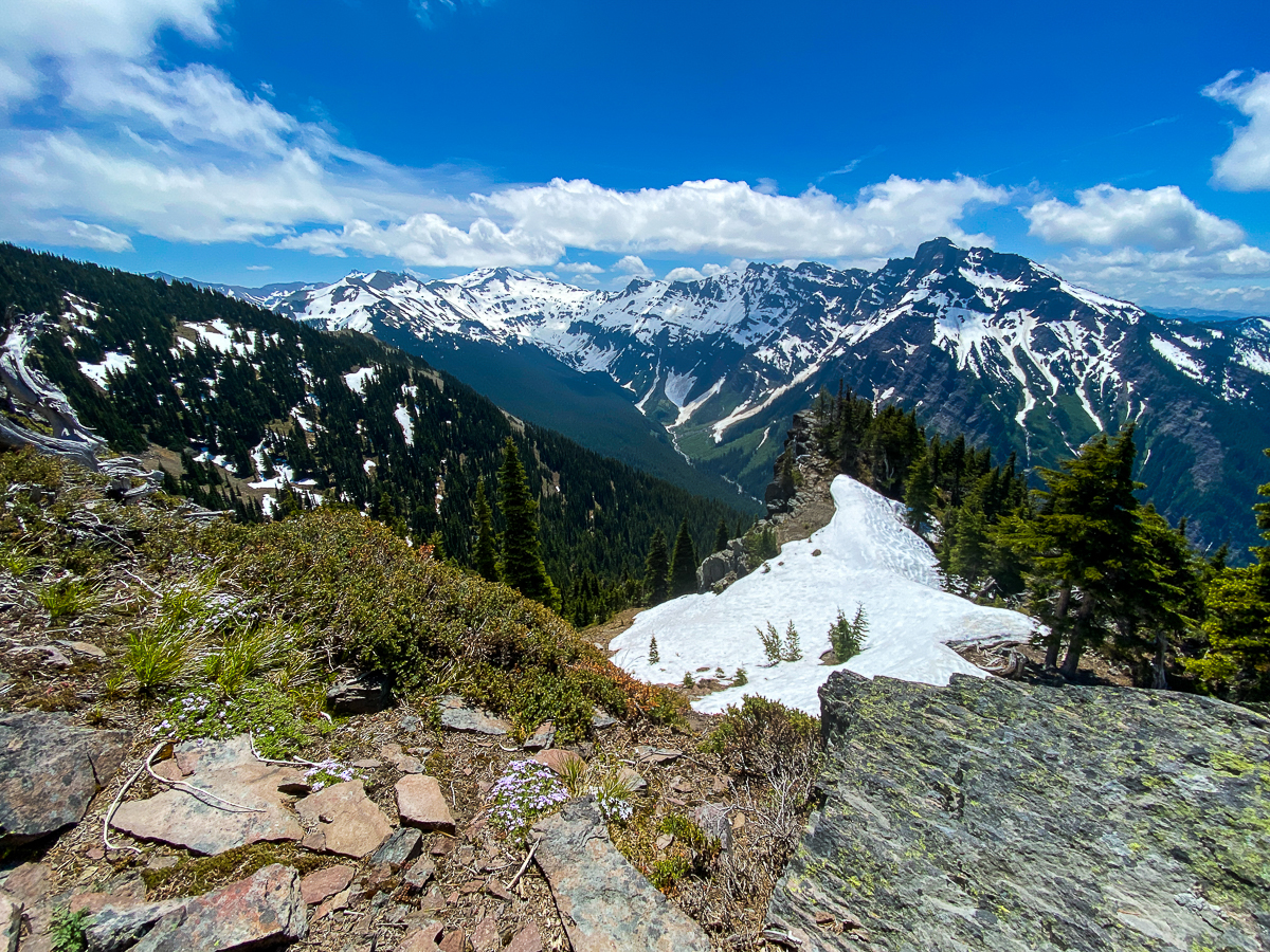
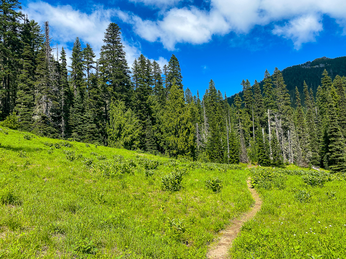
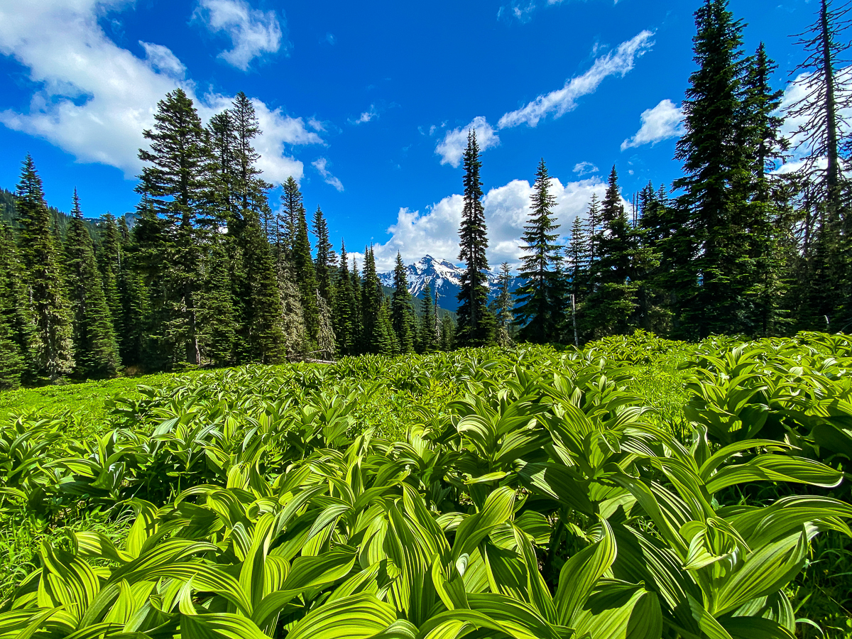
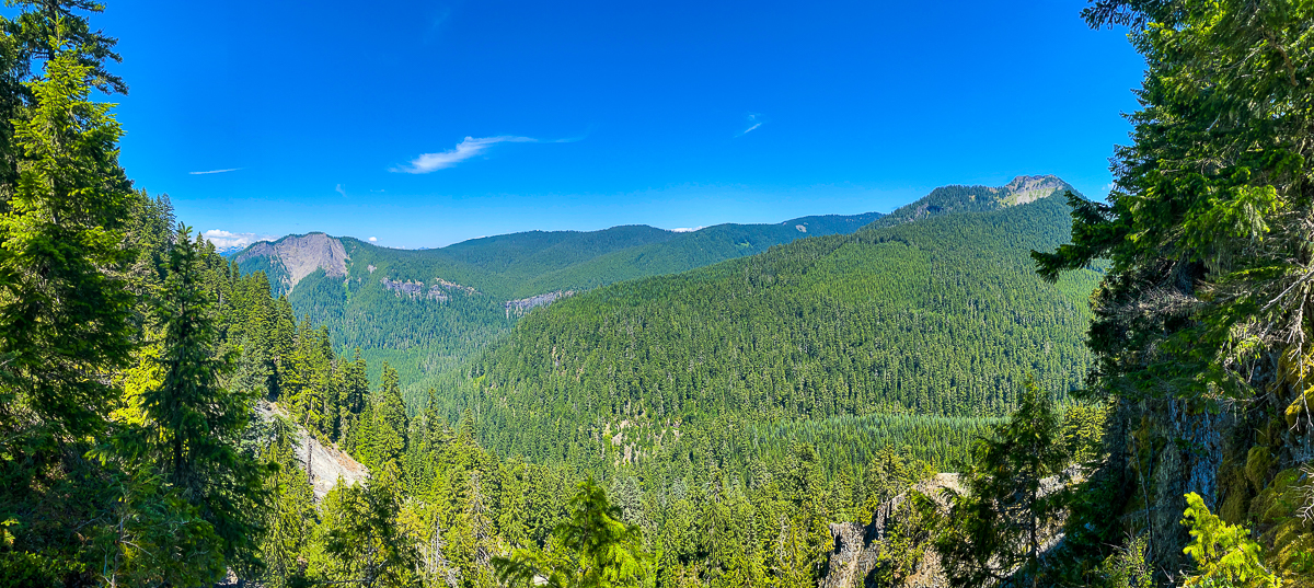
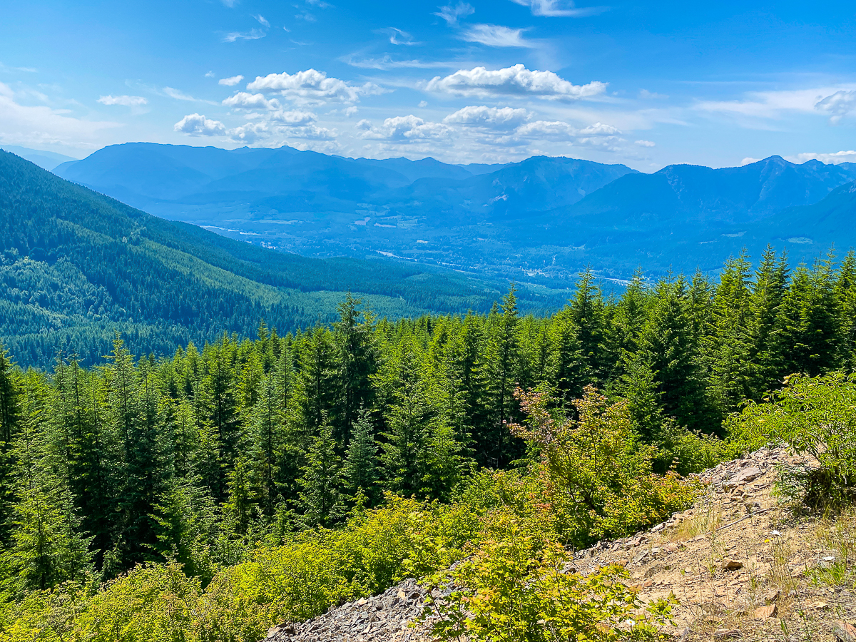
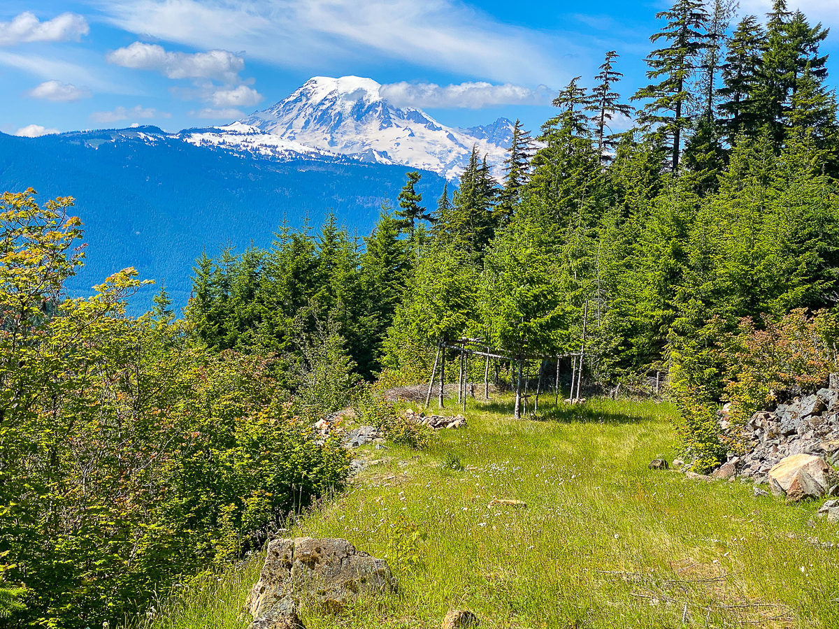
I head down (up) the Coyote Trail, east, toward Chimney Rock – about another 1,000’ up and roughly1.5 miles ahead. The trail hugs the ridge line, rolling up and down, passing to the left and right of different prominences, mostly thru gravelly wildflower-strewn scree, but often thru copses of alpine fir. The views are constant and jaw-dropping, and a busy cloudscape adds drama to the skyline in every direction. Moisture is headed up the valley, forming streaming clouds where it escapes, carried east by the prevailing winds. The cloud deck hovers just below the summits of Johnson and Old Snowy and gang, but as I rise higher, it, too, rises higher, to reveal the summits I had climbed all this way to see. Approaching noon, the air is warming. I find an excellent sitting rock with a stupendous view, take off my pack and shirt, and settle in for a break.
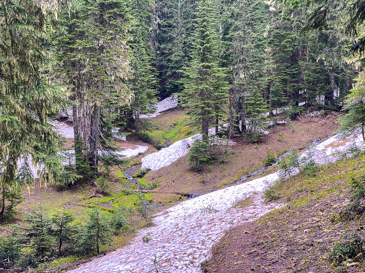
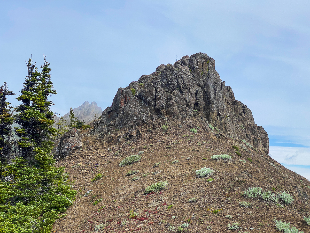
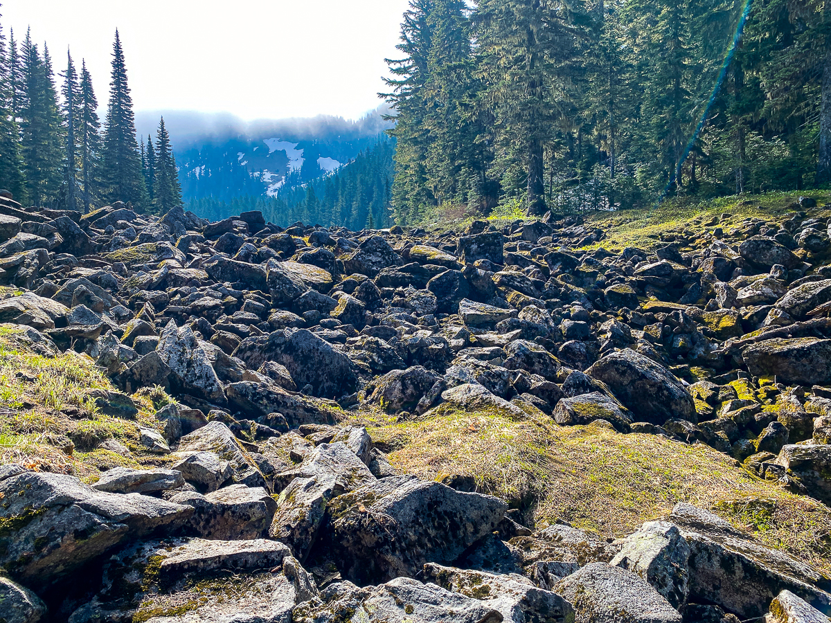
Snow patches begin to become an issue as the trail dips down from the ridge line to side-hill below the summit of Chimney Rock. I handily cross over the first few, kick-stepping my way up and over. One is a bit larger and steeper, so I skirt it, going around the top. The next two I work my way around from below, then cross over the next few, losing count at this point. This pattern takes me to the 6,400’ high point of this section of trail, directly below Chimney Peak – it’s exhausting work, especially with a full pack, and dangerous. The decision to sit and glissade down one particular patch turned risky as I slid much faster than expected, didn’t have quite the correct trajectory, and overshot the trail, headed for the trees! I arrested successfully before I got to the bottom of the snow, but ended up with a nasty, bruise-y scratch across my thigh, and a case of shaken nerves.
Reaching the high point, and taking in a few minutes to eat, drink, and enjoy the views, I left my pack behind to assess the trail ahead of me – a few hundred paces down, and I encounter a snow patch taller than I am, which I cannot see over, around, or beyond. I expect more of what I’ve already covered, but worse. The decision to turn back is not difficult, but it’s not a happy one. While I really wanted to snag a campsite at Lost Lake tonight, and I don’t savor the idea of working my way back across all that icy snow, I moreso don’t want to get into trouble. I return to my pack, bask in the sun for a while, clamber about on the cliffy rocks, bask some more, and finally turn back for an uneventful, if much quicker, return.
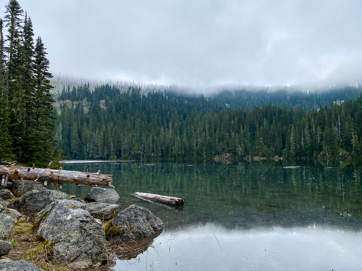
Camp for the night is back down on Lake Creek, on the valley bottom, in an area where a number of camp sites are found. I choose to camp across the trail from the river, surrounded by big trees, emerald green ground covers, and miles of solitude. It takes about a week for all the light to drain out of the sky.
Saturday dawns warm and bright, the river sings lustily in the still air. I sleep in. Its not too many miles back along Packwood Lake to the Packwood Lake Trail, and up to Mosquito and Lost Lakes. It’s a holiday today, and a Saturday to boot, and sure enough, the crowds I expect are in full force. I actually encounter a few masks, but not many. Thankfully, I am at the trail junction in fairly short order, and it’s not until I am near Mosquito Lake that I encounter any people. A each group descends, I step well off the trail, then wait a few moments after they pass. The day is sunny, and I’m thankful the trail passes thru dense old growth. The trail reaches the top of the ridge at Mosquito Lake, passes the Three Peaks Trail #79, continues rolling thru intermittent meadows along the ridge for a mile or so, passes the Coyote Trail, then drops down to Lost Lake.
Before I get to the lake, tho, I have to cross a dangerous snow bridge over a little stream. I can see a number of boot prints leading across the thickest part, and while I don’t trust it, it holds. Moments later, I am side-hilling across solid snowfields above the lake, then following a set of steps directly down toward the lake, to cross over the still snow-bound outlet to the still snow-bound camping area.
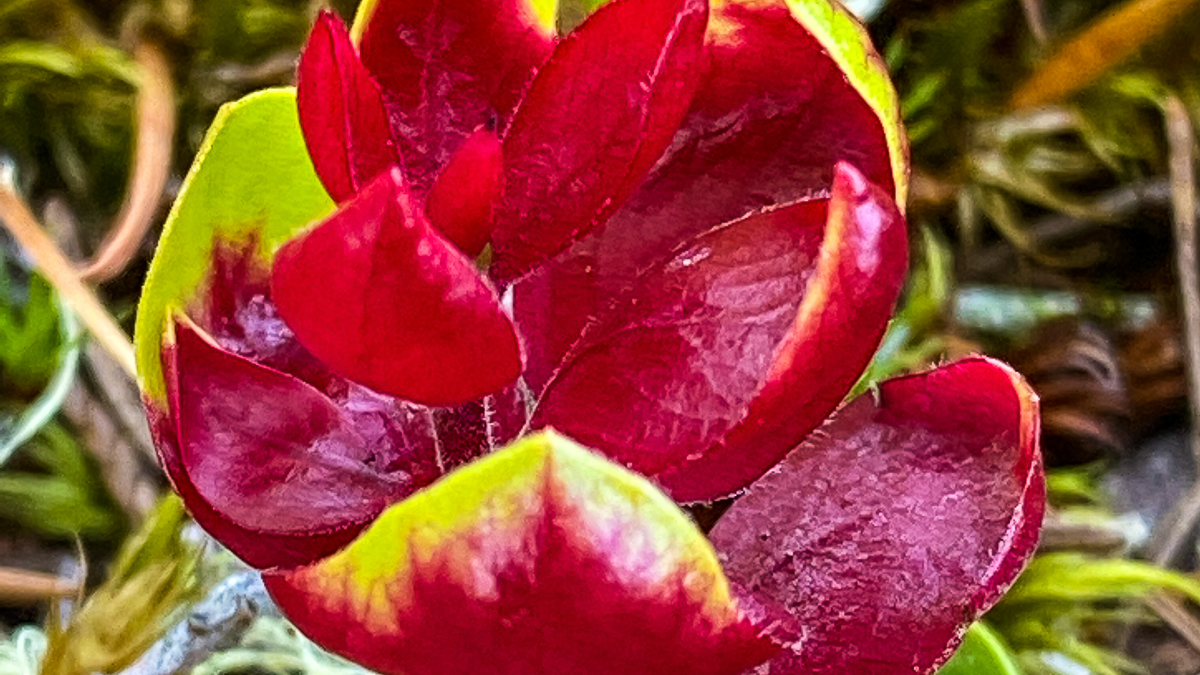
The first campsite, of course is taken, and they advise others further down are as well, so I scout along the outflow stream for a snow-free area away from them. I ended up with a pretty nice spot, surrounded by avalanche lilies and bear grass, well away from others, with handy access to water. While the view was not stunning, the water rushing out of the boulder field that dams the lake was quite scenic, surrounded by fresh green mosses and white avalanche lilies.
It’s only about 4:00 PM when I arrive, so after ditching my gear, I return to where the trail crosses the outflow – the boulders make a great, sunny open area to sit and enjoy the lake and mountain views. I perch on an old, silver log, prop my feet up on a rock, and set to reading a book on my phone for a bit. The peaks and ridge above me are clouded in, but the sky above is clear and the air is very warm, and I’m tired. It is a very relaxing way to spend a late afternoon. The ladies in the first campsite build a fire, and my nose picks up the scent of cedar kindling. Sublime! Campfires at high elevation always smell so good.
About the time I am contemplating dinner, around 6:00 PM or so, I hear voices from the trail above. Good timing, I think, as I pick up my stuff and step across the boulders back to my campsite. Within minutes a half dozen young-folk, none with masks, descend on where I’d been sitting. With much fanfare, they proclaim what an amazing place they’ve arrived at, and set to taking selfies and groupies. Two dogs bark and yip, and race about on the snow. One is a husky, and is so obviously ecstatic, it can do nothing but leap senselessly into the air, then run in a circle, then leap into the air again, over and over.
Three make their way down toward my camp to collect water, then return to their group to make dinner. They’re there for about 2 hours, noisy the whole time. Finally, with more selfies and groupies, they pack their gear back up, and trudge back up the snowy slope, laughing and calling out, and carrying on. Within minutes, peace returns. The only real sound the occasional snap of the neighbor’s campfire, and a soft laugh now and then. Which is just as it should be.
Morning dawns grey and chill, clouds continue their grip on the ridge and peaks above me, tendrils of vapor dipping down over the lake, the silver snags of a past forest fire peaking thru the clouds every so often. I do not dally this morning, but for a half hour with my scrambled eggs and mug of dirty chai on a lake-side boulder. The neighbor ladies are packing up and getting ready to leave.
Finished with breakfast and all packed up, I set off down the trail having decided that I would not be going out the way I came in. Because people. While I was unable to do a loop over the upper Coyote Trail, I can make a loop using the Three Peaks Trail which is a little over a mile from the lake, almost back to Mosquito Lake. The Three Peaks trail leads to USFS Rd 1266, which leads to Hwy 12. I’d been on this trail from the other end, but only to the first summit, this past May. I make quick time up the snowy bank and along the trail to the scary snow bridge. It has melted out overnight, and doesn’t even look like it’ll last another two hours. I go up and around, and arrive at the Three Peaks trail about 20 minutes later.
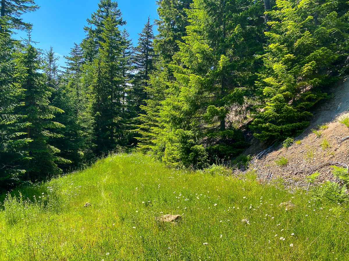
The trail on this end is marked by a tangle of branches laid across the obscure tread, and a rotting sign, many paces in, half missing. One might get the impression the trail is closed or abandoned. This is just how I like it. I step onto the narrow but visible tread and immediately see boot prints in the sandy pumice. I am not the only one that likes old trails. It’s in pretty good condition, all in all, with the exception of a few trees across the trail, and being in need of a good brushing out thru the berry fields. Up and down, I traversed the ridge, and in just a couple of hours, was back into familiar territory, and then to the road.
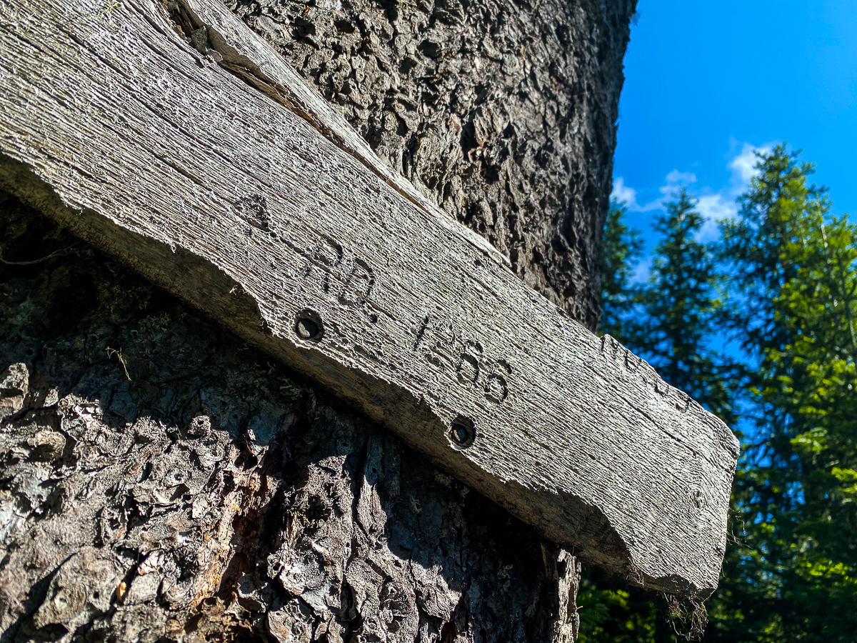
The USFS 1266 Rd is now cleared of trees all the way up to the trail head. This road, like most logging roads, switch-backs up the mountainside. For a car or truck, that is a good thing, but for a hiker, that is a laborious thing. Experience tells me that, up in Packwood, there are lots and lots of trails that don’t get mapped. Sekrit trails, those are the best! I’ve found sekrit trails on Tatoosh, Skate, and Snyder Mountains, so why not here, too? The first place I search, at the trail head itself, pans out. The little spur there does not lead to anything but down. At the first switchback below the trail head, historical maps show the old trail coming up the draw to this point, which would take one down to the midpoint of the next section of road, but no trail is found there thru the dense new growth in an old clear cut – down the road I go, and around the next bend. Finally, approaching the next switchback, my curiosity is piqued.
This switchback is built up above the hillside – a very serious switchback indeed. A corner not to be messed with – the large boulders of the roadbed’s foundation below covered in grey-green, dehiscent moss. The area below this on the outside of the curve is open, covered by the same moss, sparse salal, edged with a few old firs, the hillside dropping out of view beyond that. I realize, as my eye follows the edge of the road, that one can easily walk down there. Moreover, that dusty, mossy gap in the salal could be a footpath. If it were a footpath, I realize, it would be leading down the spine of the ridge, directly toward the end of a spur road much further down the road. I know just what I’ll find just over the lip of that hill.
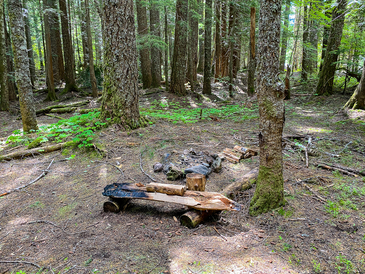
The shortcut shaved a mile off my trip down the mountain, leading me down the mountain thru beautiful old- and 2nd-growth along a very nice atv-track, and put me out right where I suspected, on the 1266 just a few minutes above the 1266-023 spur, with a great campsite I’d used the last time I was up here. Ravens rise up from the creek and from the large fire ring and parking area as I come around the corner, with much ado and flapping about.
I set up camp a few dozen paces from the stream, stringing my hammock between two firs, and have a relaxing evening with the ravens, who have remained in the trees around the clearing. One is particularly noisy. I stay up until its full dark, but the sky remains cloudy and I see no stars. I put a little extra whiskey in my tea tonight.
Morning is warm, and I’m thankful to not have had all my layers on thru the night – the lower elevation has some advantages. I hear the thrushes at 4-ish, but go right back to sleep. Promptly at 5:15, however, the noisy raven is back. And it is singing. Not quorking, or gronking, or cawing. Singing. So many strange little sounds while it pokes about inside and outside the fire ring. It sounds for all the world as if it is talking to itself as it goes thru its morning routine. It remains for almost an hour – and never shuts up for even a minute. Finally, with a beckoning call from one, they all take wing from the trees and clearing and head south toward Lake Creek. Moments later, two pileated woodpeckers show up and literally beg to make my acquaintance. I indulge them, enjoying their playful antics in the overturned stumps and on the snags nearby. I’ve dallied long enough, however, and my third mug of dirty chai is empty, so I must depart.
It doesn’t take long to reach the end of the road on Lake Creek Rd, near Hwy 12. I avoid the highway, however, opting to cross Lake Creek to head up a spur road onto private timberland. I’m chasing a memory.
My grandfather and I used to follow a route that brought us down this hillside. Details are vague, but I suspect I can find a trail that will lead me up to the 1260-022 spur. I cross the big orange gate and head up the track thru the recovering clear cut. It’s a warm, pleasant morning, and it’s good to be in the sun. Soon, I spy a trail taking off into the forest, so I abandon the track. The trail winds thru the forest with little elevation gain, and comes out on another track. I follow this track for some distance WSW, thru old clear cut the whole way. None of the territory looks familiar, nothing matching my vague, elusive memories. Eventually, the track comes to a point where I can see it leads back onto Hwy 12, and a trail veers SSW. I follow this trail, beginning to climb, and after a few moments, end up on another track. I check my map – everything is lining up. I continue to a 4-way intersection, and feel a bit of a thrill. Familiarity?
I cross the intersection and continue thru the tall grass and short trees. The trail veers up, follows a loose S-shape curve up the hill, and gets steep – this I remember. I remember it shady and surrounded by 15-year old alder trees – not sunny surrounded by 15 year old fir trees, but the sandy track is the same. And right there at the top, a steep scramble and some exposed rock leading to a sandy parking spot, angling onto the road just so.
I found it! I found the route my grandfather and I used to walk!! This is where he taught me how to peel an orange in a spiral and how to carve a whistle out of an alder branch. Sacred spot, this.
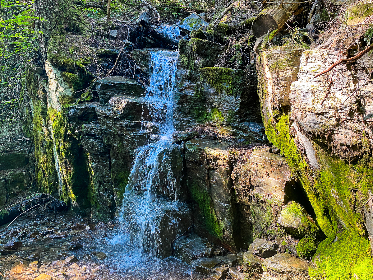
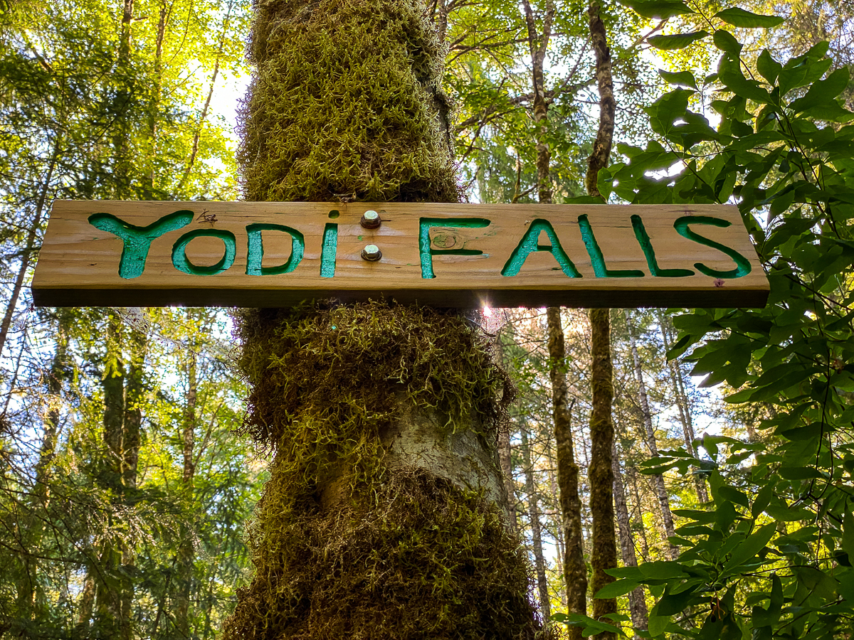
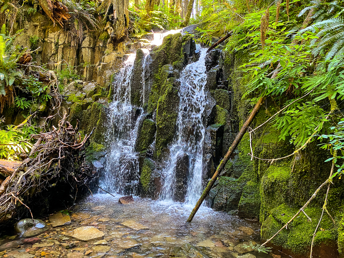
Continuing down the 1260-022 toward the 1260 Rd, I hear the sound of water – a welcome sound, as I am hot and sweaty. A short trail takes off from the road, leading to picturesque, if tiny, Yodi Falls. I did not know this was here. Did my grandfather and I really walk past this so many times, and never stop? Had I just forgotten it? It makes no sense.
After cooling off, I make my way out to the 1260 Rd and go down to where I accessed the sekrit trail I found last time – the one that goes up Snyder Mountain. Needing to satisfy my curiosity, I start out by following it down to its beginning on Powerhouse Rd. I wanted to be certain it did not let out on private property. Looking at the historical maps, it rather reasonably follows the old Packwood Lake Trail. Following this trail up the mountainside saves one roughly 1.5 miles of distance, at the cost of a steep and sweaty, but beautiful climb. I hope that, upon letting out on 1260 Rd, I can find a continuation of the trail on the 1260-053 spur, but find no trace of it. So I backtrack, and continued along the 1260, soothing my disappointed soul with wee little strawberries growing profusely alongside the road. Arriving at the trail head parking lot, I’m hot, sweaty, stained with strawberry juice, and thirsty. I tear down the mountain and head back to Yodi Falls to fill up my water cans, get a bit wet, and relax for a few. I’ve a plan to stop at the Tatoosh Mart for a coke and a corn dog, then at the Huff-n-Puff for a Logger & Fries with a strawberry milkshake.
Pulling onto the 1260, I see a motorbike coming down the road, but it appears to be just coasting – a fun thing to do, but I have no time for that. I lay on the gas, and jump in front of the motorbike – nothing aggressive, but not quite country-etiquette, either. Knowing the road very well, I take the corners a bit faster than a tourist, and the bike is not in sight. Good!, I think, no problems. By the time I hit the bottom of the hill, however, he’s on my ass. Oh-oh, a bit of road-rage? On Snyder Road? WTF?
I turn onto the highway, passing the Tatoosh Mart, and he’s on me! Obviously pissed off! It’s hard to see, but I know its there, so I whip onto the side road at the tavern. I think I manage to shake him, turning right on Smith back toward the Tatoosh Mart (Hi old house!) when I see him in my rearview. Jesus! Let it go already. By the time we reach the stop sign at Skate Creek Rd, he’s signaling me furiously. Dammit, he’s not going to let this go. I contemplate my 3/4 tank of gas, and a long detour home via Cayuse Pass. You know, I think to myself, I see more and more of those big motorbikes like my brother has, it loves mountains.
By the time we reach the stop sign at the highway, he’s pulled alongside me, lifting his visor and gesturing for me to roll down my window. God, I hate conflict.
About 45 seconds later, my little brother and I are parking at the Tatoosh Mart and I’m getting a corn dog and coke. The Logger and fries wait while we hang out together out at the Skate Creek Park. Thanks for bringing my my hat, Barry! What a great way to end a 5-day hike!!
Leave a Reply