Spring is always so difficult. The lowlands are warming, the mountain ridges are melting out, the sun is strengthening, and everybody is waking up from winter. The legs long for a stretch, the soul for a wander.
This early in the year, options are limited. I’ve been scouting the South Cascades the entire winter, and have been watching the snowline rise for weeks. This past Monday, I drove up the Quartz Creek Canyon (USFS 26), south of Randle, off the USFS 25 Rd. I don’t think I’d been up this canyon in a quarter century – my memory is dim, but this may be the route our family took when visiting Windy Ridge for the first time after the eruption, around 1984. The standard route today – USFS 25 to USFS 99 – is a much higher route, and still blocked by many feet of snow. The Quartz Canyon provides a nice drive, as the slopes downhill of the road are still mostly old-growth. Along the way, there is a site where you can park and walk a short, 1/2 mile loop through the Quartz Creek Big Trees, down in the canyon bottom.
The road above this point has been out of commission for years, and below is not much better – floods, erosion, poor construction, and a complete lack of maintenance have all taken their toll. The Quartz Creek Road is nearly lost, but the washouts up-canyon of the Big Trees has recently been repaired. Once up and out of the canyon, the road is in good shape up to the junction at Ryan Lake. The entire canyon is melted out and I had no problem driving up to the junction, but the road is still blocked beyond this point. As I drove the last set of curves, snow began to fall.
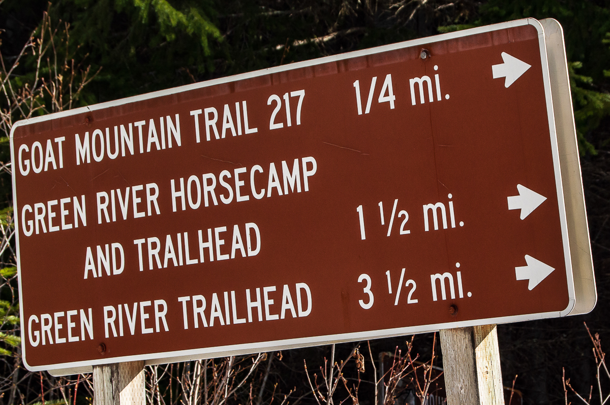
I parked here, waited briefly in the cab of my truck for what was now a white-out to end, and then walked along the 2612 spur to the first trailhead, where I headed into the woods. The trail drops thru planted second growth, this area is well within the blast-zone. The trees are beginning to look less like a plantation, and more like a new forest. The trail is soft (all soils here are soft, being full of ash and pumice) and rutted in places, but in pretty good shape all in all. In no time at all, I’d arrived at the Green River Horse Camp. It’s a nice camp, very near the river, in open sunny second-growth. I took a break here and explored a bit. There is at least one campsite across the river.
Continuing down the trail, the 2nd growth continues. I suspect the area above the horse camp had been logged prior to the eruption, but the area down river from the camp had not. Here, I encountered what was obviously 2nd growth, there were stumps of old growth everywhere – almost all with flat, chain-sawed tops. There was one crucial difference, however – all the stumps were tumbled about, ripped out of the ground. Here, I think, loggers salvaged downed timber after the eruption. Eroded gullies provide a glimpse into the history buried beneath the stumps, with evidence of a very deep pumice layer some feet under the soil.
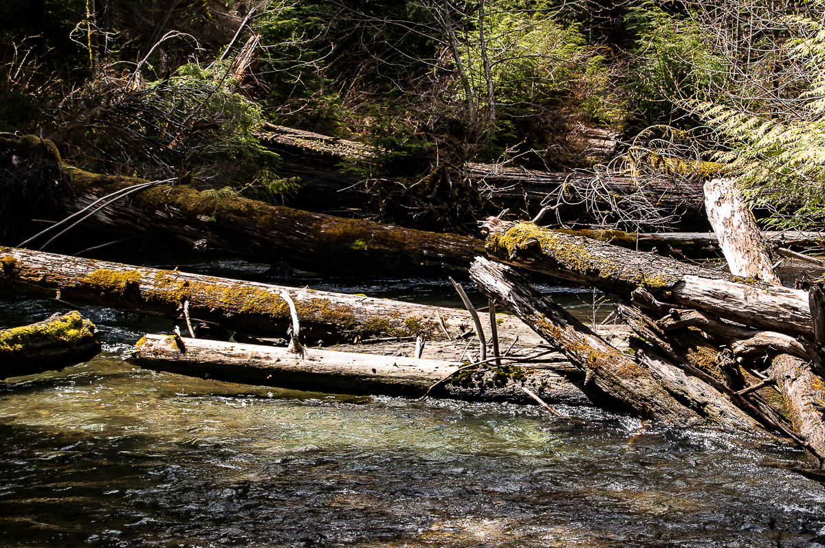
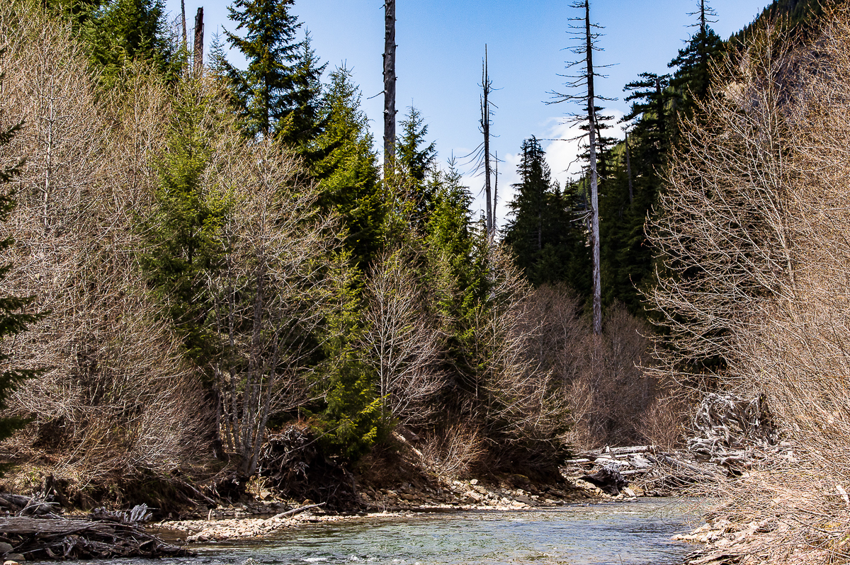
The trail wanders down the river valley, at times approaching the river’s edge, and, at one point, providing a nice view of a falls. The view is obscured a bit by alders, but they’ve not yet leafed out, so I spent a few minutes enjoying the view. After a few miles, the trail crosses an old road and what appears to have been a parking area – now it looks more like a horse-friendly camp. Not too far past here, the forest transitions from reclaimed forest to blast-edge and then to old-growth.
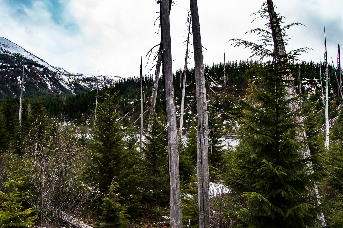
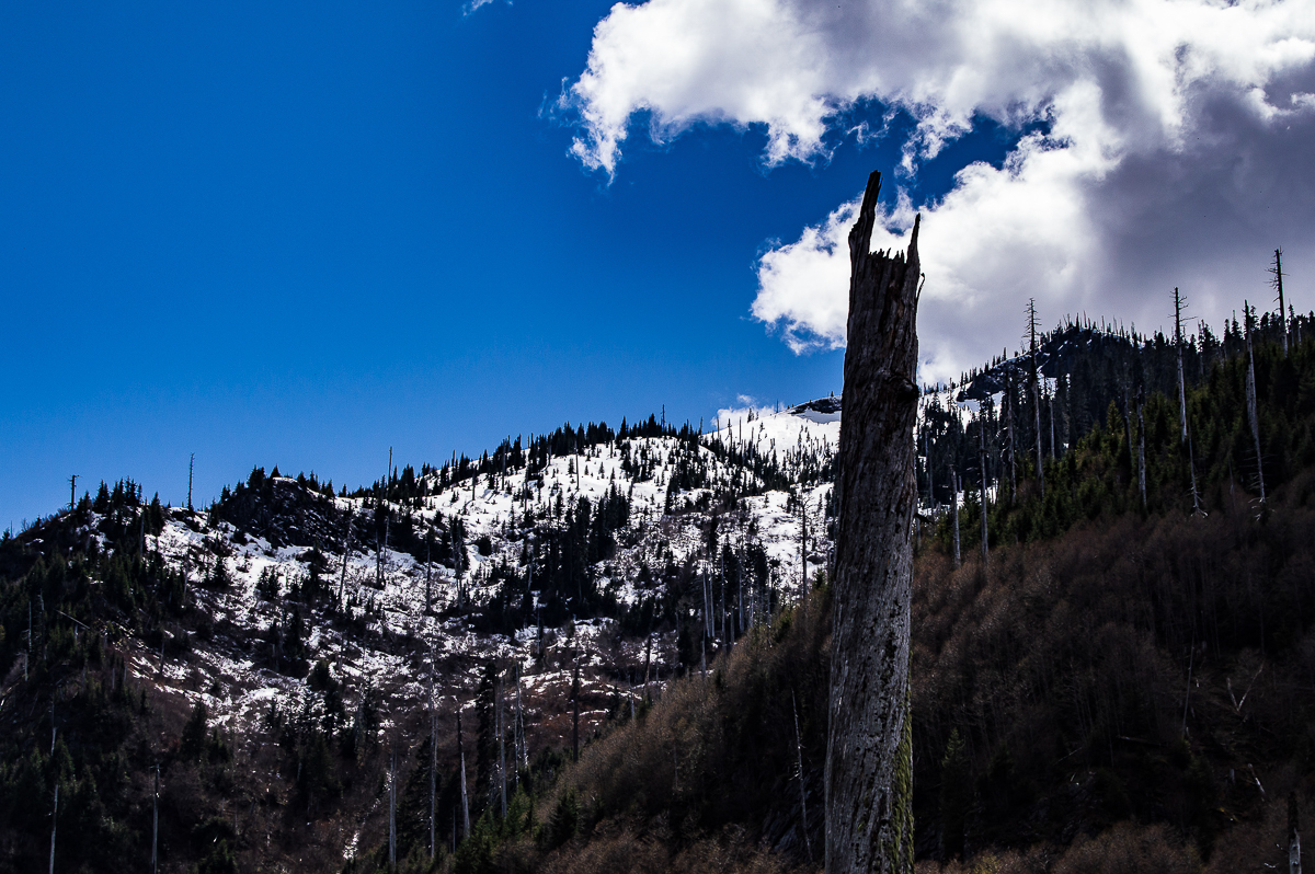
I found this transition area fascinating. It was not salvaged after the eruption. Everything is lying about just as it fell, and the forest is growing up around it. It is a rough and wild zone, at once ancient and new. This zone is narrow, however, and after just a few moments, one begins to pass towering snags, standing tall and silver yet to this day, almost 40 years later. One lone surviving ancient tree stands among them, then a handful more, and then it’s forest, real forest, complete with ancient soils, undergrowth, and a canopy. The undergrowth is thick and abundant, with so much light passing thru the canopy.
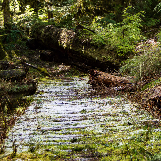
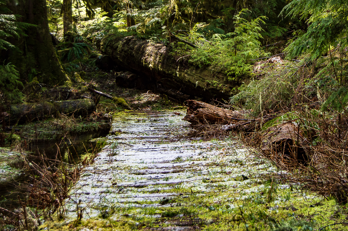
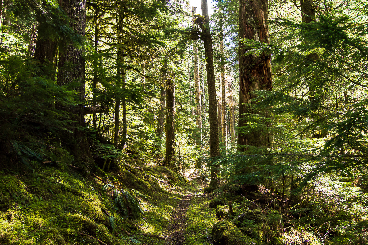
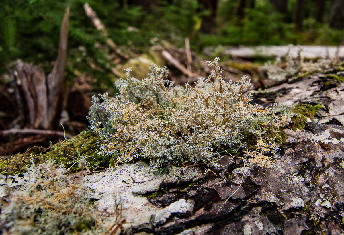
It takes no time at all, however, to leave all of that behind. Trees so large you and a half-dozen of your best friends could not link arms around them. Every surface is covered in moss. There are more trees in various states of decay laying tangled on the forest floor than there are standing upright, and yet the standing trees are uncountable. Save for the thin, fading trail, this cathedral would be impenetrable. Follow the trail around the corner, and civilization, with all it’s attendant horrors and catastrophes, falls behind. Follow it around the next bend, and time itself becomes slippery, fades away. Step over the creek, hopping from stone to log to stone, and in crossing over, enter a sacred space.
It takes only a few minutes to walk from re-claimed, blast-zone 2nd growth to millennia-old climax forest. The difference couldn’t be more astounding, and when I think about how many times this mighty, ancient forest has weathered those hot stone-winds, my mind stumbles. How many eruptive cycles has this gnarled hemlock withstood? And how many before that the rotted log upon which it sprouted so many centuries ago?
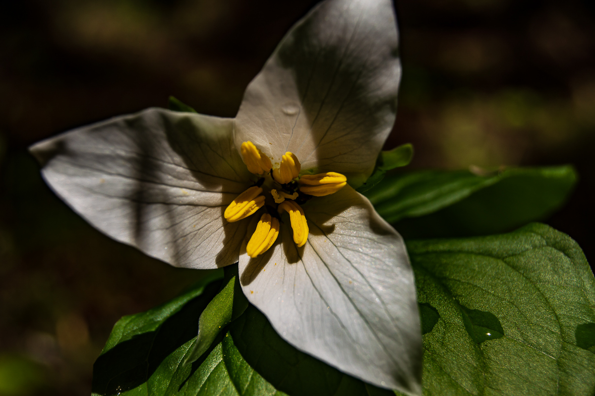
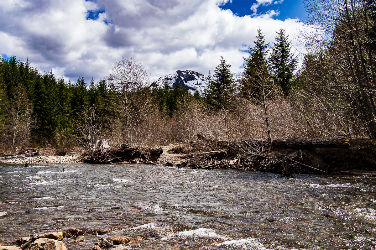
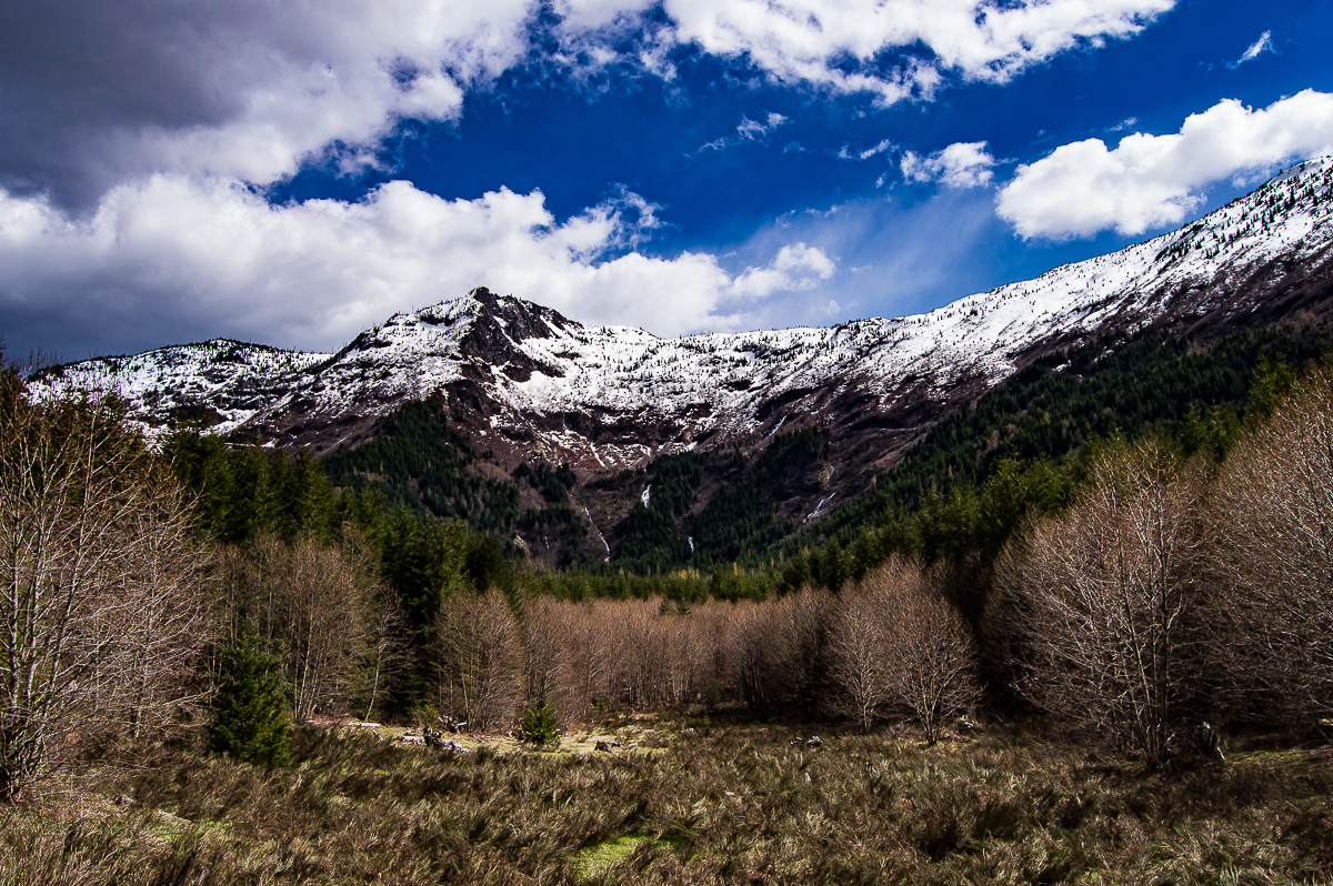
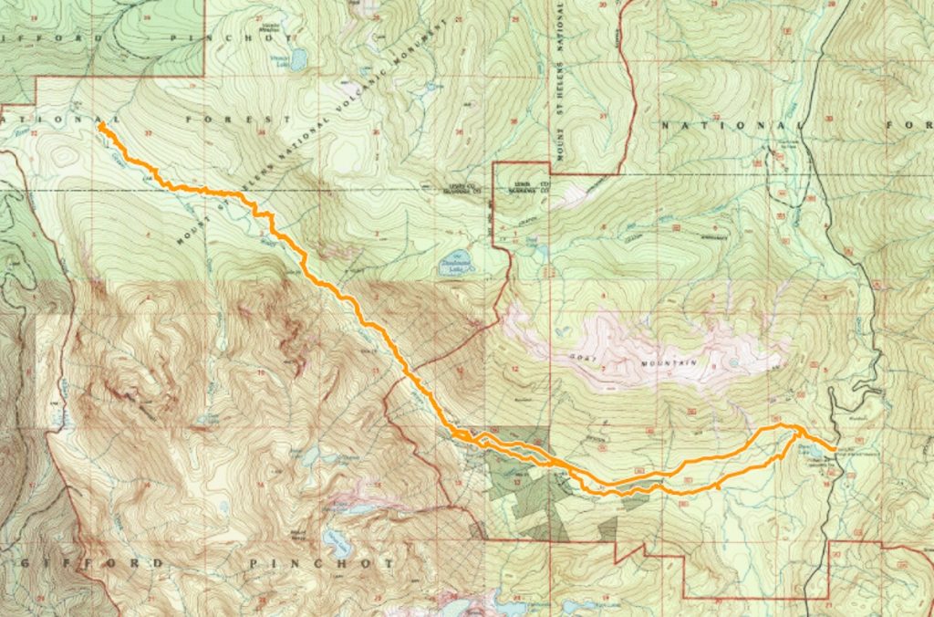
I followed the narrow, moss-covered trail up and over, down and around, across and thru. Many streams tumble down from Goat Mountain and Vanson Peak, but none so large I needed to get my feet wet. Until one was that large – this was about 11.5 miles from the USFS 26 Rd, and I was getting tired. Also, it was getting late, and I needed to stop to make camp and eat dinner. I decided a halt was in order, but couldn’t find the perfect campsite. I ended up backtracking about 0.3 miles to Vanson Creek, and setting up my hammock between two hemlocks in a very mossy hollow filled with budding trillium.
[EDIT: In reviewing my GPS track, it was Vanson Creek at which I turned about. Makes sense, it would be the largest.]
I’ve a rough process for setting up camp, and it all culminates with dinner. I enjoyed a hugely filling meal of rice and chicken, realizing I had not eaten all day. Still, I could not eat the whole 2-person pouch. I gave it a valiant effort, tho! Settling in for a smoke, I felt a raindrop. A few more raindrops came down. How fortunate could I be? The rain held off until the very last minute.
Except it didn’t stay rain – it turned to snow. I promise you, there is nothing more sublime than watching snow falling thru old-growth as the evening dims. Utter silence reigned, with the exception of the creek. I tried to keep my eyes open until it was too dark to see, but it was difficult. I awoke around 2 AM with some leg pain (thankfully, nothing serious, just needed some stretching and massage), and found myself awakened into a wonderland – starlight barely illuminating the forest floor, covered in snow. It was a cold night, and I slept poorly due to that until about 6.
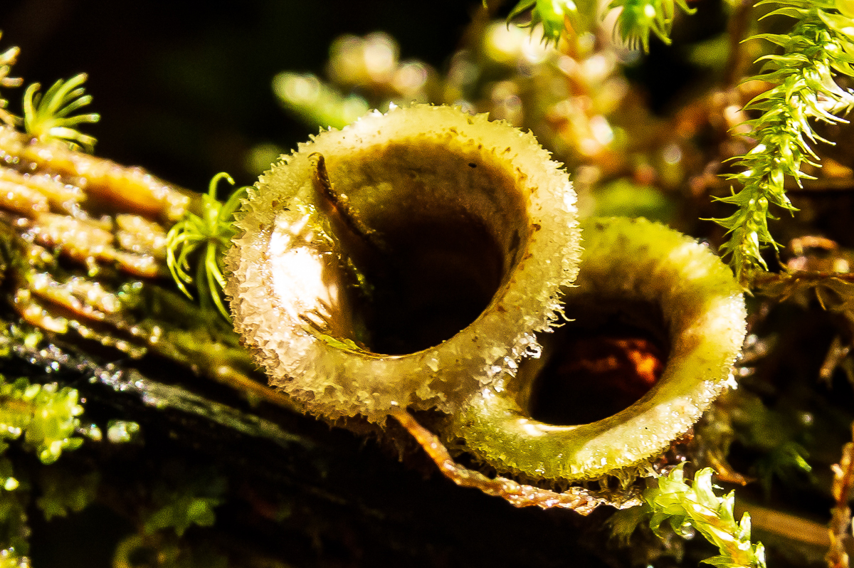
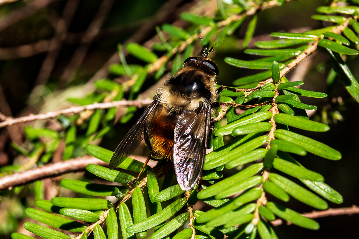
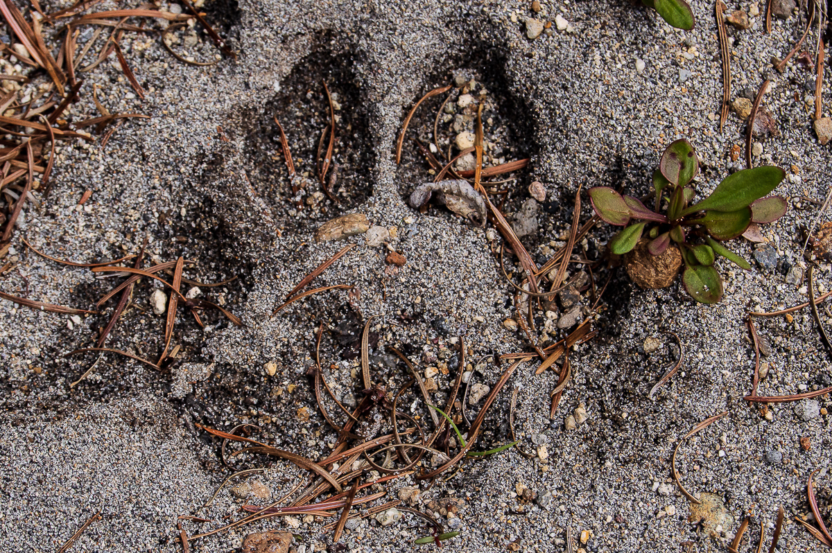
I did catch a bit of a snooze around dawn, tho, after which I enjoyed a very slow, three-cuppa-dirty-chai kind of morning. It was a good morning for photography, and I got some good shots. I don’t think I hit the trail until 11ish. It was one of those bluebird forest days – warming temps, sunny sky, very mild breeze now and then. Every bird in the forest was singing, and I encountered a very friendly bee. Thankfully, however, I did not encounter the cougar that was obviously sharing the valley with me – I saw one solitary print whilst standing on a sand-bar near the river, taking a piss. I was glad that, while it looked fresh, it did not look very fresh.
Arriving back at the 2612-032 spur, I followed it downhill to the river’s edge. Alders have created a nice grove down at the bottom – might make for a good summer campsite. I then walked out via the 2612-032 and 2612, looking to shave a bit of distance and gain off, as I was feeling tired, and had been sneezing from allergies all morning – I suspect alders. The 2612-032 appears to have been de-roaded at it’s end, and I followed the trail up until the double-track appeared, and followed that up to the 2612. Work has been done along much of this road, and it looks horrible for it! The shoulders have all been brushed, and scraped, and debris shoved up all along the edges. What a mess they’ve made.
The USFS is working toward a mineral rights lease in this area, and I am sure this ‘work’ is all about that. It’s all in the courts now, so I rather expect only road maintenance in preparation for the strip-mine for the time being. I hope it all gets stopped, but at least there is access to the area again. God-speed, Cascade Forest Conservancy!! I passed a couple of groves of old-growth, up above the horse camp. I was surprised to find that here, and wonder how it was spared during the eruption.
I also passed a stand-pipe alongside the road. A short piece of garden hose was attached, and cool, clean water poured out of it into the ditch. Not sure why it’s there, but I passed a similar feature, along the trail down below, without the hose or water flowing. Test bores? Tapped springs?
Boy oh boy, was I tired and sore by the time I got back to my trusty old Taco. This was my first overnight backpack of the season, and while my pack was relatively light, it was very heavy by the time I got done. I have much to do to get in shape for the coming season. I did 21.75 miles wit 2,844′ of gain. Not bad for first of the season, and it was all worth it for the Logger & Fries w/ Jumbo Huckleberry milkshake from the Huff-n-Puff. (H&P has great tartar sauce, btw!)


Leave a Reply