
Last weekend found me hiking in to Dose Meadow – a flower strewn meadow on the northwest bank of the uppermost Dosewallips River, roughly 30 miles upstream of Hood Canal, at elevation 4450′. The weather was fantastic, and the trail in great shape. I hiked 36 miles over two days, gaining over 3550′. I came home with four pieces of quartzite and 60 photos worthy of sharing. An interesting note: as I am writing this, WordPress’ spellchecker has a number of suggestion for correction the obviously mispelled Dosewallips. I found them humorous:
Ellipsoidal Cornwallis Codwallop
Here’s my trip report.
Arriving at the trailhead at 7:15, I am on my way by 7:25, and registered by 7:30. The sky is grey, the temps in the mid-50s, yet fortunately, dry. There are at least half a dozen cars parked along the road, but I see nobody. The slog up to the Ranger Station is unremarkable. I’ve done this portion so many times now, I think I could sleep my way thru it. There’s little remarkable about hiking along a road, truly.
If one pays attention to the details, however, this portion of the trip can be fascinating – every single time. The early years of recovery from the Constance Fire are proving to be quite interesting. I’m watching which trees live, and which ones die. The ground is starting to move due to the lack of root mass, and slides happen in the rainy season – to an extent that we didn’t previously see. The plant life is changing. What was deep mossy forest a couple of years ago is now turning into open meadow. This season, one area that used to be particularly shady and mossy is now covered in Epilobium. Next year, it will be something different.
The roadway continues to evolve, also. Here and there, small portions are cleaving away, water wears it’s way thru the roadbed, the forest slowly consumes the edges. Bridge abutments are slowly beginning to undermine and fail. The road is becoming a trail, much like has happened in many other parts of Olympic National Park.
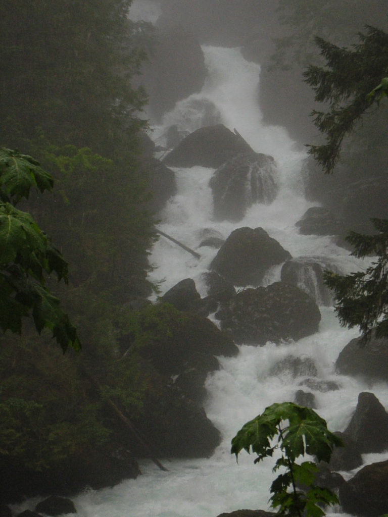
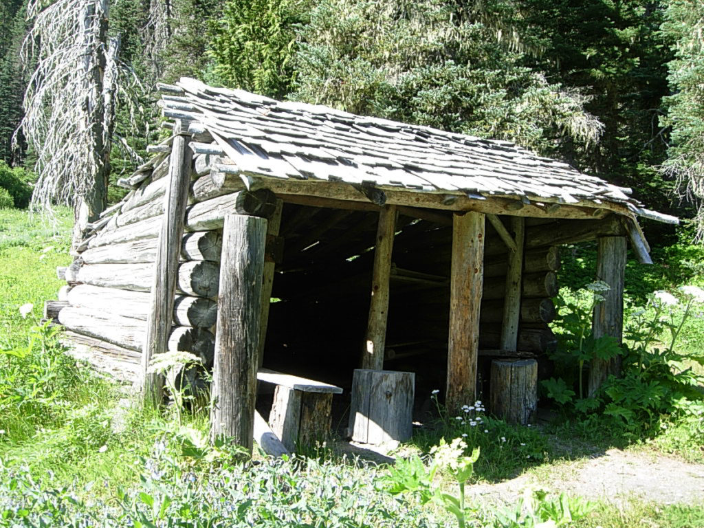
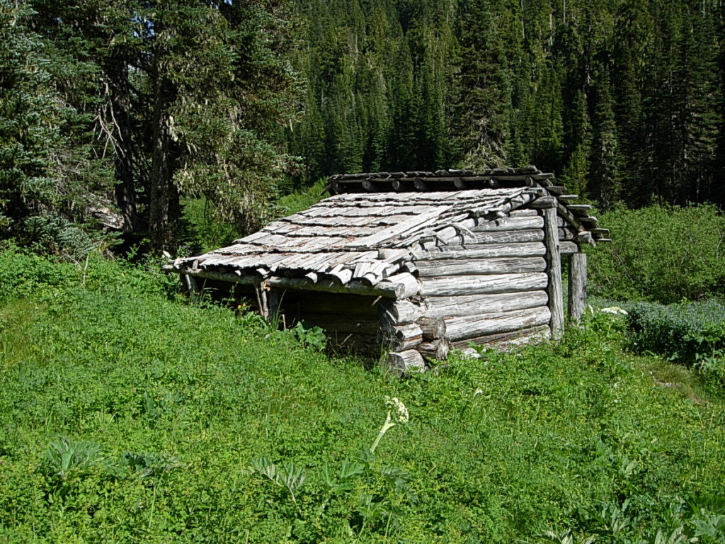
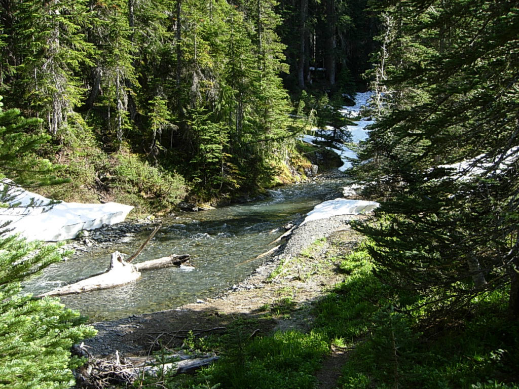
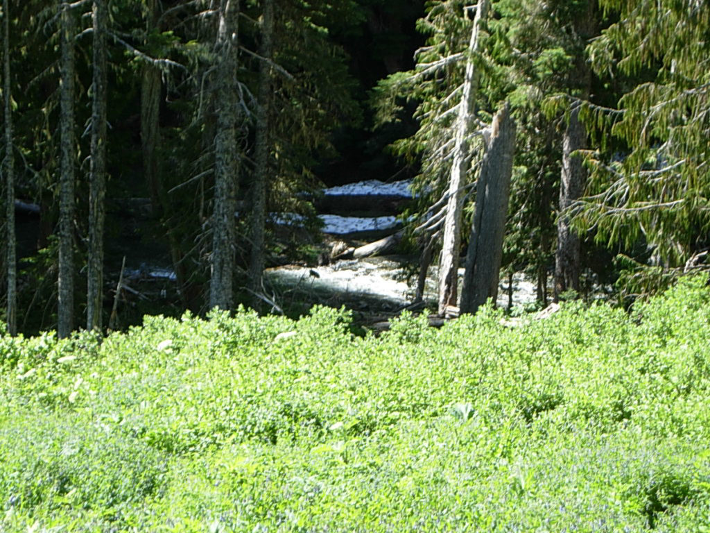
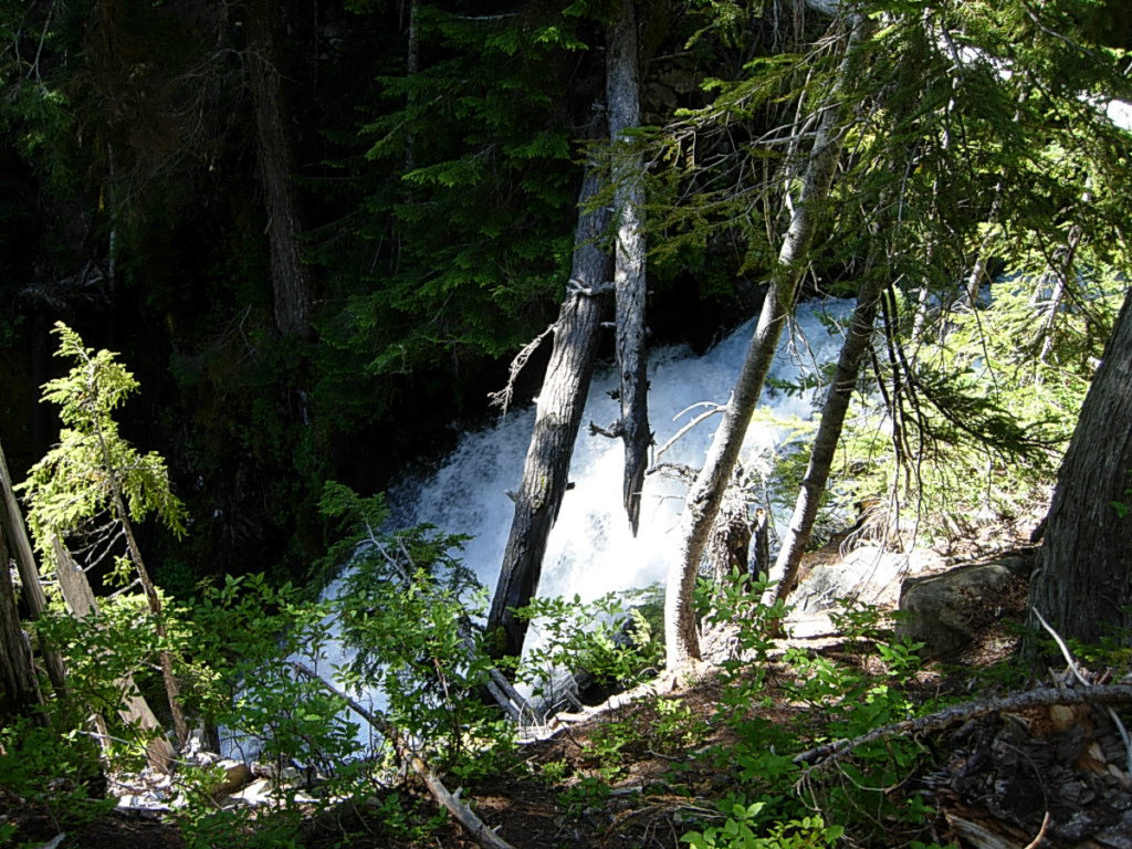
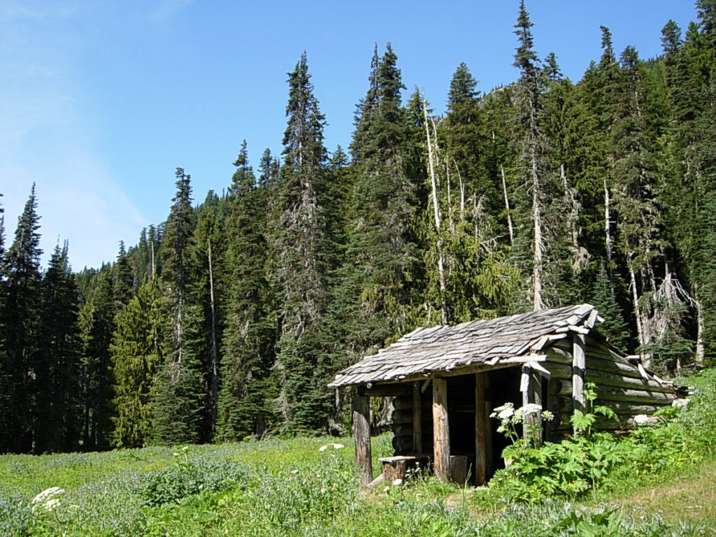
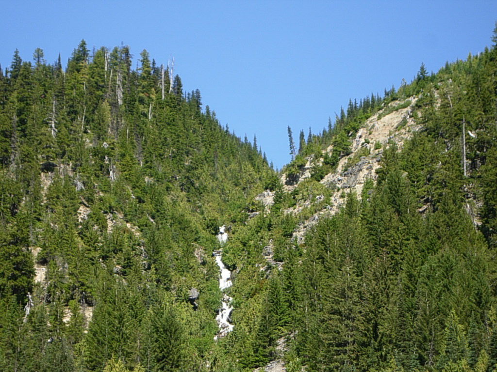
Five miles up the trail, past the towering cliffs of Mount Constance, Dose Falls and Upper Jumpoff, I arrive at the Dose Campground and Dose Ranger Station, promptly at 9:15. Dose Campground remains popular among a certain tenting set, and I can see why – it’s only a five mile walk in, Muscott Flats are simply lovely, and the place is huge. Not by RV standards, to which it was built, of course, but to a tenter? Space! Great sites, right along the river, ample fire wood… what’s not to love? There are a number of different groups camped all along the river.
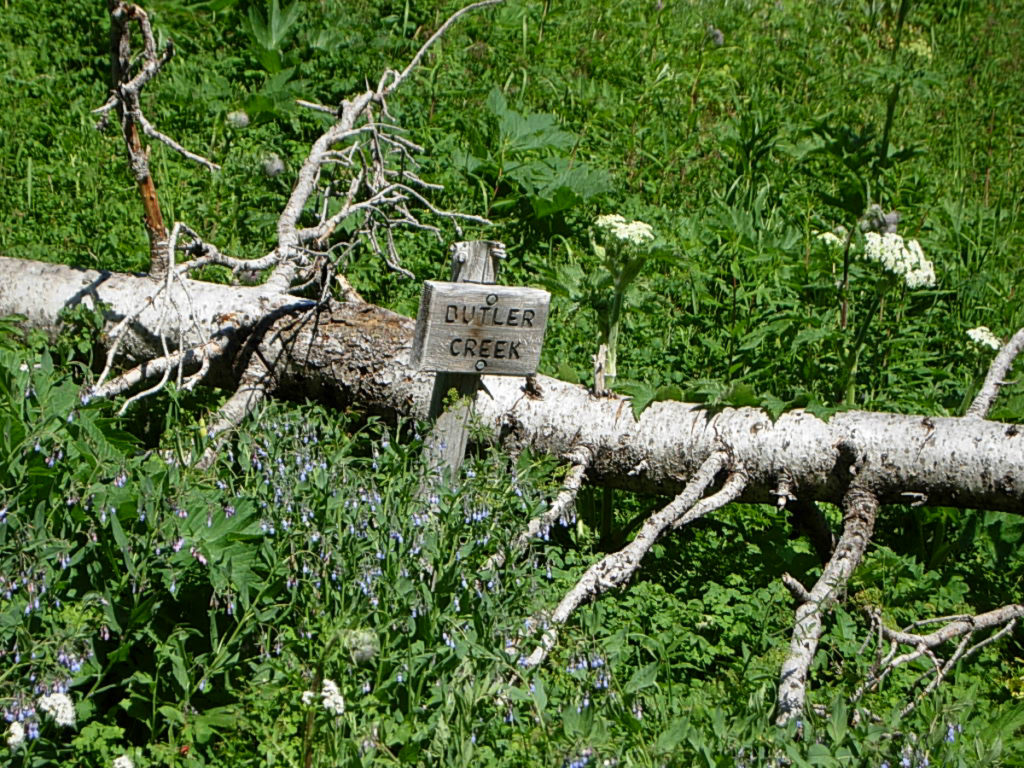
I perch myself on the river bank, at the mouth of Station Creek, for a bite of trailmix and to write in my journal. Taking stock of the weather, I look up, and notice a wonderful thing – summer, and just up the trail. Clear blue skies were breaking out all over just up the valley. Already, I can feel the air warming, the temperature has risen to a whopping 56 degrees. I decide to heave myself back up and onto the trail before my muscles get cold. By 9:45 I am putting tread to trail and passing the large signs at the Ranger Station.
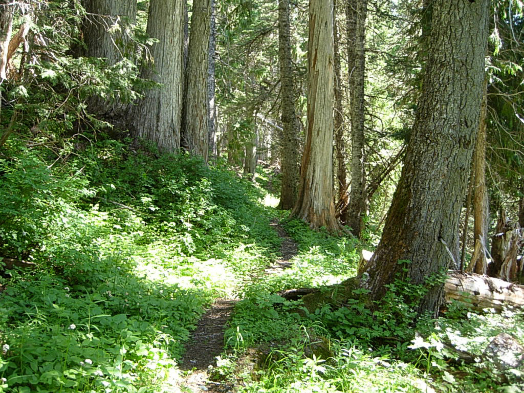
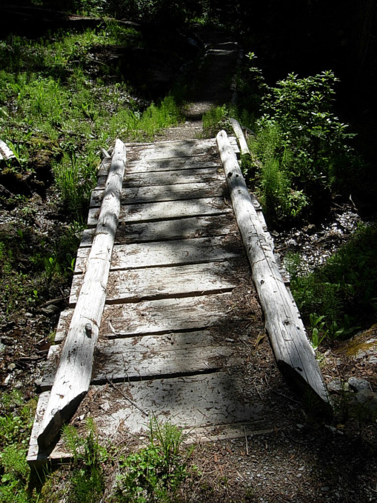
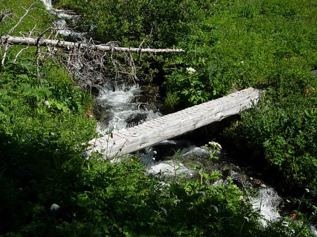
Trail crews have been out, and the trail is in wonderful shape. Blowdowns are cleared and bridges are being repaired. I passed one crew building a bridge over a creek. I was prepared to hop over it, but they insisted I walk their half-finished bridge. “Those rocks are very slippery,” one admonishes. Gingerly I step onto the raw log. I hate crossing raw logs – slippery wet logs and boots don’t usually mix well in my book. The log wobbles ever so slightly as I step forward. I step again, it shimmies again. I step forward again. Have I mentioned I have a balance issue? LOL!
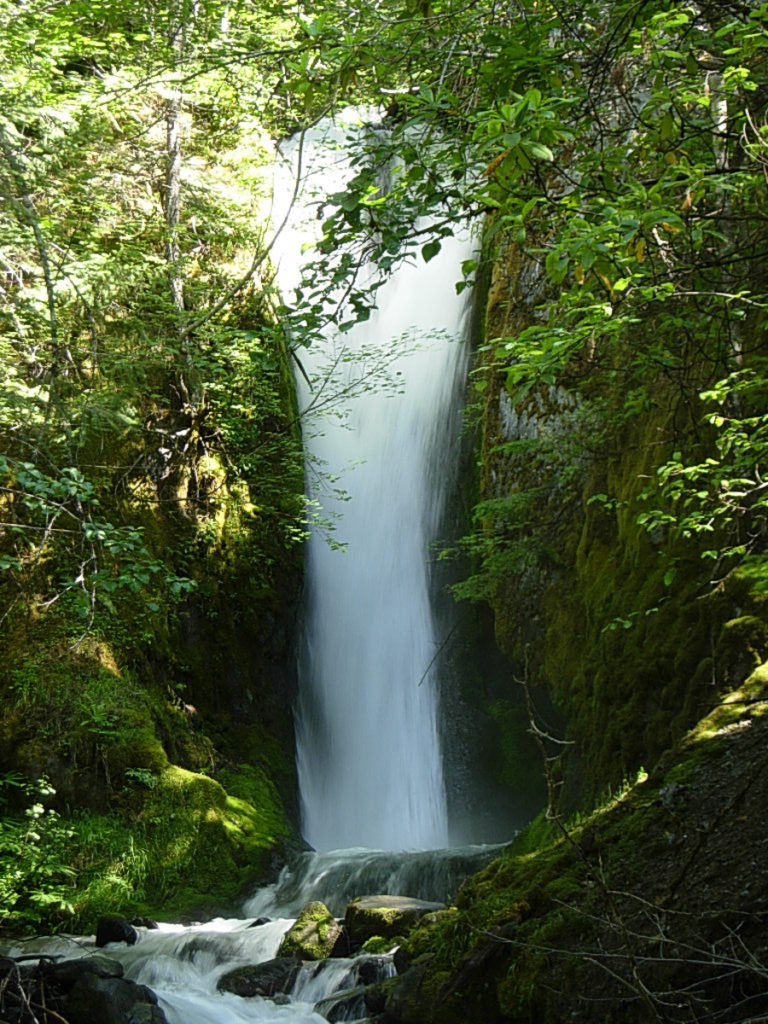
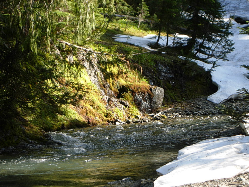
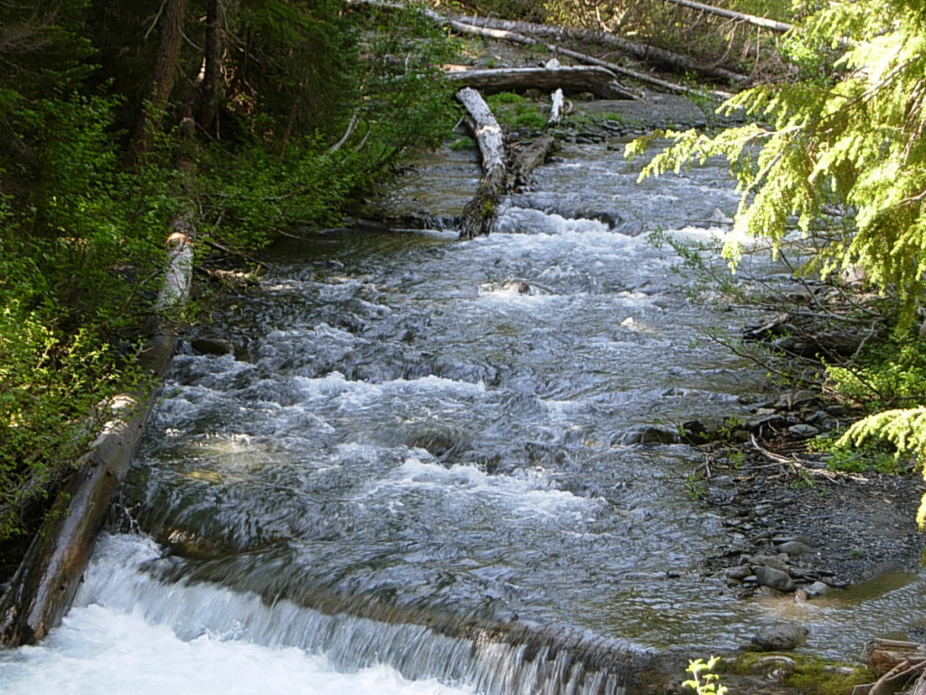
I cross uneventfully, thank the crew for their efforts, and hike on. As I approach Upper Twin Creek and the lovely Calypso Falls, I notice the rhododendron no longer show any sign of the riot I encountered just a couple weeks earlier.
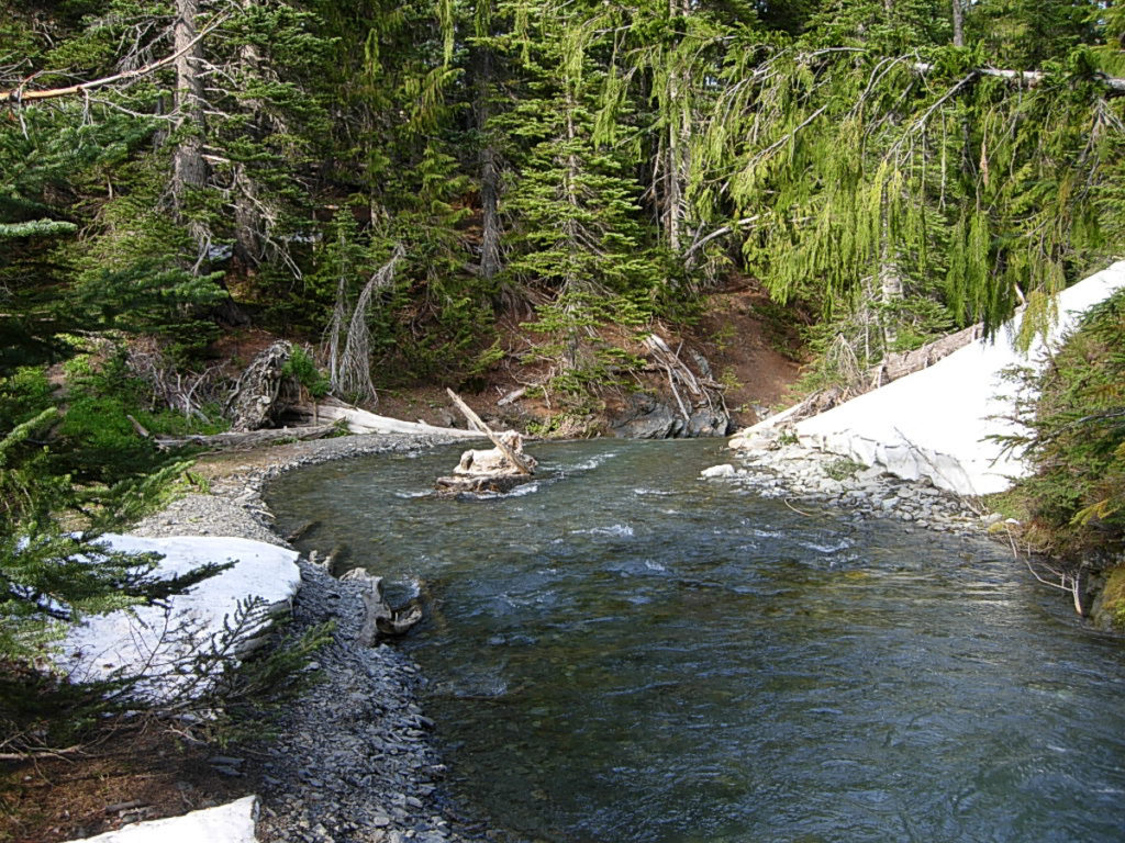
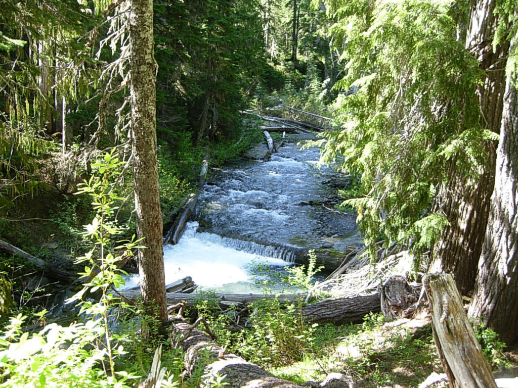
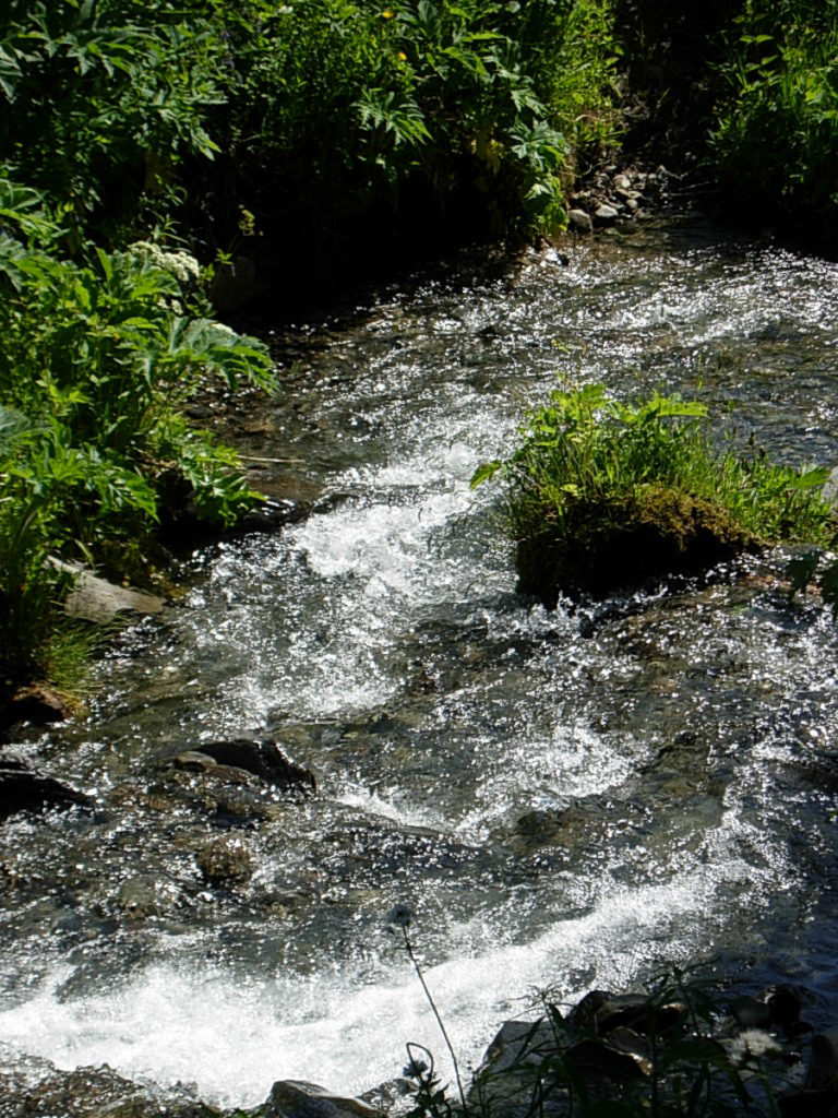
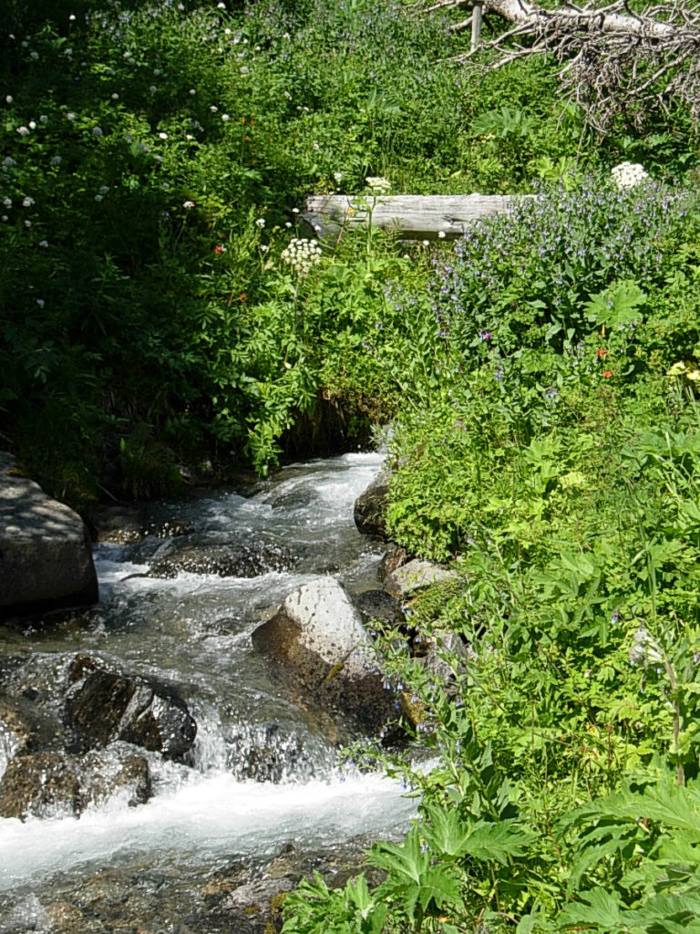
Slide Creek… Hawk Creek… Burdick Creek… Cache Creek… Deception Creek… the landscape just continues to roll by. I’ve covered this ground just a couple of weeks ago, and this time it passes just a little quicker than it had before, even tho I am wearing a pack. I’ve been footing it up the trail for three hours now and am at Deception Creek. Last time up the Dose, this was my turn-around point as I was simply on a dayhike. Today, it’s lunch break.I head for my previous sitting spot, a mossy spot under some short young hemlocks, directly above the stream. The bridgesome yards behind me, and the sun dapples me. A couple of weeks ago, I had patches of snow for company. Today is warm at 64, sunny, and snow free. I eat some lunch, write in my journal, read my novel, stare at the stream… I am a little weary at this point, and appreciate the chance to rest. I hang out here for an hour, and am on the trail by 2:00P.
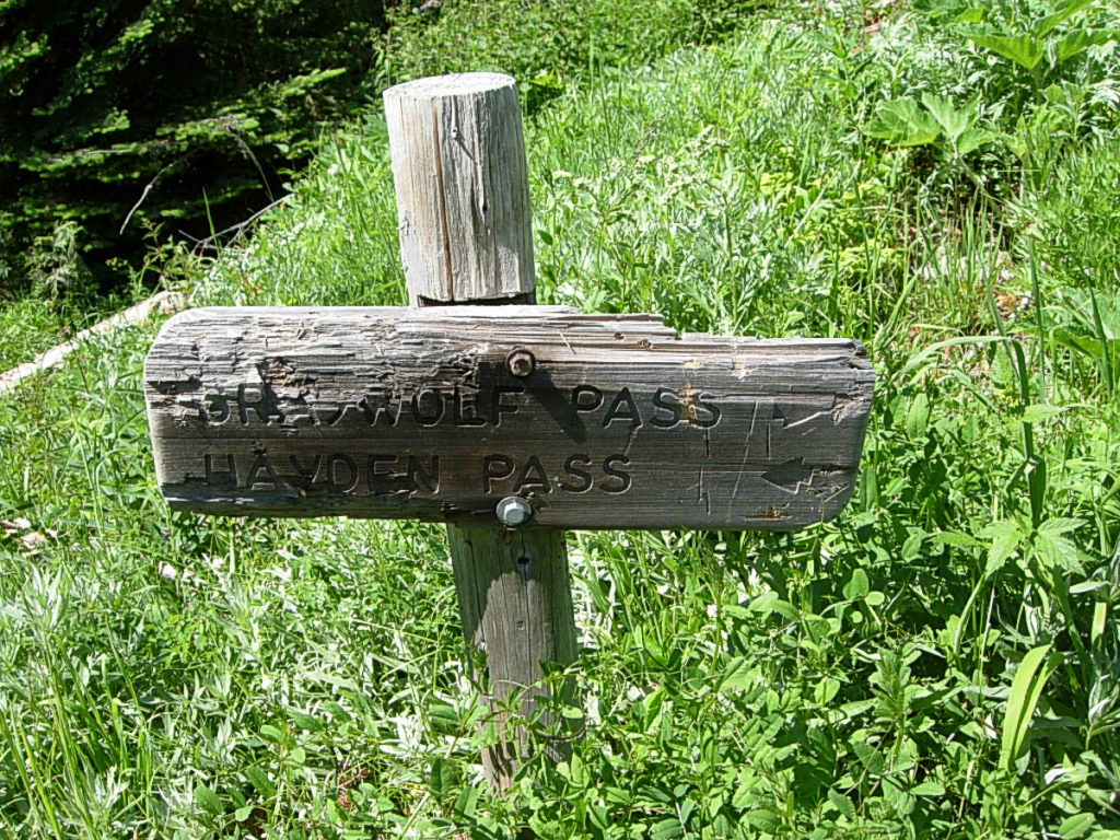
From Deception Creek, the trail works it way up to Camp Marion, then begins a climb up to the Gray Wolf Pass TH. I like the appearance of Camp Marion, situated on a broad terrace, overlooking the river from high above. I make a note to visit the camp on my way back down, as I think I might like to stay here on a three day trip up to Thousand Acre Meadow – a meadow even more stunning that the one I’ve just left. Unfortunately, it’s just far enough further up the trail to convince me it deserves three days.
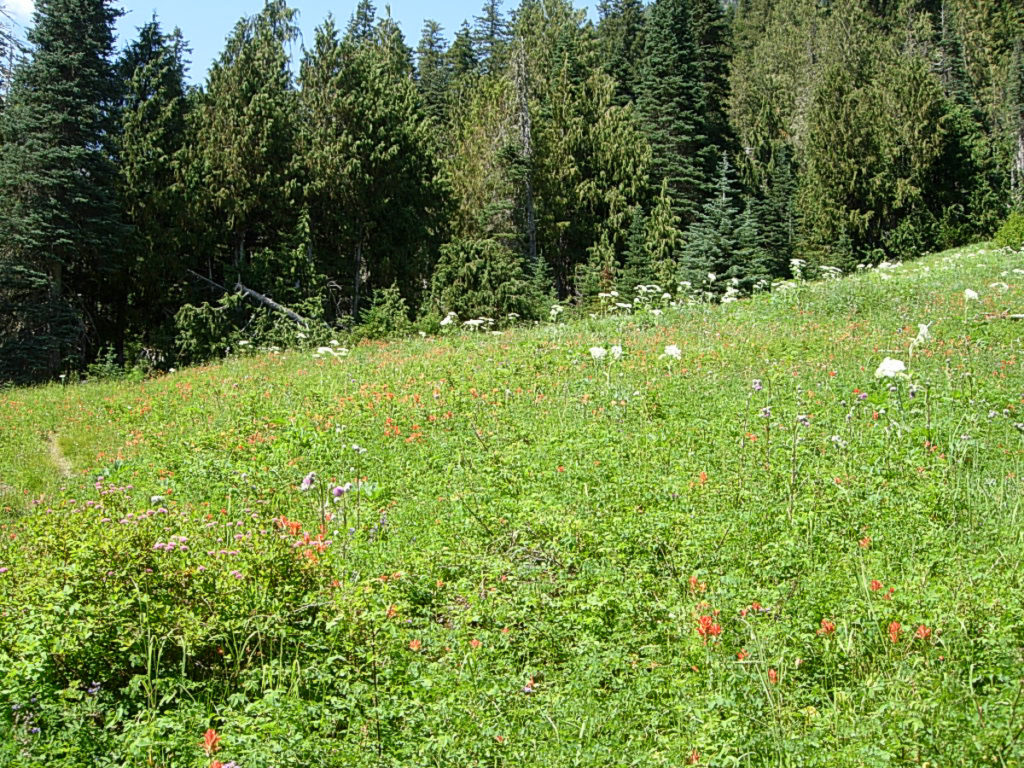
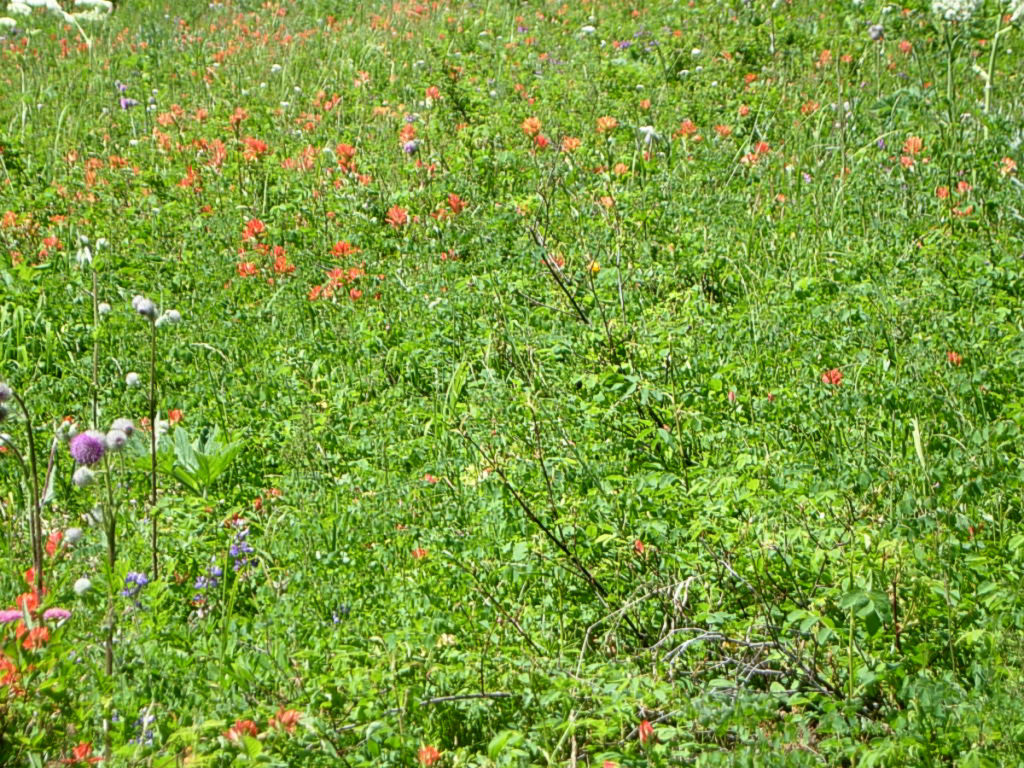
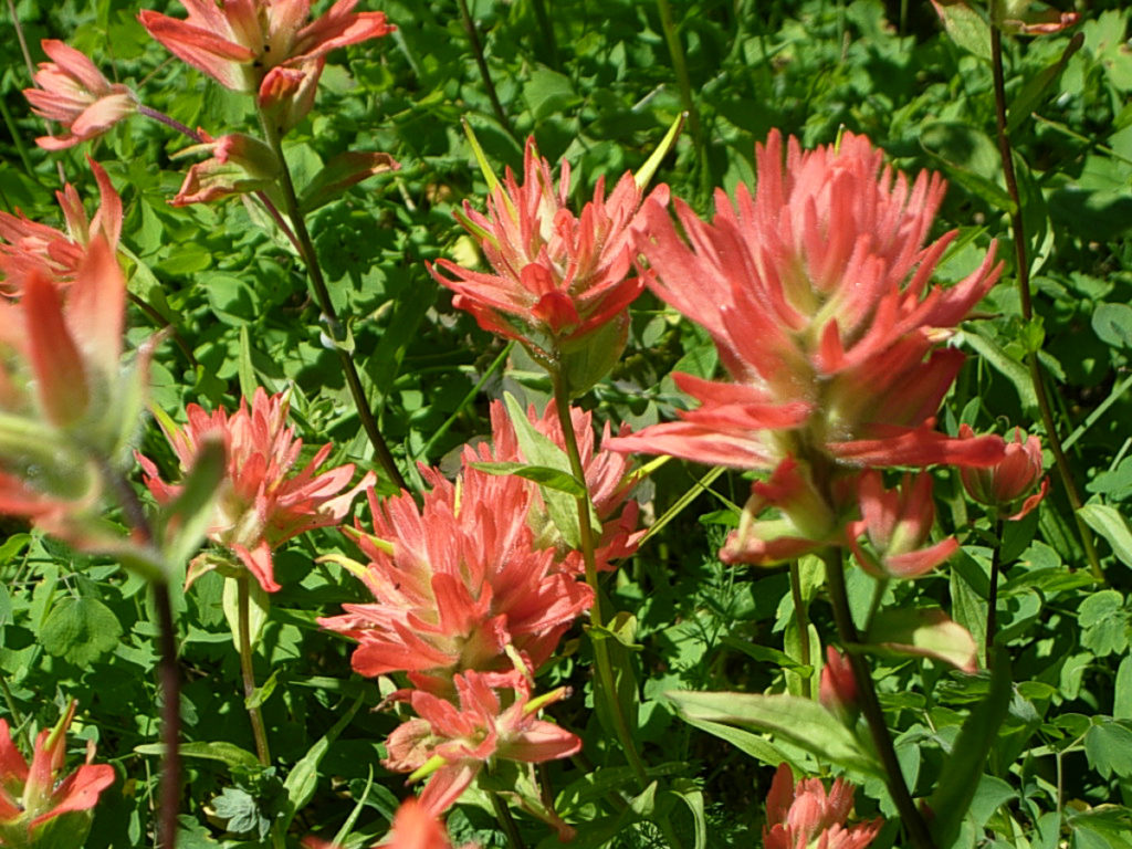
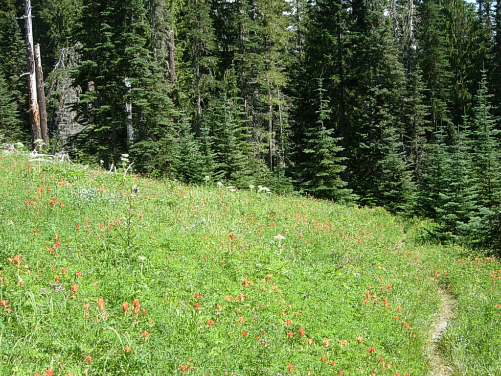
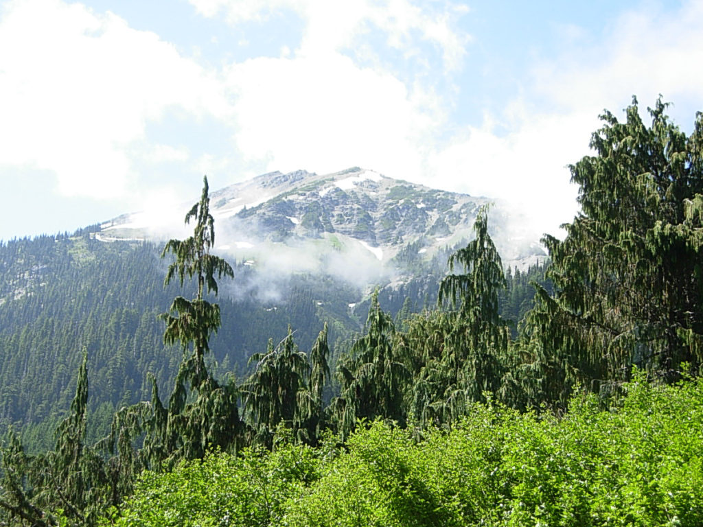
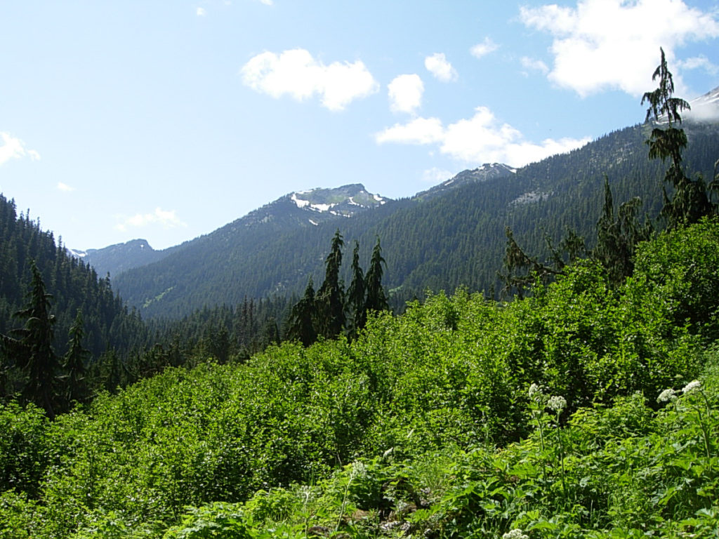
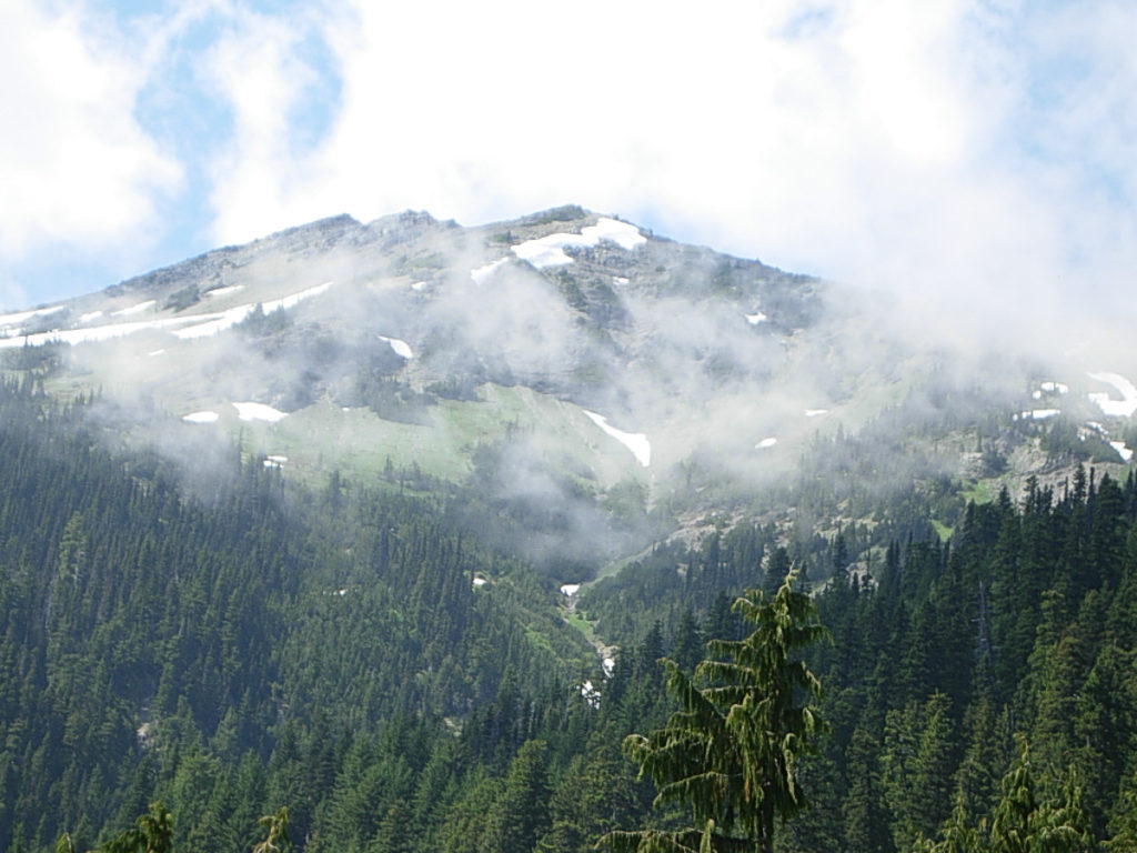
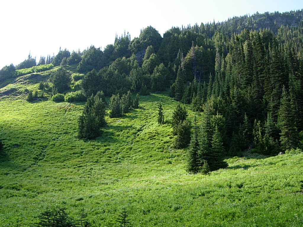
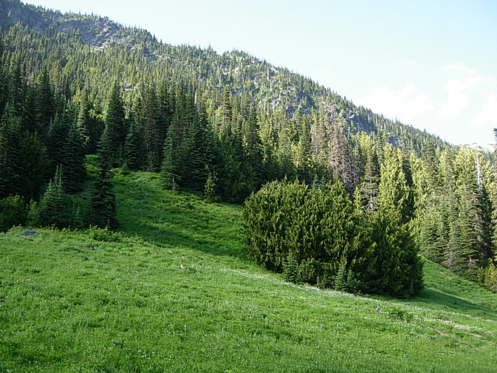
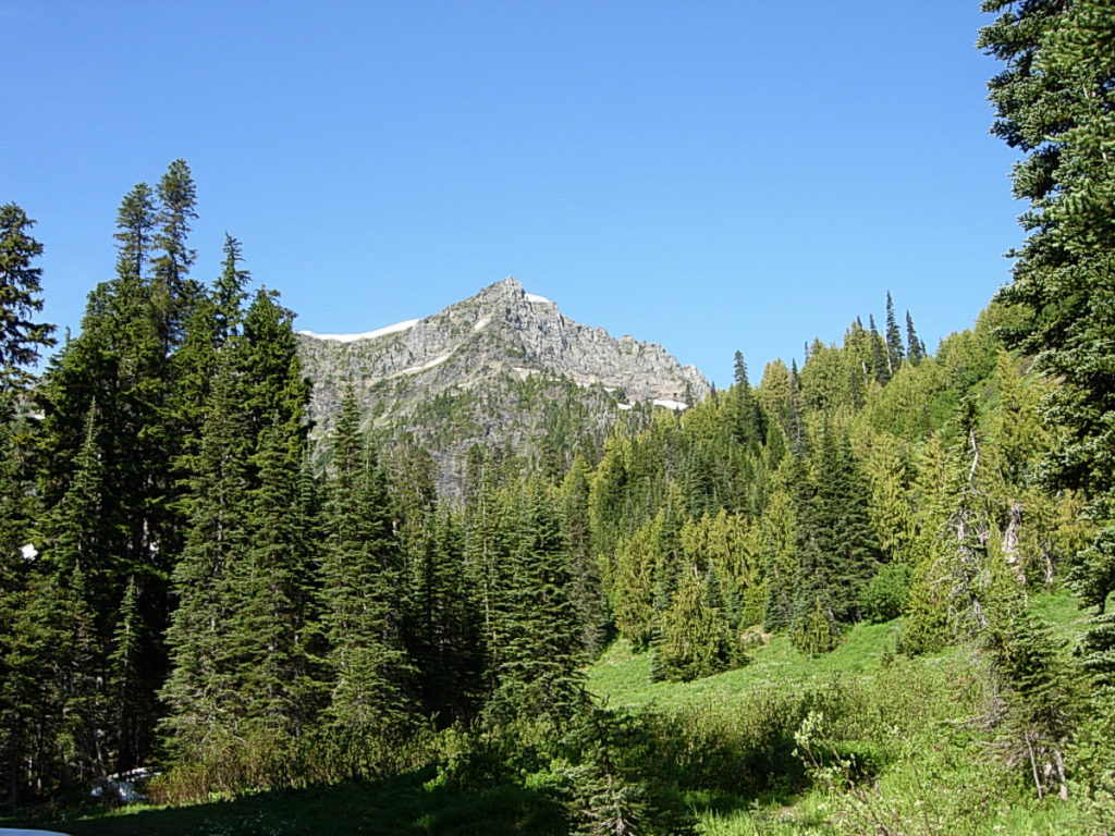
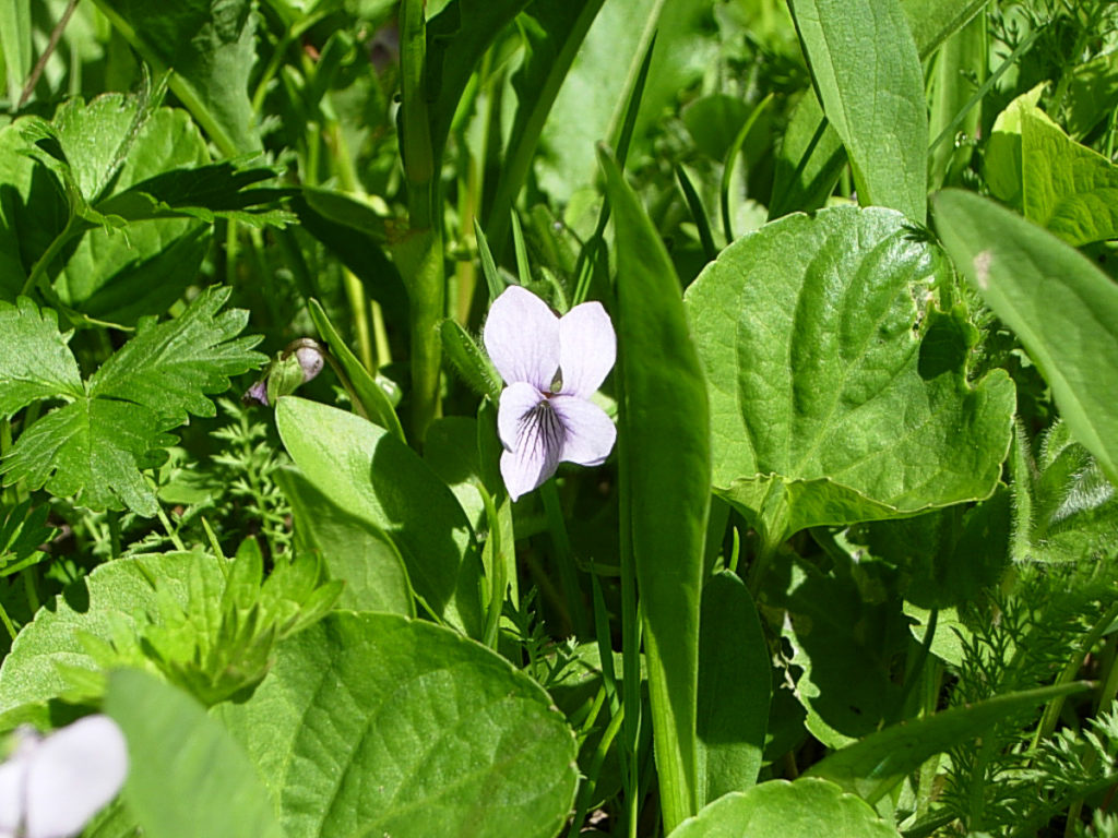
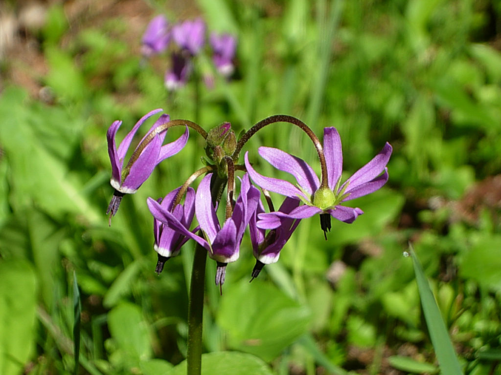
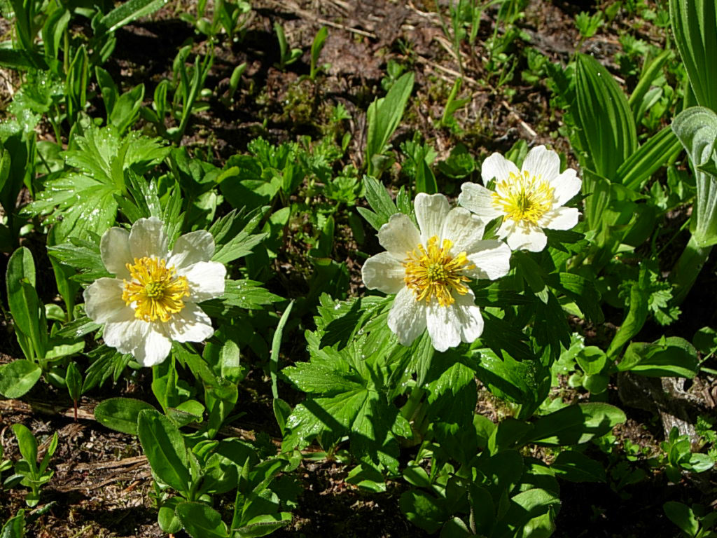
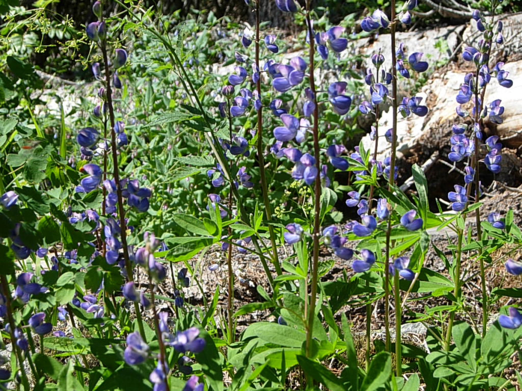
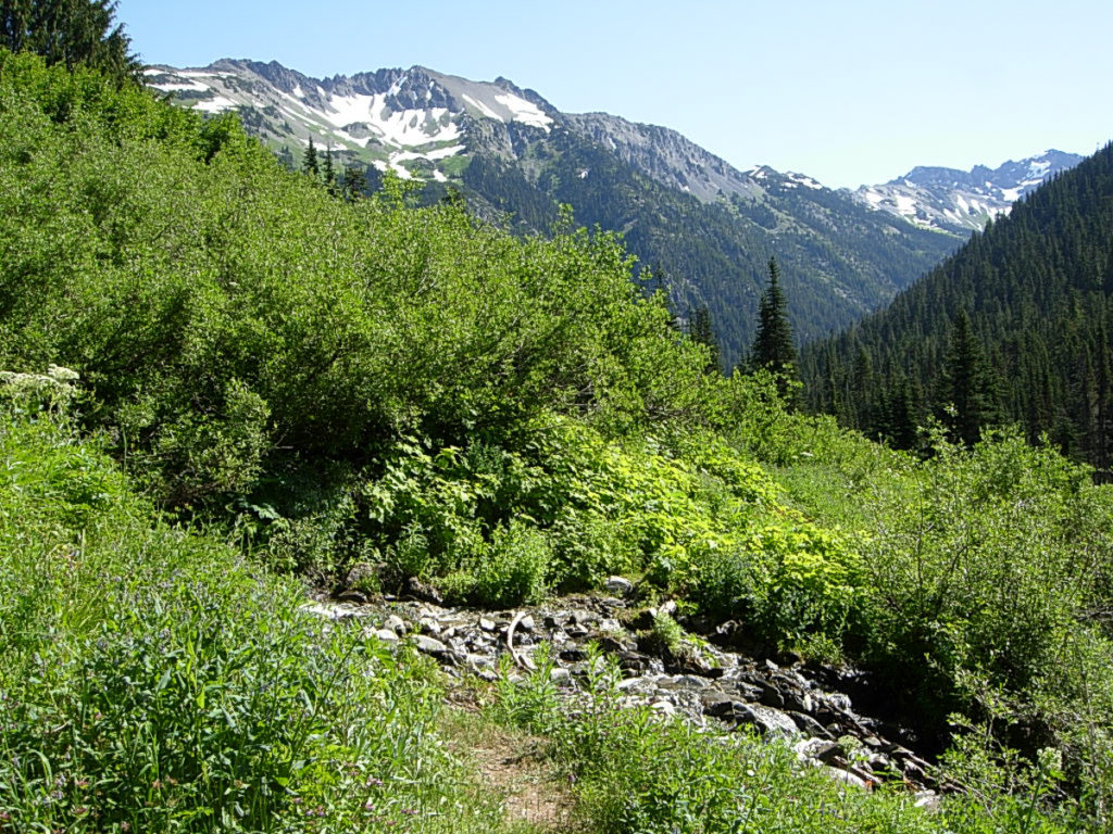
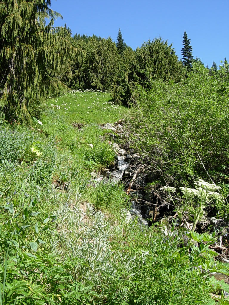
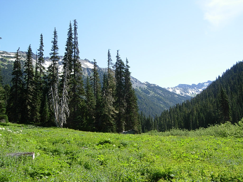
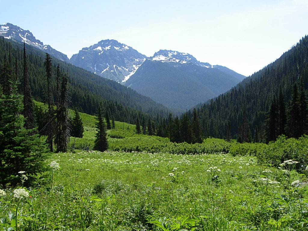
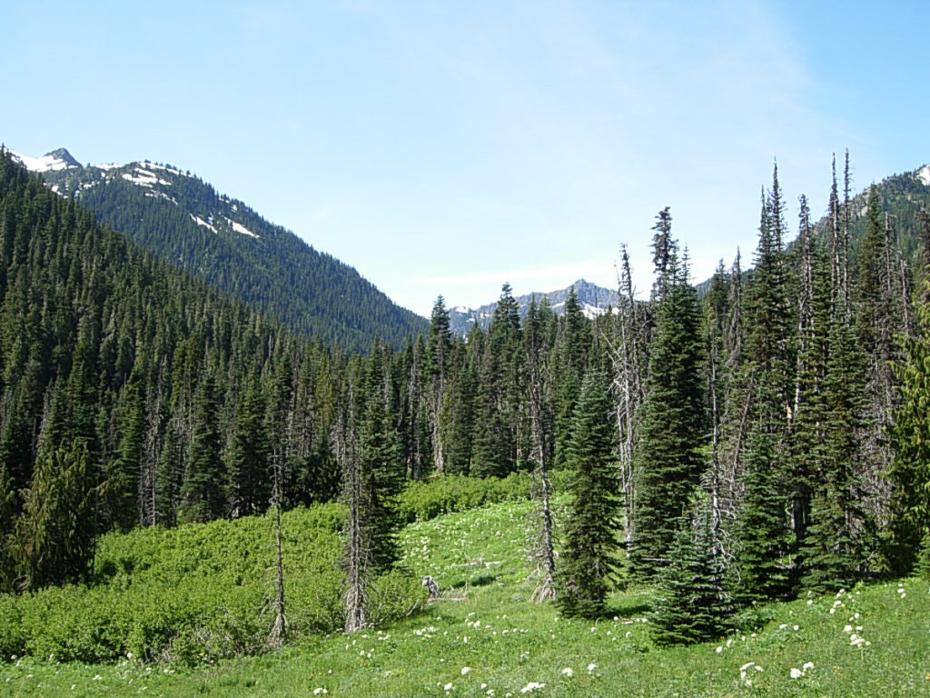
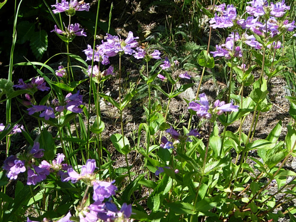
Chugging up the trail brings me out into the first meadows, and the Gray Wolf Pass Trailhead. From here on to Dose Meadows, I push thru verdant meadows bejewelled with Tiger Lily, Columbine, Lupine, Campanula, Hellebore, Cow Parsnip, Anenome… so many different things, so many different colors! The meadows are intererrupted by short stretches of forest, gnarled old gray barked trees, twisted and bent under the ceaseless cycle of snow and sun and wind and ice.
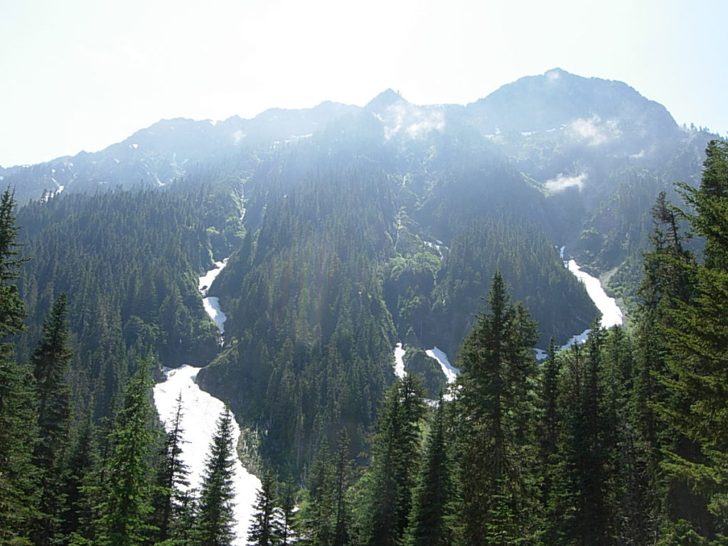
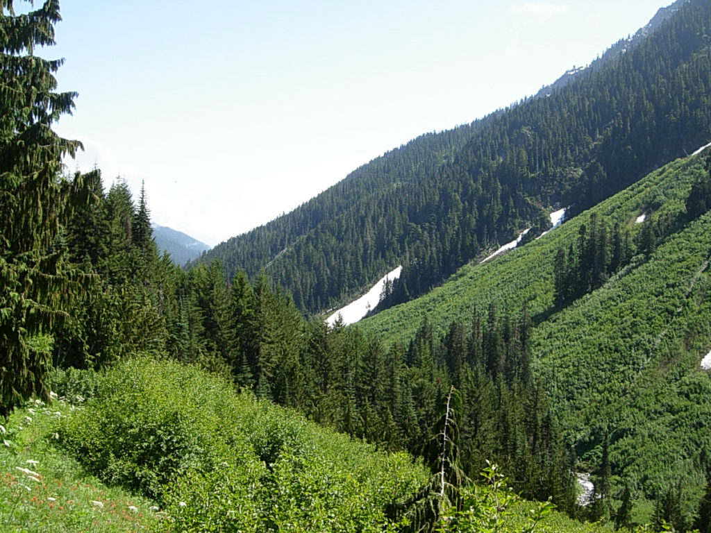
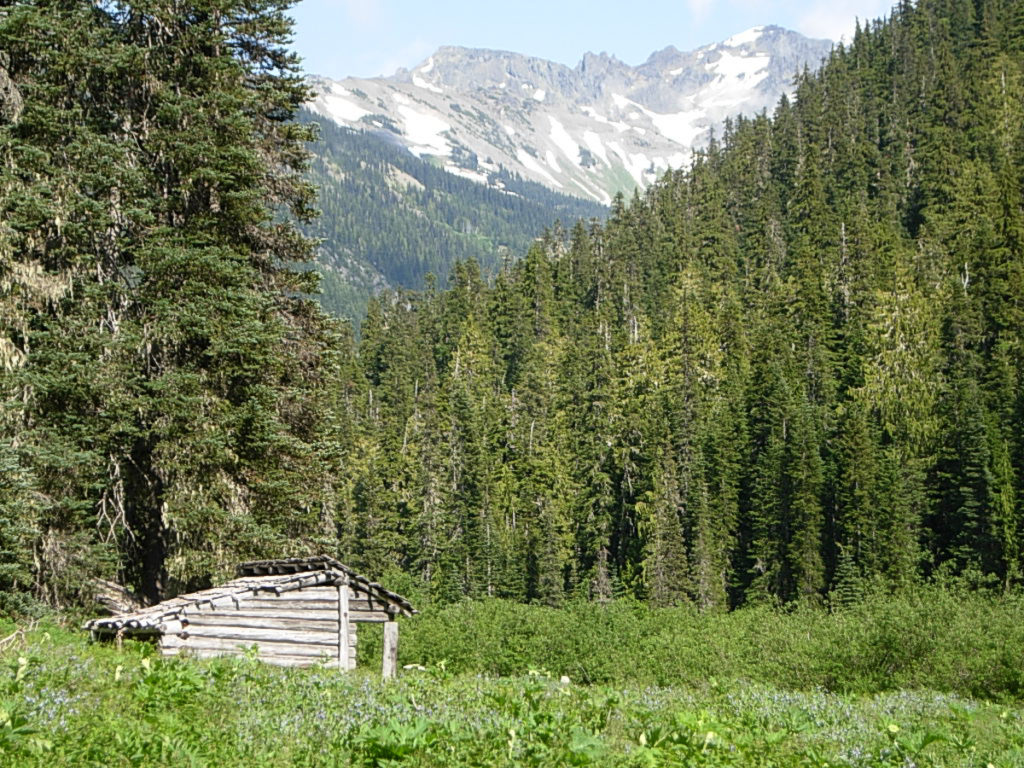
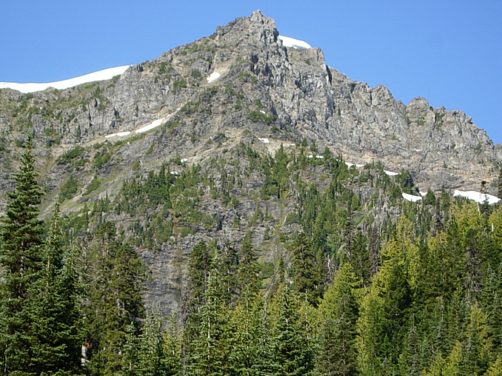
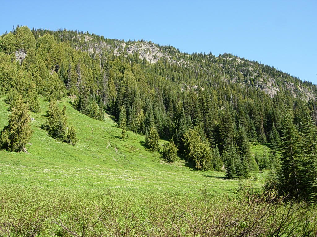
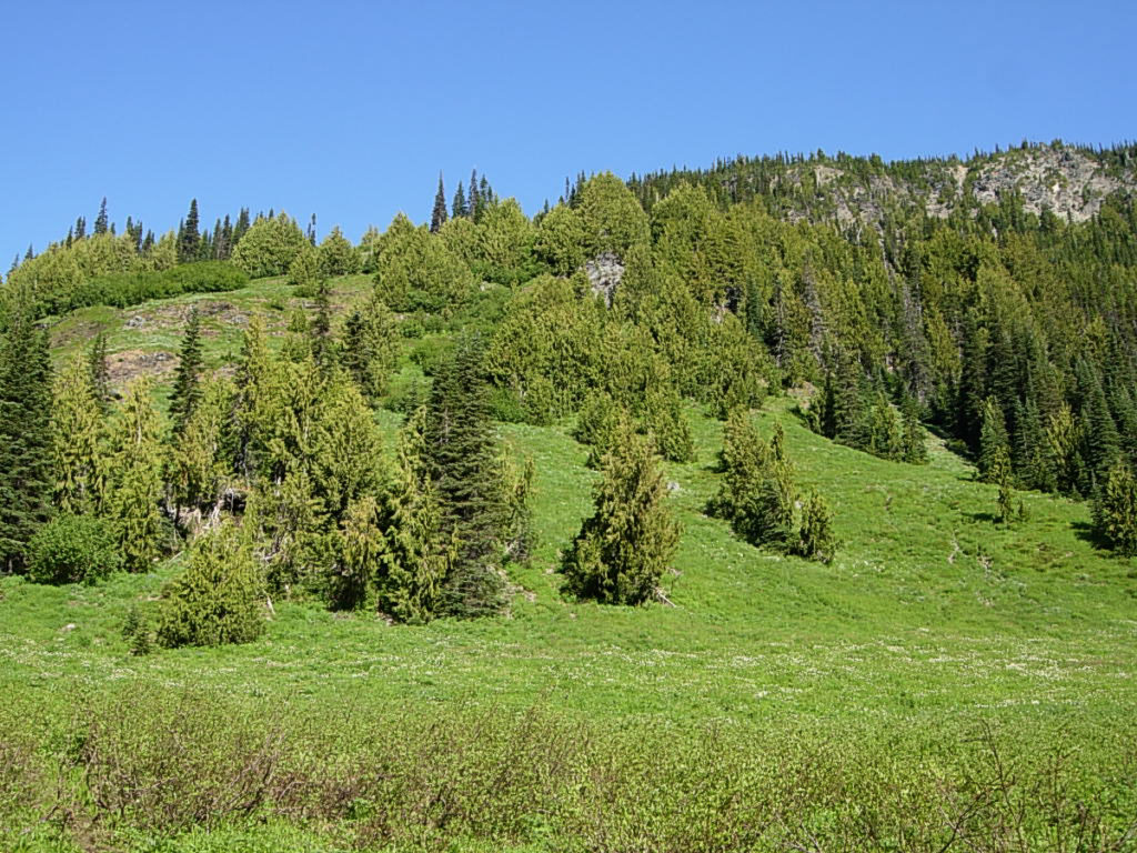
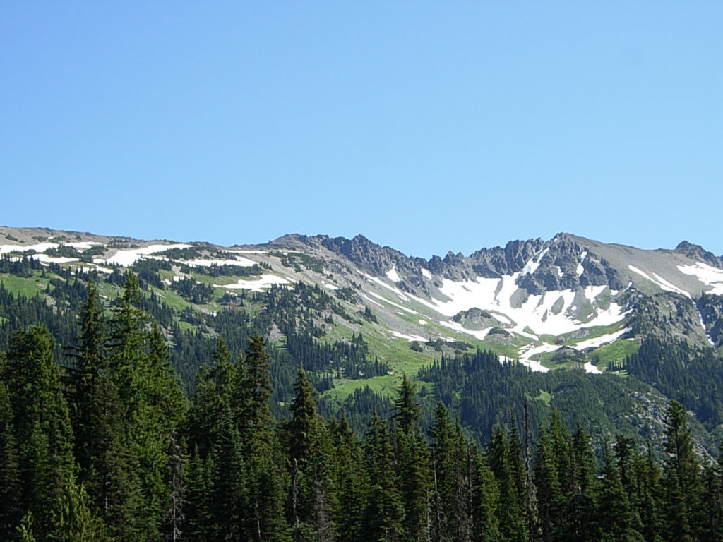
4:30 finds me breaking out into a meadow that seems a bit grander than those I’ve just passed. A sign greets me, the trailhead marker for Lost Pass. Before me stretches a meadow, a carpet of green and red and blue and white and yellow and purple, but mostly green… it creeps up the mountain slopes all around me, flowing up around outcroppings of rocks, interrupted only by cliffs or small patches of trees, or an occasional marmot-topped boulder. The meadow reaches up places where avalanches rush to leave, and blankets high stretches that can but futilely beckon this weary hiker who is out of steam and out of time.I set my pack down at the first campsite I see, then take an opportunity to walk around a bit and find the very best campsite, see who’s around, and figure out where to get water. I eventually choose a site upriver, past the privy, near the 2nd bear wire. Then I settle in with my back against a tree for an evening of simple luxury as the sun lowers toward Mount Fromme. An REI-bought manufactured meal, hot chocolate, a little bit of candy, a good novel.
I notice, just after the sun disappears behind the rocky mass of Mount Fromme, that what was clear blue sky promising stars has suddenly turned cloudy. Full on socked in cloudy. NO! I quickly string up my tarp over my sleeping bag. Not 15 minutes later, I’m falling asleep.
I awake to chill just before dawn, and don’t really get warm after that. Methinks I need a new bag. A warmer bag for the shoulder season. Something happened to my “intrinsic insulation”, and I am much colder at night. (Read: I lost 70 pounds, and am a skinny person now. Poor me, eh? LOL) As the light strengthens, and the dawn chorus waxes and wanes, as I doze on and off in the chill mountain morning, I am joined by a new friend. How I wish I had gotten a good pic of this stunning fellow. A 4-pt stag deer (mule deer? I’m not sure.) in velvet, is about 10 feet away, browsing.
As I look closer, I realize he’s eating the ground. I also realize that he’s eating the ground where I had pee’d the evening before. He’s eating every little bit he can, putting down dainty mouthfuls of forest floor duff. Not certain this is something I should be promoting, I relieve myself on the trail after I crawl out of my sleeping bag. My activities seem to disturb him not in the least, and he spends the entire morning with me. He wanders all around my campsite, browsing here and there. At one point, he inquisitively approaches within about three feet of me. I am simultaneously thrilled and scared. His intentions are harmless enough however, and he ambles off across the meadow after that.
My morning routine is the same old hiking routine as always. Hot drink, breakfast, wash up and pack up, and on the trail early… with just one variation. I really want to simply sit alongside the river, write in my journal, hunt for interesting rocks, shoot some pics of wildflowers, and soak up some warm morning sun. So that’s just what I do. Until 10:00! Truly, I am rich.
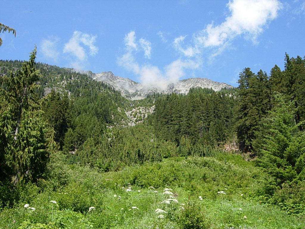
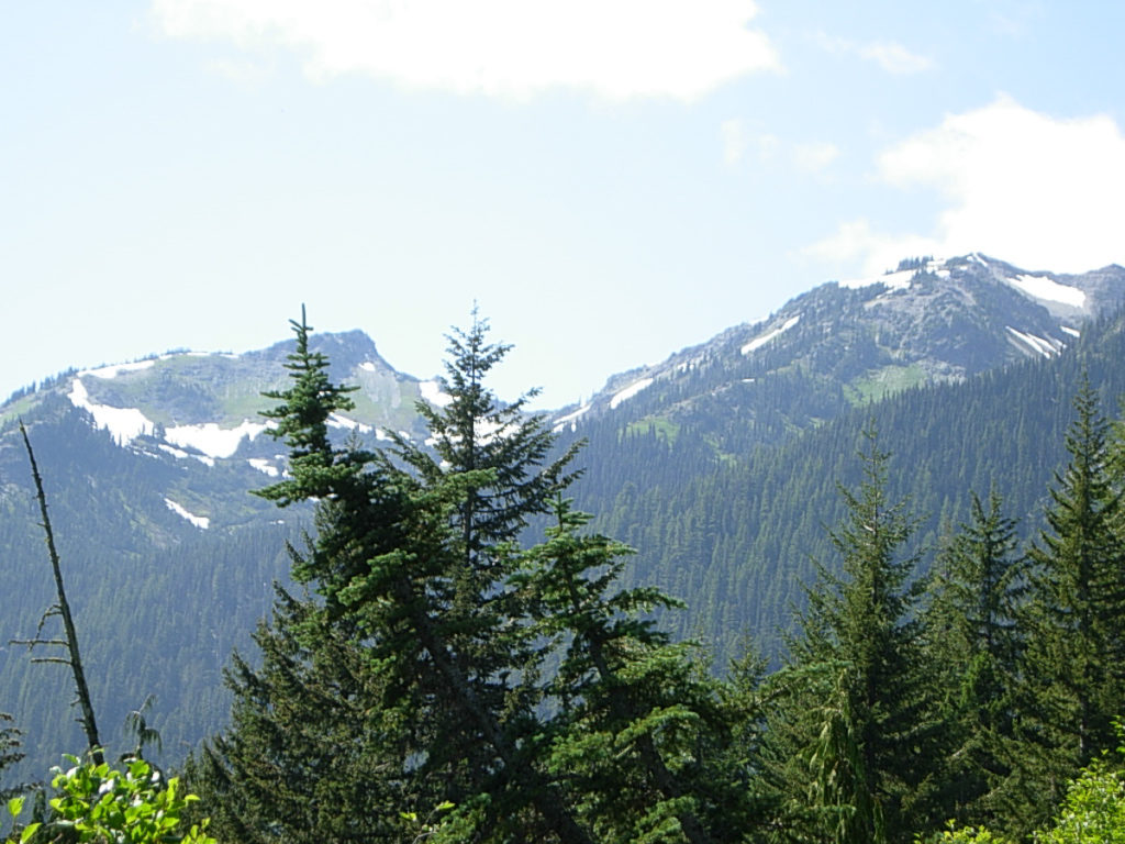
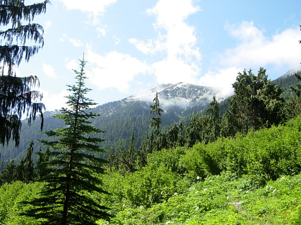
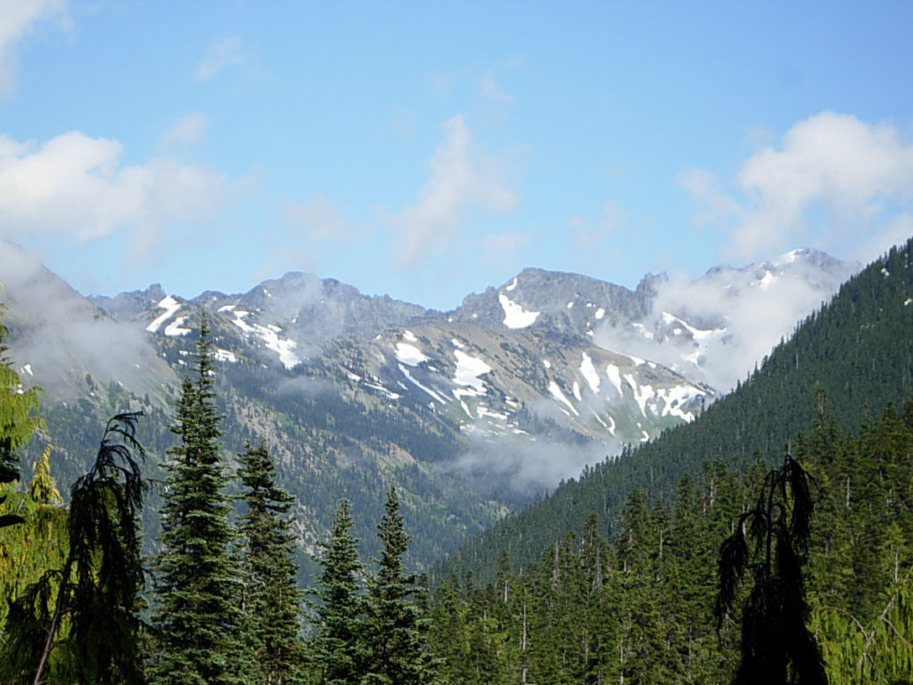
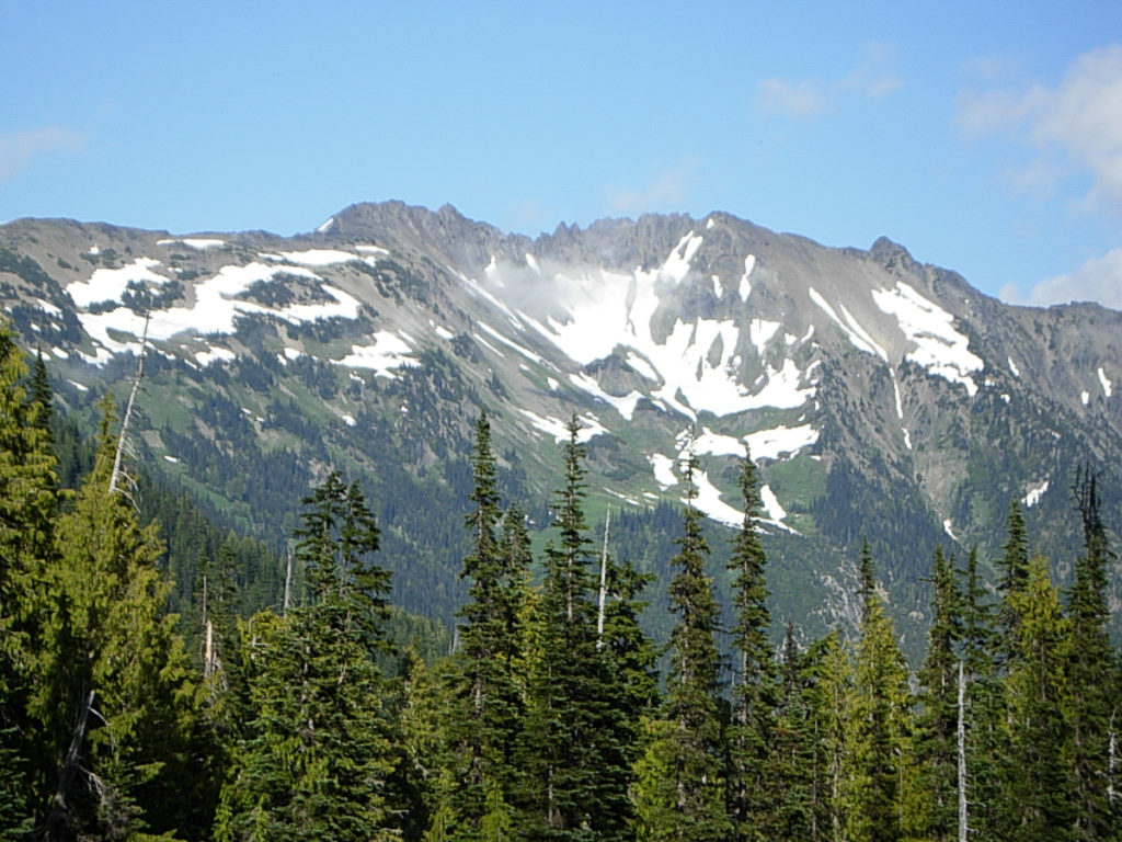
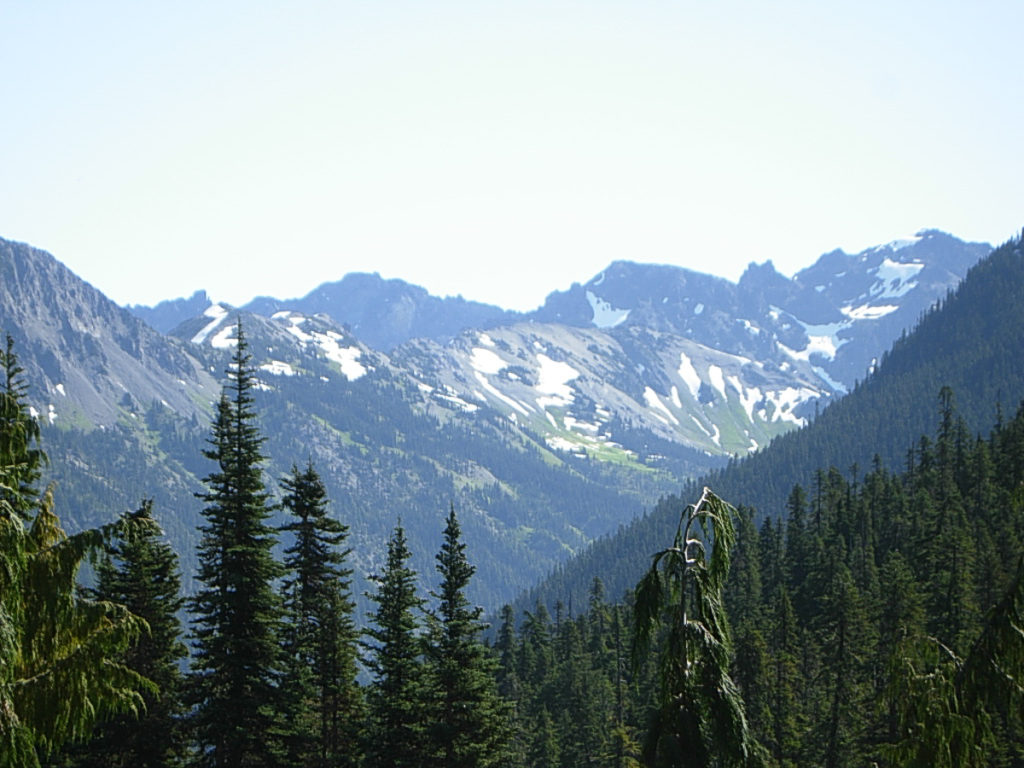
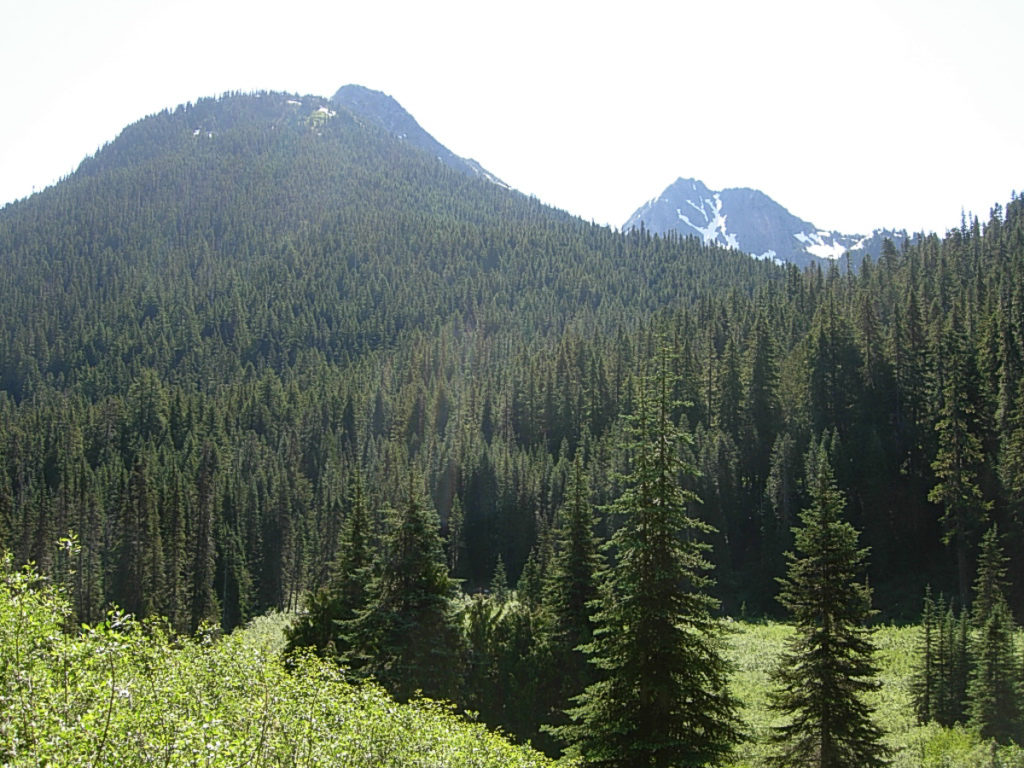
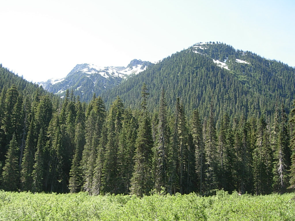
My plans had called for me to be on the trail by 8:00. That would put me to my truck by 4:00, and home in time for dinner. I tell myself I can get a burger in Shelton, and that occupies my mind quite nearly the entire way home. Well, during those moments when I wasn’t pausing to take in the stunning scenery all around, that is. I thoroughly enjoy working my way down the valley, thru the meadows, with Mystery and Little Mystery, Mount Fromme, Lost Peak, Wellesley Peak, Mount Deception and Diamond Peak all towering above me.
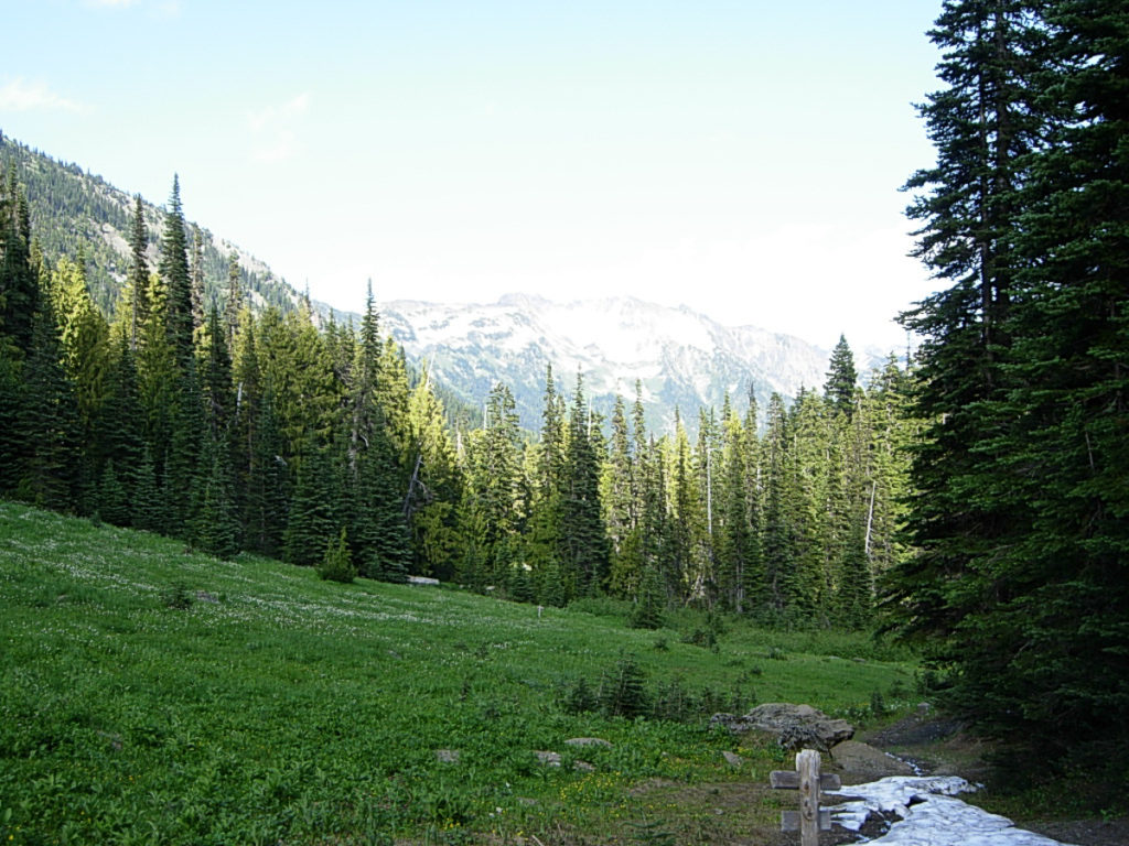
I take a break at Camp Marion, which had caught my attention the day before. I find a campsite very near the edge of the cliff, offering a wonderful view down to the river. Perched on a log, I eat a snack and drink a bit of hot chocolate with coffee in it. A few moments later, I search for water nearby, but I don’t find any. I do recall there was a stream a short distance up the trail, but down the trail one has to travel all the way to Deception Creek, about a 10 minute walk. I think to myself that I would be better off to set up camp at Bear Camp or Dose Meadow after all.
The foot log I had crossed with some trepidation is finished now. It’s one of those things where they nailed rails to the upper edges of the log, and filled the gap between them with gravel. I don’t really understand why they do that… but at least it crosses the creek. 3:45 finds me taking a break after a short chat with Ranger Pablo at the Dose Station. He’s heading in while I’m heading out. He asks after my permit, and let’s me know I can send payment in via the little envelope that came with it. He’s a newbie in the area, so I forgive him for not recognizing me as a regular user of the SEOlys. He does share that his coworker had hiked up to Lost Pass and shot some pics of 1000 Acre Meadow, showing it to still be snowbound.
It’s 6:05P by the time I clamber up off the river bank onto the road bed and spy my wonderful AblMabl. Many of the cars that were here the morning before have cleared out, but there’s still quite a few. My Triple Whopper was everything I spent the day thinking it would be.
Leave a Reply