Memorial Day Weekend is a holiday in which I generally stay home. My favorite haunts are usually overwhelmed with Packwood Flea Market tourists and hordes of recreationalists. This year, however, the game has changed. The rules were tossed out the window. Packwood was practically deserted.
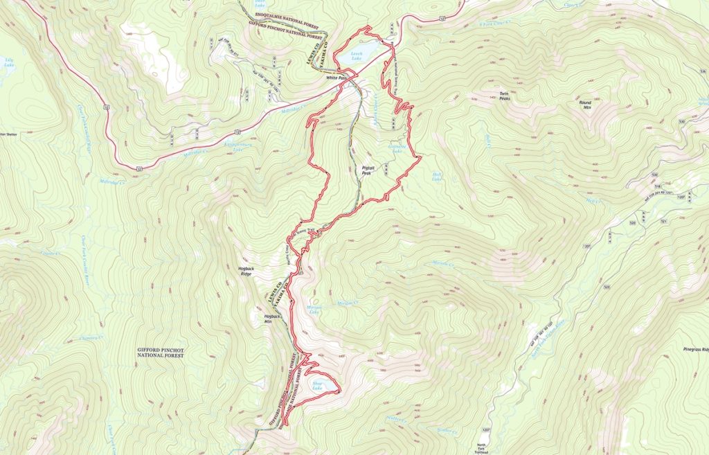
I start my day by heading out the door at first light, hitting the freeway at 6:00 AM, sharp. Making my way down the freeway and out Hiway 12, I encounter only light traffic. By 8:30 AM, I am parked alongside the hiway at the summit, ready to set out. I start by walking behind the Kracker Barrel and the condos to the Lake Loop and Kendall Konnector trails leading around Leech Lake. It only takes a few minutes, and I am soon at the PCT, heading back toward Hiway 12. Coming to the White Pass South PCT trail head, I see a horde of hikers standing around the kiosk – I am not willing to brave them just to get a permit, so I continue without one.
The day is beautiful, with much sun and a gentle, fresh breeze. The mild morning temps promise afternoon heat, but at this time of day, the sun is a comfort. Occasional hikers in ones and twos are hiking down the trail, so I step off into a meadow – it proves to be the drainfield for the White Pass Ski Area. Not very glamorous at all, but still a pretty meadow, if you can ignore the white pipes and green hatch covers here and there. I sip my coffee and wait for the voices to disappear. With the coast clear again, I head back up the trail.
I pass a NoBo German hiker, talking loudly to himself, or to a phone, I cannot tell. Next, I pass a woman, un-masked, who is very, very chatty. I am not. She peppers me with questions, do you know this trail? (yes), where are you from? (here), do you know where water sources are? (I name a handful between White Pass and Old Snowy), How many miles is it to White Pass? How far are you going? (as far as I can before I have to turn around and come back).
At this point, I am getting irritated and now confused. White Pass? I point back down the trail – it’s about two miles back the way you came. Oh, I mean Chinook Pass… I point and try to direct her, but she launches into a story about how her friend is running the trail and will be meeting her, and he’s built like a runner, you know, so you’ll probably recognize him, but we’ll be meeting back up, and we have to be back to work Tuesday, we work together you know, but I can’t figure out how to get the Topo maps I downloaded on my phone to work, and isn’t it just gorgeous out here…
Her words ran on and on and on, and I never did get a chance to re-direct her. Realizing she was a grown-ass adult, and that we each had our own hikes to hike, I left her to hers, to resume mine.
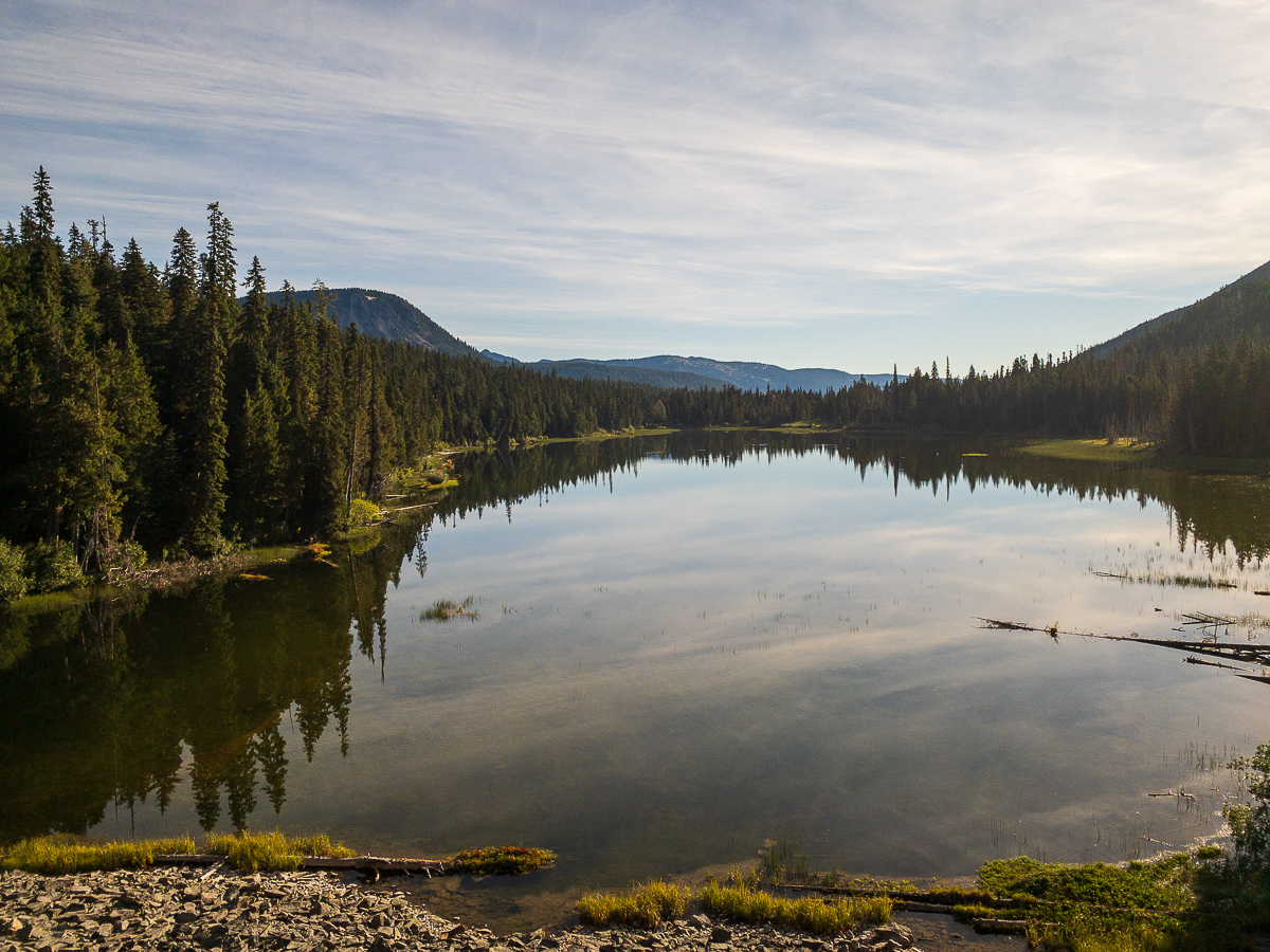
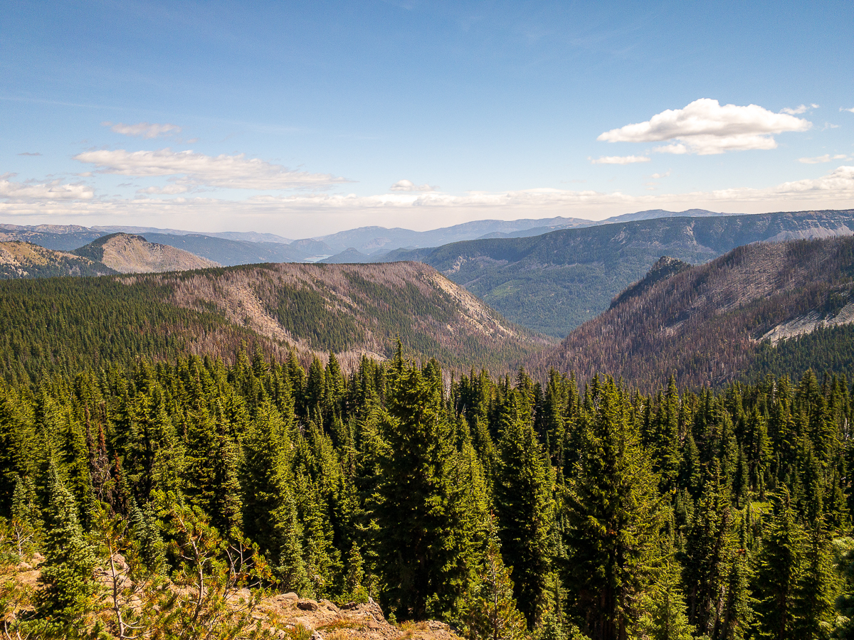
I work my way up the PCT – the grade is at all times gentle, and the trail is spacious and clear. The trail population is low, and passing Ginette Lake, I left the majority of the other hikers behind, except for some Nobos here and there.
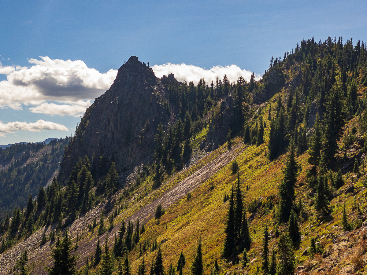
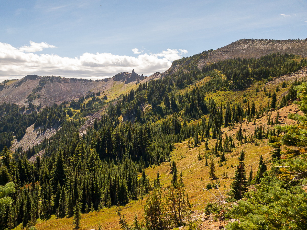
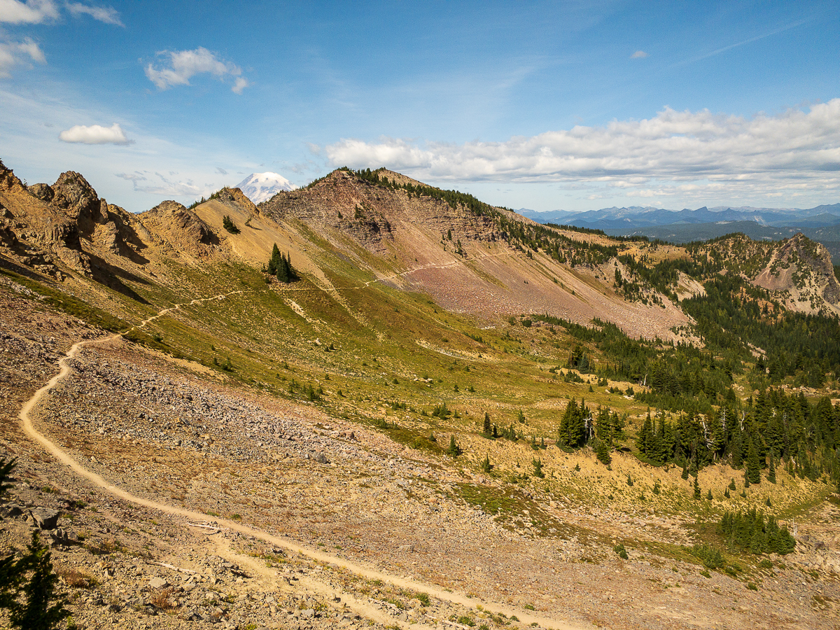
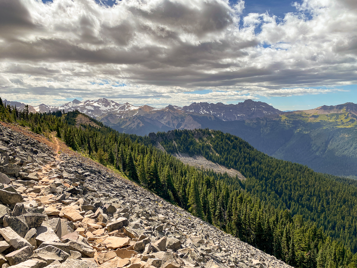
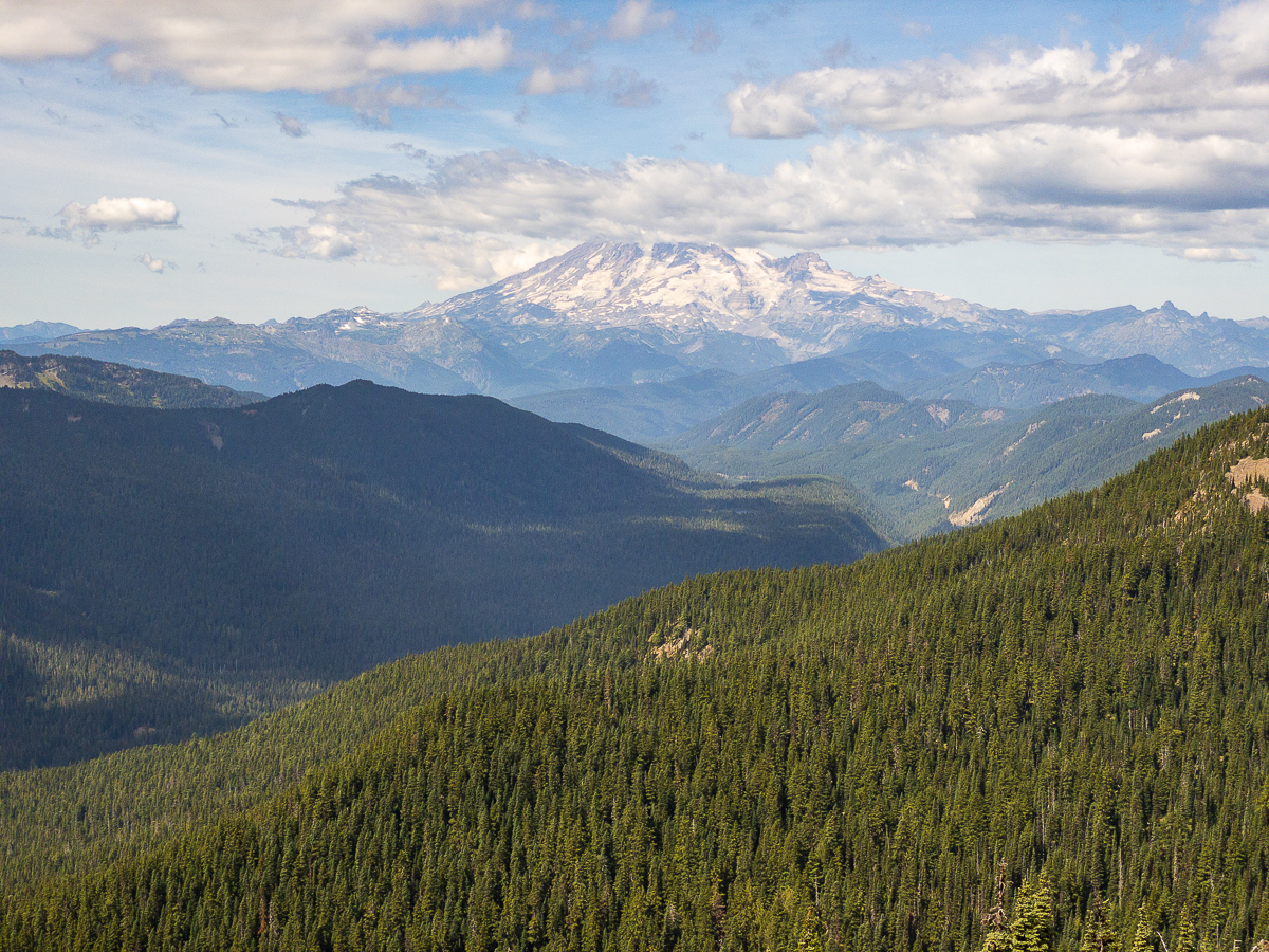
A large portion of the PCT in this area edges along the White Pass Ski Area, and occasional side-trails provide access to the ski runs. The trail runs outside the GRW in this area, but upon re-entering the wilderness it takes on a different character. Now, the trail side-hills beneath Hogback Mountain, aptly named. The long sweeping curve of the trail, the grade gentle, cuts across steep meadows, drawing the eye along the entirety of Hogback Mountain across the Miriam Creek drainage. I love these sweeping trail views! Reaching some cliffs, the trail jogs back for a quick step up to a saddle, then descends toward Shoe Lake. The breeze is pretty stiff up here, and I do not linger.
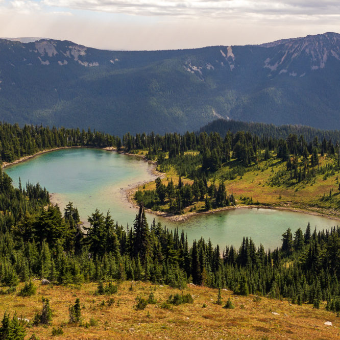
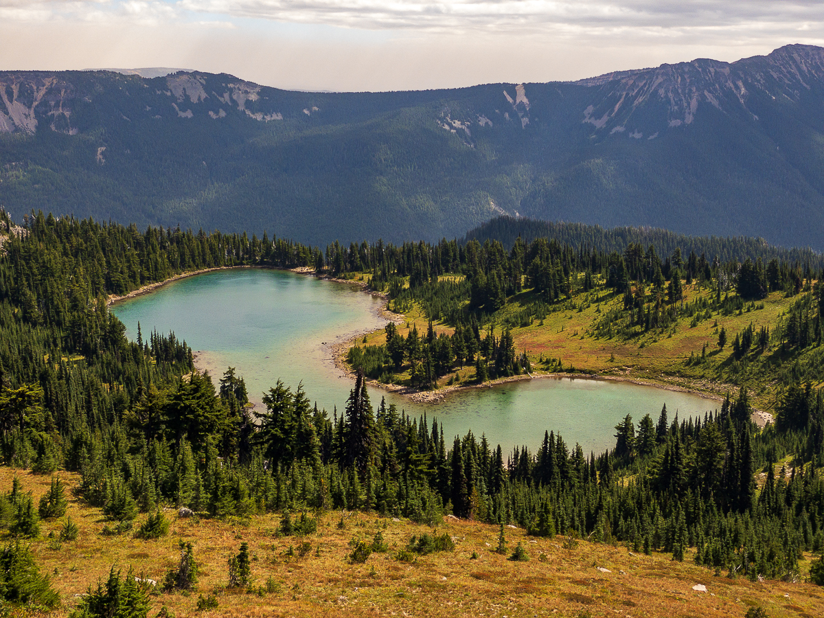
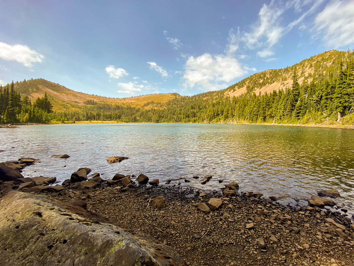
I follow the PCT past the Shoe Lake Trail #1119 – this is a loop, and reconnects with the PCT on the other side of a local peak. I pass that trail up to continue along the PCT, enjoying gorgeous views of the Goat Rocks and the Clear Fork Cowlitz drainage, swinging back around to take the loop trail to the lake. After a bit of a climb, then a gentle descent, I arrive at the lake’s now dry outflow, and find a sunny boulder to enjoy my lunch upon. I even stepped into the not-so-cold clear waters of the lake, toes enjoying the sandy bottom.
As I eat trail mix and sunflower seeds, the breeze picks up some more. Smoke has filled the Tieton valley below me, but is now reaching up to obscure Pinegrass ridge. Soon, the peak across the lake is looking quite hazy. By the time I leave the lakeshore, about 30 or 40 minutes, visibility has plummeted to about 1/2 mile. I can no longer see the Goat Rocks. Arriving back at the PCT, the edge of the lake is barely visible thru the smoke and the wind is really starting to blow. Reaching the saddle, I hold on to my hat as the gusts are now upwards of 40 mph – difficult to stand against. My throat is beginning to smart. Smoke is blowing, and I can no longer see much of the lake below and behind me, nor much of Miriam Creek below and in front of me. As I stand upon the saddle and peer about, leaning into the wind, a figure down on the trail below waves up at me.
The situation is deteriorating, and I’m thankful for my mask – for completely non-pandemic reasons. It’s no N95 mask, but it does keep my throat from burning. The temperature is dropping in the increasing wind, and I consider putting on a long-sleeve shirt. I’ve been hiking comfortably all day in shorts and a tank top, but now the afternoon is getting on and the wind is getting serious.
It’s the chatty one – she is obviously unprepared for the situation she has hiked into. “I didn’t think you’d make it this far,” she says to me, sitting on a trail-side boulder. She looks very tired and asks about water. I point her to Shoe Lake, telling her the water there is clean and good, but there is no camping there, and the smoke is getting worse by the minute.
“You should turn around,” I say to her, “it’s dangerous out here”. She thinks it best to continue on and camp at Shoe Lake. I admonish her. She persists, then asks where all the smoke is coming from. “The Evans Canyon Fire”, I respond, pointing down the Tieton Valley. “Is it close? Will it come here?”
“That fire isn’t the one you need to worry about, it’s dozens of miles away, but this weather can create fires. This is a bad situation, you could get trapped out here. And the smoke will get worse, you don’t want to spend the night in that.”
She asks again about campsites at the lake. I shrug my shoulders and carry on. She continues southward on her journey north. My last view of her is as she crosses over the saddle into the smoke.
Crossing back over the wilderness boundary, I pop over to the chair lift, and follow the service road down. I expect it to be a shorter, more direct route back to the hiway. If I can make it back to my truck by 6:00, there is an outside chance I can make it back to Randle in time for a burger. My walk down the service road is nice, albeit sometimes steep, smoky and quite windy, The ski area is not a pristine wilderness, regardless, it was quite enjoyable, and I was back to my truck and hitting the hiway by 6:00 sharp.
I got that burger just as a blood-red sun sank below the smoke-shrouded mountains, leaving a cherry syrup-colored sky as a backdrop. It was a spooky scene, and everyone at the hamburger stand was talking about it.
Leave a Reply