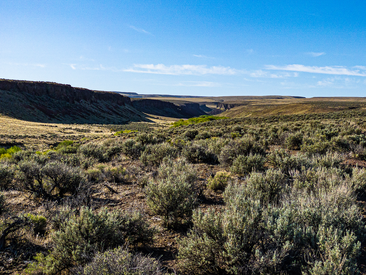
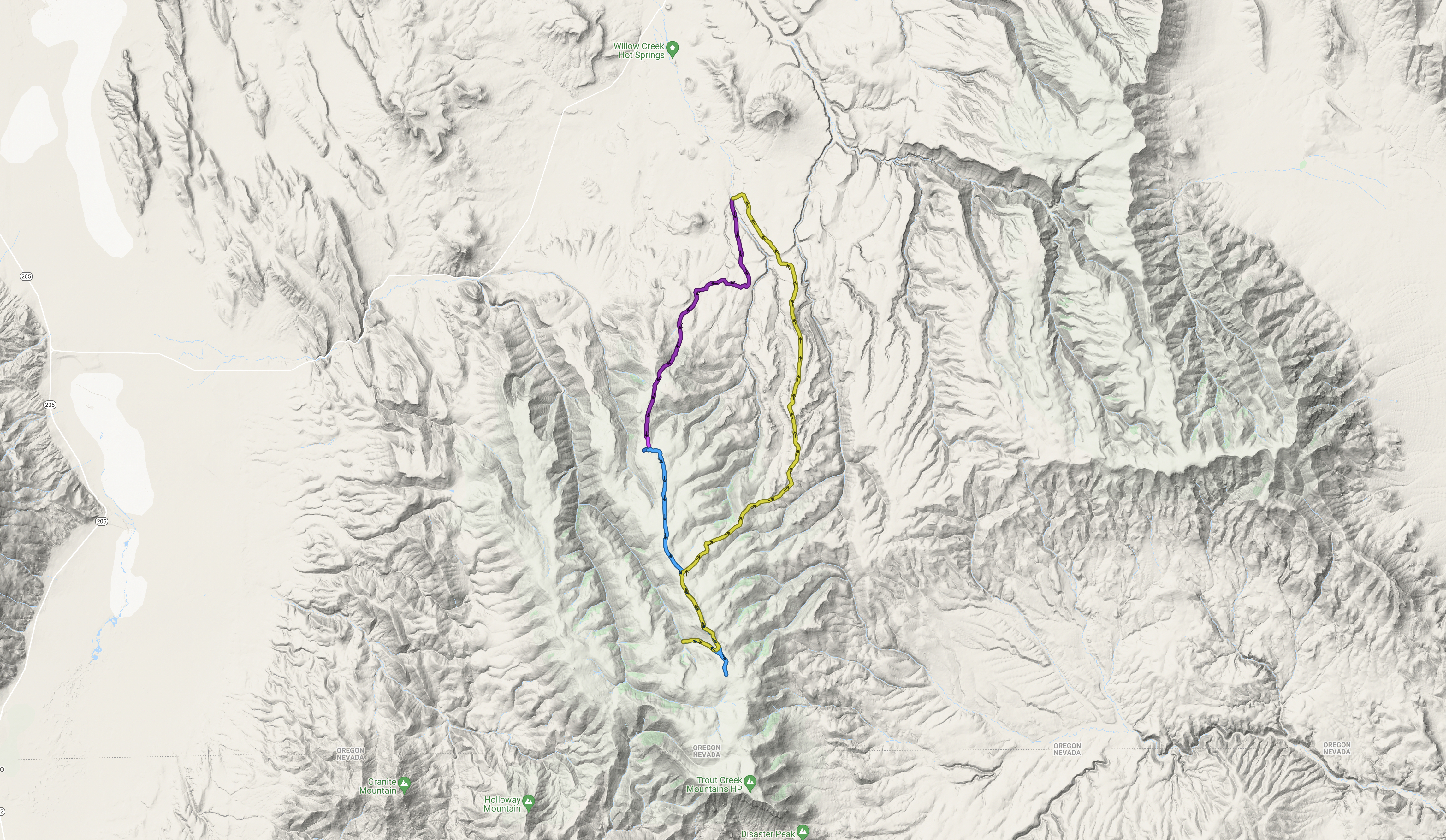
Having visited Willow Creek Hot Springs a few times, I am always left with the desire to explore those mountains the creek drains down from. For this trip, I chose to backpack from a point upstream of the hot spring to which I had hiked previously, then follow a loop up to the summit along BLM roads on the west side of the creek, returning via the Oregon Desert Trail and via BLM roads along the eastern side of the canyon. I had no plans beyond sun, wildflowers, and a ridge-top excursion.
Come Monday morning, I set out early, but not as early as previous trips, making good time to Hines for a last tank of gas, then down thru Frenchglen and the Catlow Valley. I make my bumpy way down the Whitehorse Ranch Road and pull into the hot spring in the very late afternoon to find the campground about half full, and the hot spring empty. I manage to get a quick soak in before other campers showed up for an evening soak. At that point, I get back in my truck and drive up the Willow Creek BLM road about 5 miles to a crossing where I spend the night sleeping in the bed of the truck. It is a gorgeous night, the stars out in force, and the moon bright, Willow Creek sings a soft, gentle song all thru the night.
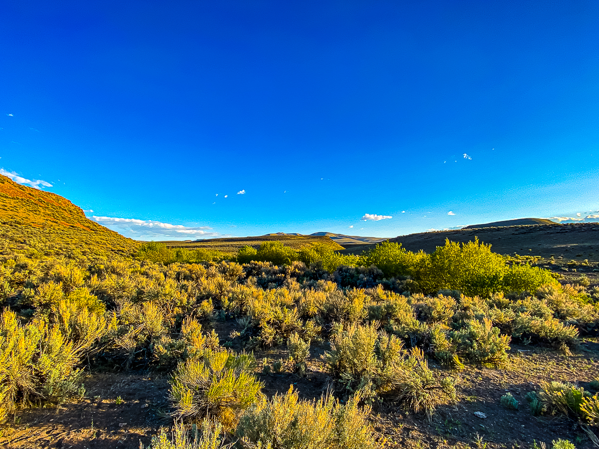
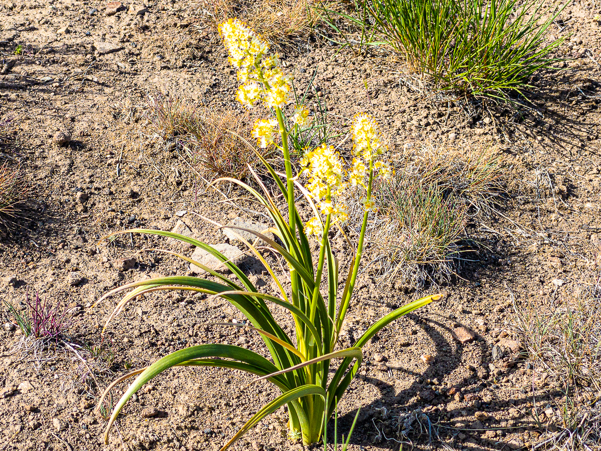
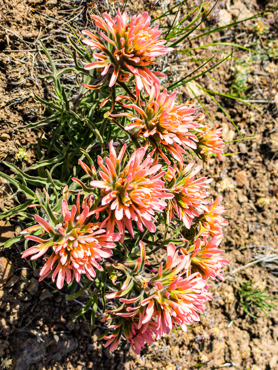
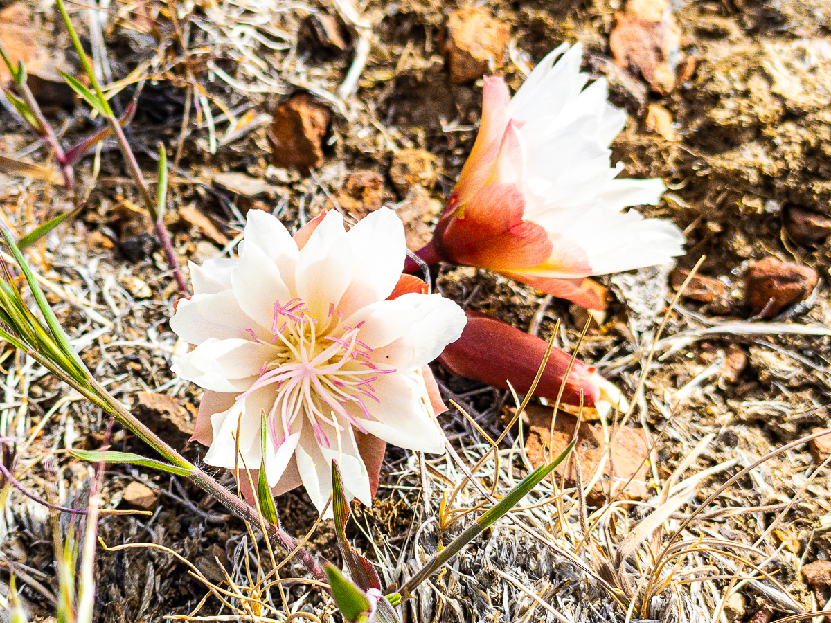
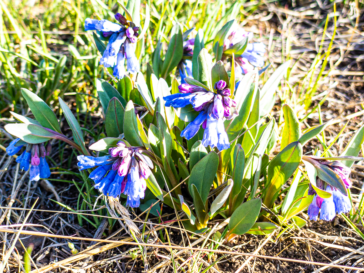
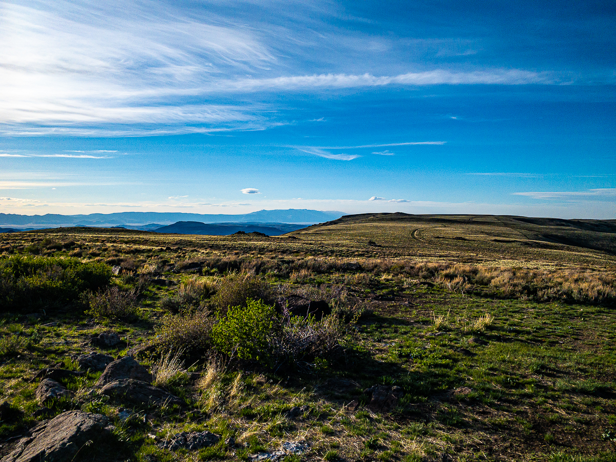
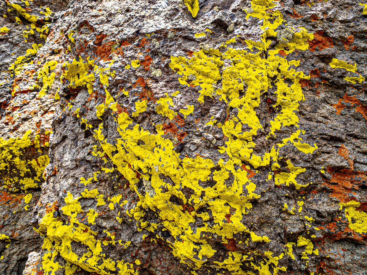
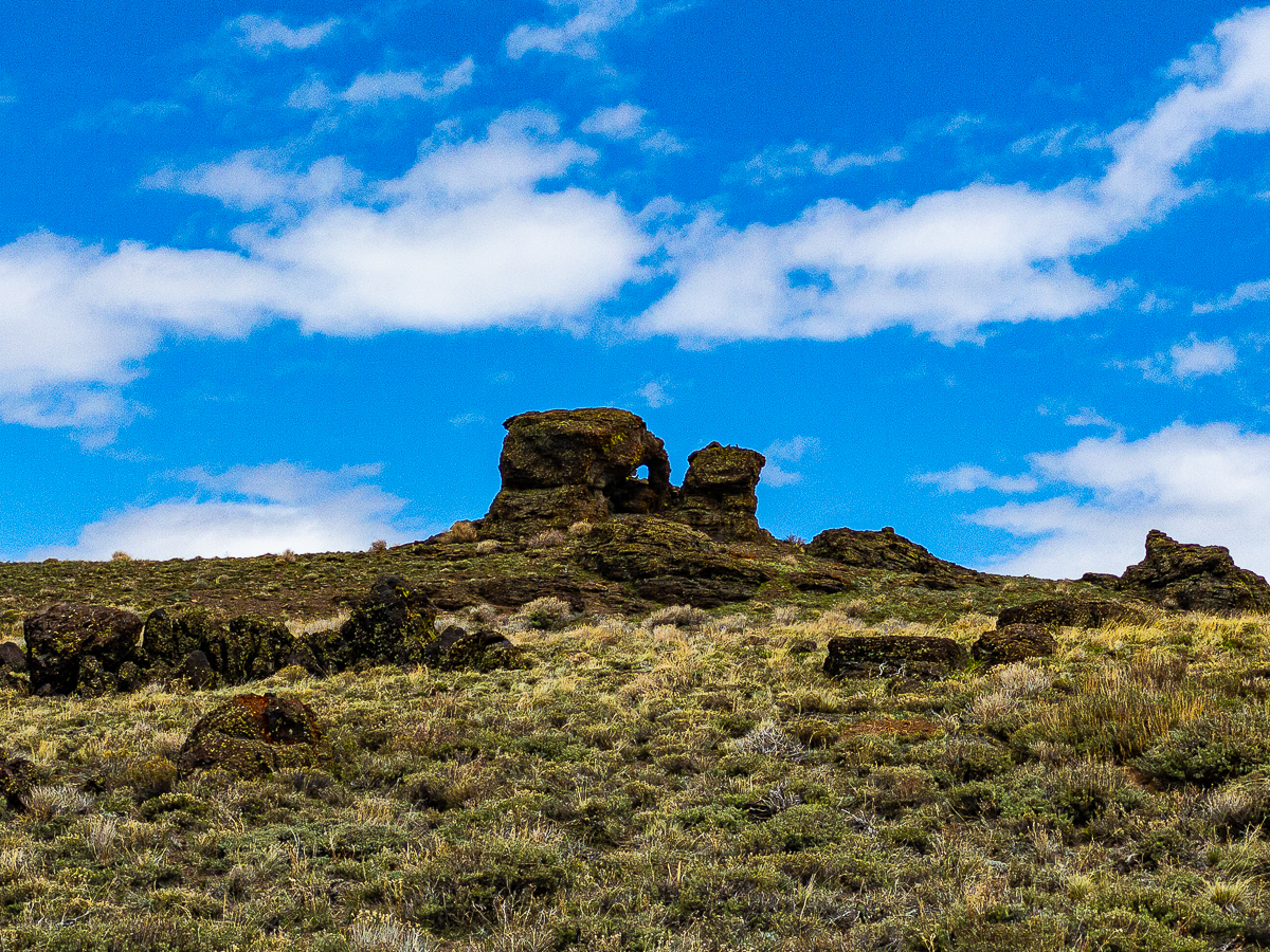
Morning dawns bright, and the air warms quickly. My gear is ready to go, but I take one last opportunity to double check everything as I down my last cup of dirty chai. Before very much morning has slipped by, I am stepping into and across Willow Creek to begin my adventure. I follow the BLM road south a distance to where it turns west at the base of the ridge. I can see a draw leading up to the summit, but I can also see that I am not yet at that draw. I work my way down the road, enjoying wildflowers such as Castileja (an unfamiliar color), a lily I do not know, and something that looked very much like a cactus flower without the cactus – to a point where it crosses the draw to find a small stream of delicious water. The sun is much brighter now, and I’ve set up my new piece of hiking gear – an umbrella, designed just for desert hiking. It works pretty well, even if it is a bit cludgy to attach to my pack and keep in the right position. It is vastly better than nothing, to be sure! I am thankful there is nobody about to see me getting down on my hands and knees to photograph these flowers.
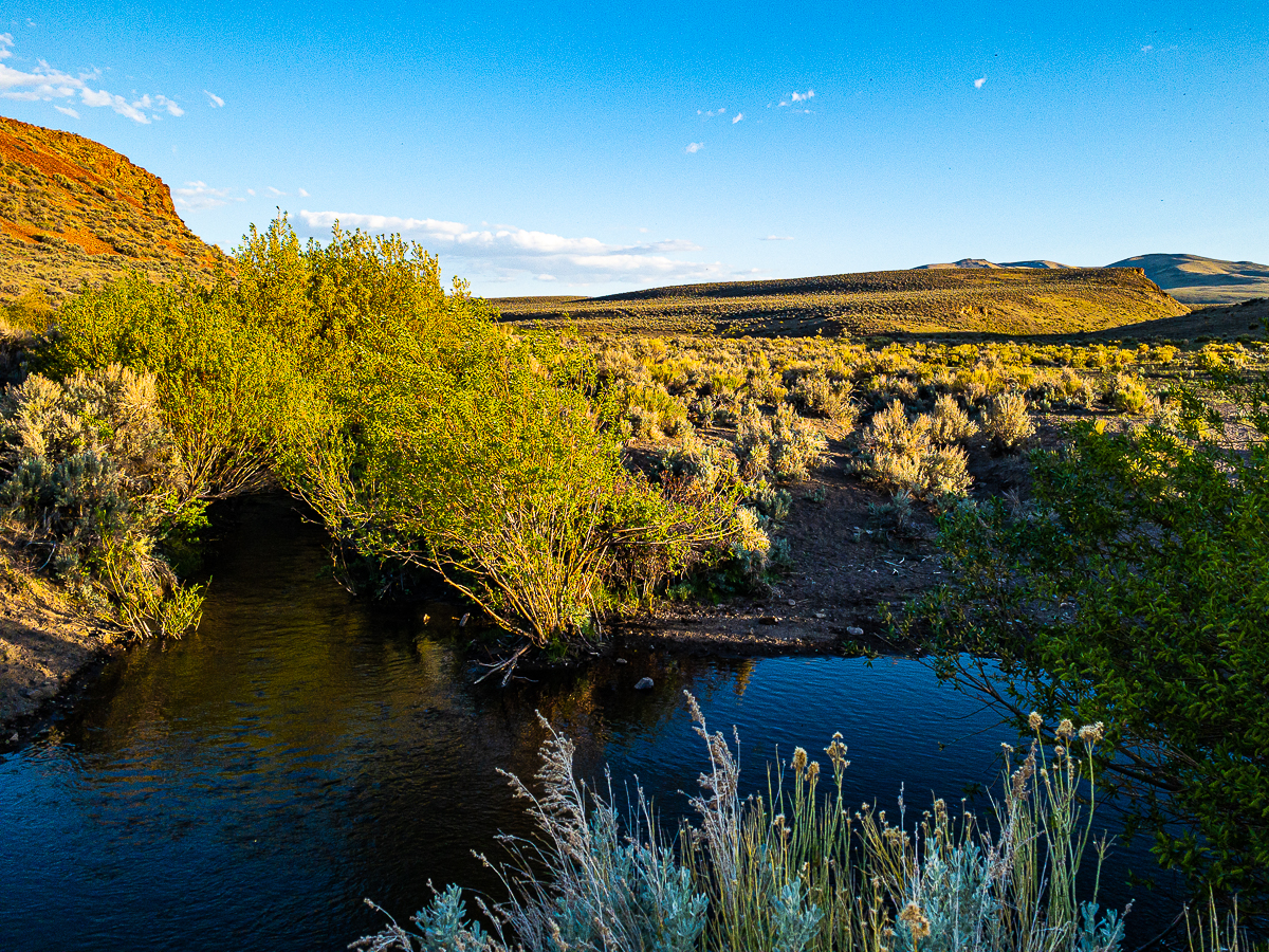
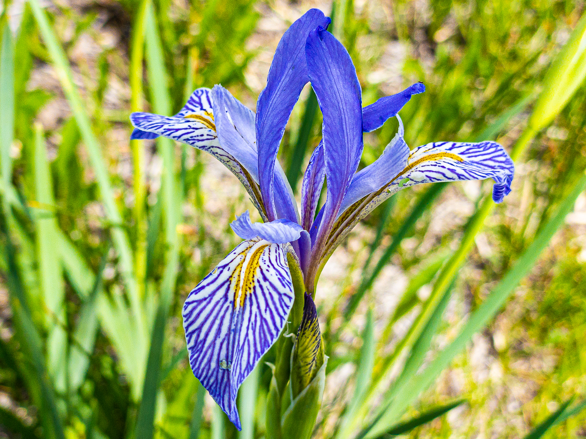
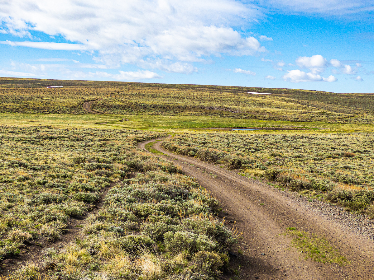
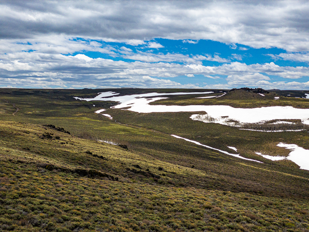
Turning off the road now, I follow a faint trail alongside the stream. As the terrain begins to steepen, I find myself walking up a series of verdant meadows hugging the stream. Large patches of Iris missouriensis are seen all about, many just beginning to bloom. The draw twists and turns gently as it ascends the ridge, and I can see damage from wildfires in the form of whitened tree trunks here and there – not many, this is not a forest, but along the stream a number of aspen groves and willow groves are regenerating around the bleached skeletons of their forbears, their shocking green vitality contrasted by bleached wood and sun-baked grasses. Sage grouse call and flush from along the stream, and meadowlarks fly between the softly textured willow bushes. I find a nice log to sit on adjacent to a series of springs in a bit of shade cast by a large copse of willow. This is obviously a popular waterhole, as there are hoof prints all about, and multiple springs seep out of the rocky soil all about. A sage hen does not care that I am near the stream, she pokes about the water’s edge with no concern at all, until I drop my water bottle on a rock and make a noise, then she is all fuss and bother as she flees into the sage above the creek. It is getting very warm now, and I am half-inclined to take a little nap here. After almost an hour to rest, curiosity pulls me further up the draw.
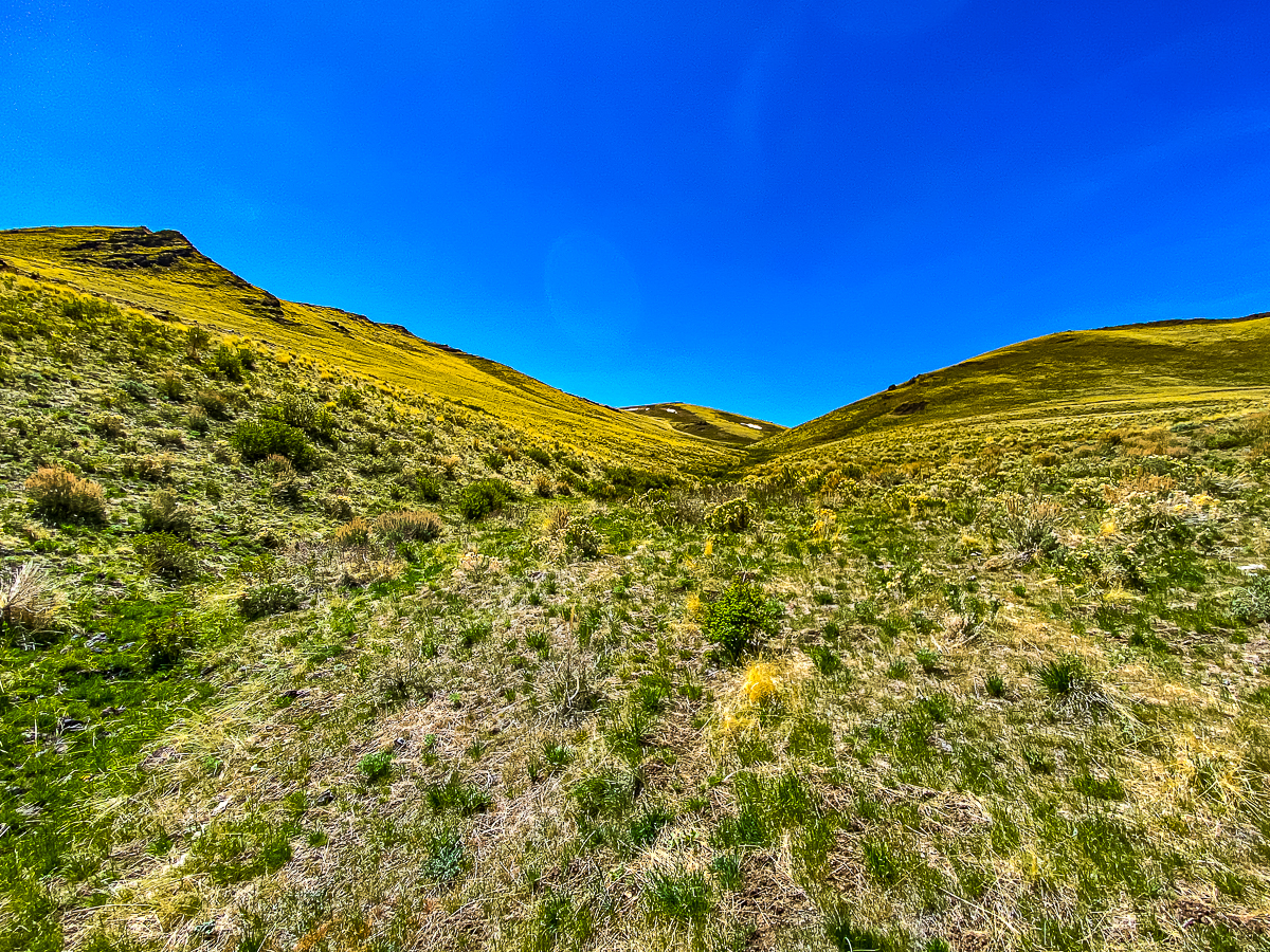
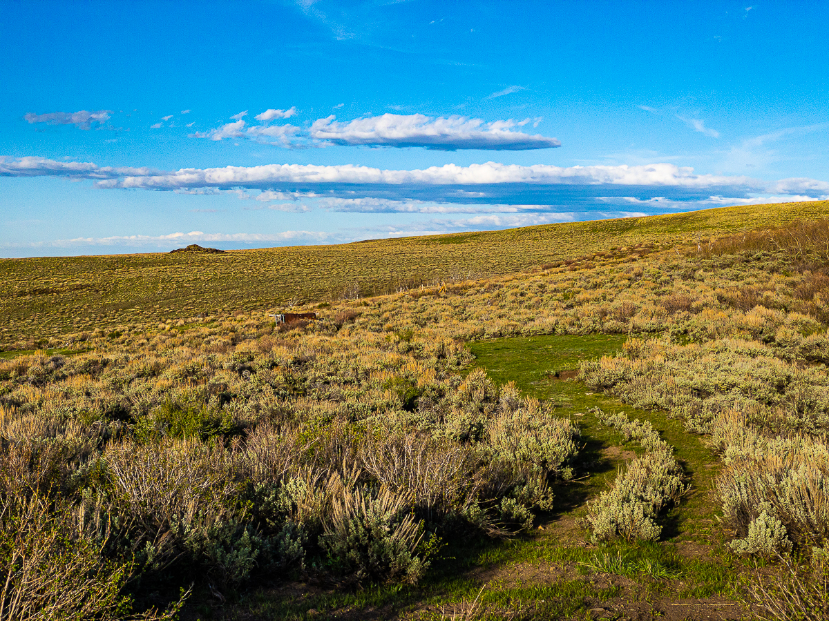
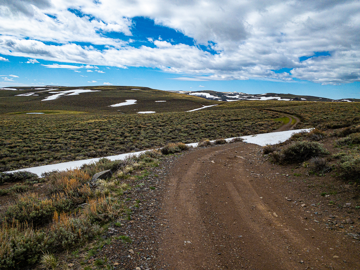
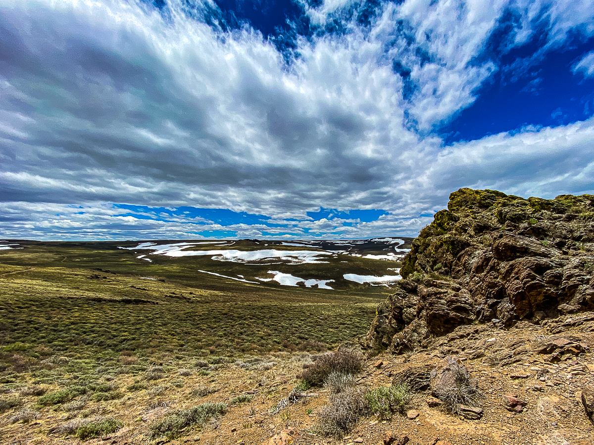
It is only a few moments before I am at the headwaters of the stream, and not very far from the ridge line. Here water rushes out of rocks into small algae-choked pools hidden by aspen and willow. I’m a bit too high for wildflowers this early, but I can see this is a very verdant place. Grasses grow lush near the water, the soil is soft and spongy. The draw, dry above this point, curves around and up out of sight, a few mahogany trees grow in the lee of rocks above. The trail is increasingly faint, but I no longer need it to find my way up this last bit of slope and to the road at the top of the ridge. I have to cross one barb-wire fence to get to the road, then it is time to sit for a few and enjoy the view.
It takes a couple of hours, but before too long I find myself at the top of the adjacent draw. I find a campsite some distance above a spring-fed stock tank, and set up camp for the night. High clouds are moving in, but the wind stills with sunset and the night remains calm.
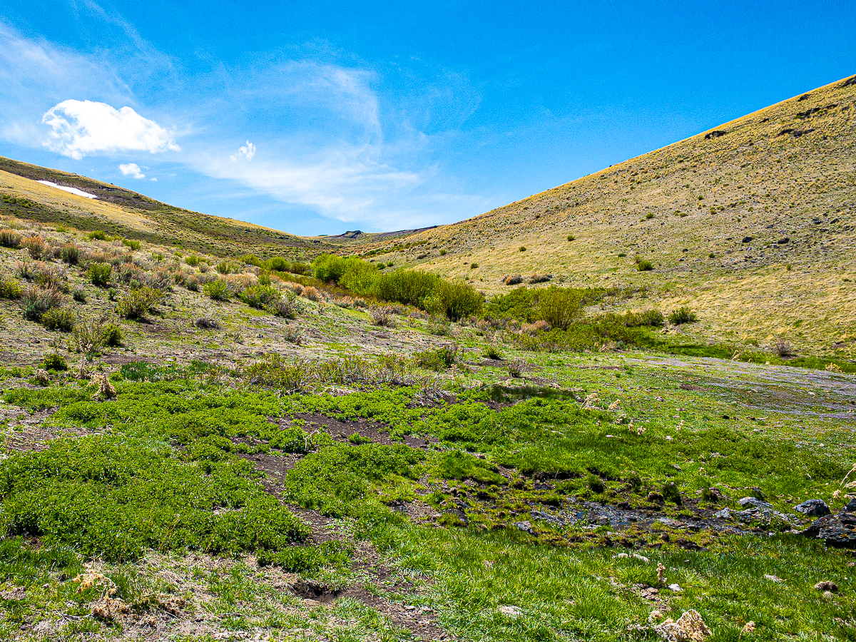
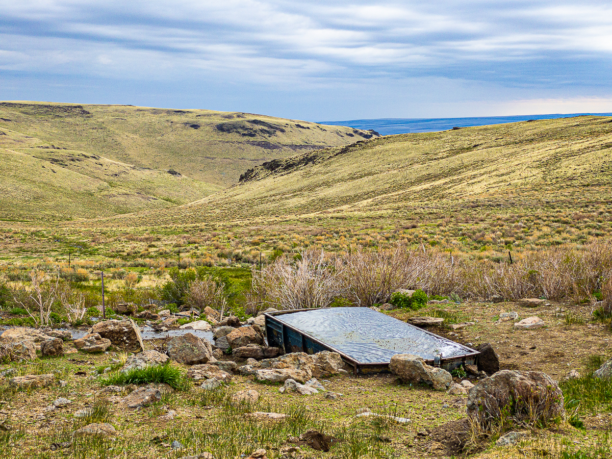
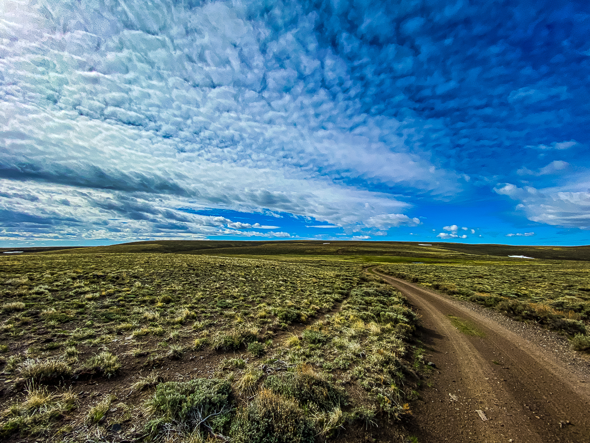
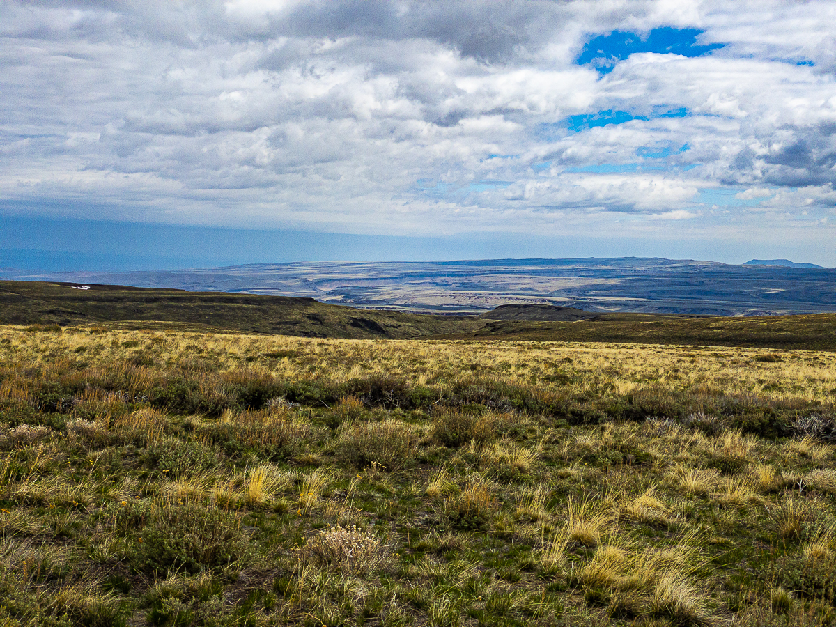
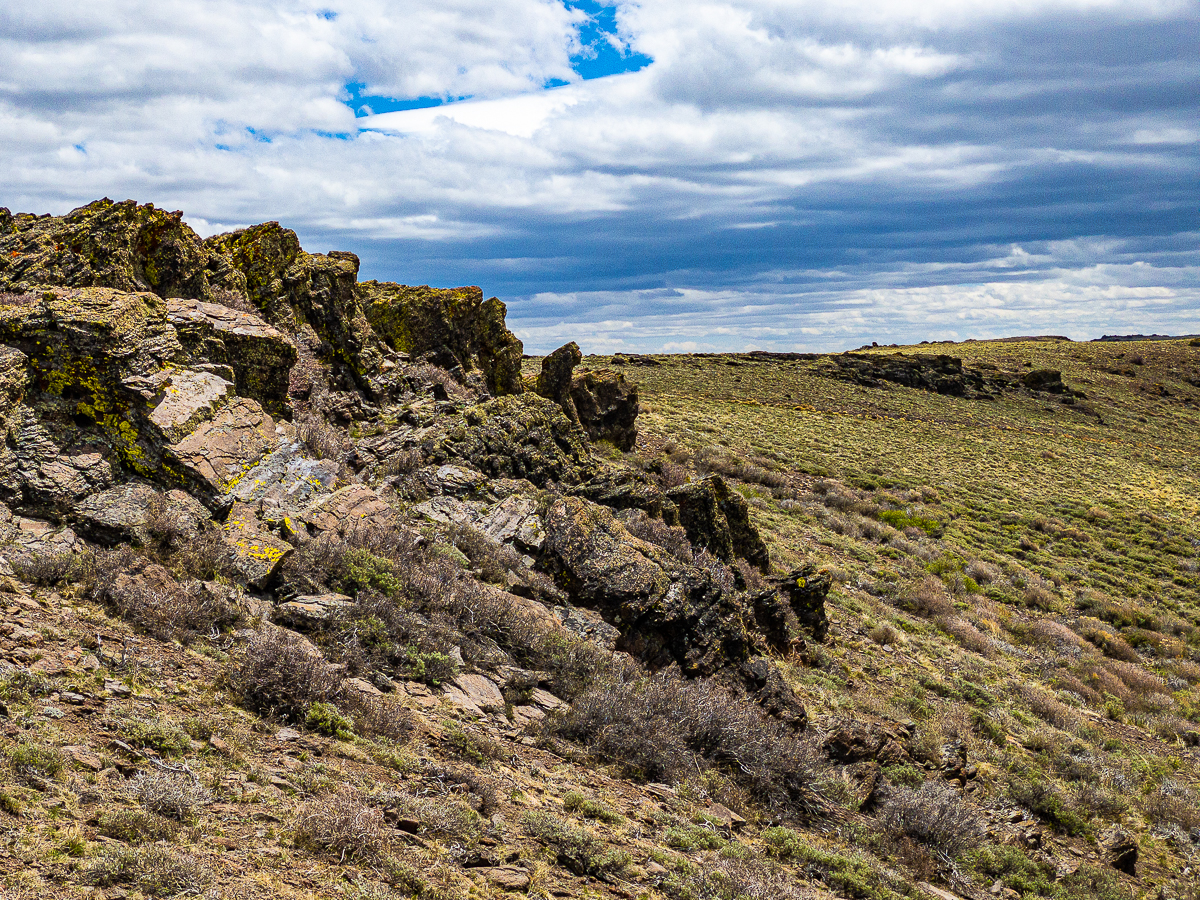
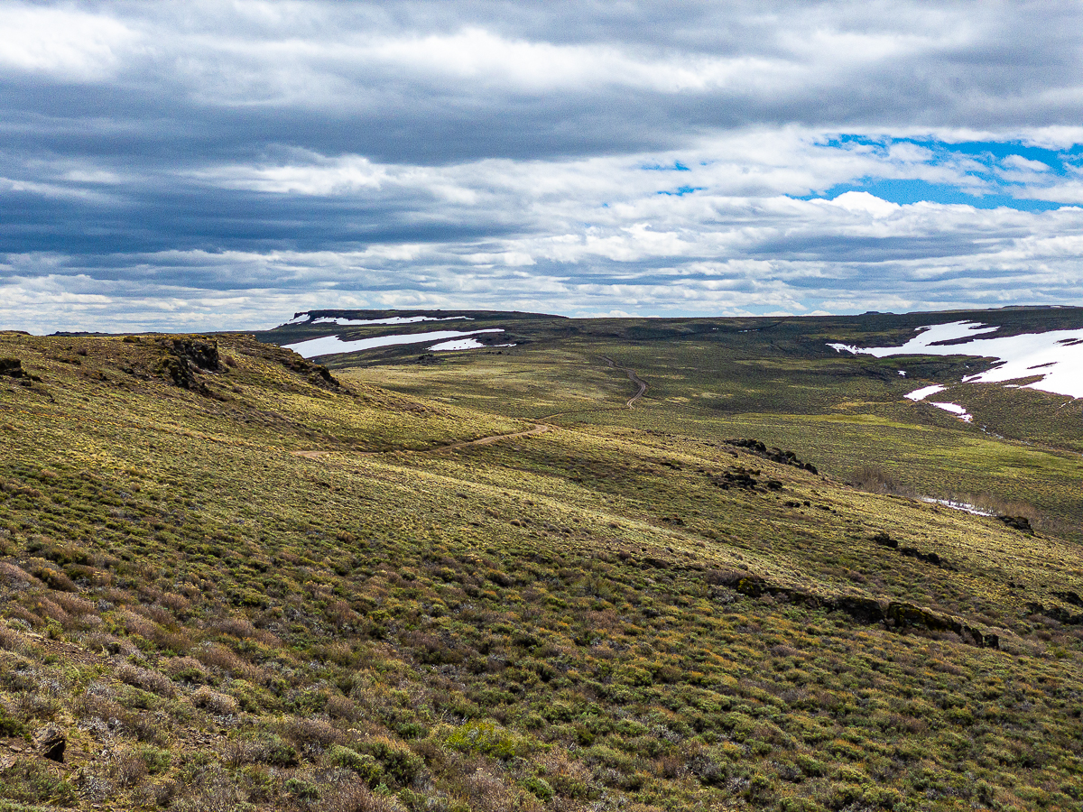
Come morning, I break camp, wash up a bit at the stock tank, and continue my journey along the top of the ridge. With the exception of being on top of the world, this is actually a rather boring ridge walk. Eventually, however, I make my way to the headwaters of Little Trout Creek. At around 8100′ the Oregon Desert Trail takes a hard turn to the west, but I wanted to continue south into the Disaster Peak area and the Nevada border. The map was showing what looked like a sheltered area near water and vegetation, and I wanted to set up camp there. Unfortunately, I hit a fence.
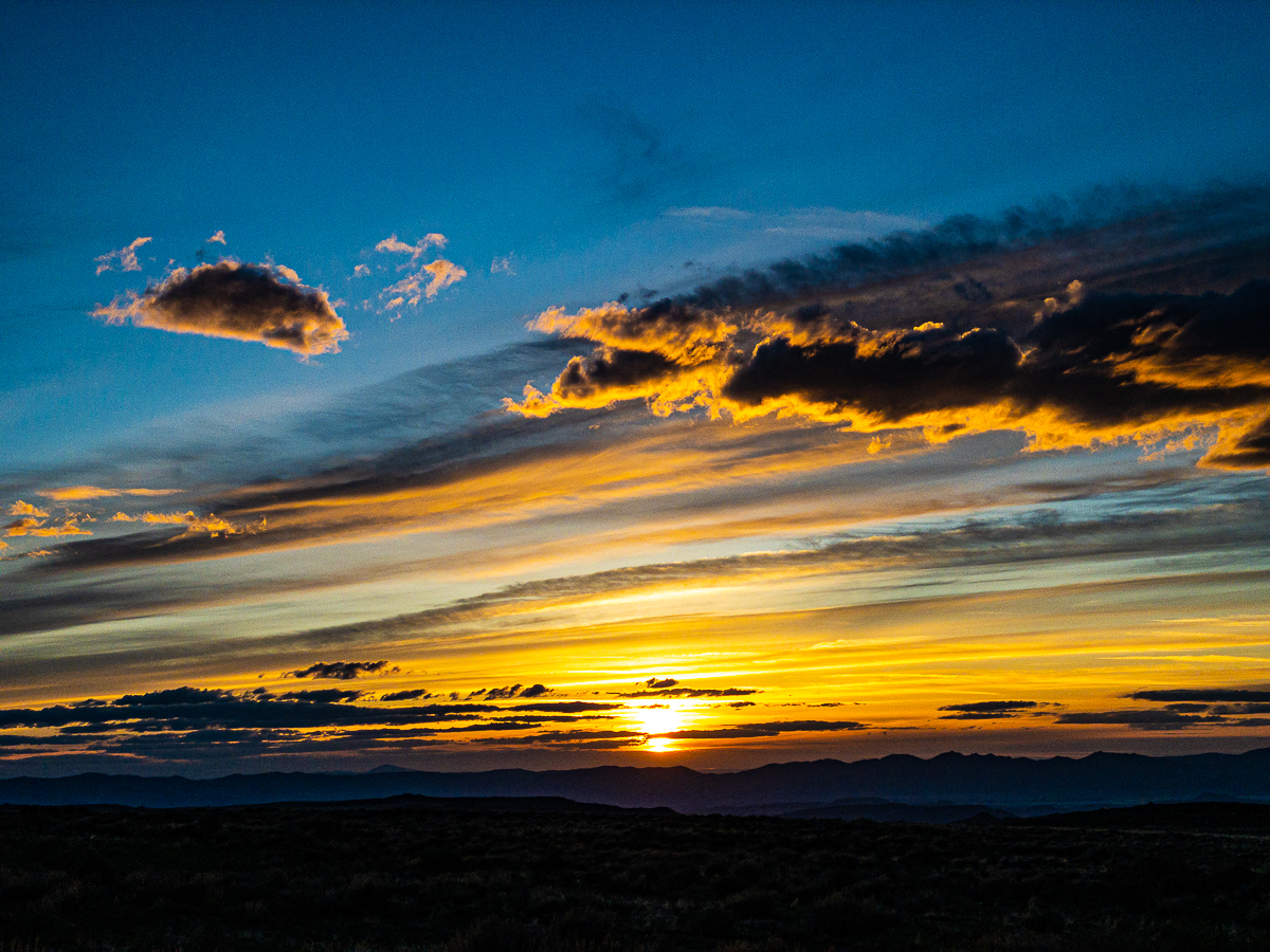
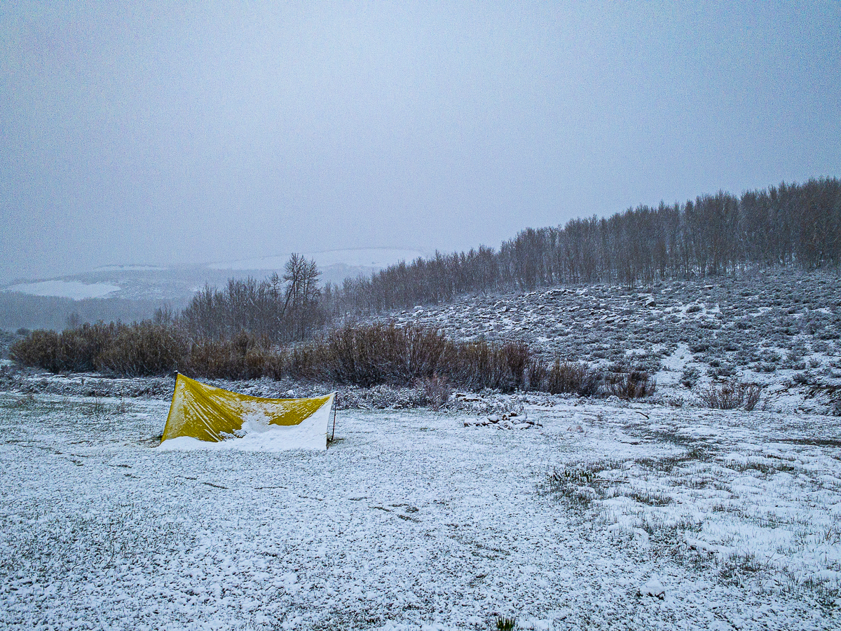
The clouds have been thinkening up all day, and weather is on my mind. Knowing I likely didn’t want to sleep on the ridge top because of the wind, I elect to descend a road down to Little Trout Creek. I followed the road down along the creek for some distance, where it leads to an open vale with campsites and largely ringed by aspen trees. The stream is still high, and over running its banks in places, but I find a relatively dry area in the middle of the meadow and set up my tarp tent. I had hoped to escape some of the wind by descending to this point, but no such luck.
I dither about, finally setting up my camp by about 4 pm. Very shortly thereafter, I realize the sky has really thickened up. The first snow flakes begin to fly very shortly afterward. By 6 pm, I am set up inside my tarp shelter, having re-staked it twice to deal with the wind. The snow is lovely, the small, light flakes drifting sideways in the wind.
I while away the evening reading a book on my phone, looking at my maps, and just watching the weather. I am resigned now to a snow camp, and am already planning my departure – how I’ll break camp down in the snow and stay dry and comfortable. Reclined in my camp chair with my bear canister under my knees and my down sleeping bag wrapped all around me, I am not concerned. I’ve camped in the snow before. Eventually, sleep claims me, a bit before the gloom descends into full darkness. I awake around 3 am. I can tell the snow has continued all thru the night, as my tarp tent is sagging down all around me. I peer outside, it is not dark, but it’s not yet morning, either. I can see a lot of snow has fallen, perhaps 2-3 inches. I knock the snow off the tarp and notice the far corner has come unstaked or something. The corner of the tarp is loose and flapping. I burrow deeper into my sleeping bag and sleep for another couple of hours.
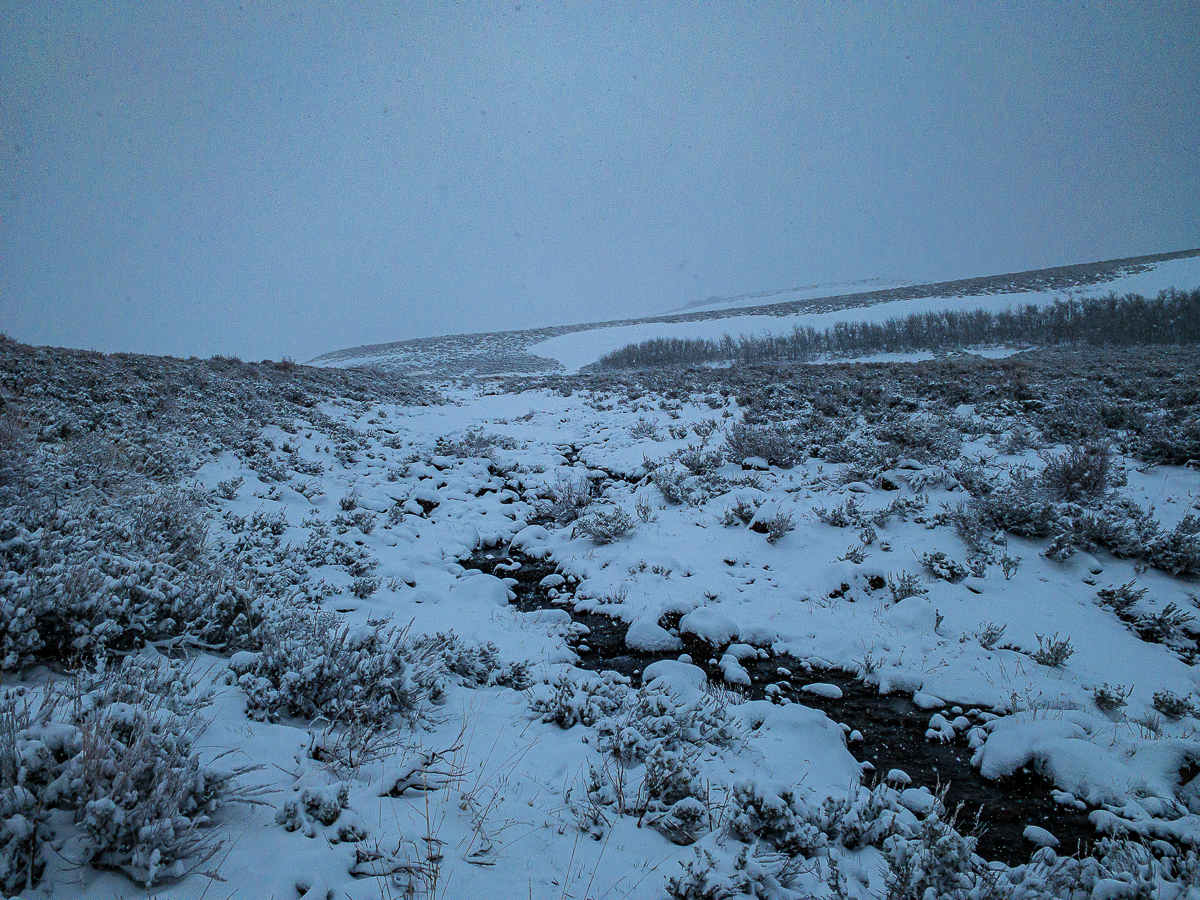
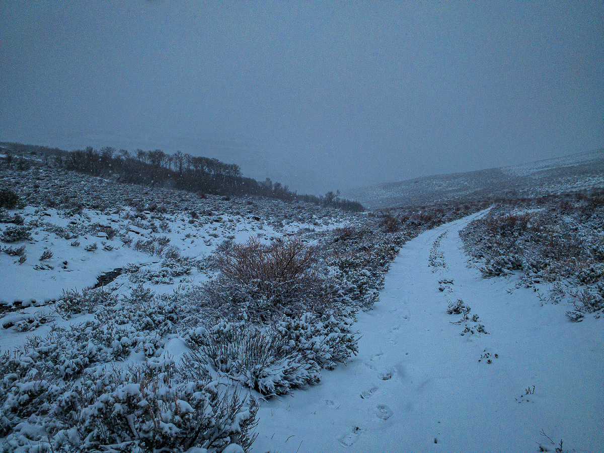
I’m up by 5:30. This is not good. The wind continues, the snow deepens, and my tarp is busted. My morning routine is abbreviated as I hastily pack up my gear, dig a cat-hole for my morning toilet (not fun!), then begin my march back up out of this drainage to the ridge above. The wind is driving the snow sideways, and I pull my hood tight over my head. Getting to the top of the drainage, I realize my tactic to move down into the drainage was a good one – the weather actually was milder down there. Up here, it’s much windier, and much snowier. I am not having a great time, but really, this isn’t anything I haven’t experienced in the Cascades, right?
I’m realizing now that I’ll be making my way back to my truck in one day – with no desire to deal with my busted tarp, or to camp cold and wet, I steel myself for a very long walk down to my truck. In the couple of hours it takes to get to the road that would take me to the east side of Willow Creek, where I have to make a route decision, the weather somehow continues to worsen. I want call it a blizzard, but that seemed a bit dramatic. Blowing snow, very low visibility, ice hanging from beard, snot-cicles from my nose, what about that says blizzard? Toughen up, Skookum.
I reach the junction, turn east and descend. The snow comes down harder, the wind gets stronger, and after another couple hours I am having some difficulty discerning the over-grown double-track thru the snow covered sage. I’m hiking now thru about 6″ deep snow, with drifts up to 18″ in places. Every so often, I have to stop, scan the countryside, and consult my phone to find the road. This entire day, I’ve hiked with my head down, protected by my hood, staring at my feet. Not a fun way to hike.
After many miles and many hours, I realize the situation is shifting a little bit. I can see further, the wind has lessened a bit, the snow is not so deep. l find an exposed rock in an outcrop to sit down on while I drink some water. I can see cattle tracks in the snow now. And then, when I look up toward where I had come from, I see a line of 8 cows and calves following me. That takes me by surprise! Once they see I’ve noticed them, they work their way around me and continue down the road. I follow them for a short distance, but that upsets them, so they bellow and scatter. From here, the road is exposed, and eventually the snow disappears, but the soils are very wet, and the mud is very sticky. It’s hard to keep my footing sometimes.
By the time I reach my truck I am exhausted. I drop my gear, start the engine, then begin the very complicated and uncomfortable process of changing into dry clothing and getting the wet clothing hanging up inside my truck to dry. I heat up a mug of hot cider and spend a few minutes just being thankful I am done.
Done but not yet out. The cold rain continues to fall. The muddy road continues to get muddier – and I am not on a good road. My trip in involved navigating very deep ruts, now I’m worried I’ll stuck. It took 4-Low to get out of there that first 1.5 miles, and 4-hi to get to the gravel road, but eventually I was back on terra firma. I parked alongside Whitehorse Ranch road to re-organize a bit, and let a vehicle coming up behind me pass. It was a schoolbus, and the driver wanted to make certain I was OK. That would be a theme every time I stopped alongside the road in this region – a bother, but a sign of good people.
Having returned to Olympia, it was only in the week afterward that I began to have some true sense of the risky situation I was in, and how very bad it could have gotten. It appears a woman with many years and miles of hiking experience was caught in the exact same area, just a day after me. I hiked out of the Trout Creek Mountains on Thursday. On Friday, she activated her rescue beacon from about 8000′ elevation – from what I can gather, she was at the same place I was, but a day later and the conditions were much worse. Ranchers used quads to get to the area and rescued her – she had already developed hypothermia. She’s alright, and plans to continue her hike from where she left off shortly.
Leave a Reply