Low-key weekday retreat to the river for some soul-healing, and some sole-healing. I’ve hurt my foot, so I needed to take it easy. I decided to drive up to Packwood and find someplace along the river – the weather was forecast to be cool, cloudy, and dampish, with really low overnight temps. Sweet!
I arrived Monday afternoon, drove out to the end of Cannon Road and to the river’s edge below. The entire area was deserted, which I found strange, given it’s a pretty popular dispersed-camping area and quite easy to get to. I found a primo site w/ a great hang for my hammock, set up my camp, and then took up position in my camp chair facing the river to read my book, retreating to my hammock when it got dark – but only after the bats had made their showing.
Overnight temps were cool, but not as low as I expected. The morning dawned cloudy with damp air – no rain, but all the nearby mountains were socked in. I lazed about camp for a while, but eventually decided I was bored, so I wandered up the mountain along the trails to the Tatoosh Trail #161 trailhead, then beyond to the point where the trail crosses Hinkle Tinkle Creek. By now, I was into the clouds, and had been getting slowly wetter. Here, however, it actually felt like rain, and I lost interest in going any further. So I turned around, and explored trails and old roads heading back down the mountain. One of those old roads dead-ended, and it seemed easier to just bushwhack back to the road, so I did that.
Of note, I found another one of those old un-mapped trails, this one taking off from a dogleg in the road above the previous dogleg where I found a trail some years ago. This one paralleling the other trail, leading toward a creek deep in a ravine. The trail was easy enough to follow, and obviously not commonly used. Once it got to the ravine, however, it dropped very steeply down to cross, and I could not see if I could get down there, across, and back up with out struggle, so I turned around. I wonder if the lower trail is the original Tatoosh Peak/Lookout trail, and if the one I found this day is an old re-route to the contemporary trailhead, part of which has since been built up to be a road. If so, this trail will likely encounter the other trail across the ravine, alongside which the original trail to the peak used to climb straight up. I suspect the whole trail system was relocated for a gentler route up Hinkle Tinkle Creek. This most definitely deserves further exploration.
My take-it-easy day turned into a 13+ mile hike. Oops.
Thursday turned out to be a gorgeous sunny day, and I spent the early afternoon walking along and thru the Clear Fork Cowlitz River near Jodie’s Bridge, pretty much directly across the river from where I had camped (but a 15 minute drive), visiting a few great swimming holes along the way. The river is not so very cold now, and it was very refreshing. I even walked beyond the site of the old bridge, thru the river around the sharp cliff-walled bend in the canyon, which I’d never done before. I interrupted the reveries of a group of three mergansers. It was gorgeous, but I had left my phone behind across the river, so no pics of all that.
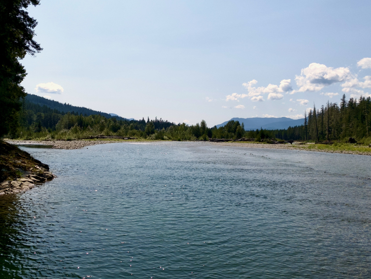
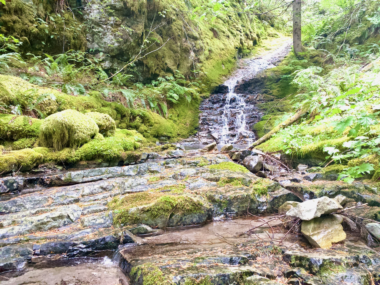

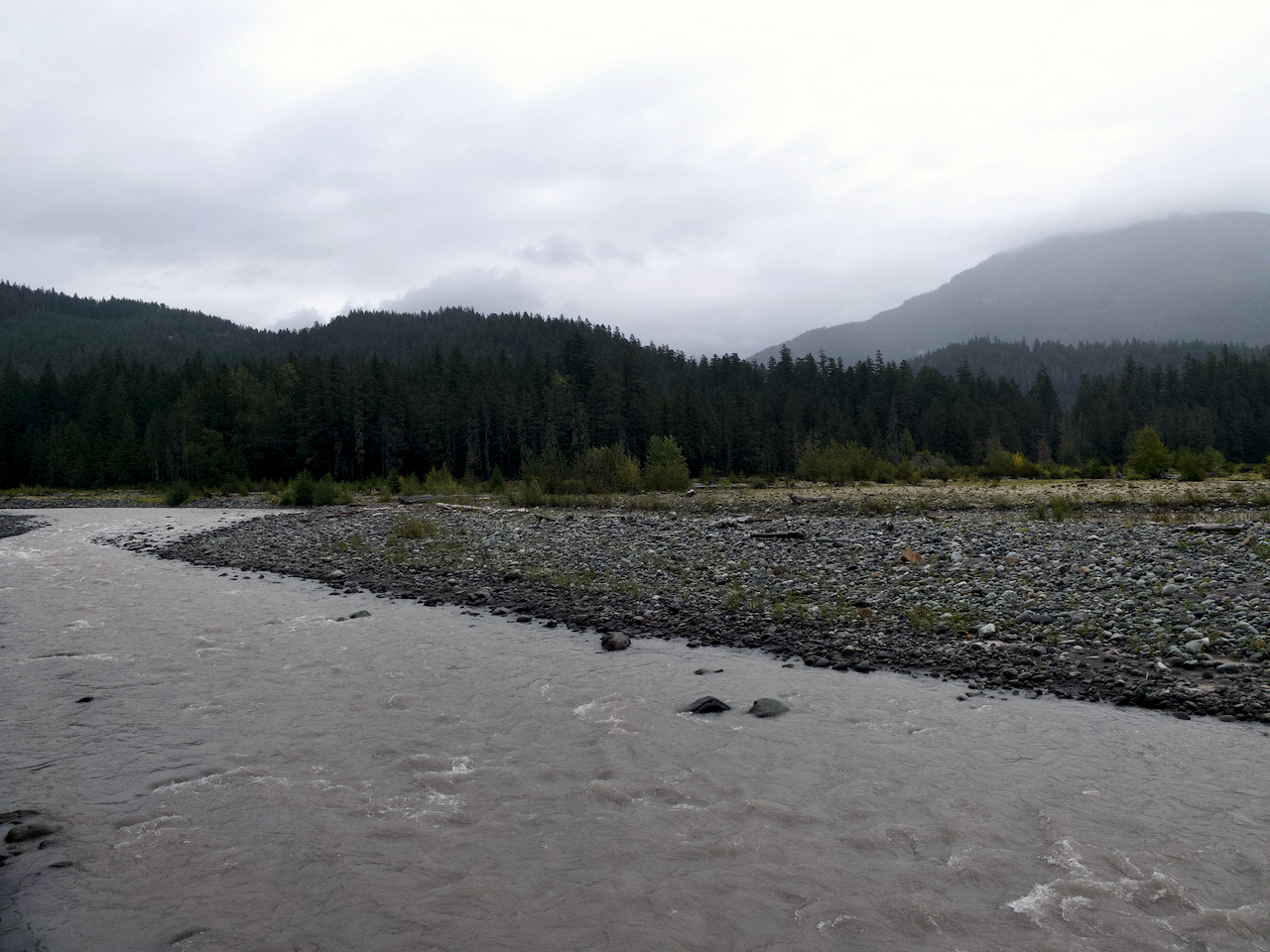
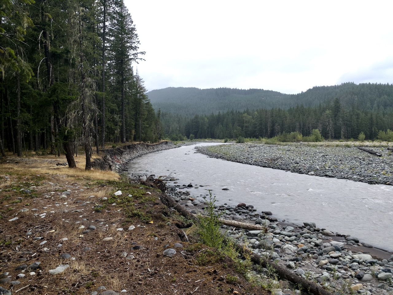
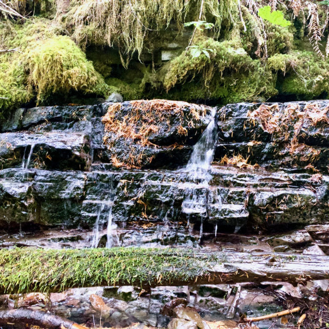
Images taken August 16 & 17 along the Muddy and Clear Forks of the Cowlitz River, GPNF
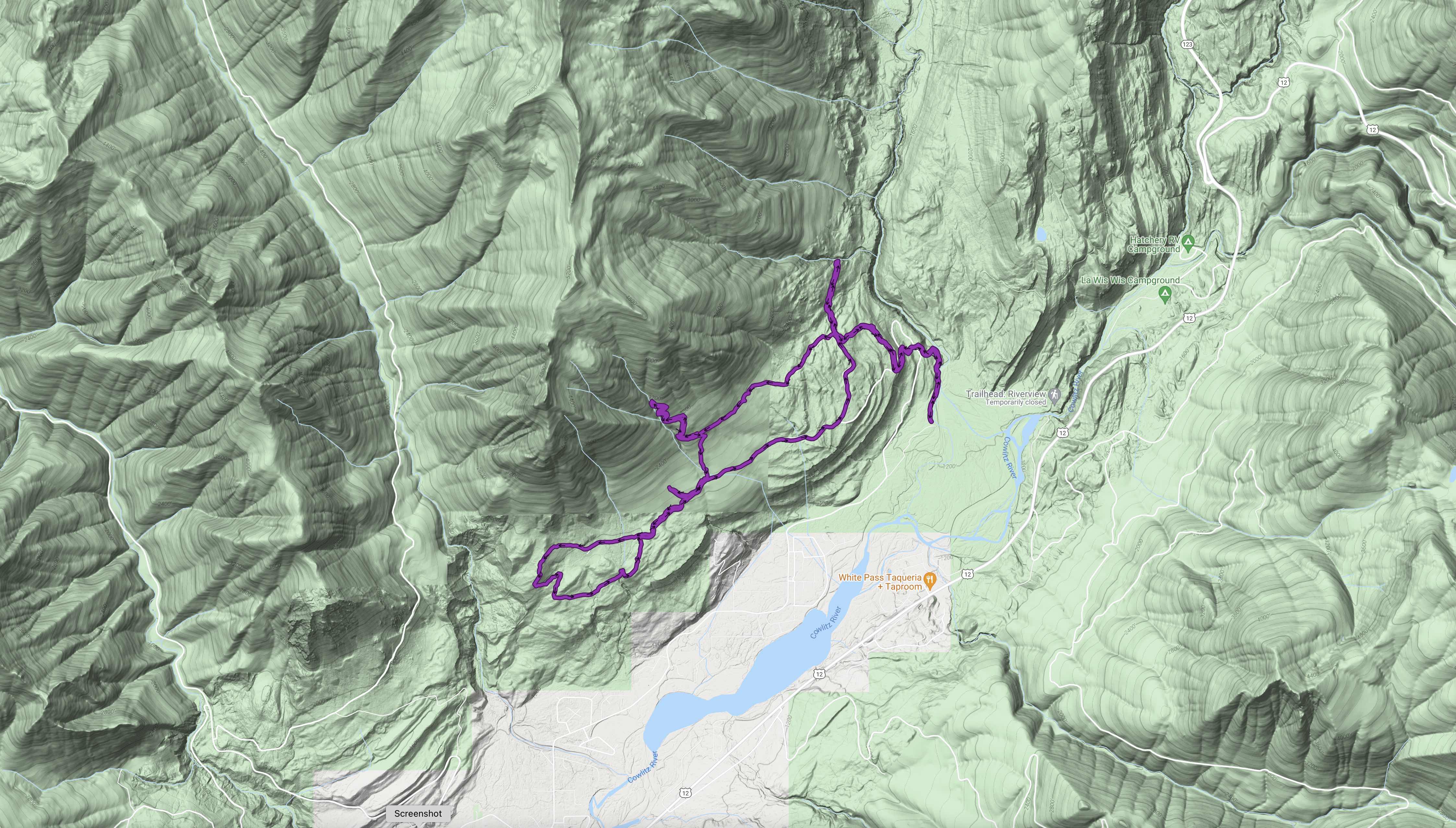
I hiked 13.4 miles w/ 2,779′ elev. gain.
Leave a Reply