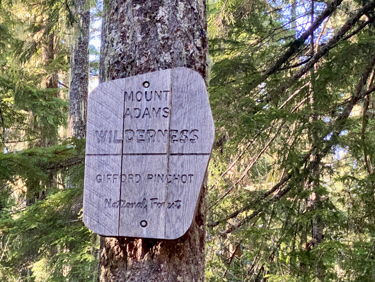
Time for another Big Ass Hike, version 2023. This adventure takes me from the the Cispus River to Panther Creek, all in the Gifford Pinchot National Forest, climbing into the Mt. Adams Wilderness, then following the Pacific Crest Trail southbound thru the Indian Heaven Wilderness, exiting above the Wind River Road at Panther Creek Campground, a total distance of 86 miles, with 16,000+ feet of elevation gain over 6 days and 5 nights.
Tuesday, October 5
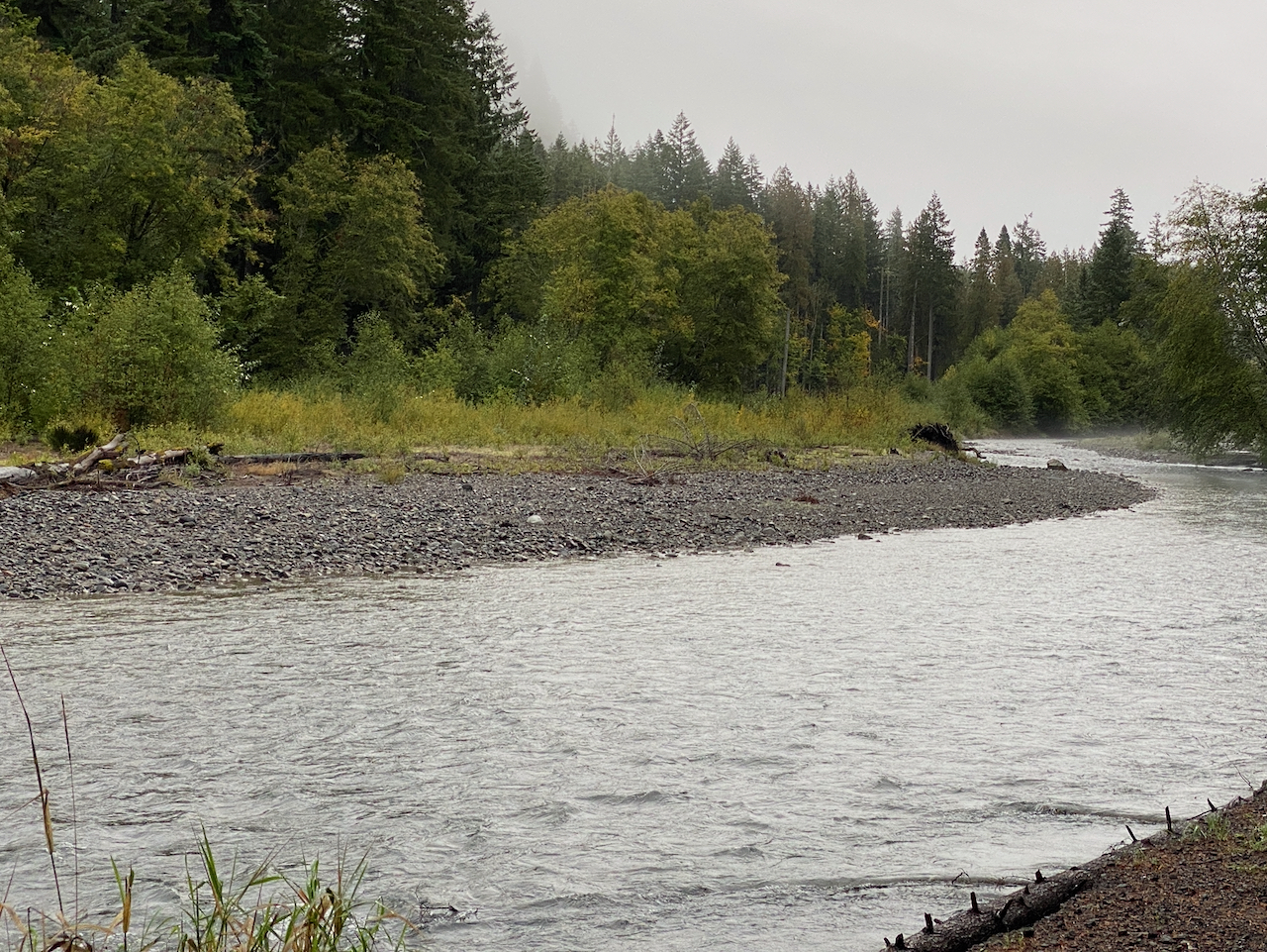
Julie picks me up and we hit the road before 6:00 am, driving down I-5 and up US 12 to Randle, then up the Cispus Road and parking at the 2801 Rd washout, where I’ve camped previously. I had shortened my planned hike from the main intersection at Randle all the way to the Columbia River, sacrificing 9 miles of road walk at the beginning, and days along the lowermost section of the PCT, which I expected to not be very noteworthy. And for which I really didn’t want to pack the extra weight, nor take the extra days, as weather changes loomed.
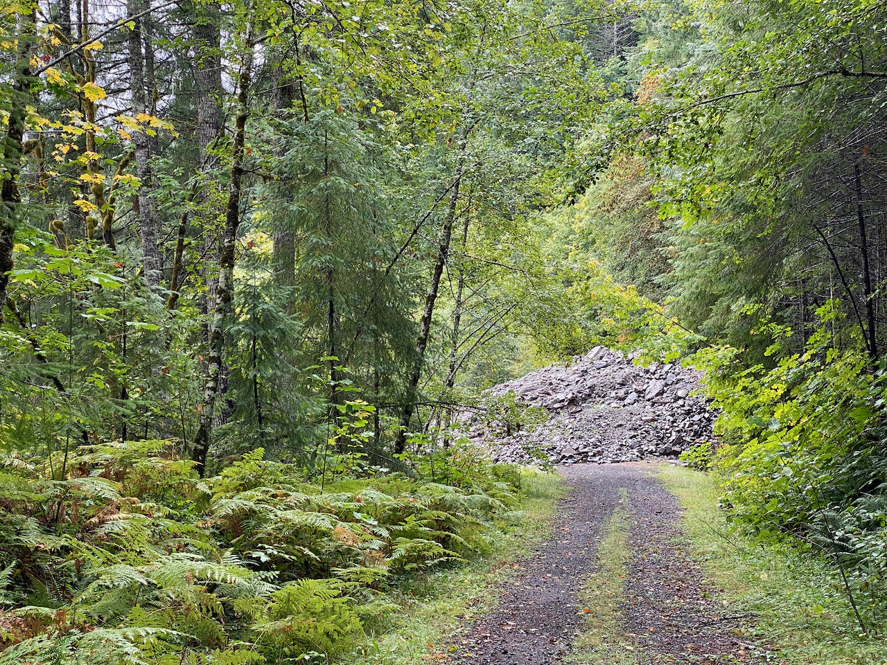
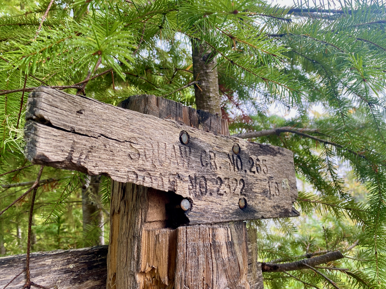
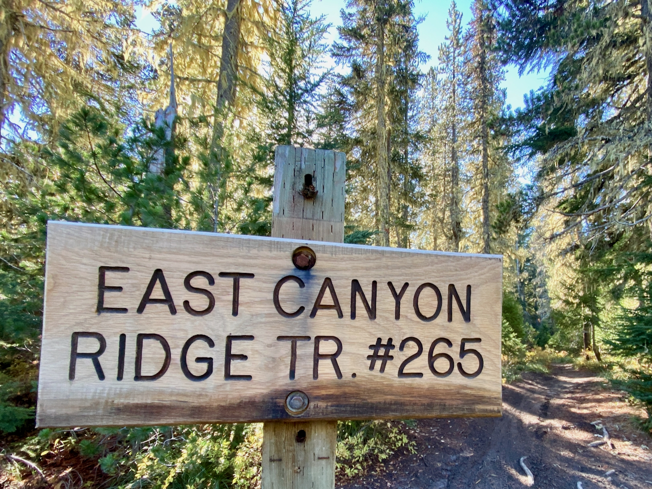
I heft my pack onto my back just after 8:00 am, and with Julie’s taillights disappearing around the bend back to the main road, set out for the base of East Canyon Ridge, following the 2801 Road (closed, gated, washed out, and made completely impassable to vehicles by two landslides. Easy to walk, tho.) I arrive at the camping area near the 23 Rd bridge over the Cispus River, ditching my pack at a lovely overlook and backtracking a short distance for water – the river, besides being muddy, is a hundred feet below, and inaccessible. It is a late lunch, and I don’t want to waste time, so after a short spell, I push on to the 23 Road, climb the grade for a short while, then turn off onto the 2322 Road, which provides access to Lower Dark Creek, and the East Canyon Ridge Trail #265 trailhead. **I’m a bit surprised as this trail is signed “Squaw Creek Trail #265” at the lower TH, but on maps is labelled “East Canyon Ridge Trail #265”. I debated even naming it in this trip report, but will settle for noting my discontent. It’s ridiculously racist, and as other area landmarks w/ similarly problematic historical names have been renamed, I’ll note the additional dose of sexism. WT actual F USFS? It’s 2023. Replace it, or take the damn sign down already.
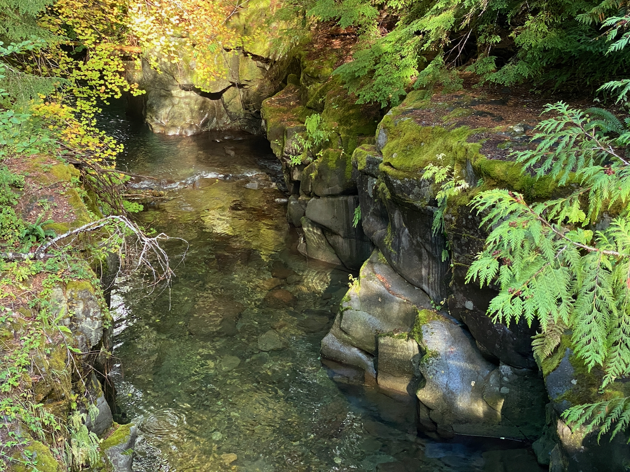
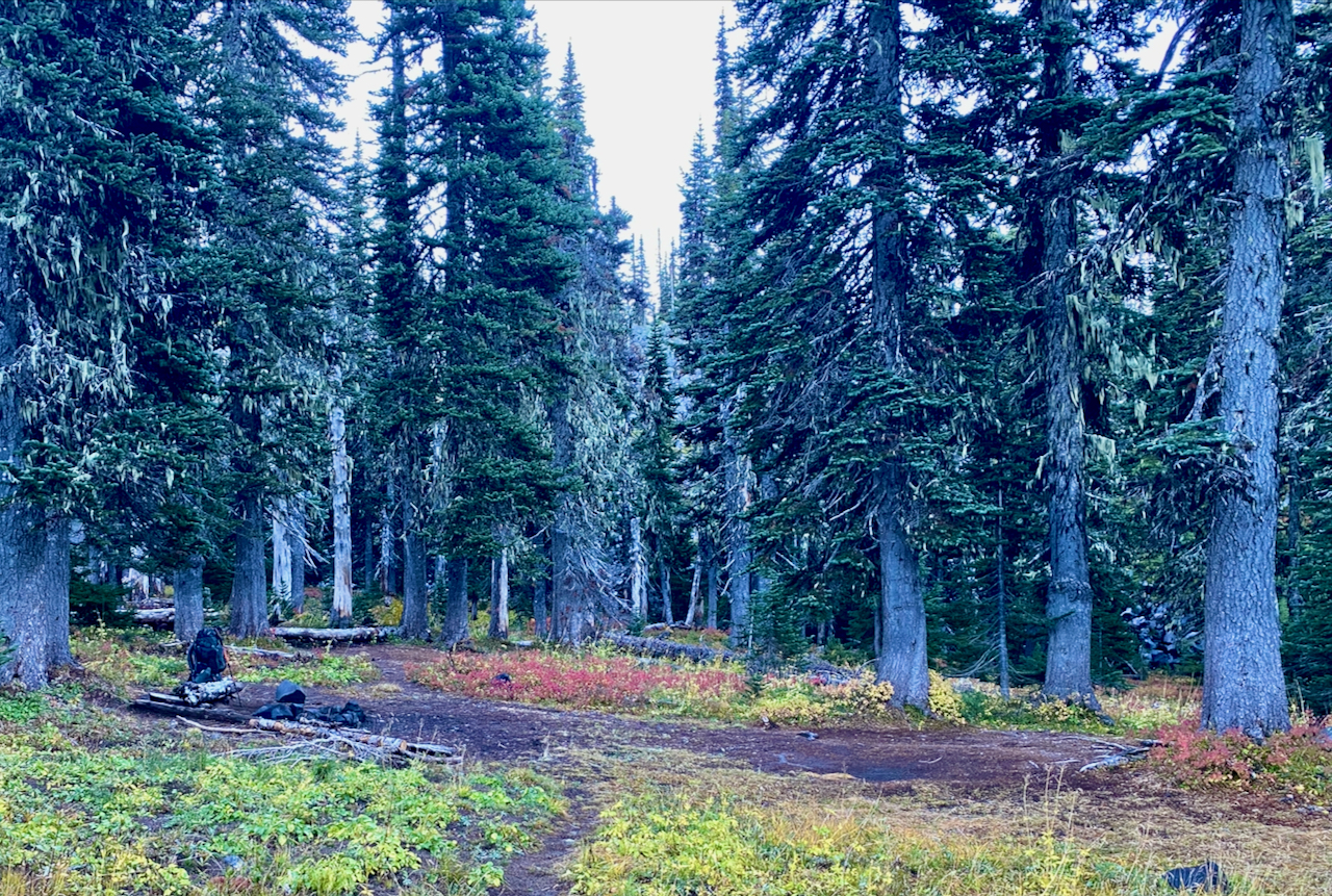
Crossing over Dark Creek, I see there was a really nice site, and the creek was so lovely, but I planned to camp at the TH, so I could start the day with a climb. After a couple of miles, I’m there. Unfortunately, water is still another half mile down the road, which, being blocked and abandoned, means a bit of hassle getting across downed trees and overgrown brush on occasion. Still, better than carrying the water I needed with that heavy pack!
Settled in the for the night, I enjoy the antics of a little mouse hopping about my camp. In the morning, it was replaced by a duo of very mouthy Douglas Squirrels. I remain thoroughly chastised for invading their privacy still!
Wednesday, October 6
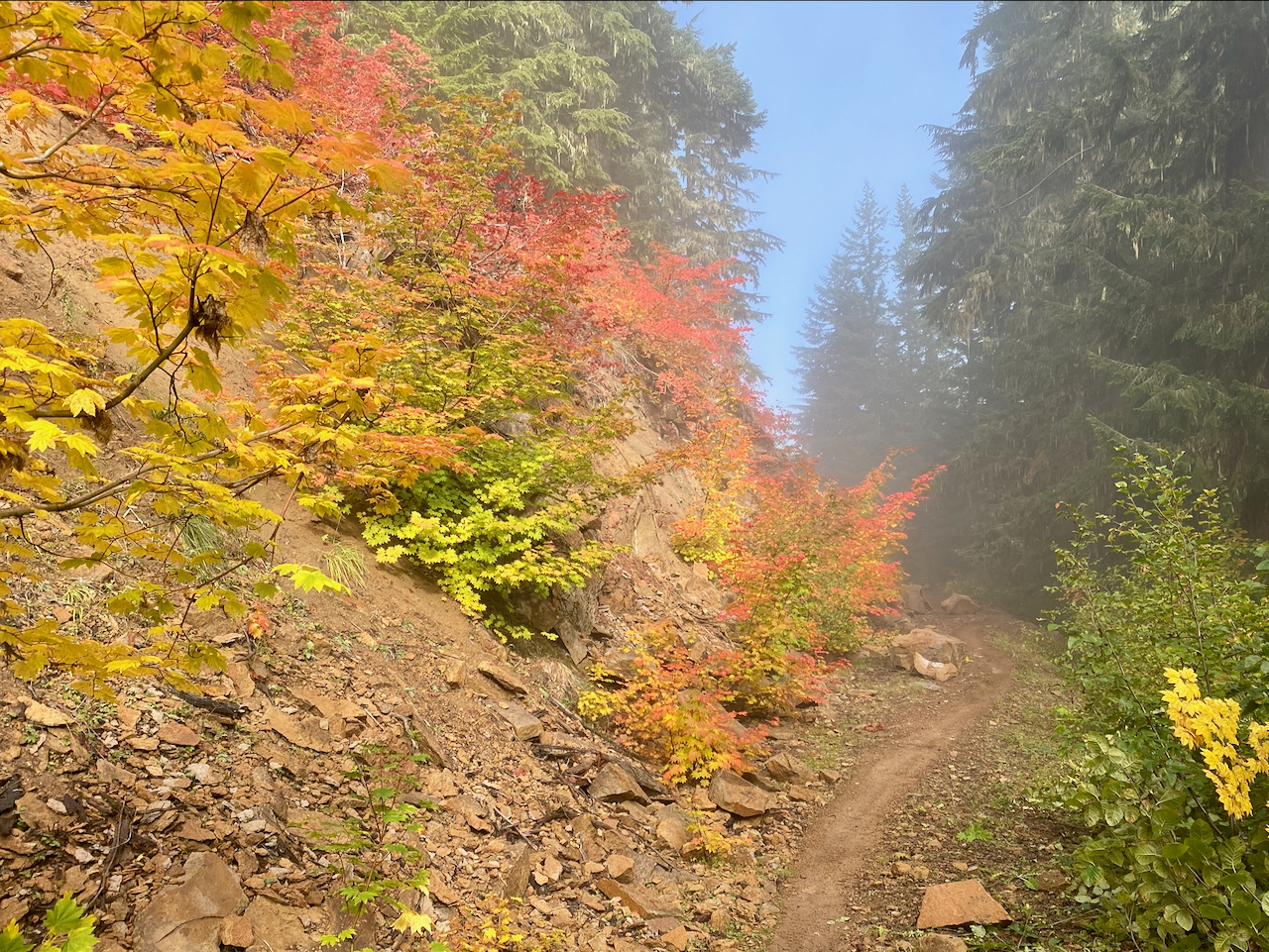
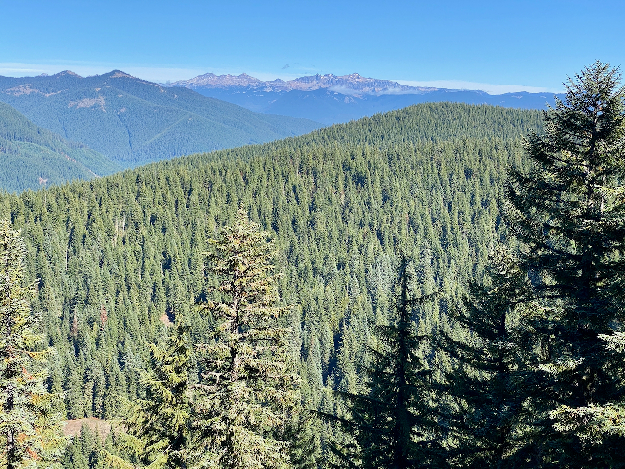
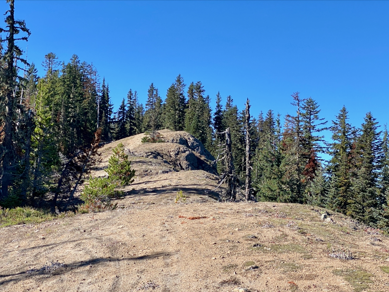
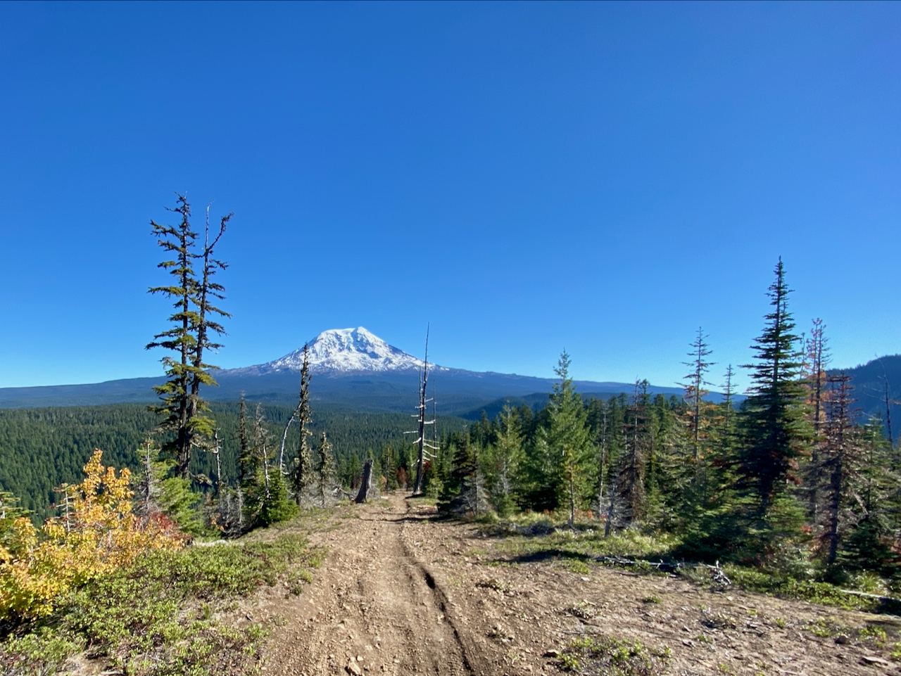
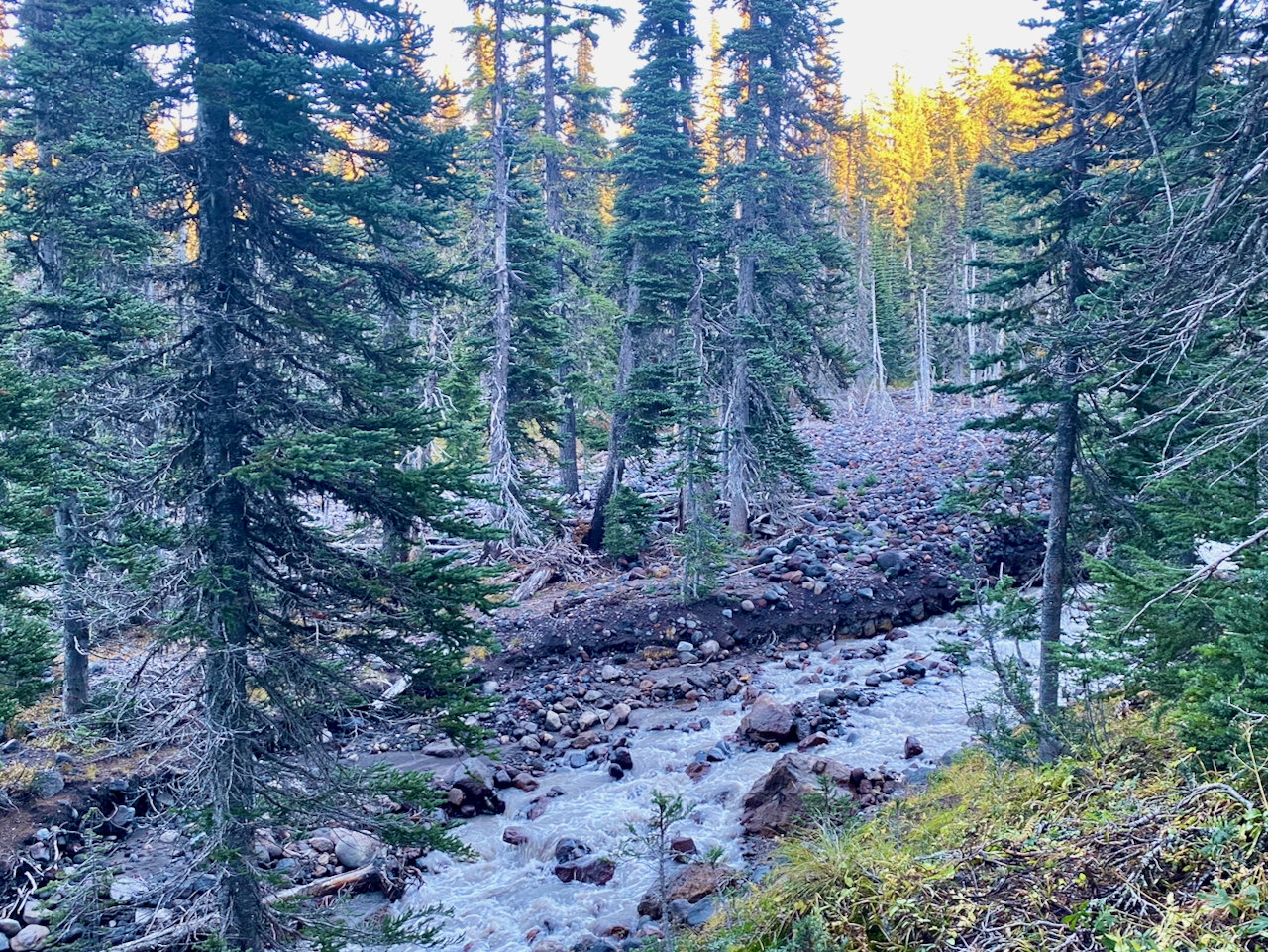
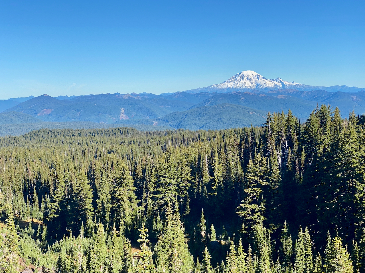
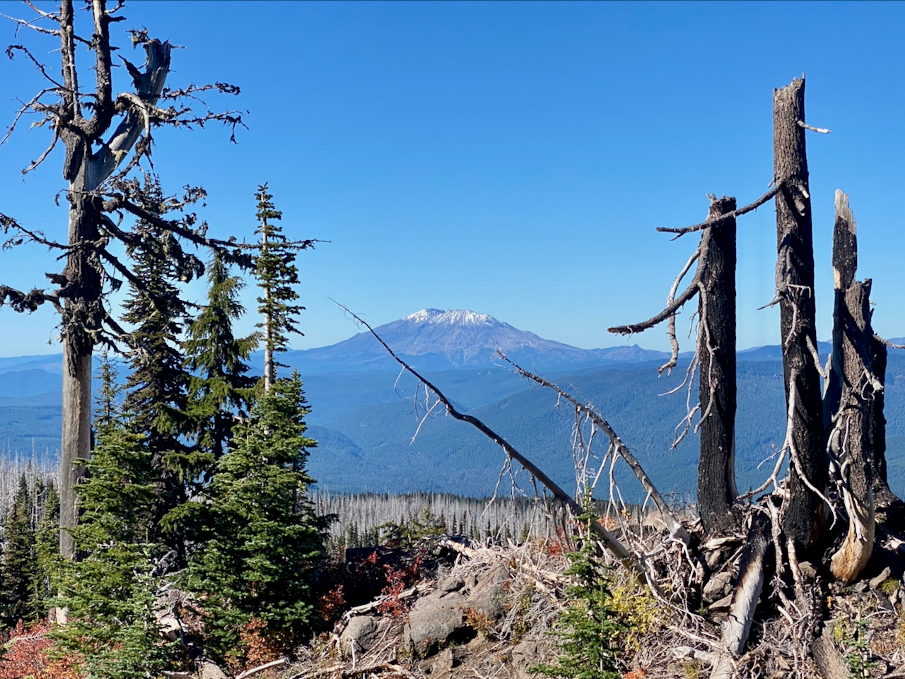
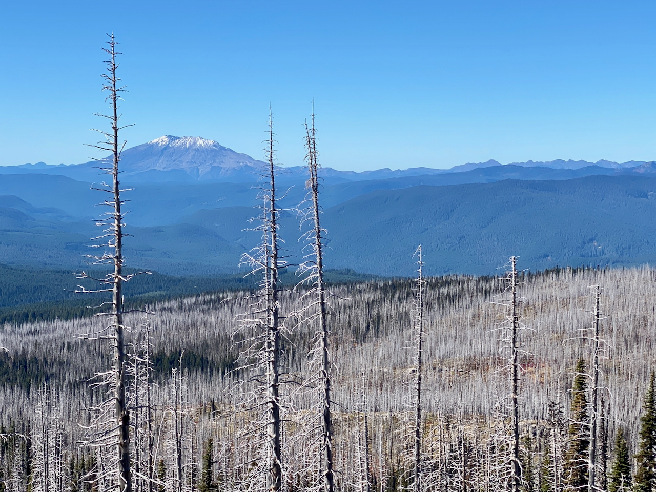
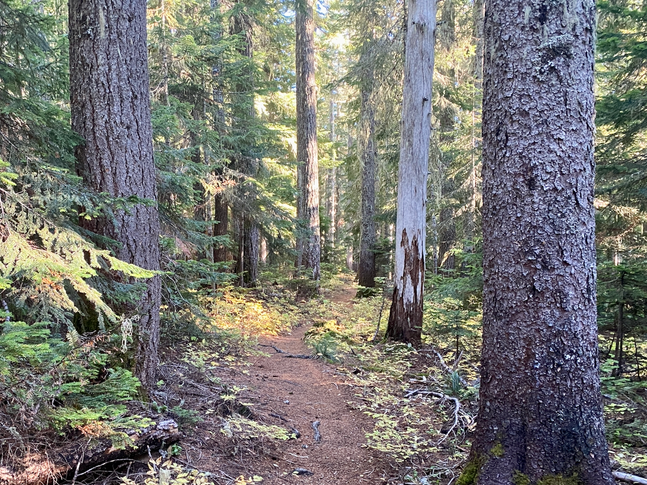
Up early and on the trail as quickly as I can manage – Divide Camp is 15.5 miles up and over East Canyon Ridge, then up the lower slopes of Pahto to just below the Pacific Crest Trail along the timberline. It is a long day, with perfect bluebird weather, and I am completetely wiped out by the time I arrive. I really enjoyed all the territory along the way. Not as gorgeous as was to come, this is a working forest after all, but the views are stellar. I complete a trail I’d previously started but never finished, and I check more road miles off my list, finding a great future car camp site in the process. East Canyon Ridge trail is used and maintained by motorbikers, so one has different expectations, but compared to WADNR’s Capitol Forest, I am impressed at how well maintained this, and other area motorbike trails are. Also, since it’s late season and the soils are getting wet, riding is largely done with in the National Forest, so no bikes bothers me at all.
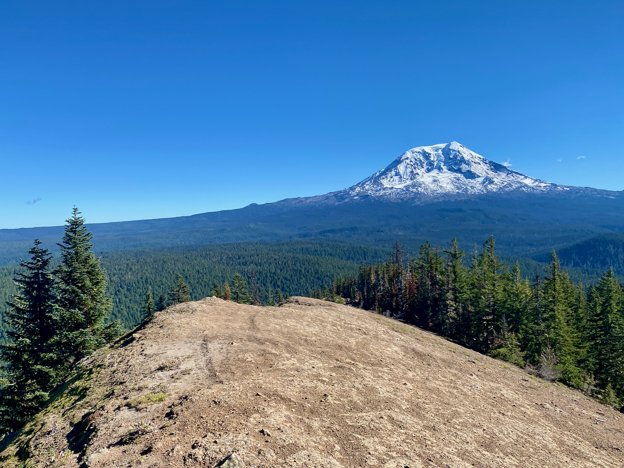
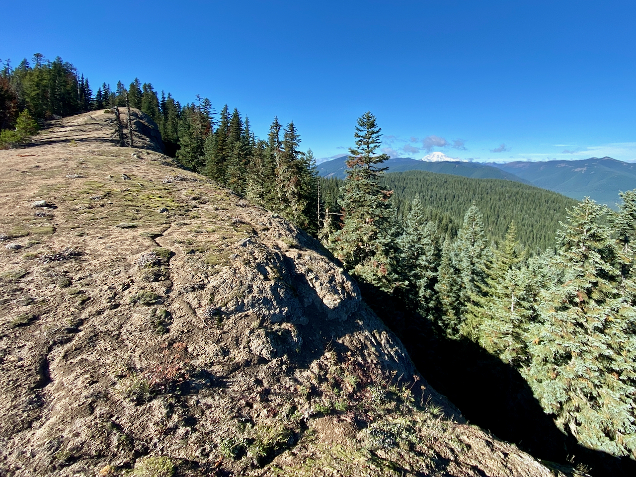
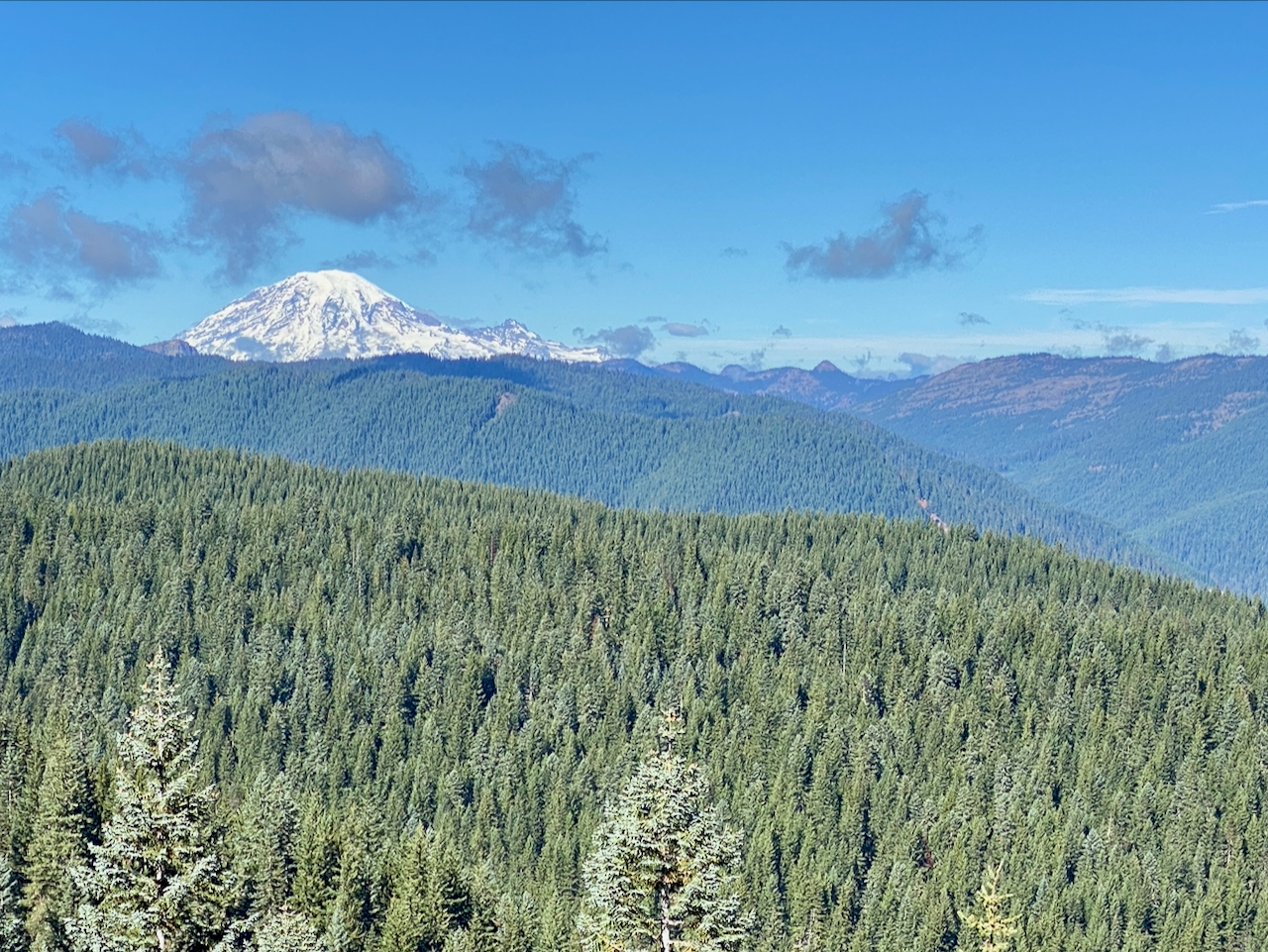
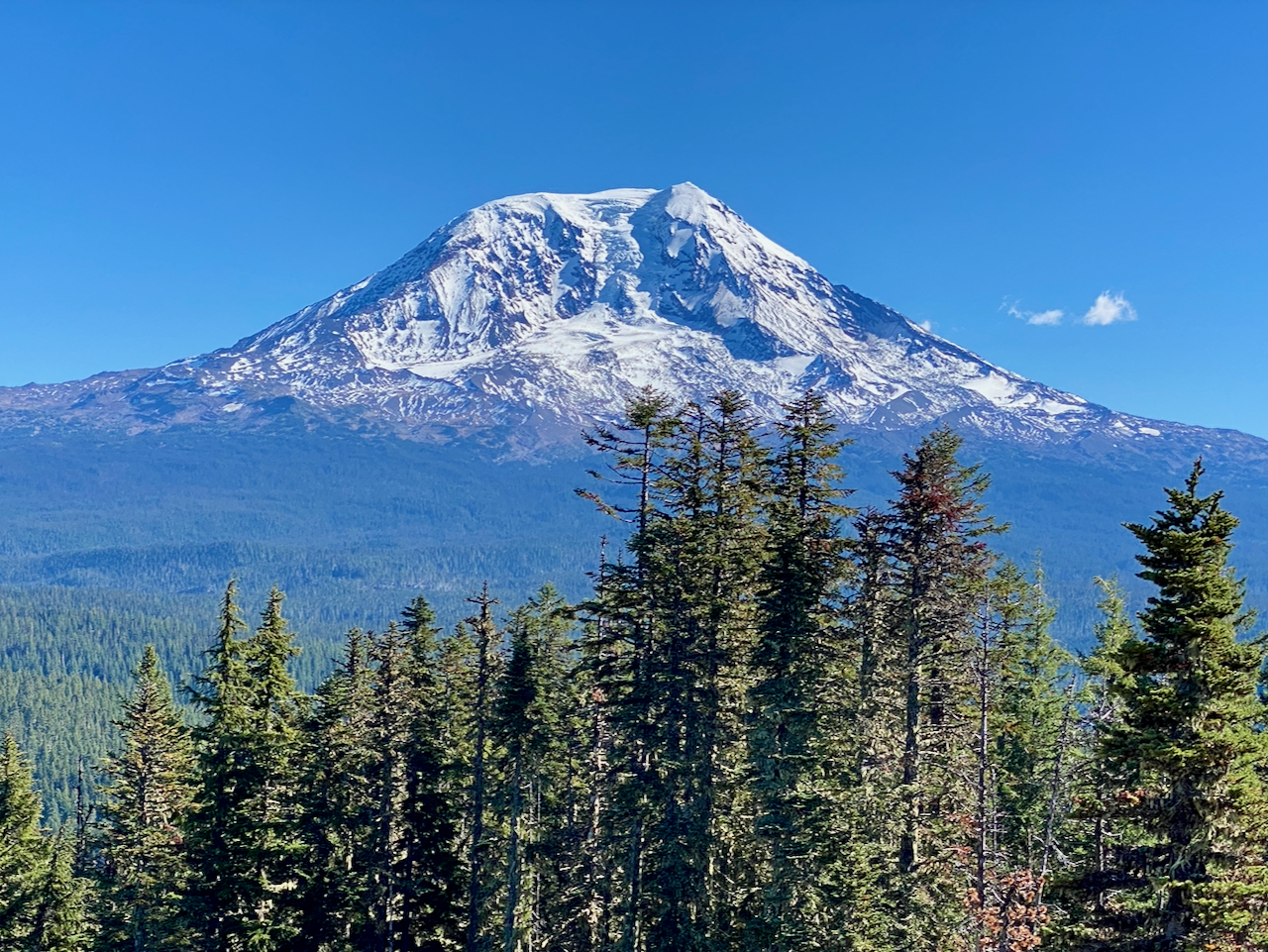
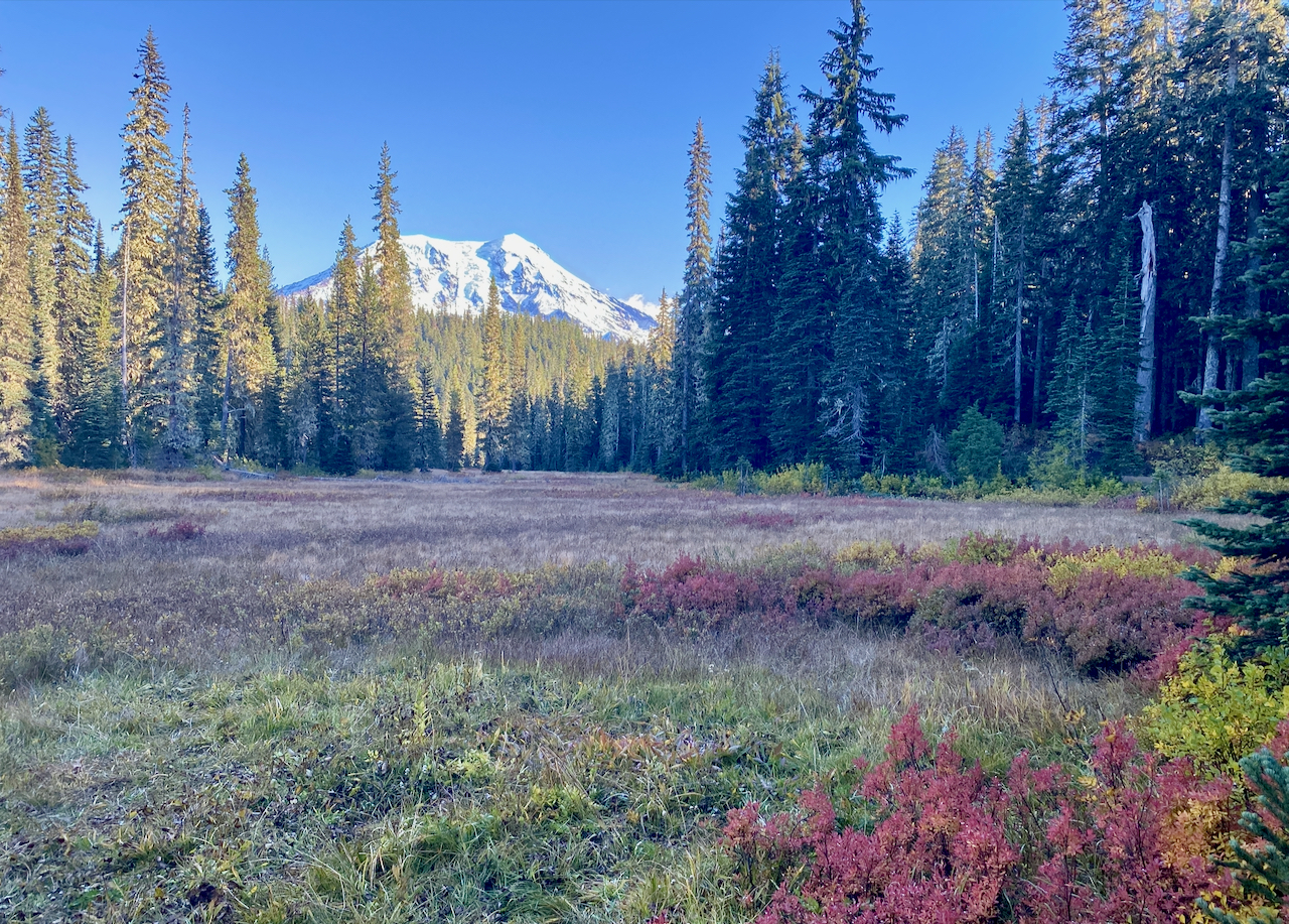
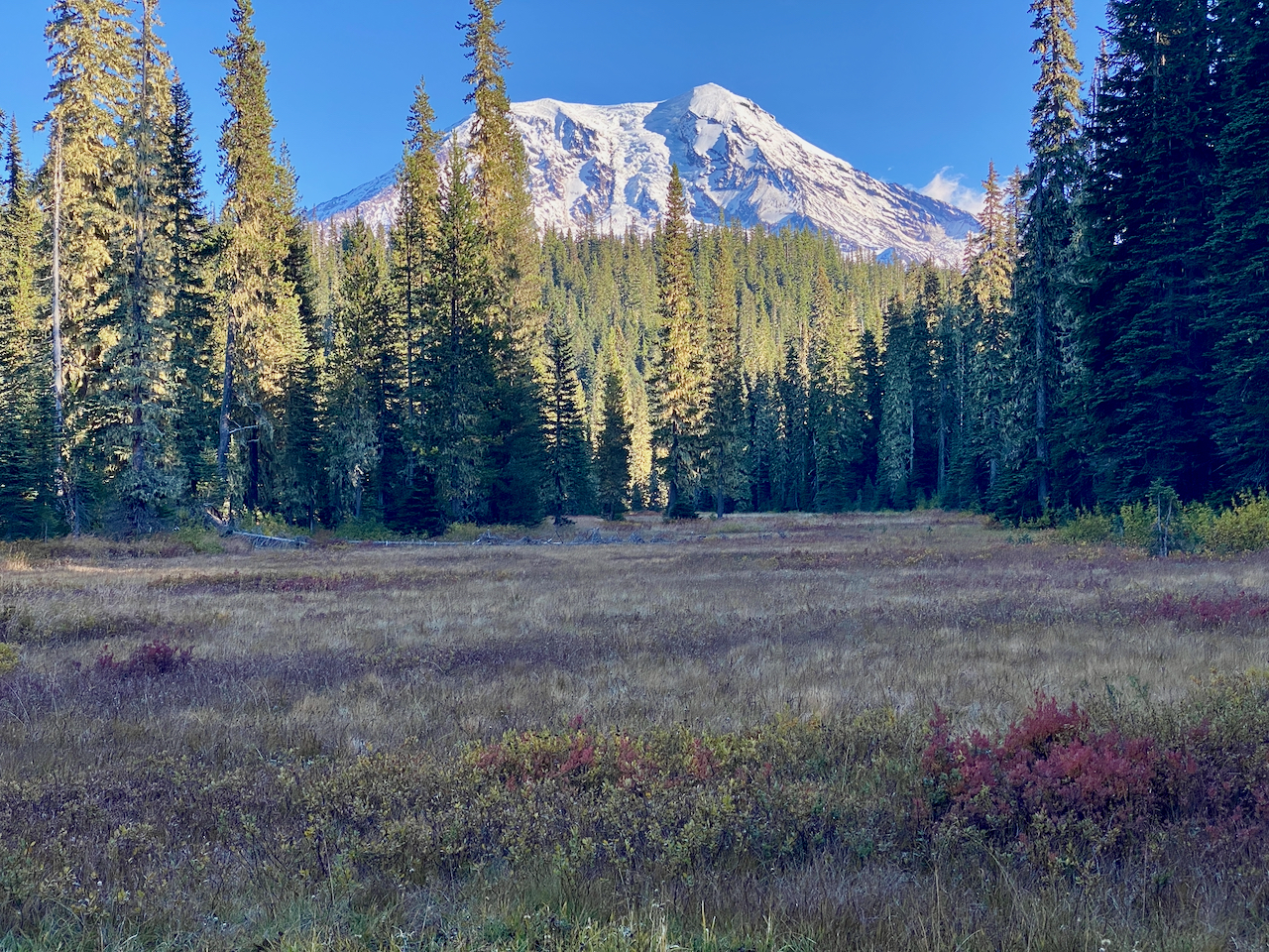
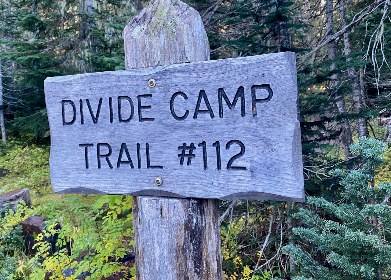
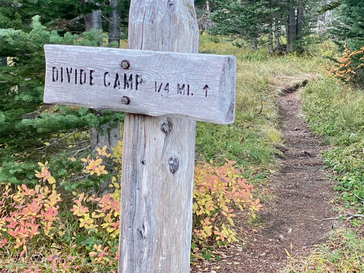
I reach the summit around noon, and descend without any real pause – the views here are great, and I get off a few photos, but it is not really a place to tarry. Not yet 4:00, I arrive at the 2329 Road, and approaching Takhlakh Lake. I consider detouring along the lakeshore for a break and chance to get off the road, but decide not to waste the elevation. The road walk is nice enough – vehicle- and bug-free, in the shade, and not too long. I pause at TakhTakh Meadow for a quick break at about 4:30, arriving at the Divide Trail TH at 5:00 sharp. I take a moment to fill out a Wilderness Permit, then trudge on. I’m tired at this point, but only have a little over 2 miles to go.
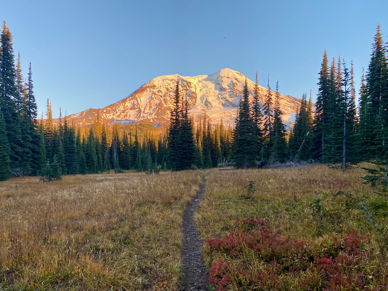
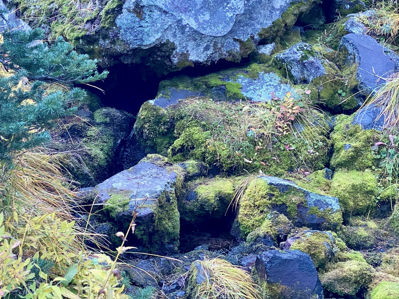
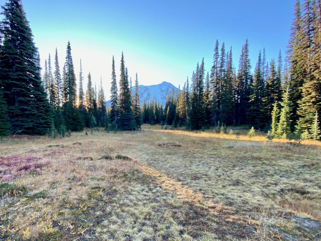
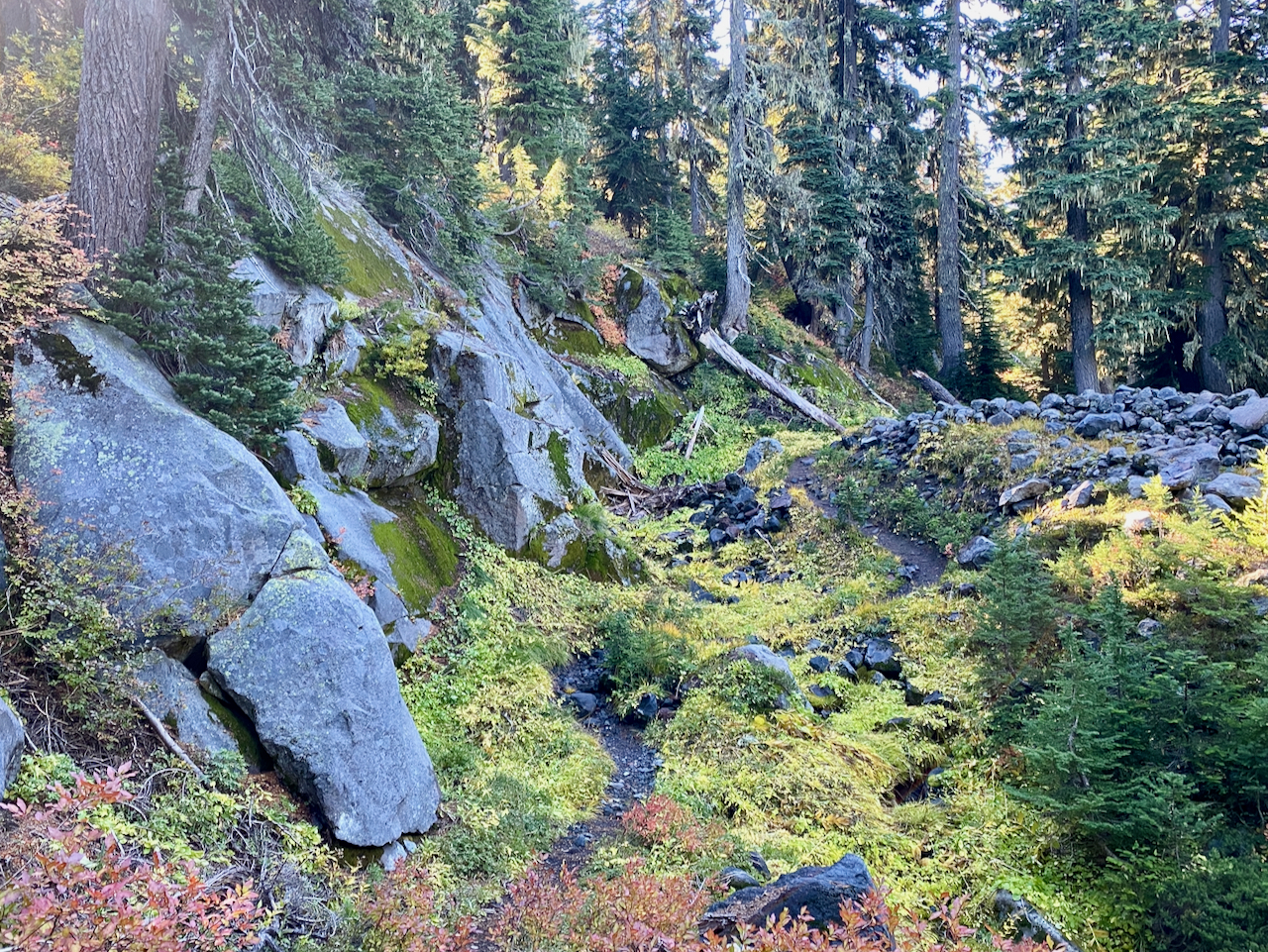
The sun is going down when I arrive at the turn off for Divide Camp – it’s another quarter mile down to a nice camp in forested meadow above a spring, located on the watershed divide between the Cispus and Lewis Rivers. I drop my gear at the campsite, grab my walter filter, and head the rest of the way down the trail for some cold, clear spring water. It’s not running fast, but it’s cold and clean, trickling out from the base of a lava flow. Yum!
The stars are divine from here, of course, at elev. 5,940′, with the Milky Way, Big Dipper and Orion on full display, the moon waning, but strong enough to cast shadows, and illuminate the small meadow around me. Lovely!
Thursday, October 7, 2024
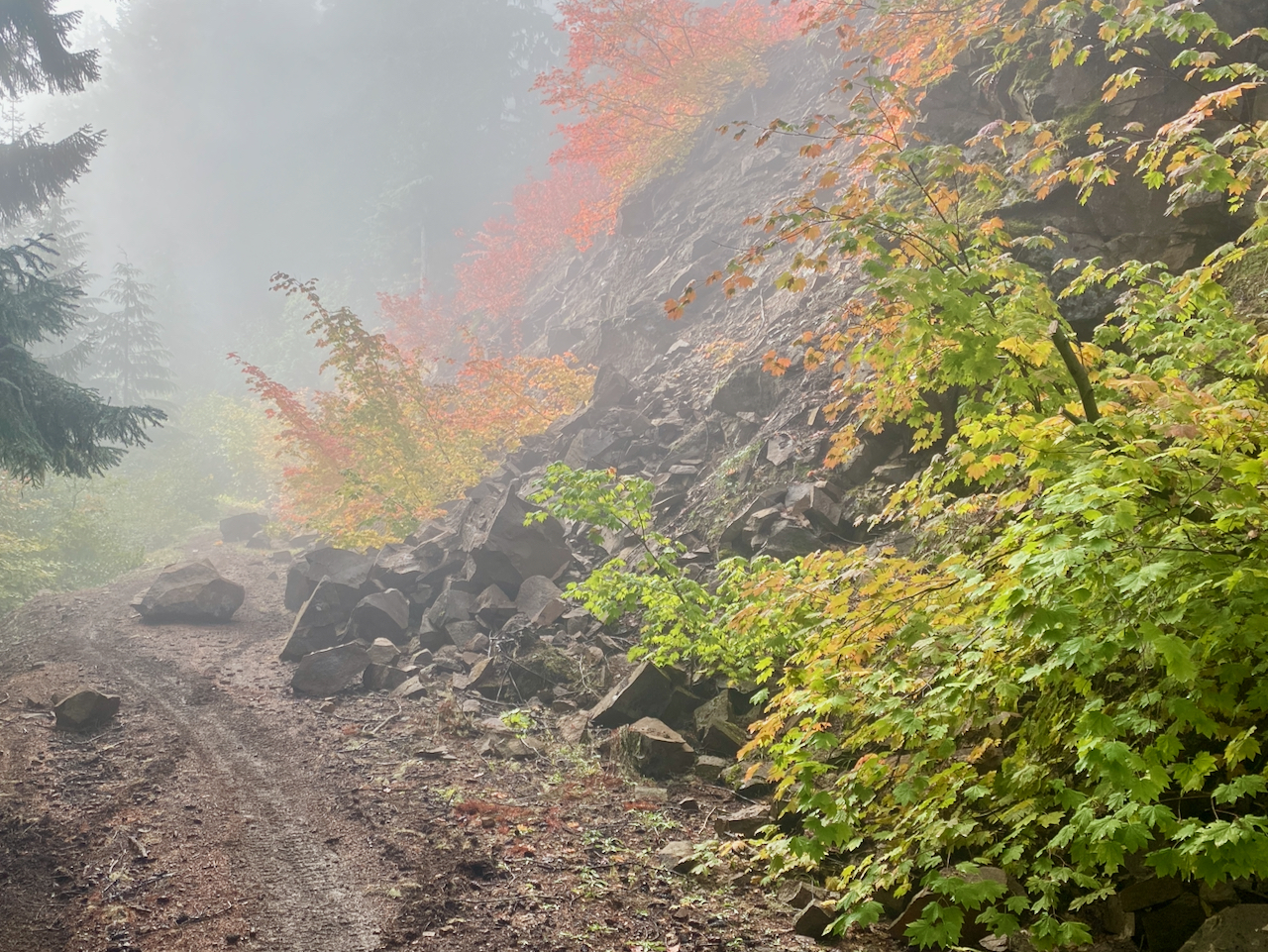
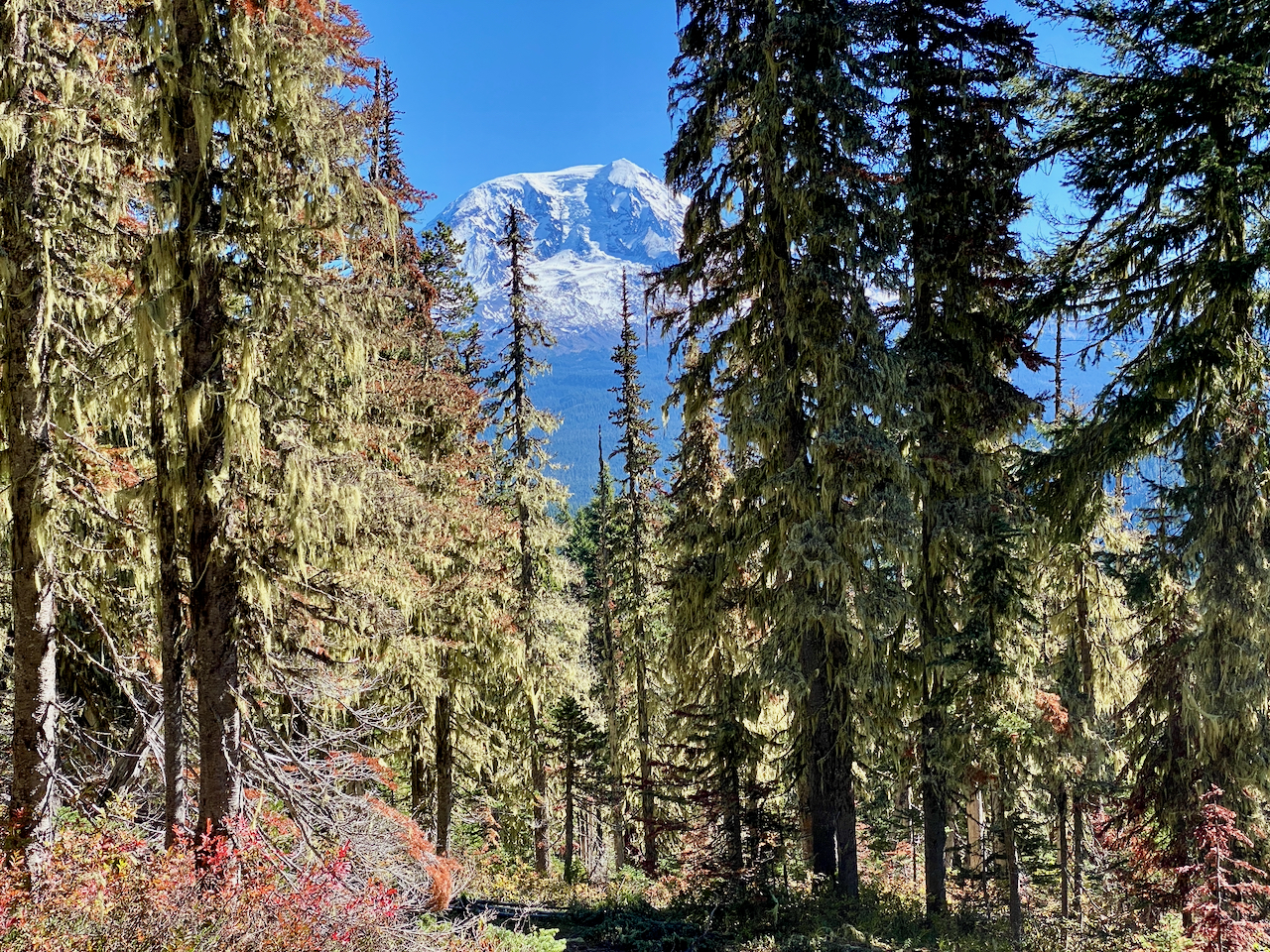
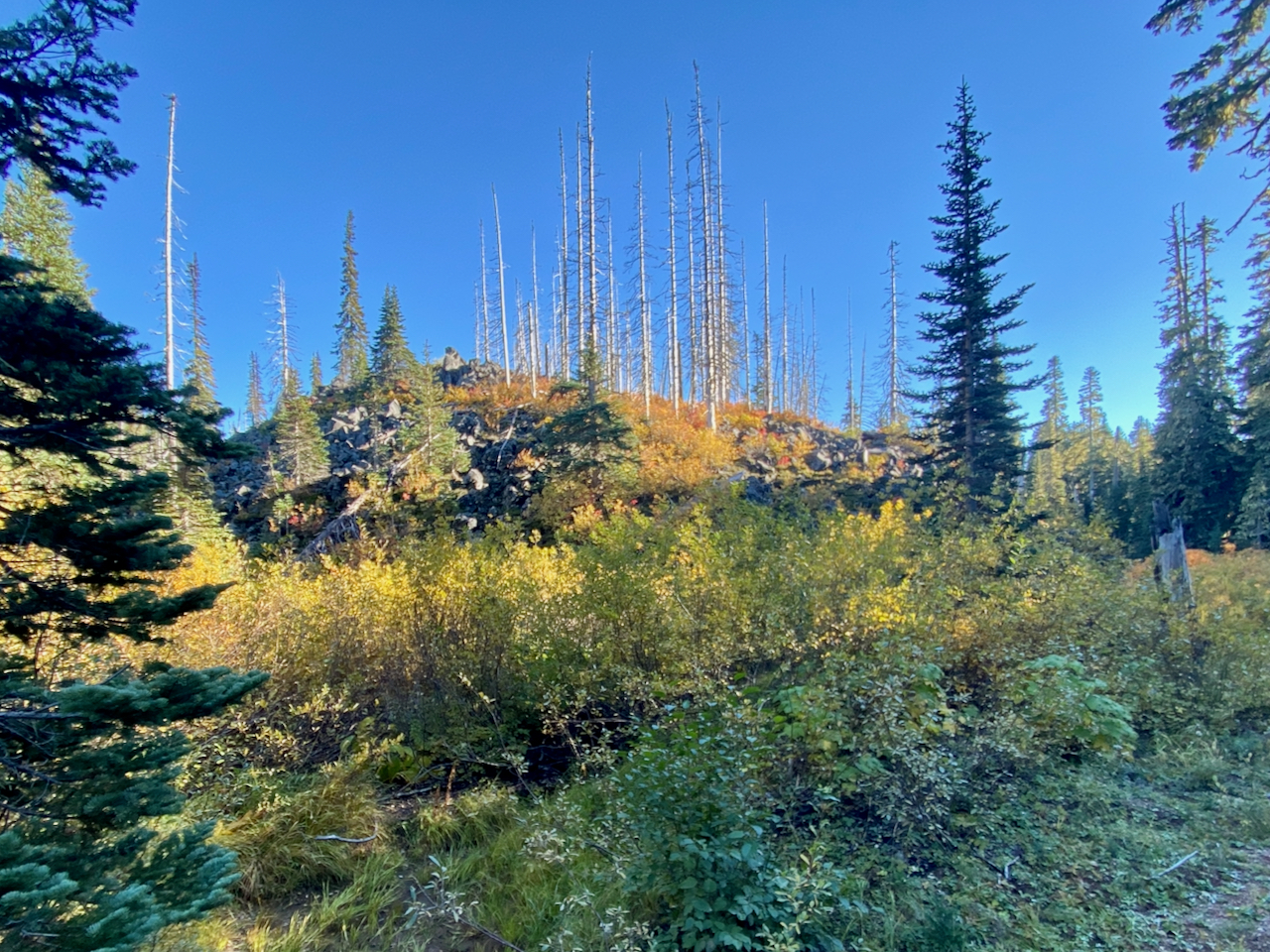
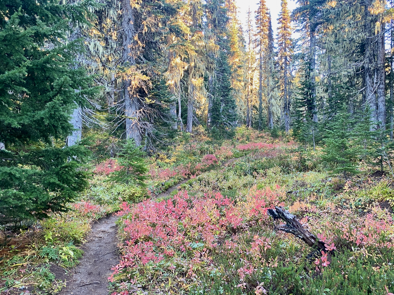
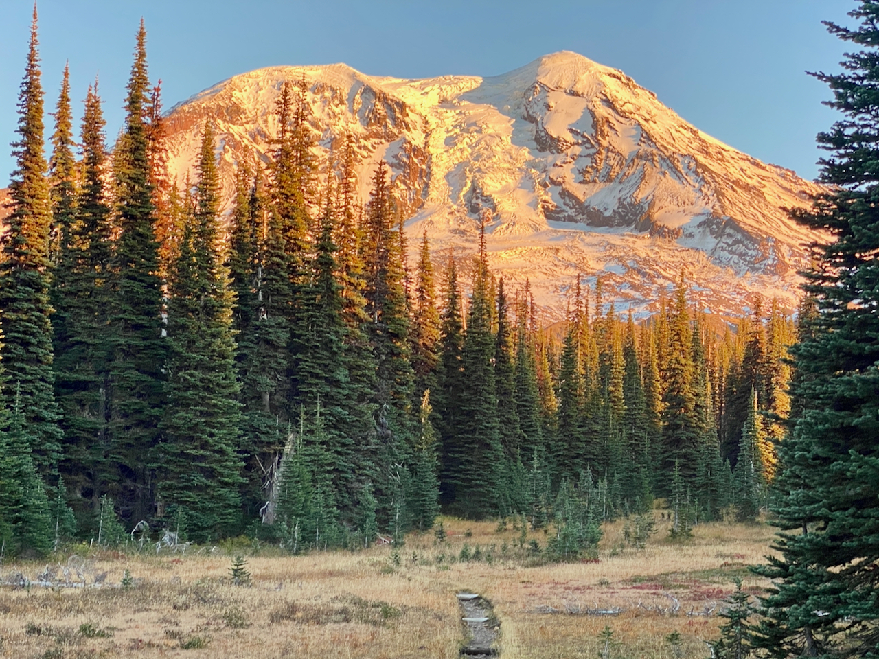
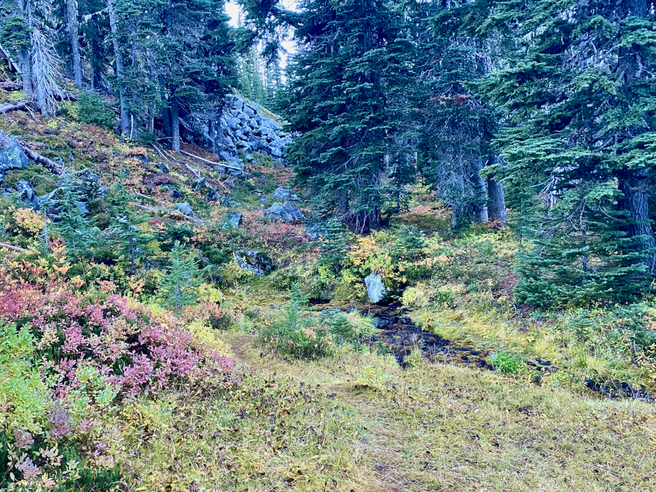
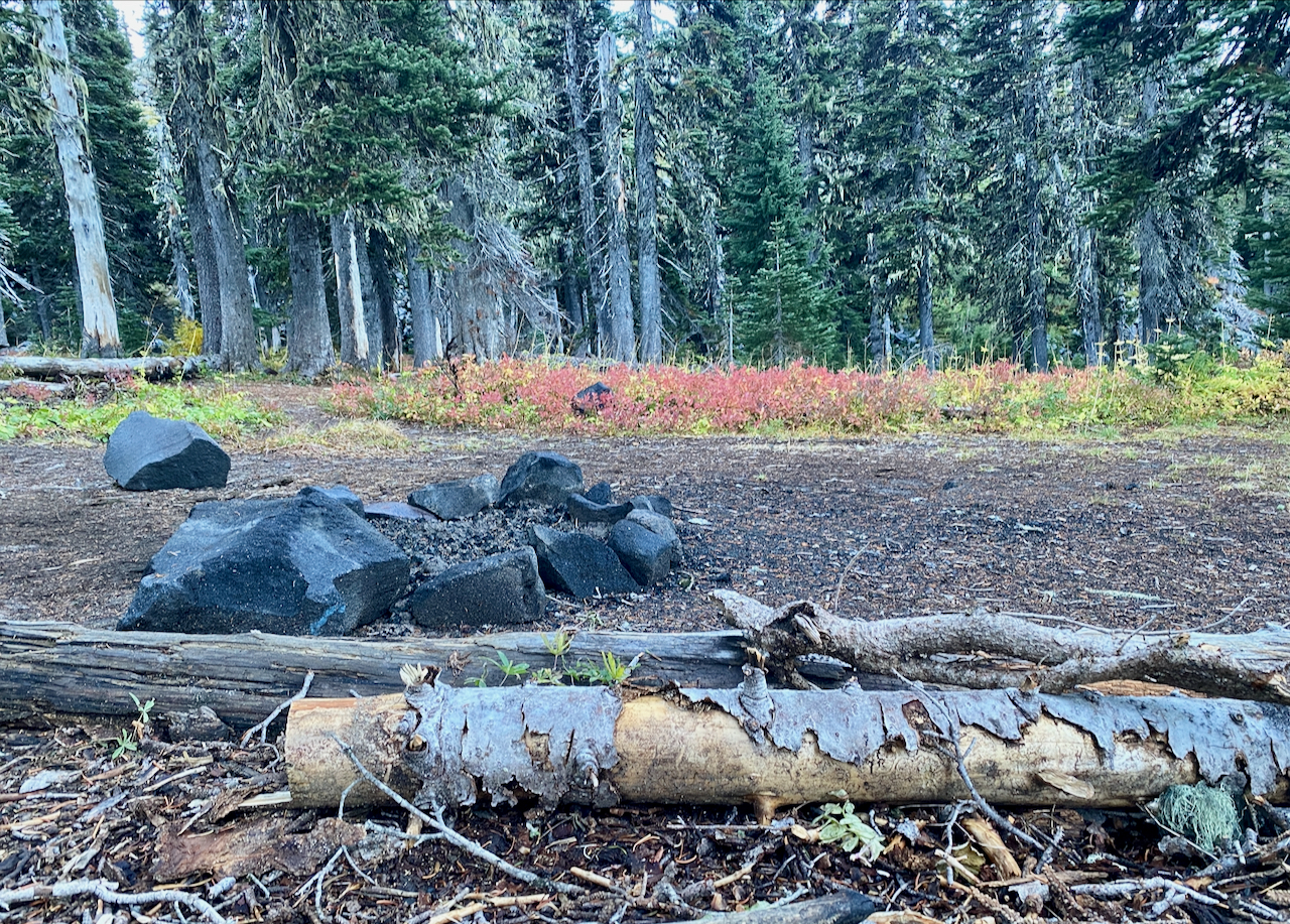
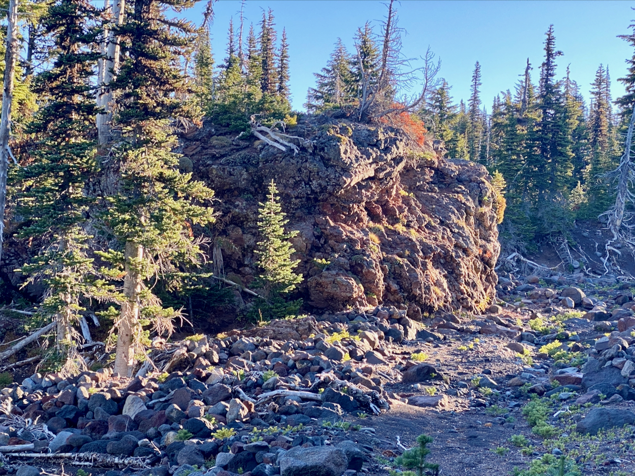
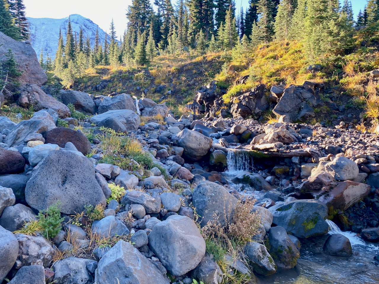
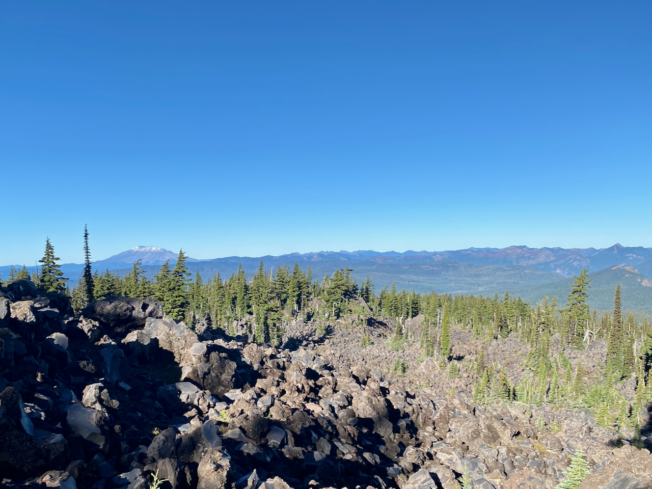
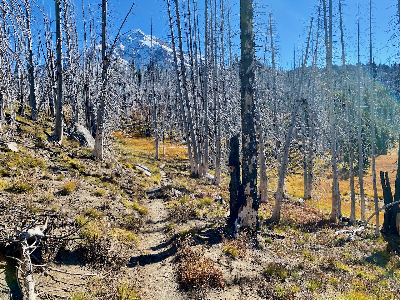
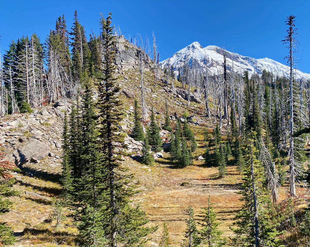
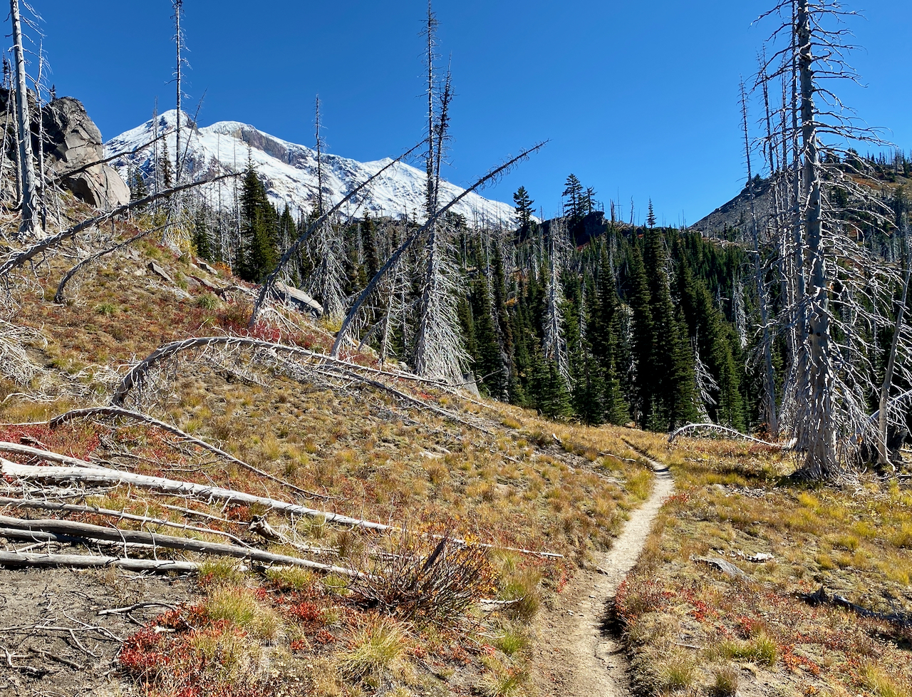
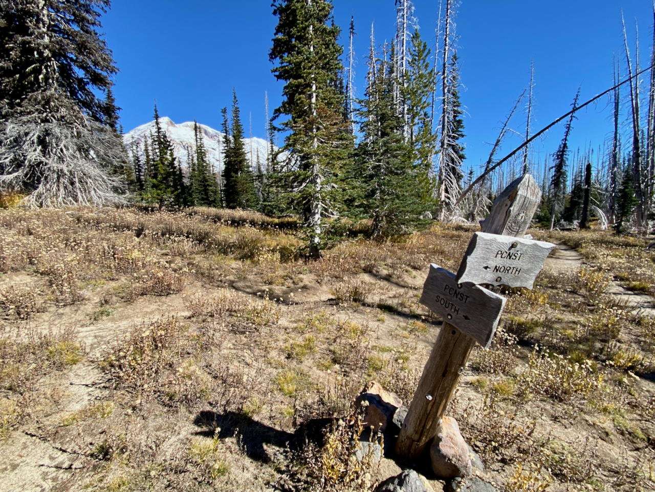
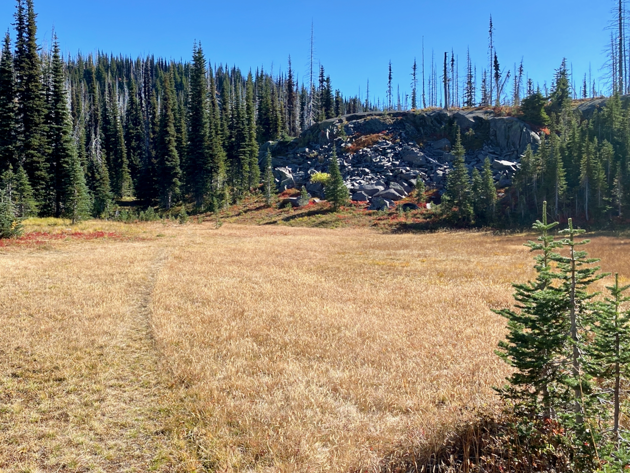
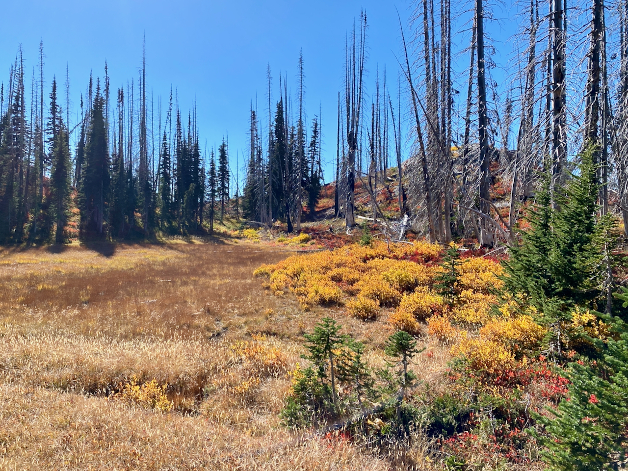
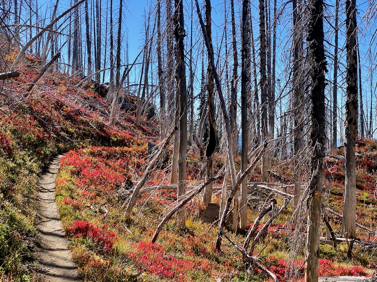
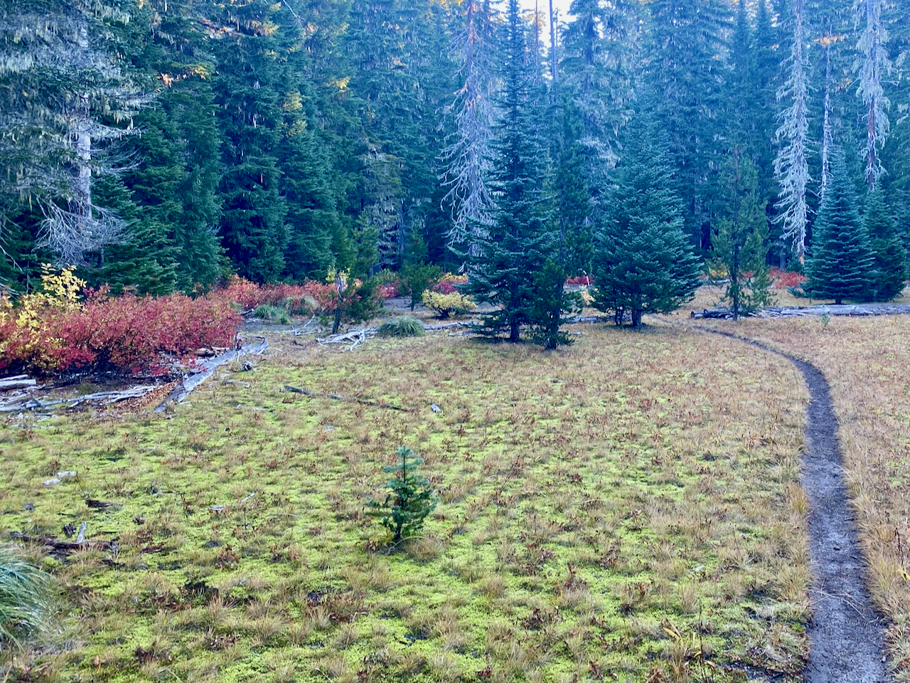
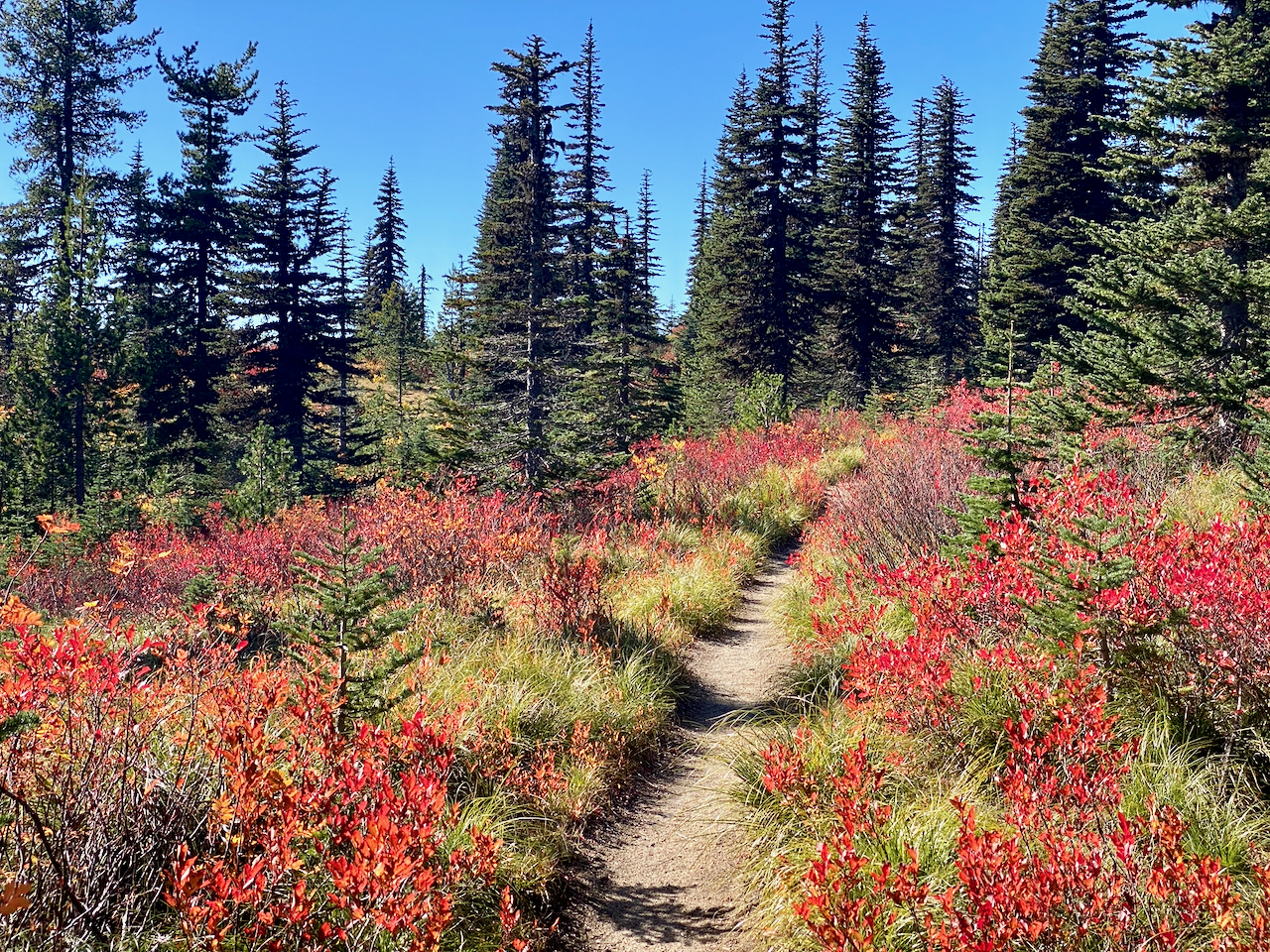
And morning is even more divine. I set out at 8:00. The sun is just peaking above the horizon, and the light is stunning against the trees and golden meadow. In a short bit I’m at the PCT, and turn south. It’s a stunning section of trail, in full autumn glory, and by lunchtime, I’m at Burnt Rock, entering the area where all that beautiful forest was burned away some years ago. It is here the trail goes from stunning to jaw dropping in the autumn. I spend the remainder of the day hiking thru silver snags surrounded by fiery yellow, orange, gold, and crimson foliage, all set against tumbled black volcanic rocks under an intensely blue cloud-free sky, w/ shiny white Pahto always looming. Just enough breeze to keep everything cool, but never chill. I cannot imagine a more beautiful day. I take a rest break in the shade at Horseshoe Meadow, and filter some nasty stream water, as my can is dry by now. The PCT breaks from the Round-the-Mountain trail here, and I follow it SW and down the tumbled, burned, fiery slopes of Pahto. Finally, with afternoon already giving way to early evening, green forest overtakes me again, and shortly after, I come upon the 23 Road, and finally some water again. There is a decent camp here, entirely too close to the road, but I take it. Traffic is a distraction, but ends before too long.
I had noticed at Divide Camp that my phone hadn’t charged overnight, and I spent some time charging it that next morning. Tonight, I cannot get it to charge at all. Yikes! With naught to do about it, I retire, and do not sleep so well, considering what I can do about the charging issue, and concerned with the miles yet to come.
Friday, October 8
I’m up a bit past 4, ready to break camp as quickly as possible, and maximize my mileage. Because of my phone charging problems, I take some time to note out my intinerary in my journal, noting mileages and such, figuring at some point, I’d run out of charge entirely and not have access to my maps. Not a biggy, I’m on the PCT – just walk south, I would eventually get to my destination. But keeping to schedule might be a touch difficult. Mike is picking me up Sunday around 2:00. I need to be there by that time. An hour or two may not be a big deal, but without a clock, how would I know, especially after another three days? I’ve used up half my time, but I’m not yet halfway thru my hike, with another 45 miles to go. I need to step it up! So I plan to do 20 miles today, and need to get a very early start, and stay on schedule thru out a very long day.
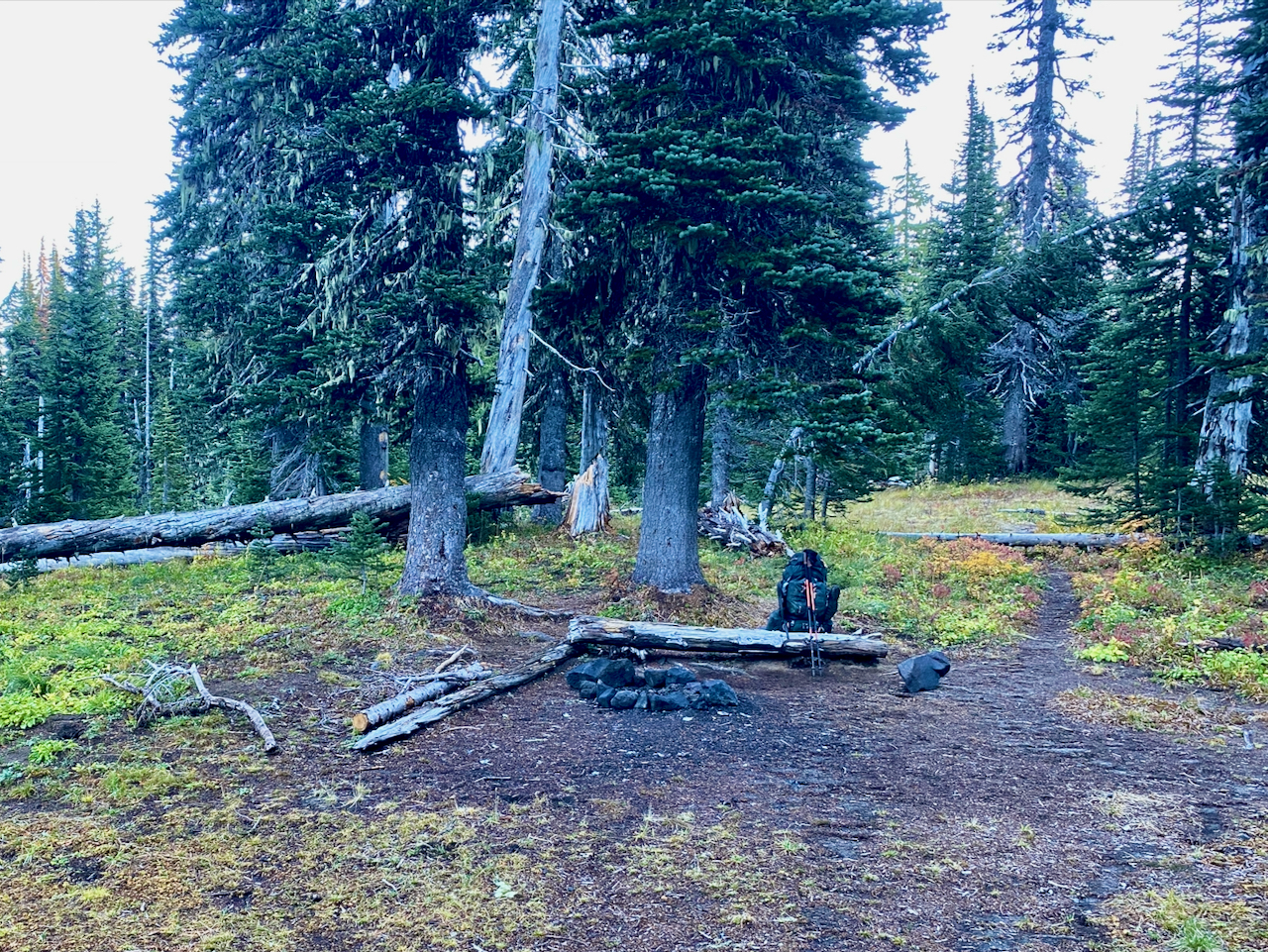
Fun thing – whilst taking care of ‘morning business’ some distance out in the dark pre-dawn woods, my headlamp quits. The battery is dead. I was hopeful that I was facing the trail while sqatting, so I finished up and struck out into the the dark underbrush. I figure I’d hit trail, water, or road, so couldn’t get lost. I find the trail easy enough, my actual campsite just off the trail not so easily, but I persevere. I take some time to charge the headlamp battery, and give up on the idea of pre-dawn start.
While that is charging, I spend a moment fiddling with my cord and battery – I wondered if there was something wrong with the software that might get reset by the flashlight battery – and sure enough, this time I can get a connection, but I get a warning about water in the charging unit. Granted, it’s not yet dawn, and quite damp, but this is odd. In any case, I eventually get the phone up to half charge before I set out, hoping I can repeat that random stroke of phone charging luck again tonight.
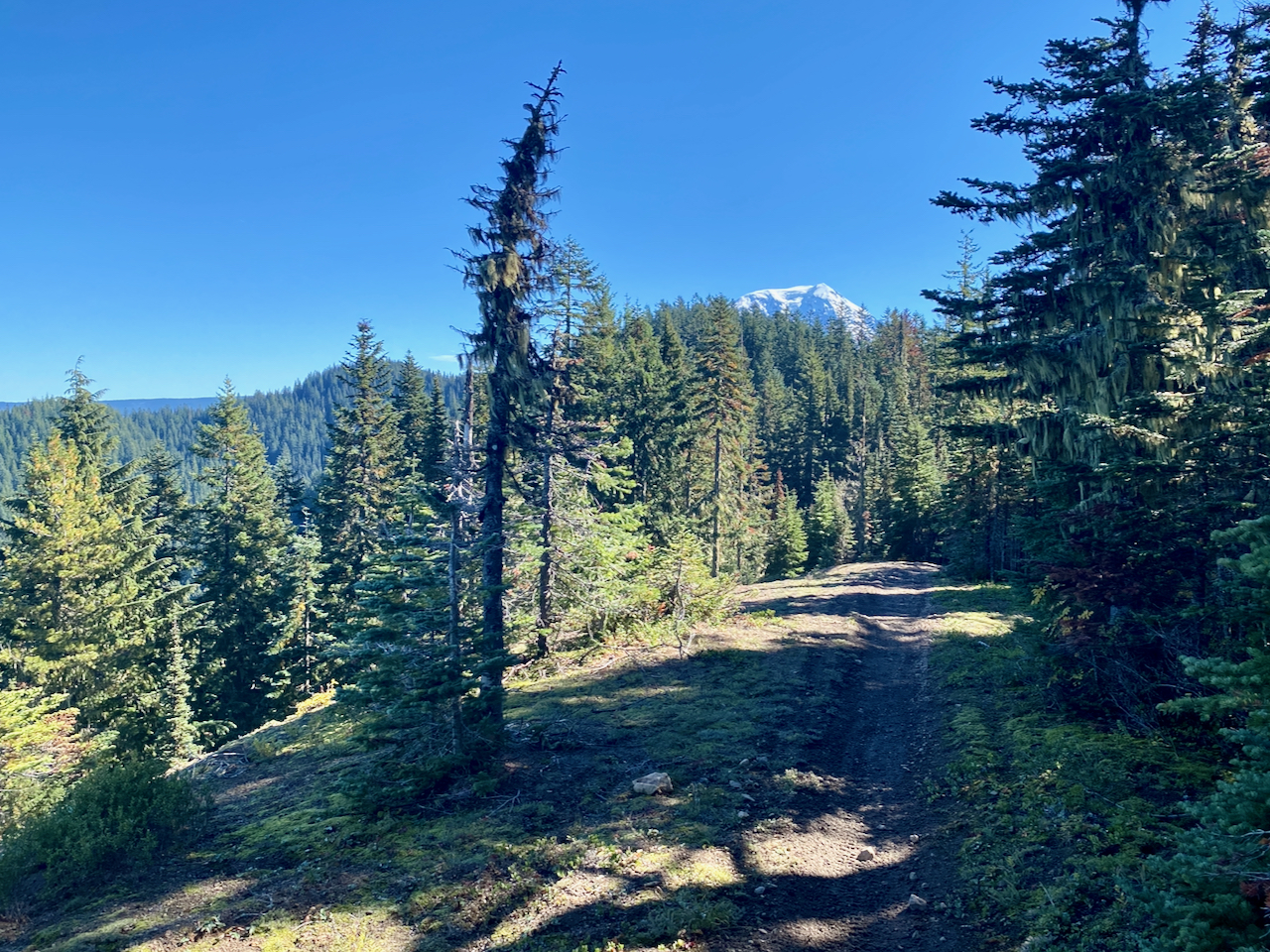
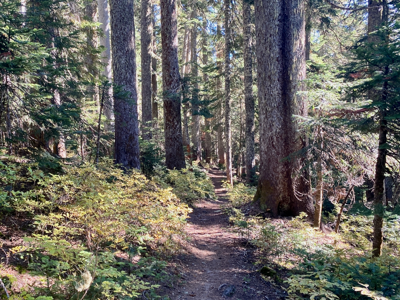
The day starts with a mild climb, the trail then descends to Trout Creek, then crosses the southern flank of Steamboat Mountain, before turning south at the Twin Buttes then arriving at Berryfields just outside Indian Heaven Wilderness. Gorgeous spot, this! Back into the woods and up and over the western flank of Sawtooth Mountain, up onto Bird Mountain, then descending into the region of lakes between Bird Mountain and East Crater. I stop and Bear Lake, having made my 20 miles.
Bear Lake is popular, and a number of groups are arriving at the same time I am. The consensus is the gorgeous little spit of land jutting out into the lake is a stunning place to camp, but all agree the No Camping sign is a put-off. They all head around to the far shore of the for what appear to be good campsites. I choose a small bivy site just up from the spit of land – it provides a nice hang, I get to camp closer to the main trail (so less distance in the morning), but also, I get this sweet little spit all to myself this evening, and the next morning. Which is nice, as a Great Blue Heron spent both fishing from within view just off-shore.
Saturday, October 10
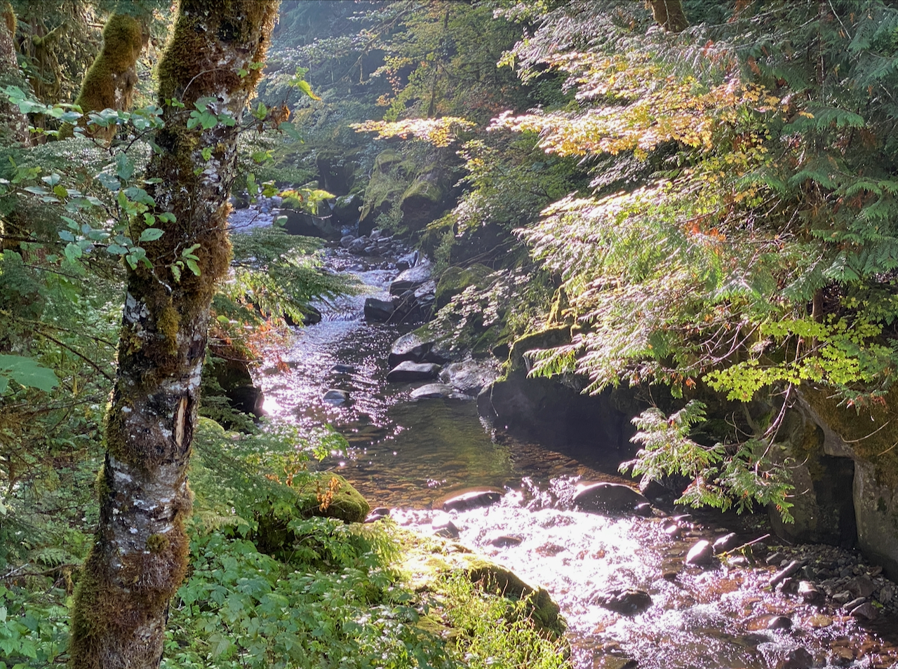
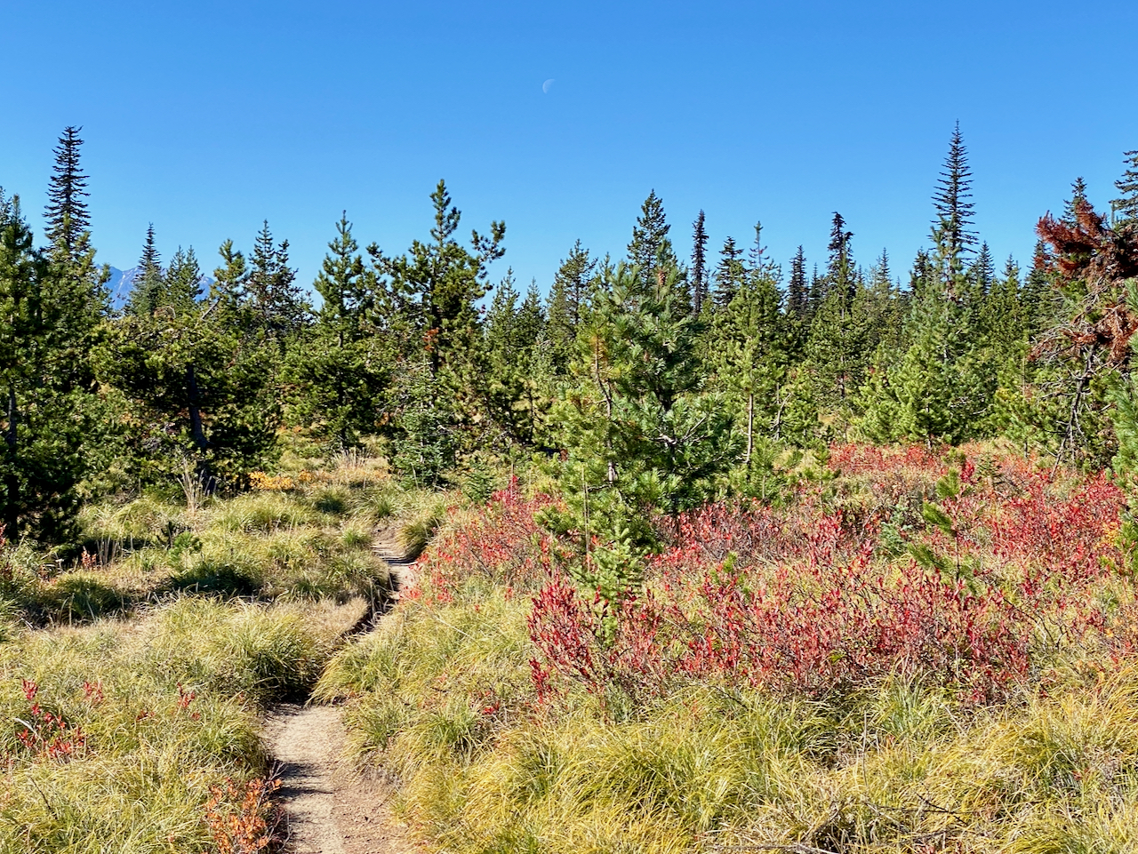
Oatmeal for breakfast for me, again, and a fish for the heron, I can see. Another long day is ahead of me, but not quite so long. I’m not absolutely certain of my campsite tonight, I know the day does not give me many opportunities for water – I had made a note to water up at Blue Lake, with a potential campsite about 17 miles down the trail I had marked as potentially near a water source. I also noted a spring near Crest Camp, and another one 2 miles further on. I did water up at Blue Lake, never saw the first spring, and didn’t bother to fill up at the second, as I didn’t want the extra weight. I still had over a liter, and was hopeful about the next campsite. I regret that. The scenery is gorgeous all along the way, but as with much of Indian Heaven wilderness, not big on vistas along the PCT, being largely within the forest. While my phone isn’t dead yet, it’s quite low, and I take only a couple of photos, and have even shut if off for a few hours at a time, powering up to check location and time..
After 17 long miles along a nice, soft trail, without too much climbing at all, I arrive at a lovely camp – a big bald rock face with a great view, including a copse of firs right next to it providing a sweet hang. No water tho. I realize the nice bald rock, perfect for enjoying the night skies while sipping nitey-nite tea, would not be so enjoyable without the tea. I wanted water, so pushed on another mile. At which point, the light was beginning to fail, as were my hopes for water – I would be on a ridgetop for miles to come. Naught to do but settle in for the night. I have enough water for dinner, and one cup of coffee in the morning. One short cuppa, that is.
The weather has been perfect all day, and as the day closes, I’m camping on a rounded, forested ridgetop, surrounded by a sea of golden yellow understory vine maples. In the fading light, it is quite glorious. The silouettes of the trees against the glowing sky are fascinating as I rocked slowly in my hammock. My belly is full, and I’m tired. It’s been a good day. With 12% charge left on my phone, I luxiouriously burn the power to read my ebook for a while.
Sunday, October 11
Exit day! And I’m ready for it. Still no sign of impending weather, so all that raingear ends up being just so much weight. Or maybe it was my talisman against the rain – who knows? I am up with first light, packed quickly, and with only one cup of coffee to drink, and on the trail quite early again. Today is a steady descent, providing some great territorial views, and an occasional peek into some of the geology of the ridge I’m hiking along. I encounter some oak groves, which I always enjoy, but otherwise spend the entirety of the day descending thru forest toward the Panther Creek campground, arriving at about 11:30, which provides ample time for a break, meal, coffee, a quick washup in the creek before Mike arrives shortly after 2:00. The campground is closed, but still a popular destination for dayhikers and dogwalkers.
My phone remains alive at 3%

Images taken October 4, 2023 – October 9, 2023 in the Gifford Pinchot National Forest.
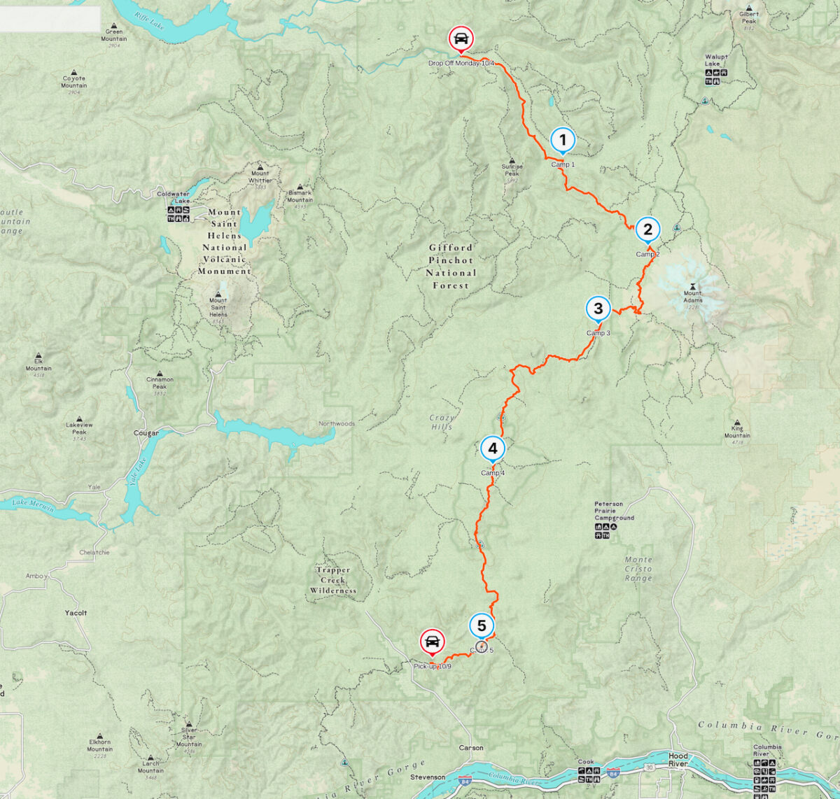
86 miles hiked over 6 days and 5 nights, with 16,168′ elevation gain.
Leave a Reply